Florence, Helene, and Isaac Strengthening In The Atlantic

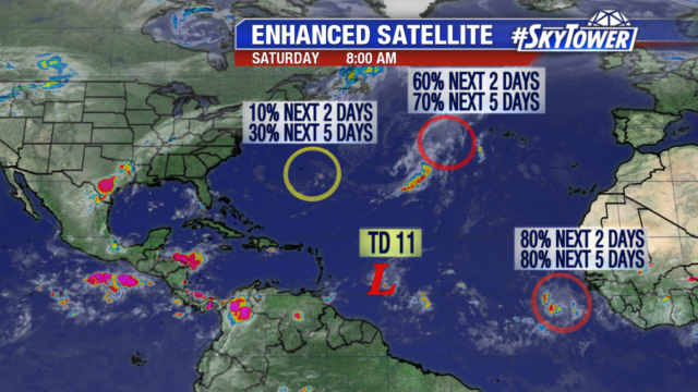
The Atlantic hurricane season hits it peak on Monday and we now have three named storms to watch – Florence, Helene, and Isaac.

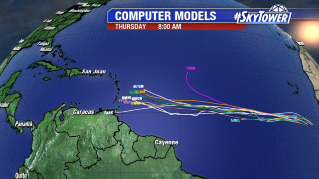
Of highest importance for the United States right now is Florence, which is now located about 800 miles southeast of Bermuda and heading due west. Model trends over the last day or two have been disconcerting for interests along the southeastern U.S. coastline. We’ve seen a shift that has hinted at a more southwesterly track, slowly diminishing the possibility of the storm staying offshore as it begins to turn north. That being, a track that keeps the storm offshore is still in the cards.

The afternoon Euro model run took Florence onshore in southeastern North Carolina near Wilmington, while the last couple runs of the GFS have turned the storm north sooner and actually kept it just offshore.

While there are still some questions to be answered regarding the track of Florence, intensity guidance has been fairly consistent. The National Hurricane Center has high confidence that this system will strengthen rapidly over the next few days and approach the SE coast as a category 4 or 5 storm. This is could be come an extremely dangerous situation for folks in those areas and they need to monitor the progress of this storm closely.

Helene and Isaac will be moving west over the next few days and both are likely to become hurricanes. Helene should start to curve north by the middle of the week and should ultimately not pose a threat to anyone. Isaac on the other hand will likely be moving into the Caribbean by Thursday. Parts of the Lesser Antilles may see tropical storm or hurricane warnings issued at some point on Tuesday. Still too early to say whether Isaac will have any impact on the U.S. mainland, but there aren’t any reliable models hinting at that possibility right now.


Florence & Helene in the Atlantic, Isaac Likely to be Named this Weekend

By the end of the weekend we will likely have 3 named storms in the Atlantic and 3 hurricanes by early next week. Tropical Storm Florence is the storm of most concern right now as models are indicating impacts along the east coast. The storm weakened to tropical storm status as it entered an area of high wind shear, but rapid intensification is likely as the storm moves into warmer water and lower wind shear. Florence is expected to become a major hurricane by Monday. Large swells are affecting Bermuda and will begin to impact the East Coast tomorrow.

The exact track is not set in stone yet, there is still time for Florence to take more of a northerly turn as it nears the coastline. Right now the European model is taking Florence to South Carolina, while the GFS is a little further north into North Carolina. We may get a weakness in the ridge which is steering Florence to the west. The weakness would allow for more of a northerly path.

The tropical wave that recently came off the African coast has organized into Tropical Storm Helene. Strengthening to a category 1 hurricane is forecast as it moves westward. Helene will pass very close to the southern Cabo Verde Islands tonight into early Sunday. Flash flooding is possible as the storm is expected to produce 3-5″ of rain, locally 8″ is possible. After pulling away from the Cabo Verde Islands it will likely turn north, heading out into the open water.

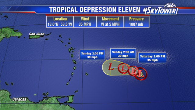
Tropical Depression 9 will likely strengthen into Tropical Storm Isaac by the end of the weekend, then become a category 1 hurricane. It will continue to battle dry air as it moves westward toward the Lesser Antilles into the middle of next week.