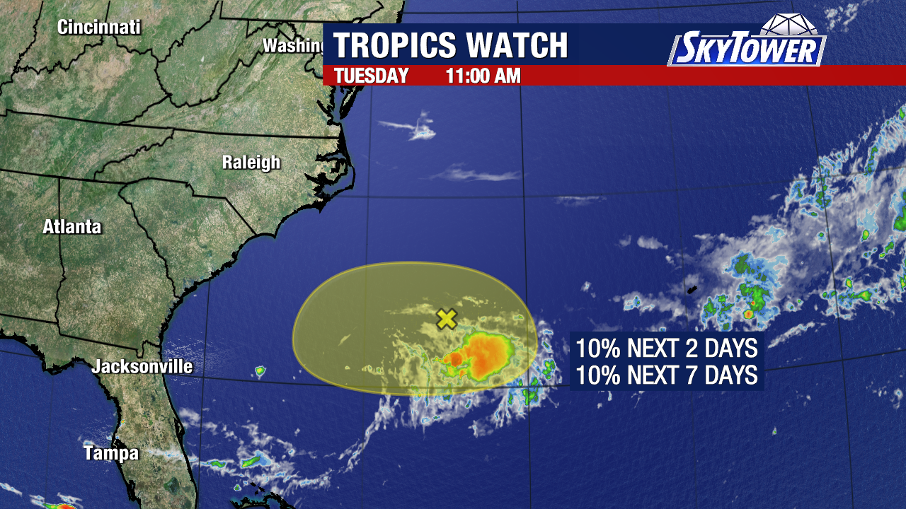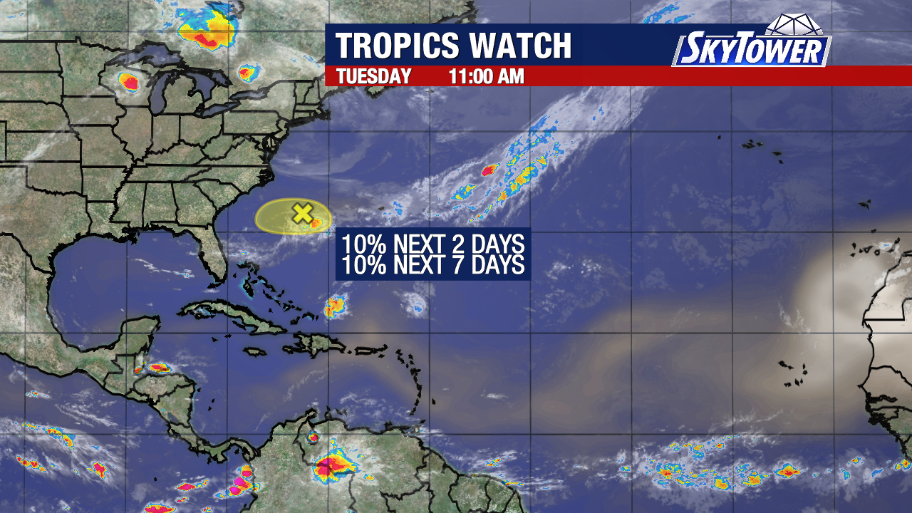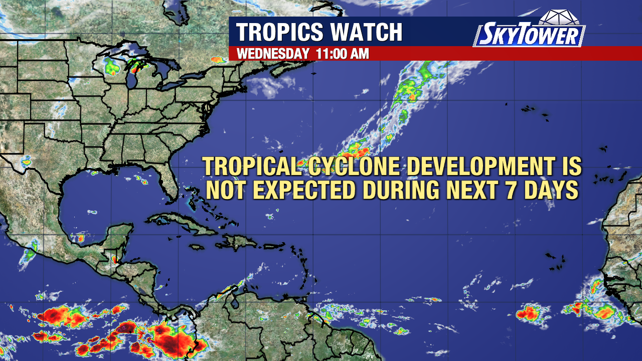
As we turn the calendar to July, the Atlantic is off to a quiet start. With the National Hurricane Center no longer tracking the disturbance off the Southeast coast, no tropical development is expected over the next seven days.

Forecast models suggest this quiet pattern could last even longer. One of the biggest reasons is El Niño, which is producing stronger winds high in the atmosphere. Those winds make it much harder for tropical systems to organize. At the same time, the Pacific has weaker upper-level winds, helping fuel a more active hurricane season there.
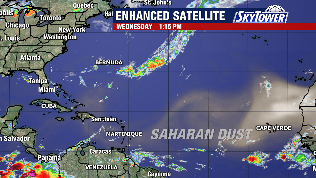
Another factor keeping the Atlantic quiet is Saharan dust. Thick plumes of dry, dusty air have spread across the tropical Atlantic, Caribbean, and parts of the Gulf over the past several weeks. This dry air limits thunderstorm development, making it more difficult for tropical systems to strengthen. Long-range forecast models suggest the dust will continue to be a factor through much of July.
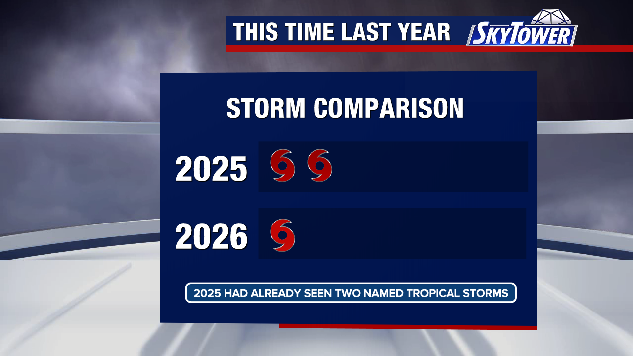
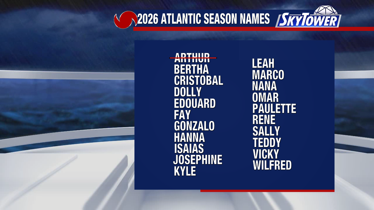
So far, Arthur remains the Atlantic’s only named storm of the 2026 hurricane season. At this point last year, we had already seen two named storms, with a third developing on July 4th.
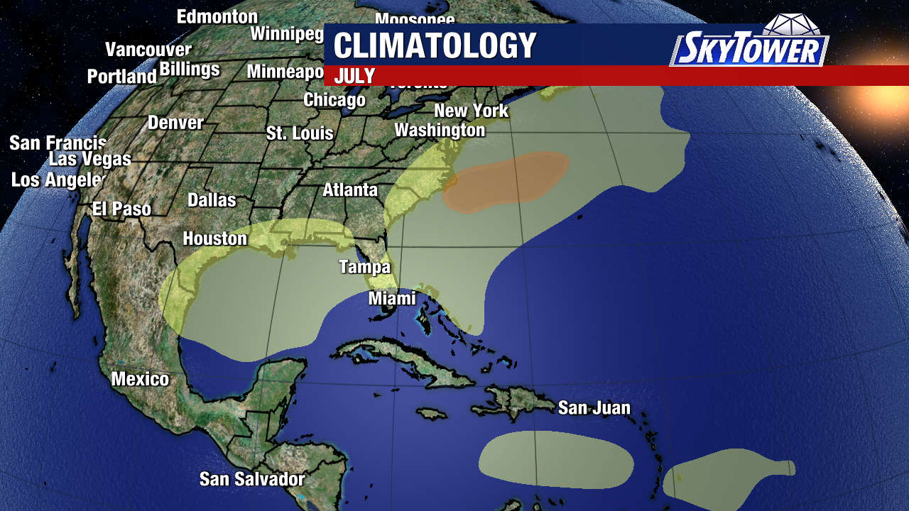
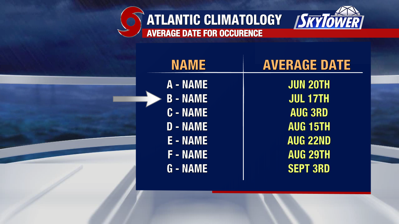
Historically, July accounts for about 8% of all Atlantic named storms. Most systems that develop this month form closer to the U.S. East Coast or in the northern Gulf rather than deep in the tropical Atlantic. While the Atlantic looks quiet for now, hurricane season is still in its early stages. Activity typically begins to ramp up in August before reaching its peak in September, so it’s still a good time to make sure your hurricane plans are in place.