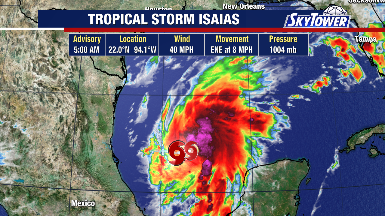
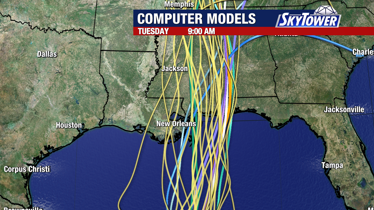
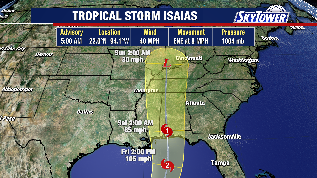
Tropical Storm Isaias is quickly getting wrapped up with a better looking system in the southwestern Gulf today and sustained winds up to 40 mph.
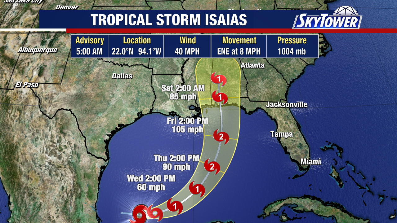
The National Hurricane Center is forecasting the storm to make landfall on the northern Gulf Coast as a hurricane late Friday or early Saturday.
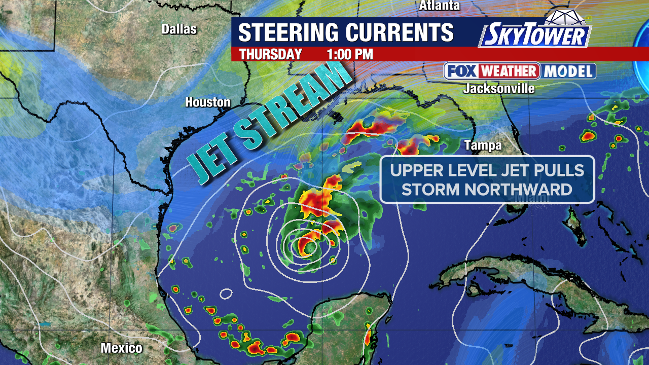
The storm is moving east-northeast, and will start to curve more northeast on Thursday, then eventually north on Friday.
Rapid strengthening is forecast over the next day or two. Isaias is expected to become a hurricane by Thursday.
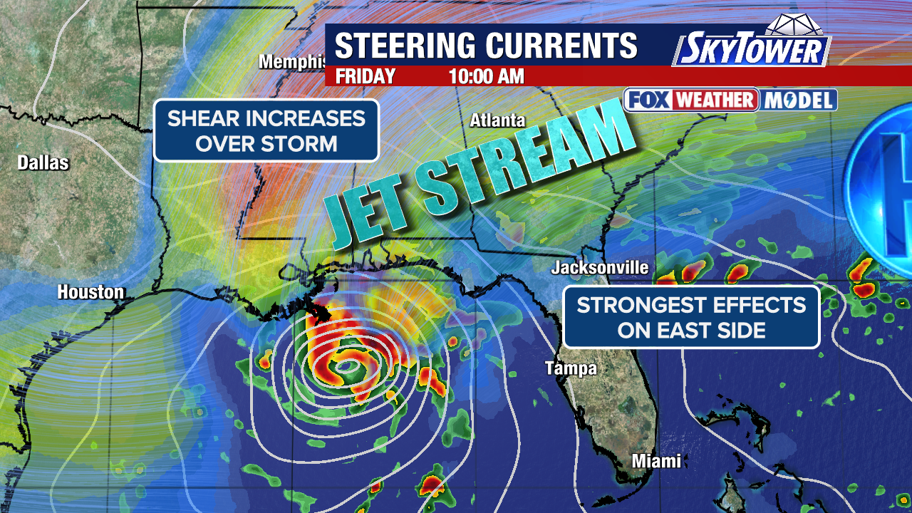
The threat for heavy rain, flash flooding and isolated tornadoes will be focused on the east side of the storm’s center. It’s important to stress: don’t focus only on the center because impacts will be felt a long distance east/northeast of where it comes ashore.
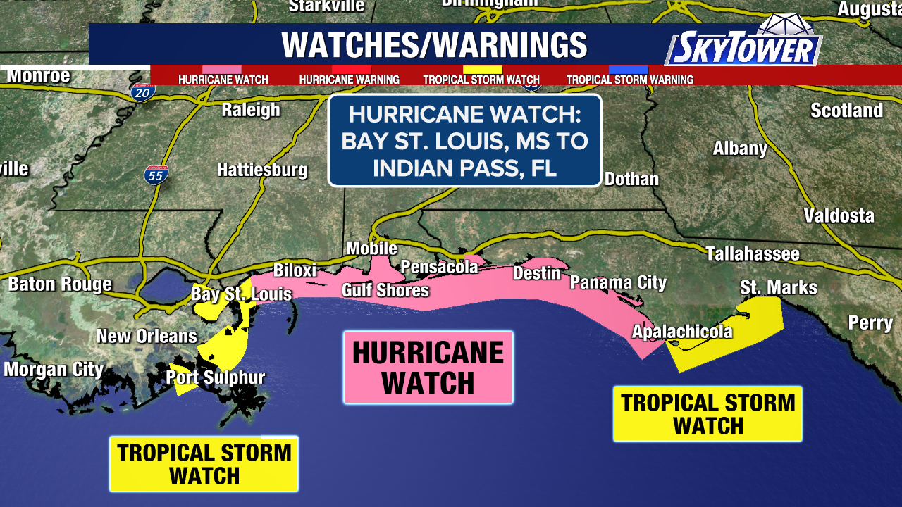
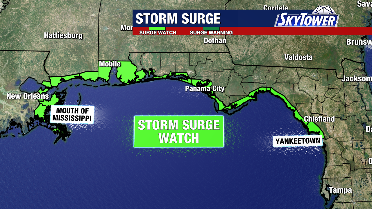
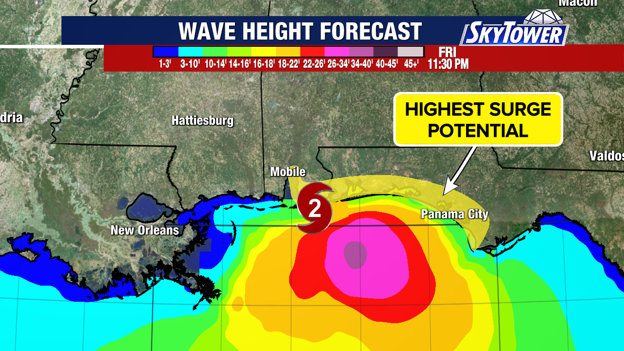
Dangerous storm surge, wind impacts and the threat for flooding spans from the Florida Panhandle to eastern Louisiana.
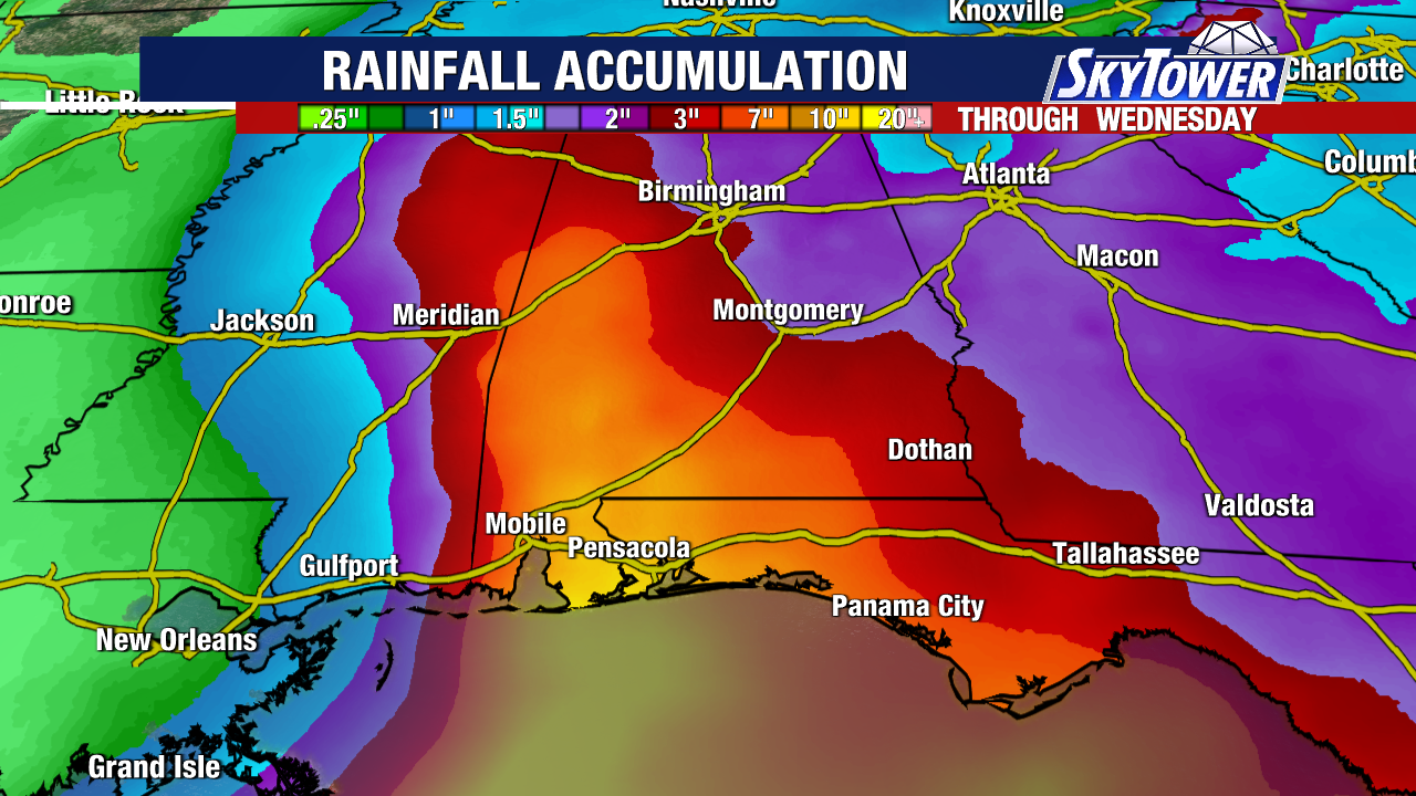
Heavy rain will bring a flood threat to a large portion of the Southeast including Georgia, Alabama and Mississippi.
Isaias will interact with strong shear and dry air as it moves north. The hope is that this will hurt the storm, shear it apart, and cause it to weaken in the 24-hours before landfall.
How much the dry air and wind shear will hurt Isaias is one of the tricky parts of the forecast. A weakening storm ahead of landfall often allows the wind field to spread out and impacts to stretch across a larger area.
Bottom line is those along the Florida Panhandle to Louisiana should be prepping for a major hurricane.
Tropical-storm-force winds currently extend outward up to 45 miles from the center. Since it’s a rather small storm, it will able to intensify fast over very warm Gulf waters and limited wind shear in the southern Gulf.
Isaias is expected to produce rainfall amounts of 3 to 6 inches, with localized totals up to 10″ from Friday through Sunday. Isaias will die out over the Southeast but its impacts will linger into next week.
Rainfall amounts of 1 to 3 inches, with localized amounts up to 5 inches, are possible across much of the Southeast as far north as the Tennessee Valley and the Carolinas.
More updates to come as we watch the latest model trends and getting updates from Hurricane Hunter missions.