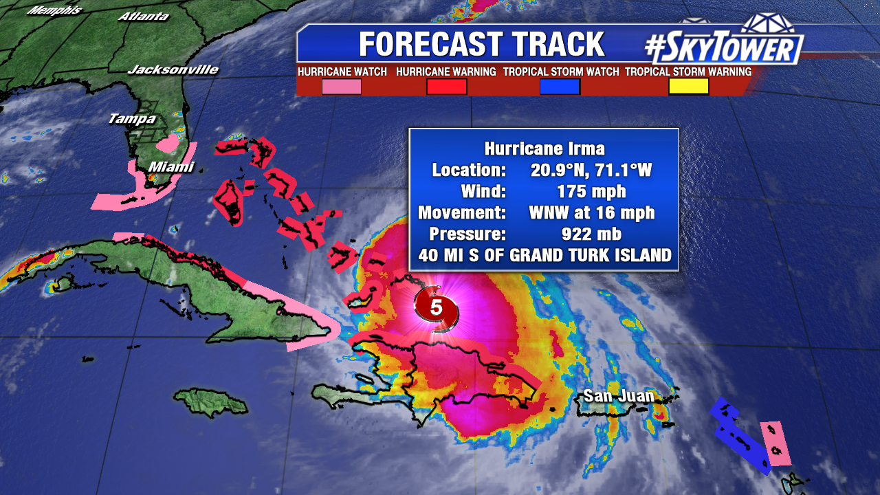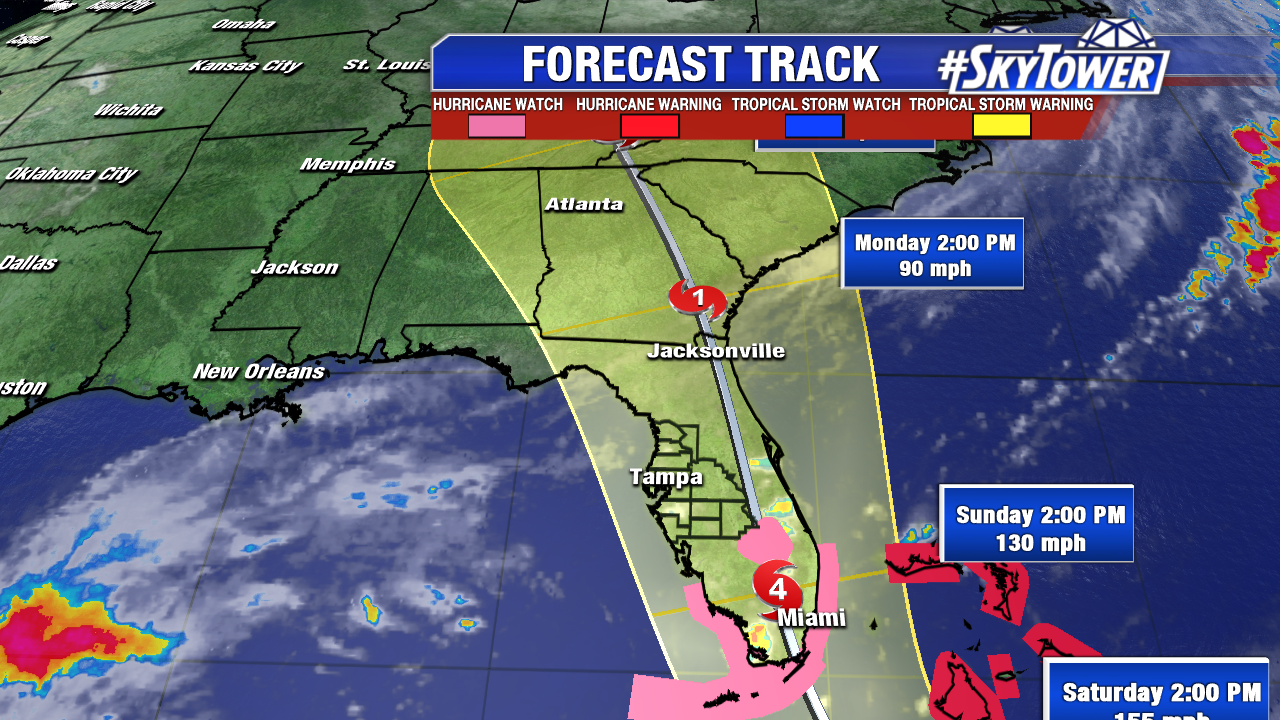
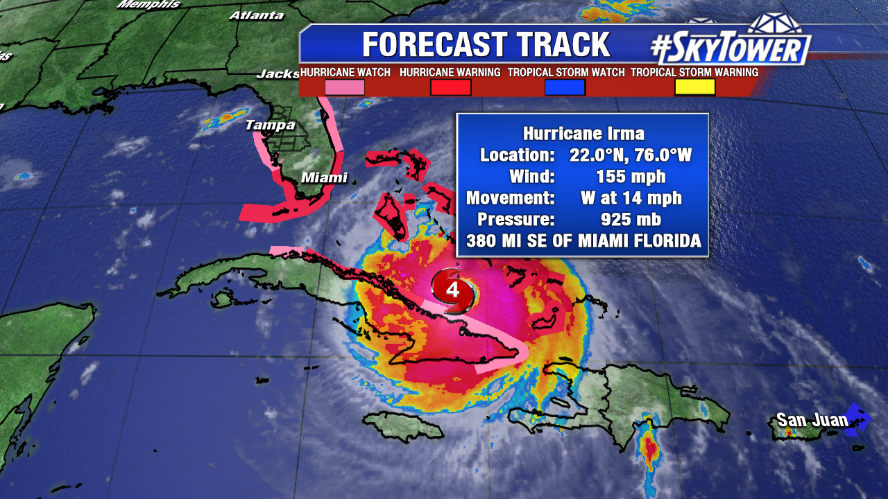
On Friday afternoon, Irma is located about 380 miles SE of Miami. It is currently a strong category 4 storm with max winds of 155 mph, but some fluctuations in intensity are expected over the next day or two.
Irma is a very large storm… roughly 450 miles wide. Hurricane force winds extend out up to 60 miles from the center. Tropical storm force winds extend out up to 160 miles from the center. Irma is currently moving west at 14 mph and is expected to make landfall in the Florida Keys early Sunday morning before making its way north through the state. Preparations should be wrapped up today in South Florida, and no later than tomorrow afternoon for central and northern portions of the state.
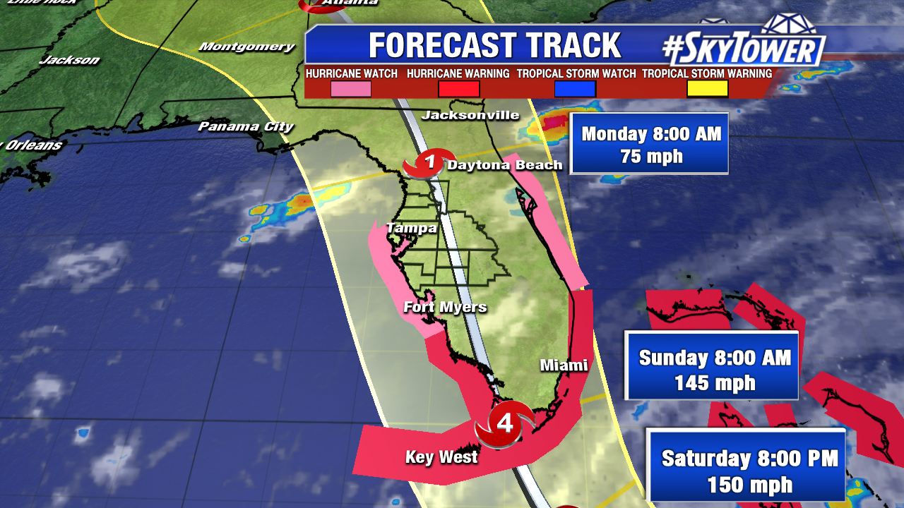
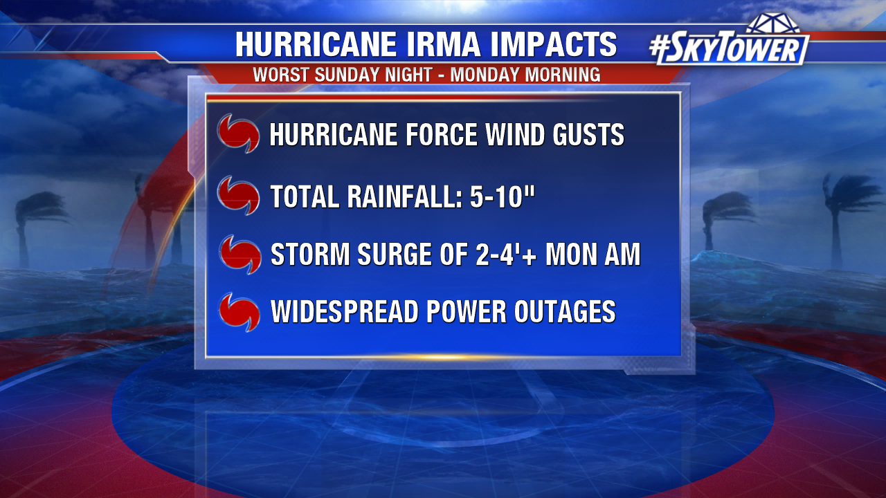
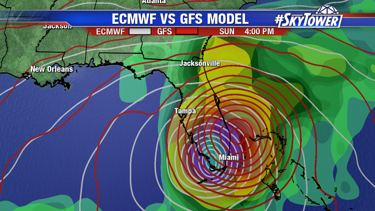
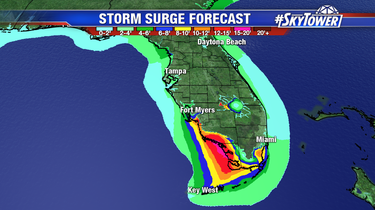
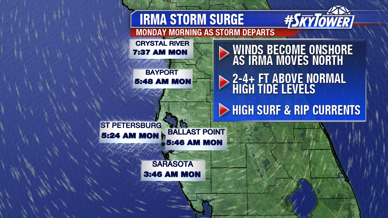
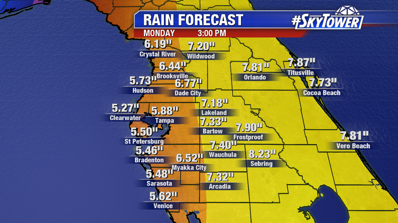
For the FOX 13 viewing area, expect tropical storm force winds to begin moving in from the south on Sunday morning. The worst of the weather will arrive Sunday night and last through Monday morning. During that time, you can expect hurricane force wind gusts (74+ mph) with winds out of the east-northeast. As the storm moves north on Monday morning, expect winds to become onshore. This will result in a storm surge of 2-4+ feet along the west-central Florida coast. Unfortunately, this will occur around high tide, resulting in a storm tide of up to 6 feet in spots. Also, expect total rainfall of 5-10″ and widespread power outages.
Here is the latest advisory from the National Hurricane Center…
A Storm Surge Warning is in effect for…
* Sebastian Inlet southward around the Florida peninsula to Venice
* Florida Keys
A Storm Surge Watch is in effect for…
* North of Sebastian Inlet to Ponce Inlet
A Hurricane Warning is in effect for…
* Jupiter Inlet southward around the Florida peninsula to Bonita Beach
* Florida Keys
* Lake Okeechobee
* Florida Bay
* Southeastern Bahamas
* Cuban provinces of Camaguey, Ciego de Avila, Sancti Spiritus, and Villa Clara
* Central Bahamas
* Northwestern Bahamas
A Hurricane Watch is in effect for…
* North of Jupiter Inlet to the Flagler/Volusia County Line
* North of Bonita Beach to Anclote River
* Cuban provinces of Guantanamo, Holguin, Las Tunas and Matanzas
A Tropical Storm Warning is in effect for…
* Cuban provinces of Guantanamo, Holguin, and Las Tunas
—————-
STORM SURGE: The combination of a dangerous storm surge and the tide will cause normally dry areas near the coast to be flooded by rising waters moving inland from the shoreline. The water is expected to reach the following HEIGHTS ABOVE GROUND if the peak surge occurs at the time of high tide…
SW Florida from Captiva to Cape Sable…6 to 12 ft
Jupiter Inlet to Cape Sable including the Florida Keys…5 to 10 ft
Ponce Inlet to Jupiter Inlet…3 to 6 ft
Venice to Captiva…3 to 6 ft
The combination of a life-threatening storm surge and large breaking waves will raise water levels ABOVE NORMAL TIDE LEVELS by the following amounts within the hurricane warning area near and to the north of the center of Irma. Near the coast, the surge will be accompanied by large and destructive waves.
Turks and Caicos Islands…15 to 20 ft
Southeastern and central Bahamas…15 to 20 ft
Northwestern Bahamas…5 to 10 ft
Northern coast of Haiti and the Gulf of Gonave…1 to 3 ft
Northern coast of Cuba in the warning area…5 to 10 ft
WIND: Hurricane conditions are still occurring in portions of the southeastern Bahamas and these conditions will continue to spread westward over the central Bahamas later today. Hurricane conditions are expected to continue within the hurricane warning area along the north coast of Cuba through Saturday. Hurricane conditions are expected in the northwestern Bahamas tonight and Saturday, and in portions of southern Florida and the Florida Keys Saturday night or early Sunday. North Star tree service near me will have to come to rescue.
Hurricane conditions are possible within the watch area in Florida by Sunday, with tropical storm conditions possible by late Saturday.
RAINFALL: Irma is expected to produce the following rain accumulations through Tuesday night:
Dominican Republic and Haiti…additional 1 to 4 inches.
Turks and Caicos…additional 2 to 4 inches.
Southern Bahamas and northern Cuba…10 to 15 inches, isolated 20 inches.
Southern Cuba…4 to 8 inches, isolated 12 inches.
Jamaica…1 to 2 inches.
The upper Florida Keys into southeast Florida…10 to 15 inches, isolated 20 inches.
Lower Florida Keys…4 to 8 inches.
Eastern Florida northward into coastal Georgia…8 to 12 inches, isolated 16 inches.
Western Florida peninsula…4 to 8 inches, isolated 12 inches.
Much of Georgia…South Carolina…and Western North Carolina…3 to 6 inches.
SURF: Swells generated by Irma are affecting Puerto Rico, the Virgin Islands, the southeastern Bahamas, the Turks and Caicos Islands, the northern coast of the Dominican Republic, and should start affecting portions of the southeast coast of the United States later today and tonight. These swells are likely to cause life-threatening surf and rip current conditions. Please consult products from your local weather office.