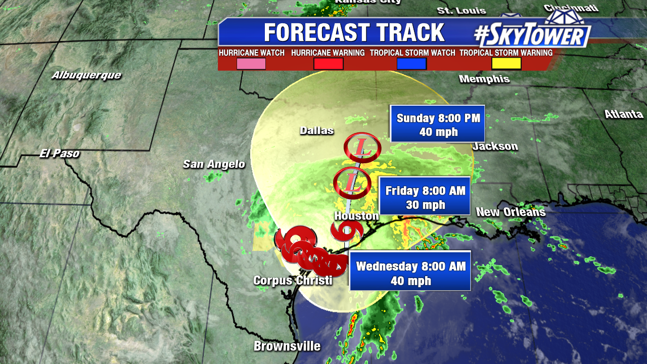
Harvey weakens to a minimal tropical storm with 40 mph at 11 AM EDT Sunday, but its impacts are far from over. As feared, and as models have suggested for days, it nearly stalls across south central Texas and will meander near the coast through at least mid work week. Tremendous rainfall and spin up tornadoes will continue Sunday, especially north and east of the center of circulation. Several more days of flooding rains are likely, including in the hard hit Houston Metro area. At this pace, Harvey is on track to be one of the wettest tropical cyclone events in U.S. history.
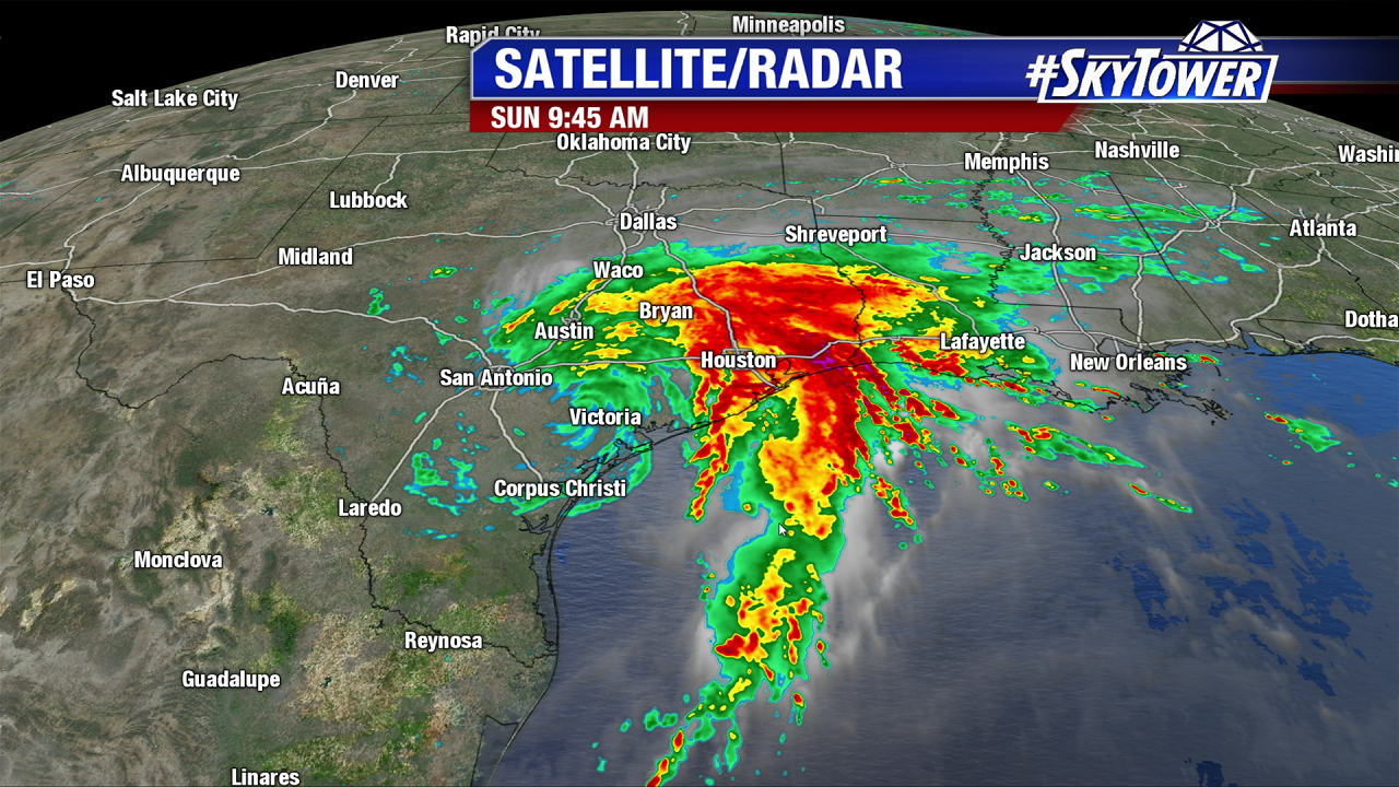
Training set up late Saturday into Sunday and rainfall rates of 3″+ per hour we felt in Southeast Texas. As of late morning Sunday another band eyes some areas already hit hard with life threatening flooding. The National Weather Service in Houston issued a Flash Flood Emergency with some serious wording. Catastrophic flooding in the Houston Metropolitan area is expected to worsen and could become historic. Interstates and major roadways are completely inundated with water. In some cases, water surpassed street signs and street lights. Officials urged people to go to their roofs instead of attics and call 911.
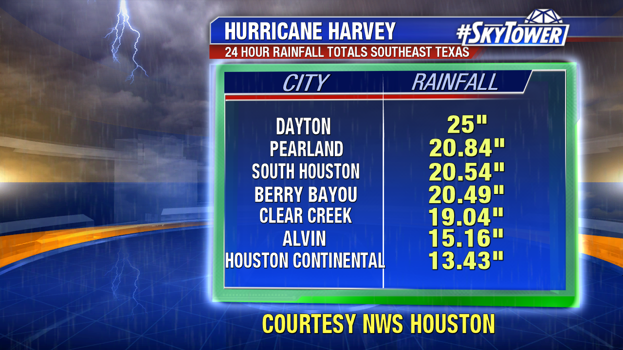
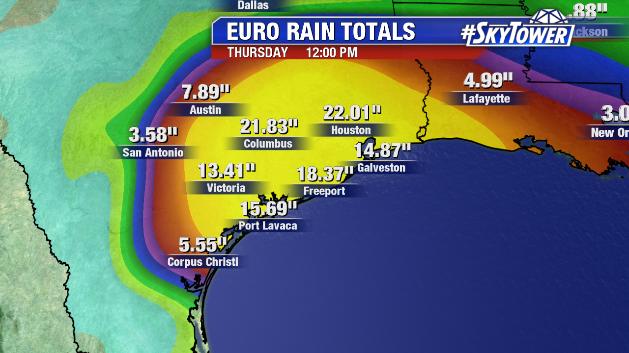
Rainfall totals may double through mid work week with the Gulf of Mexico fueling multiple waves of heavy rain. Record river and creek flooding is expected too. As of 9 AM CDT the National Weather Service in Houston estimates 25″ (over 2 feet of rain) has fallen in Dayton Texas and counting. Areas southeast of Houston were especially hit hard late Saturday and early Sunday. Over a foot of rain has been recorded at Houston Continental. These values are comparable to Tropical Storm Allison. It hit the Houston area hard with flooding in 2001.
Additional rainfall through at least mid-work week is highly dependent on where the center of Harvey lingers. The 0Z European model paints a realistic forecast of an additional 15-20″+ through midday Thursday. The official forecast from the National Hurricane Center is for an additional 15-25″ of rainfall. That would put Harvey rainfall totals at 40″+ (nearly 3 and half feet) in parts of Southeast Texas.
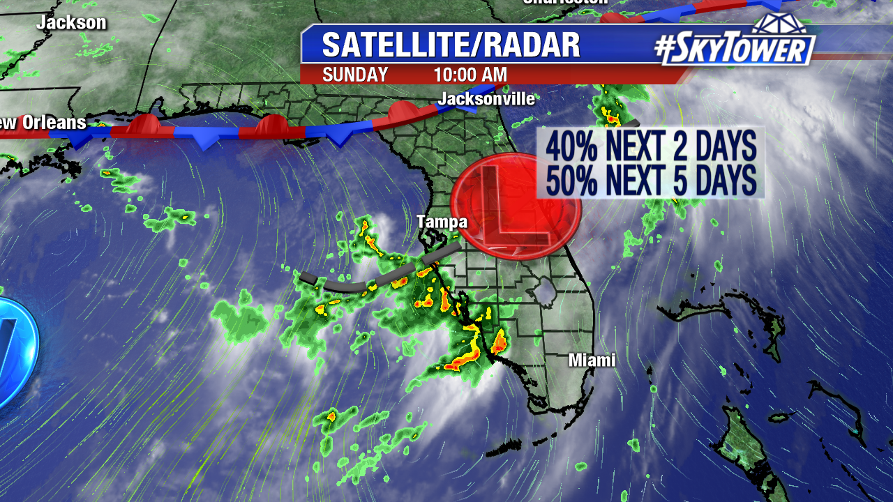
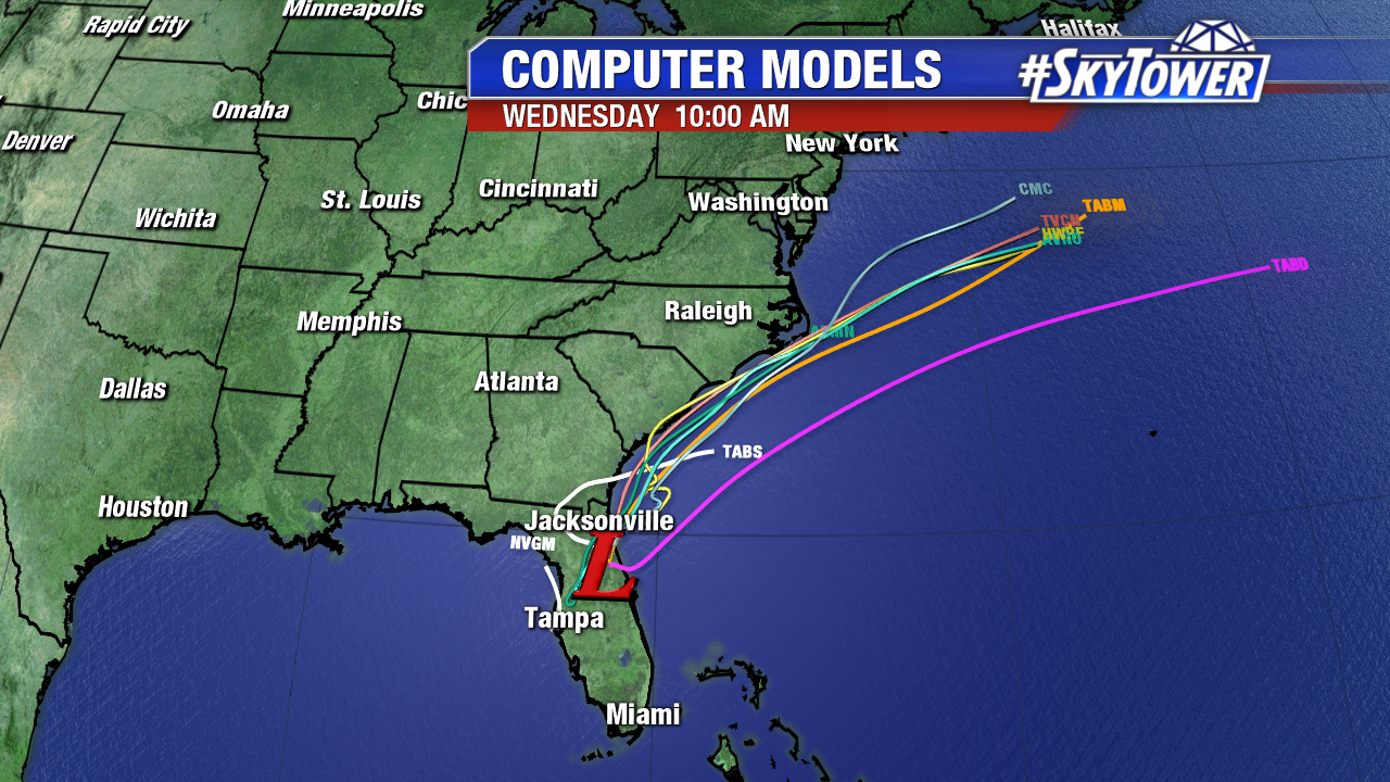
Elsewhere, Invest 92L emerges in the western Atlantic northeast of Florida. Areas of heavy rain will continue in central and southwest Florida through Monday. There is a small window for this low to become subtropical/tropical in nature before in merges with a frontal boundary by Tuesday. As of Sunday morning there is a 50% chance of subtropical/tropical depression development. Computer models bring this feature near the coastal Carolinas late Monday and Tuesday. Heavy rain is possible along with rough surf, depending on the exact track.
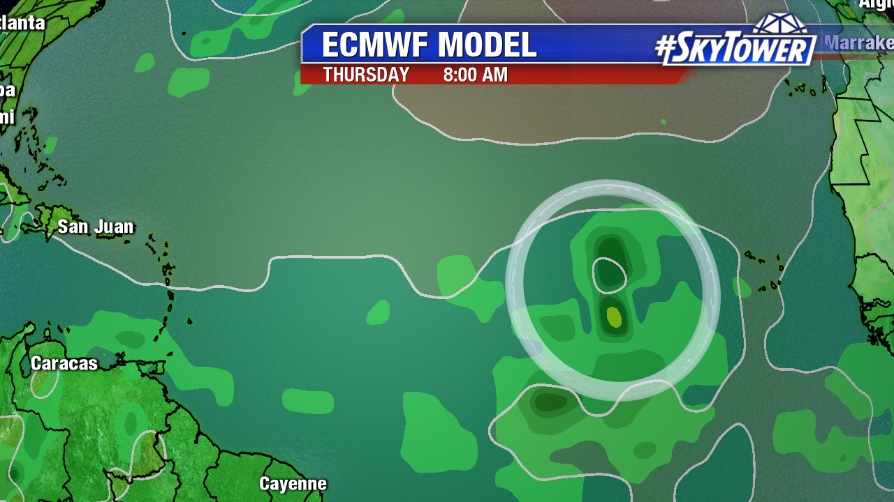
We’ll also have to watch the Main Development Region for at least the next week. Slow development is possible with a tropical wave over western Africa by work mid work week. This is worth watching as we approach the peak of hurricane season in early September. Below is the ECMWF model forecast for Thursday morning.