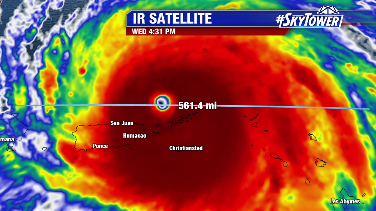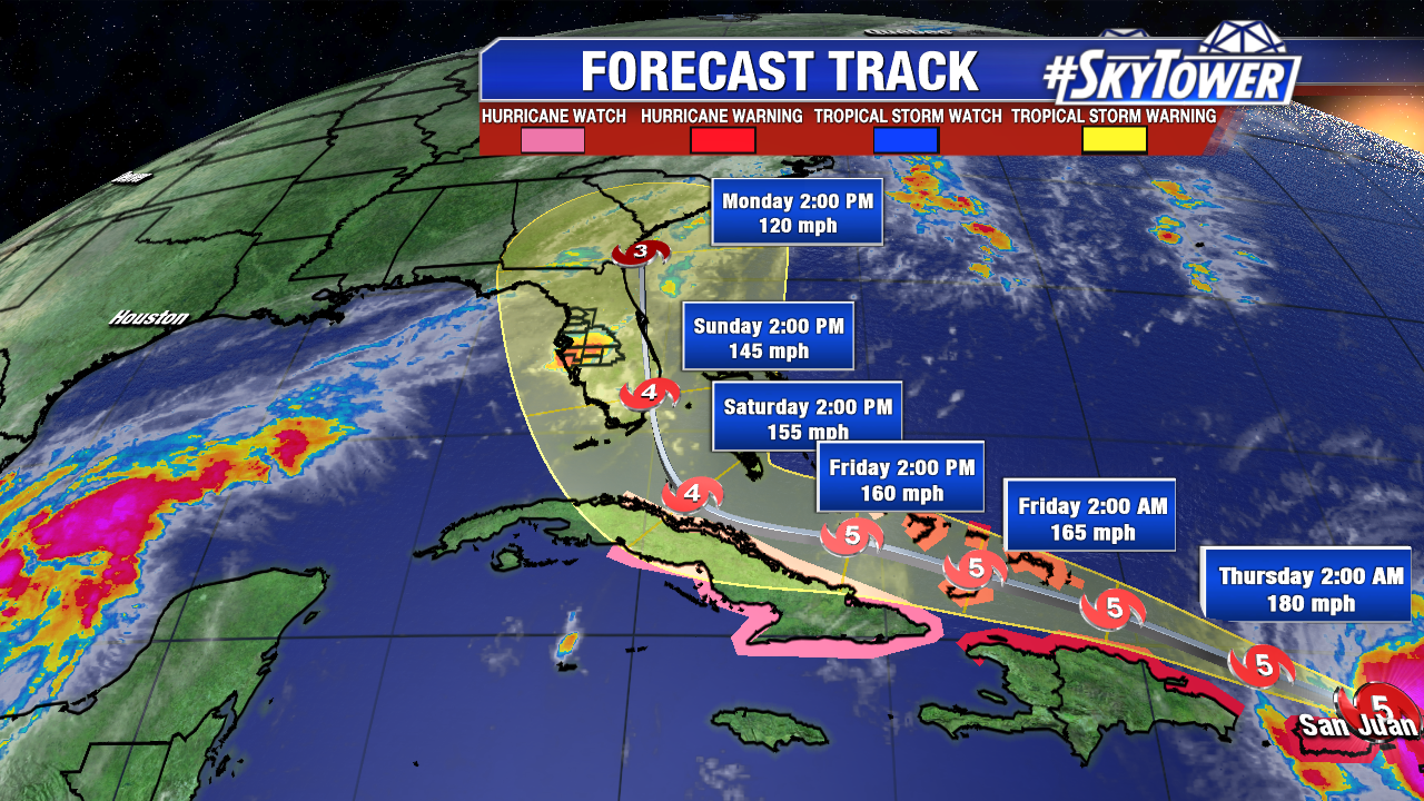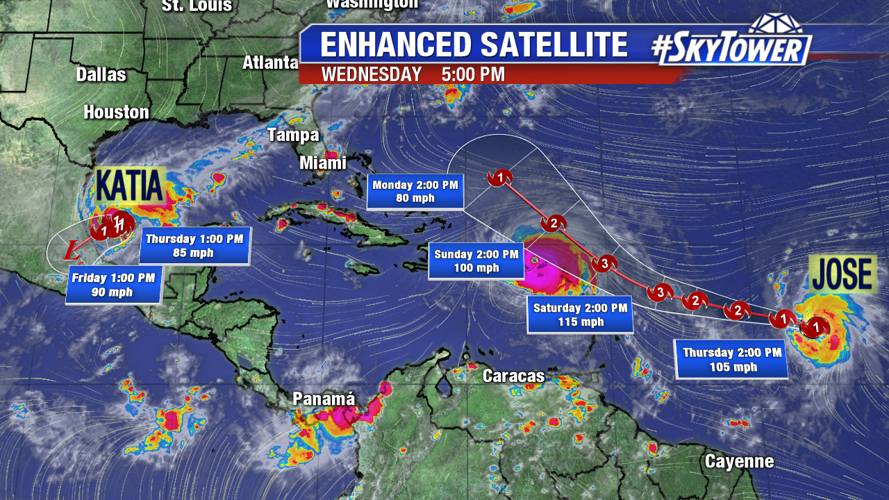
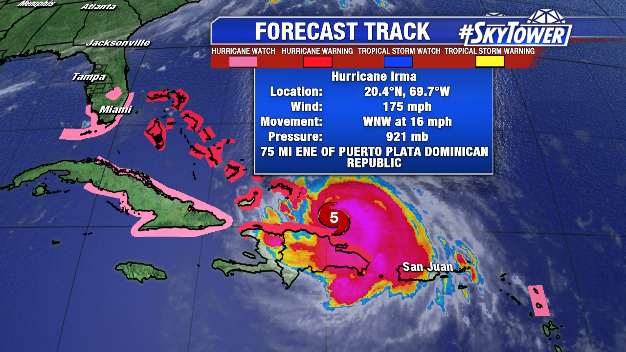
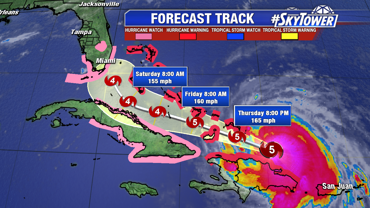
At 11AM Thursday, Irma remains a dangerous category 5 hurricane with winds of 175 mph. It’s moving WNW at 16 mph and is located about 120 miles SE of Grand Turk Island in the Turks & Caicos. Irma is expected to continue this general WNW motion over the next couple of days before making a northward turn as it nears the state of Florida. Hurricane watches are now up for all of South Florida.
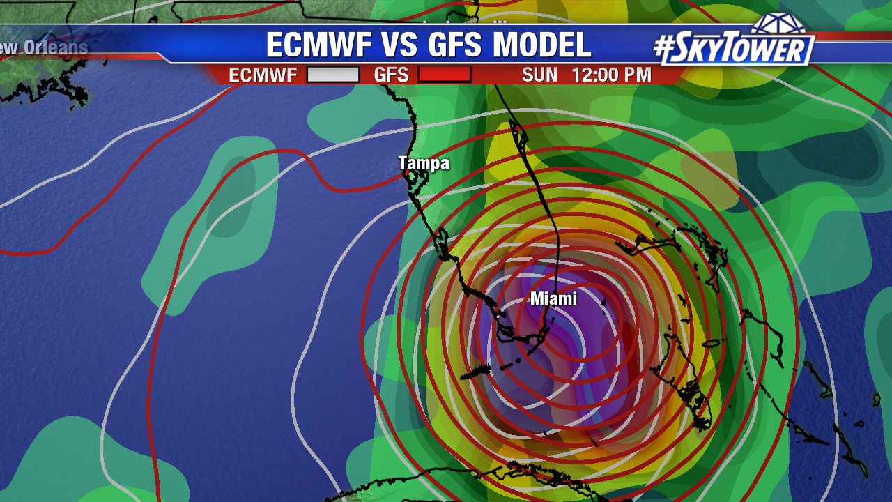
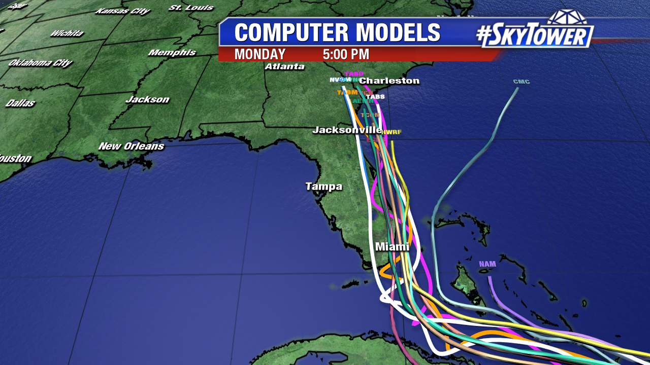
The time of that right hand turn is critical in determining the range of impacts felt across the state. The worst of the weather will be felt on Irma’s northern and eastern sides. Areas directly in front of and east of the center of the storm can expect sustained hurricane force winds for a time. While winds on the western side of the eye will be decreasing the further west you go. It’s still too early to pinpoint the impacts for an exact location, as a shift in track of just 20-30 miles could dramatically change who sees what. As of now, the entire Florida peninsula is in the cone of uncertainty and should be preparing accordingly. Mandatory evacuations are now in effect for the Florida Keys, as well as coastal portions of Miami-Dade, Broward, Brevard, and Martin counties. Heed warnings of local authorities.
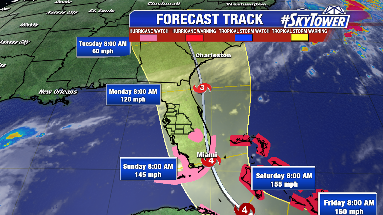
Impacts across the northern Caribbean over the next couple of days will be quite extreme. Here is the latest advisory from the National Hurricane Center…
STORM SURGE: The combination of a dangerous storm surge and the tide will cause normally dry areas near the coast to be flooded by rising waters moving inland from the shoreline. The water is expected to reach the following HEIGHTS ABOVE GROUND if the peak surge occurs at the time of high tide…
Jupiter Inlet to Bonita Beach, including Florida Keys…5 to 10 ft
The deepest water will occur along the immediate coast in areas of onshore winds, where the surge will be accompanied by large and destructive waves. Surge related flooding depends on the relative timing of the surge and the tidal cycle, and can vary greatly over short distances.
The combination of a life-threatening storm surge and large breaking waves will raise water levels ABOVE NORMAL TIDE LEVELS by the following amounts within the hurricane warning area near and to the north of the center of Irma. Near the coast, the surge will be accompanied by large and destructive waves.
Turks and Caicos Islands…15 to 20 ft
Southeastern and central Bahamas…15 to 20 ft
Northwestern Bahamas…5 to 10 ft
Northern coast of the Dominican Republic…3 to 5 ft
Northern coast of Haiti and the Gulf of Gonave…1 to 3 ft
Northern coast of Cuba in the warning area…5 to 10 ft
Water levels around Puerto Rico should subside today.
WIND: Hurricane conditions are expected to begin within the hurricane warning area in the Dominican Republic and Haiti today. Hurricane conditions are expected to begin in the southeastern Bahamas and the Turks and Caicos Islands later today with tropical storm conditions expected within the next several hours. These conditions will spread into the central Bahamas by tonight or early Friday.
Hurricane and tropical storm conditions are possible within the watch area in Cuba by Friday. Tropical storm conditions are expected to begin within the warning area in Cuba tonight. Hurricane conditions are expected in the northwestern Bahamas Friday night and Saturday.
RAINFALL: Irma is expected to produce the following rain accumulations through Saturday evening:
Northeast Puerto Rico and the British and U.S. Virgin Islands… additional 2 to 4 inches, isolated 6 inches
Much of the Bahamas and Turks and Caicos…8 to 12 inches, isolated 20 inches
Andros Island and Bimini, Bahamas…12 to 16 inches, isolated 25 inches
Northern Dominican Republic and northern Haiti…4 to 10 inches, isolated 15 inches
Southern Dominican Republic and southern Haiti…2 to 5 inches
Eastern and central Cuba…4 to 10 inches, isolated 15 inches
Southeast Florida and the upper Florida Keys…8 to 12 inches, isolated 20 inches
Lower Florida Keys…2 to 5 inches
In all areas this rainfall may cause life-threatening flash floods and mudslides.
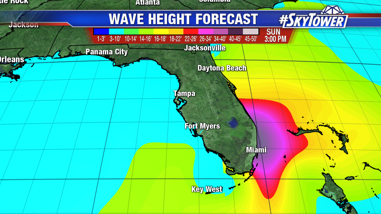
SURF: Swells generated by Irma are affecting the northern Leeward Islands, Puerto Rico, the Virgin Islands, the southeastern Bahamas, the Turks and Caicos Islands, the northern coast of the Dominican Republic, and should start affecting portions of the southeast coast of the United States later today and tonight. These swells are likely to cause life-threatening surf and rip current conditions.
A Storm Surge Watch is in effect for…
* Jupiter Inlet southward around the Florida peninsula to Bonita Beach
* Florida Keys
A Hurricane Warning is in effect for…
* Dominican Republic from Cabo Engano to the northern border with Haiti
* Haiti from the northern border with the Dominican Republic to Le Mole St. Nicholas
* Southeastern Bahamas and the Turks and Caicos Islands
* Central Bahamas
* Northwestern Bahamas
A Hurricane Watch is in effect for…
* Jupiter Inlet southward around the Florida peninsula to Bonita Beach
* Florida Keys
* Lake Okeechobee
* Florida Bay
* Cuba from Matanzas province eastward to Guantanamo province
A Tropical Storm Warning is in effect for…
* Dominican Republic from south of Cabo Engano westward to the southern border with Haiti
* Haiti from south of Le Mole St. Nicholas to Port-Au-Prince
* Cuba provinces of Guantanamo, Holguin, Las Tunas, Camaguey, Ciego de Avila, Sancti Spiritus and Villa Clara.