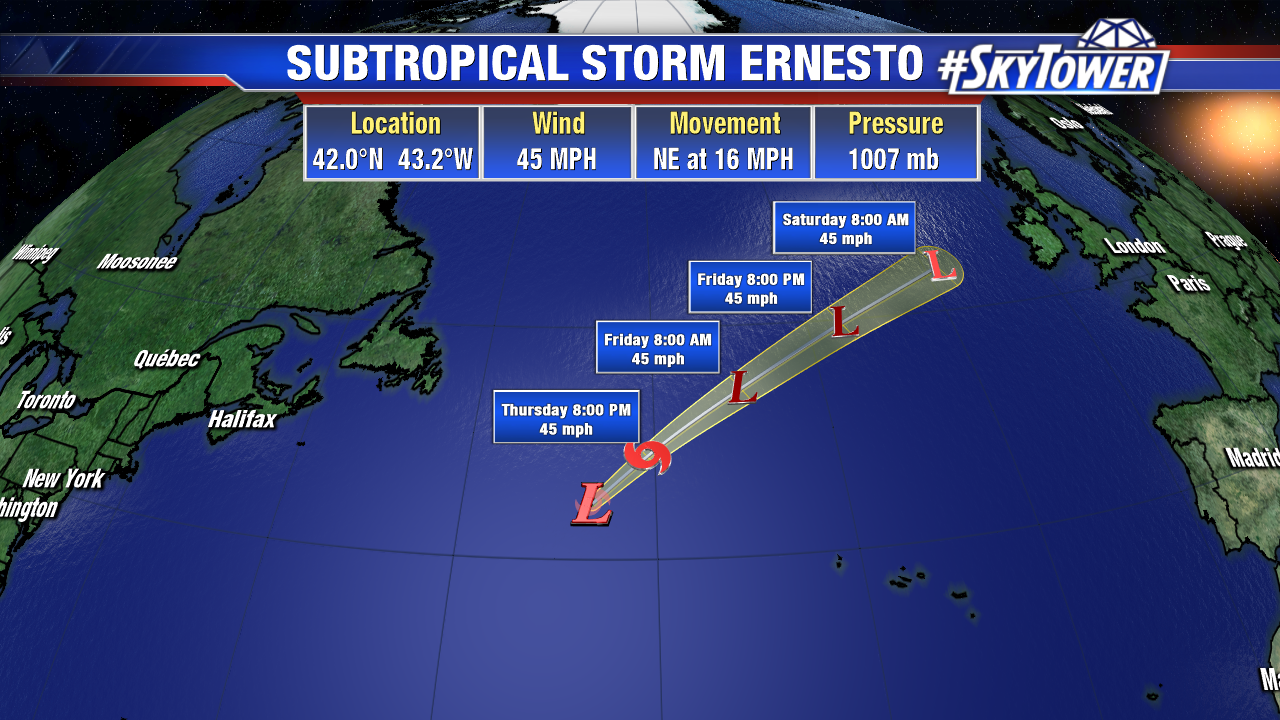
As of Thursday morning, Subtropical Storm Ernesto was still producing some bands of showers and storms around its center. Dry air was beginning to wrap into its circulation on the western side as it begins to lose the few tropical characteristics it had. It will soon be moving into much cooler waters and an area of stronger wind shear. The system should merge with a frontal zone this weekend and bring some wind and rain to the UK.
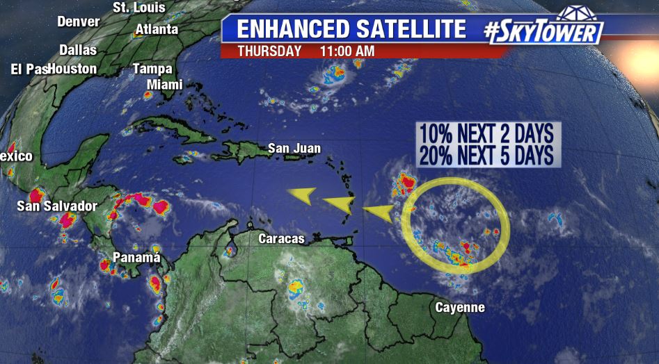
In the Central Atlantic, we’re watching a tropical wave about 750 miles east-southeast of the Lesser Antilles. This disorganized area of showers and storms has a somewhat favorable environment to work with over the next couple of days as it moves west-northwest. While gradual development is possible in the short-term, higher wind shear over the Caribbean will likely put a cap on things, so to speak, this weekend. That being said, this is the time of year when things can change fast in the tropics and we have to keep an eye on how things play out. The National Hurricane Center currently has a 20% chance of development for this disturbance over the next 5 days. Regardless of development, locally heavy rainfall is possible in portions of the Lesser Antilles over the next few days.