Cristobal Weakens To A Depression; Will Restrengthen and Move North On Friday

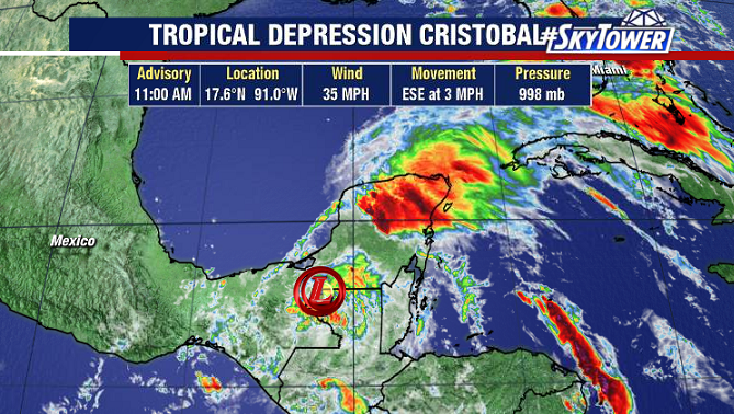
As of early Thursday afternoon, Tropical Depression Cristobal was nearly stationary over southern Mexico. It continues to bring torrential rainfall to parts of southern Mexico and Central America, which has lead to life-threatening flash flooding and mudslides.

Over the next 24-36 hours Cristobal will turn north, moving back over the southern Gulf of Mexico by late Friday. Once over open water, the storm will steadily strengthen.

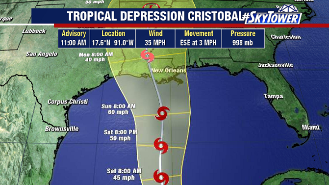
Intensification will be somewhat limited as Cristobal begins to interact with a trough over the western Gulf. Despite some dry air and wind shear though, we should still end up with a strong tropical storm, if not a minimal hurricane, as Cristobal nears the U.S. Gulf Coast this weekend. Models continue to be very consistent in the track of this storm, with landfall along the central Gulf Coast late Sunday or early Monday – likely in Louisiana or Mississippi.

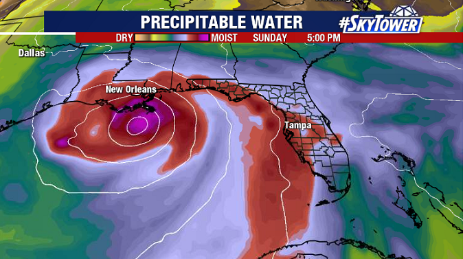
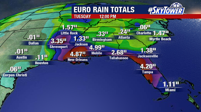
Deep tropical moisture will generate periods of heavy rainfall along the central and eastern Gulf Coast through the weekend. In the next day or two, we’ll start talking about more specific impacts for areas close to the landfall location.

Tropical Storm Cristobal Forms; Will Head North Later This Week

Tropical Storm Cristobal formed in the southwestern Gulf Tuesday afternoon. This the earliest third named storm on record in the Atlantic. On average, the third named storm doesn’t form until early August.

For the next few days, Cristobal will be meandering around the Bay of Campeche. Whether or not it stays over the water or drifts over land for a period of time, will play a big role in the storm’s intensity as it begins to move north toward the northern Gulf Coast later in the week.

Current GFS run valid for Sunday evening.
Current Euro run valid for Sunday evening.

Models are in fairly good agreement at this point. Both the GFS and Euro, and their ensemble members, show a healthy tropical storm moving north this weekend. However, the Euro is showing a stronger storm. There won’t be many factors working against it, so steady strengthening is expected. Residents along the northern Gulf Coast from Texas to Mississippi should be monitoring the progress of this storm over the course of this week and check back for updates. Once the storms moves away from the Yucatan in a few days, we can starting talking about specific U.S. impacts.