Tropical Storm Olga Forms; Heavy Rain Continues In The Deep South

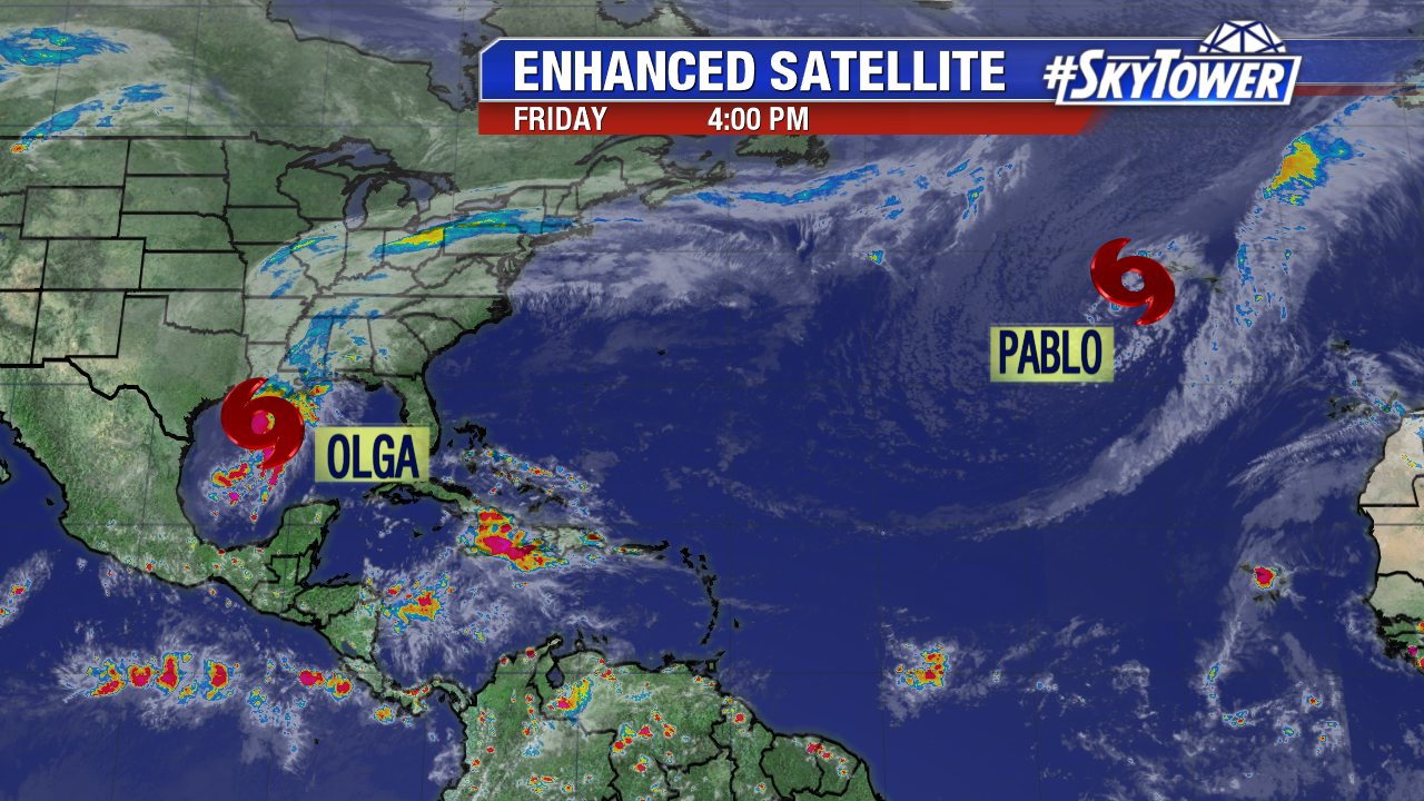
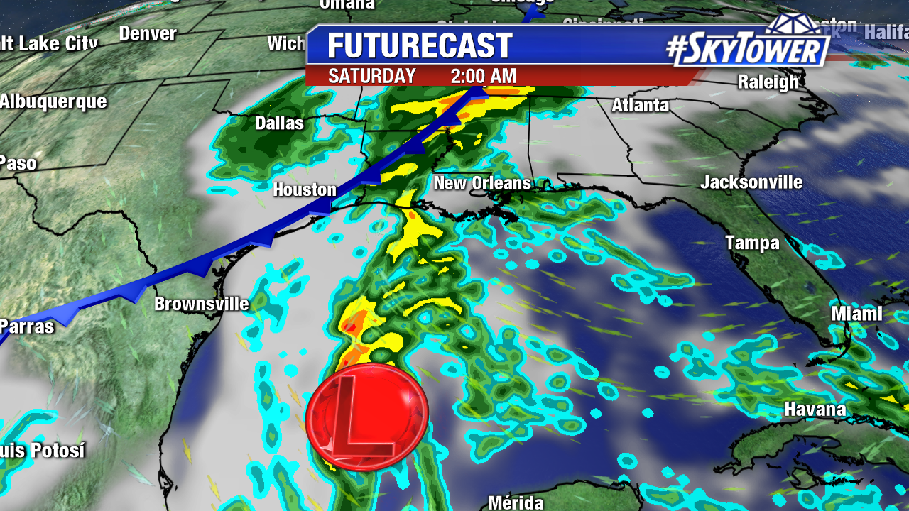
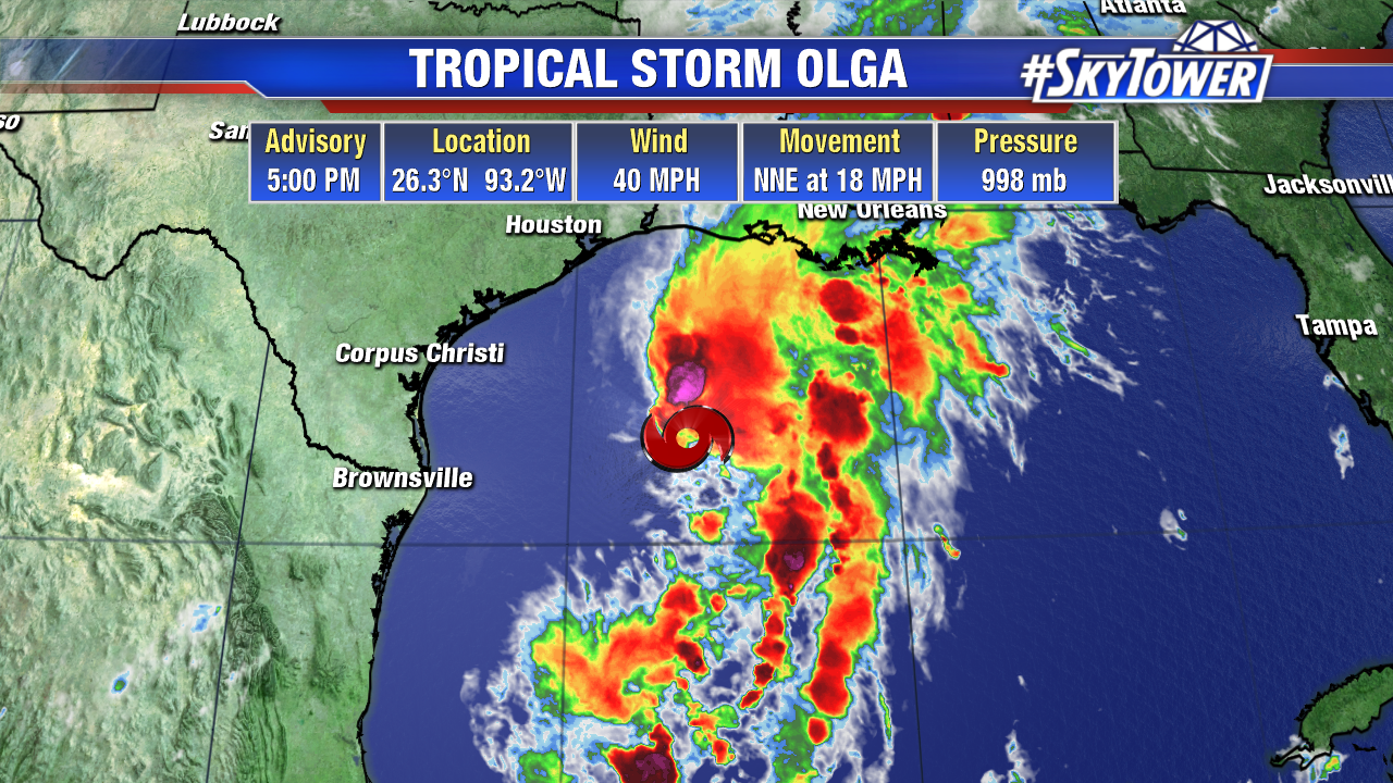
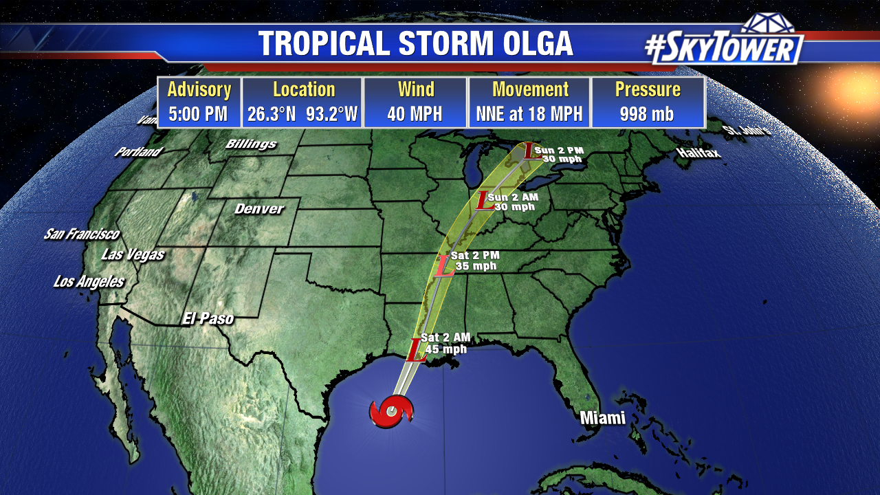
We now have Tropical Storm Olga in the western Gulf. However, tropical system or no tropical system, the outcome is the same – a lot of rain for parts of the Gulf Coast and Southeast. There are currently no tropical watches or warnings in effect.


This big slug of moisture will continue to merge with a cold front tonight into Saturday, and continue moving north through the weekend.

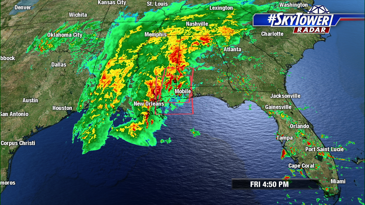
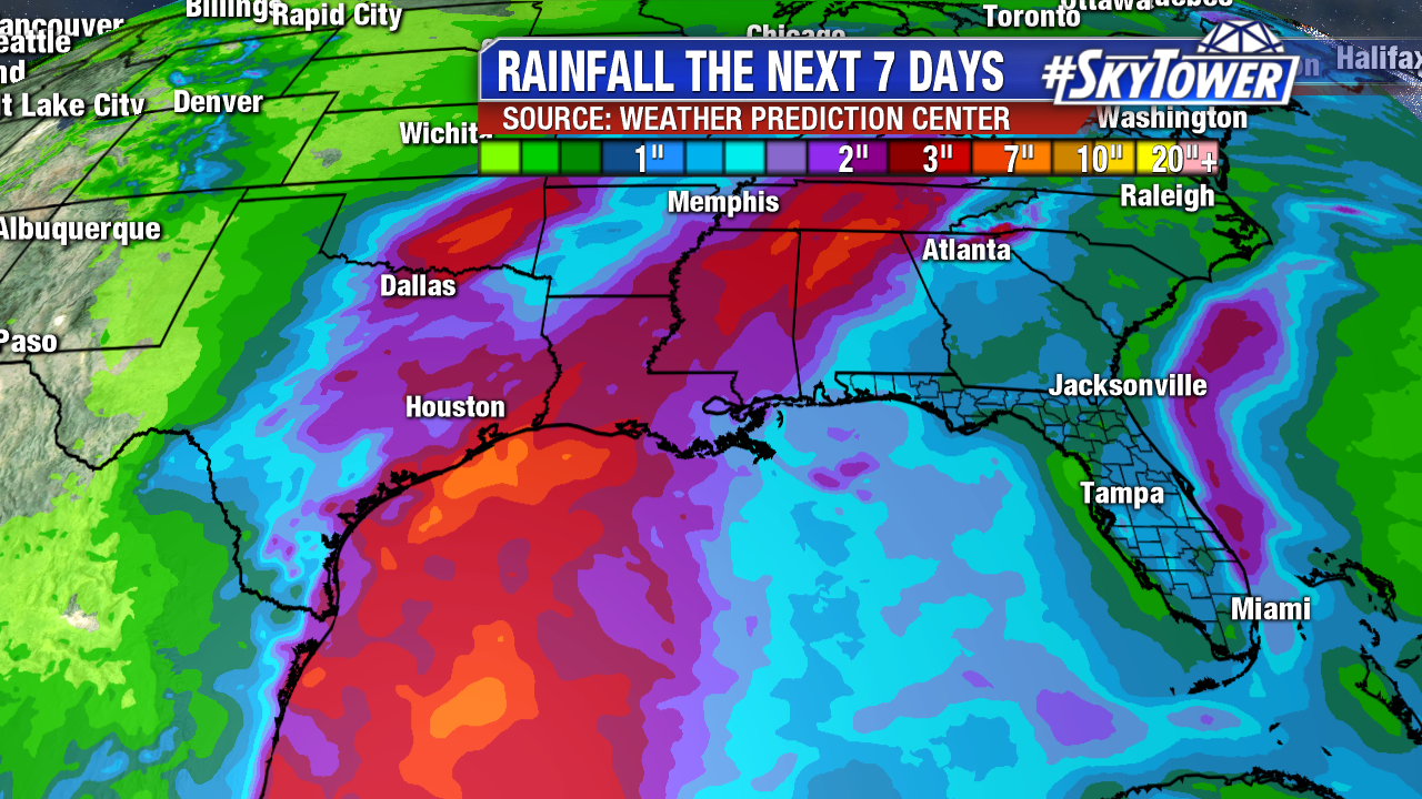
Widespread moderate to heavy rain has been falling for most of the day across the lower Mississippi Valley. As rain continues to fall in these areas over the next 18-24 hours, the flash flooding threat will continue. Rainfall totals may top 8 inches in spots. The cold front should make good eastward progress over the weekend, with many areas getting some much needed dry weather by Sunday.

In addition to Olga, Tropical Storm Pablo was just named in the Central Atlantic. This will present very few issues for any land areas other than some wind and rain in parts of the Azores.

Slight Chance of Development for Wave in Western Caribbean Over Next 5 Days

A disorganized area of showers and storms over Central America will be headed northwest into the Bay of Campeche over the next couple of days.

This time of year, these areas have to be watched, as development can happen quickly close to home. That being said, what we’re dealing with here will likely end up being just a slug of tropical moisture that will merge with an approaching cold front over the western Gulf on Friday.

Above: Weak low merging with front heading into this weekend.

While the chance for tropical development is low, the chance for rain and localized flooding will be high for a good chunk of the Gulf Coast and Deep South later this week and through the weekend.

Once Halloween rolls by, the mainland U.S. threat for tropical systems drops pretty quickly. The official hurricane season end date in the Atlantic basin is November 30.