Fred To Make Landfall In The Florida Panhandle On Monday; Grace Struggling In The Northern Caribbean

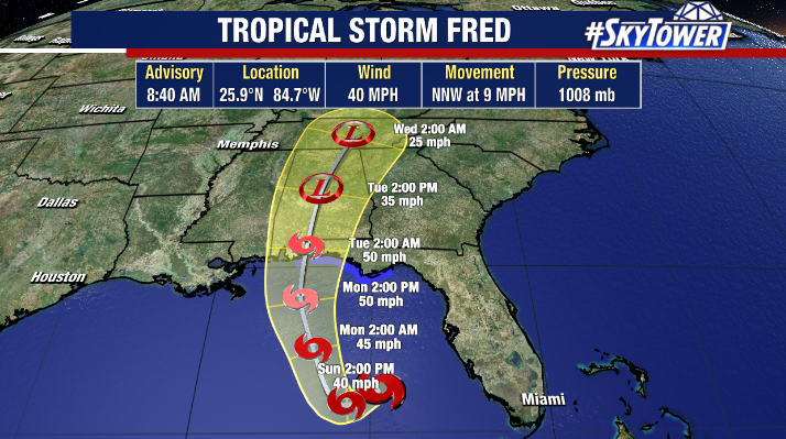
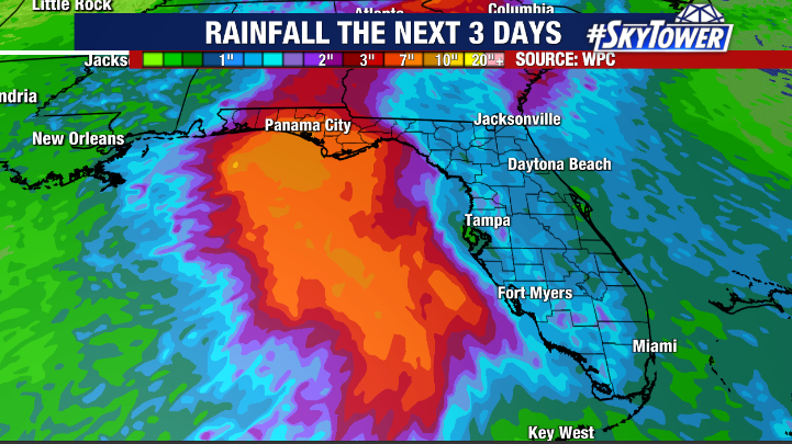
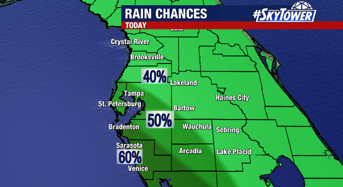
Fred regenerated on Sunday morning and has been moving northward about 200 miles off the west coast of Florida today. It is far enough offshore that the worst weather has stayed out in the Gulf. Periods of mainly light to moderate rain will continue along Florida’s west coast through the night into Monday morning.

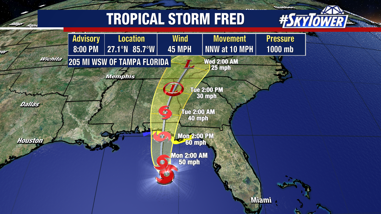
Fred is headed for a Northwest Florida landfall on Monday. As of 8pm Sunday, max sustained winds were at 45 mph and some slight strengthening is forecast up until it comes ashore. Heavy rain will be the biggest threat for much of the Panhandle with widespread 4-8″ totals and isolated amounts up to a foot.

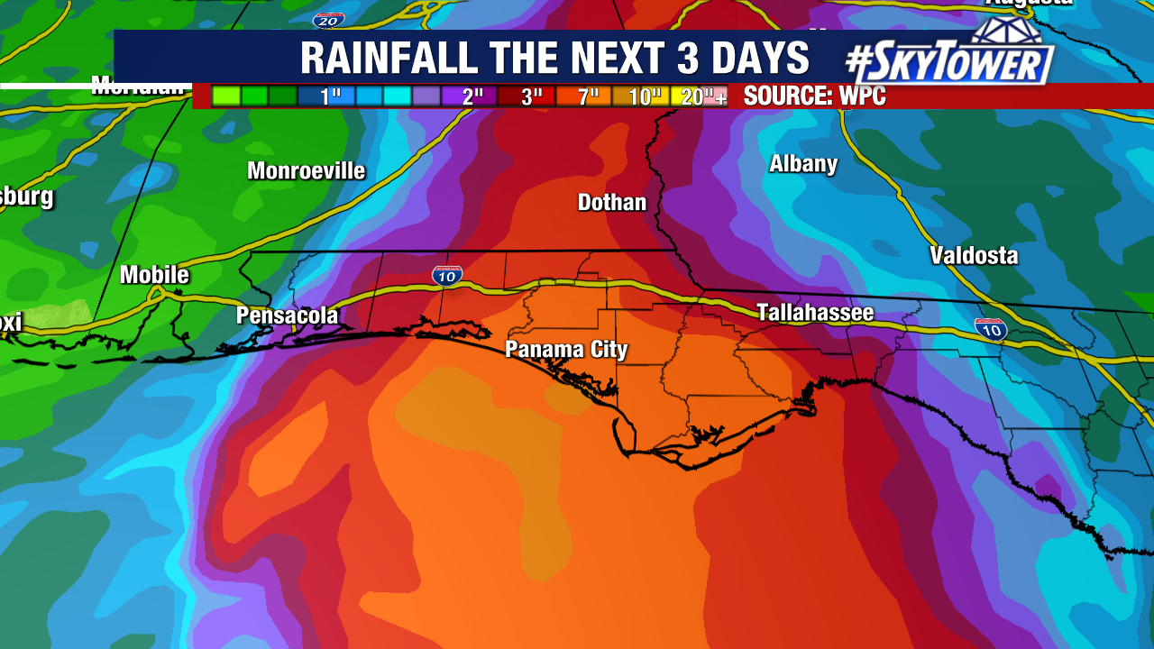
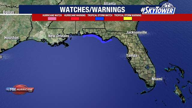
Minor storm surge is also possible along with tropical storm-force winds, especially at the immediate coastline. A tropical storm warning is in effect from Navarre to the Wakulla-Jefferson Co. line.

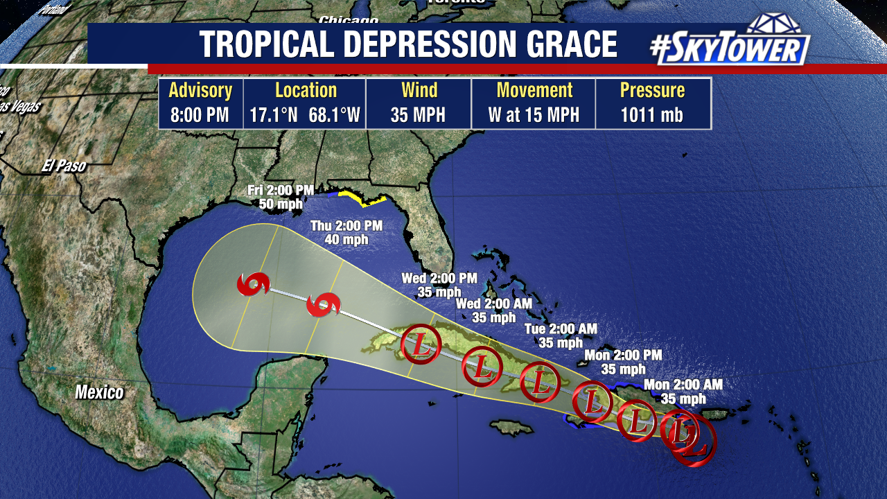
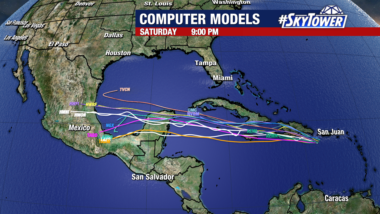
Tropical Storm Grace is bringing heavy rain to Puerto Rico and the island of Hispanola – areas that received heavy rain from Fred a few days. Not to mention, Haiti is still dealing with aftermath of the massive earthquake that struck recently. The storm will struggle with land interaction in the days to come. We’ll see how it navigates the islands, but majority of model guidance is currently not very bullish on future strengthening.

Fred Re-Strengthens To Tropical Storm; Tropical Storm Watch Issued For Northern Gulf Coast

After battling land interaction and wind shear which caused Fred to be downgraded to a remnant low on Saturday, Fred has regained tropical storm status Sunday morning.

Hurricane Hunters finding a closed low and sufficient winds of 40 mph within the storm.

Regardless of the upgrade, local impacts for the Tampa Bay area remain unchanged and minimal as Fred continues to track in a general northwest direction away from the region with the worst weather staying offshore.

Still, outer bands from Fred could bring occasional waves of rain, especially near the coast during the day on Sunday. A marginal risk for a severe storm exists west of I-75 as well and a quick spin up tornado or waterspout can’t be ruled out. While winds won’t be a significant issue with Fred, there’s an elevated rip current risk along area beaches today and a small craft advisory in effect for boaters.

A Tropical Storm Watch has been issued for parts of the Northern Gulf Coast including the Alabama/Florida border to Ochlockonee, Florida. Some additional strengthening is possible over the next day or so and Fred is expected to make landfall near the western Florida Panhandle sometime Monday night/early Tuesday as a moderate tropical storm.