After battling land interaction and wind shear which caused Fred to be downgraded to a remnant low on Saturday, Fred has regained tropical storm status Sunday morning.
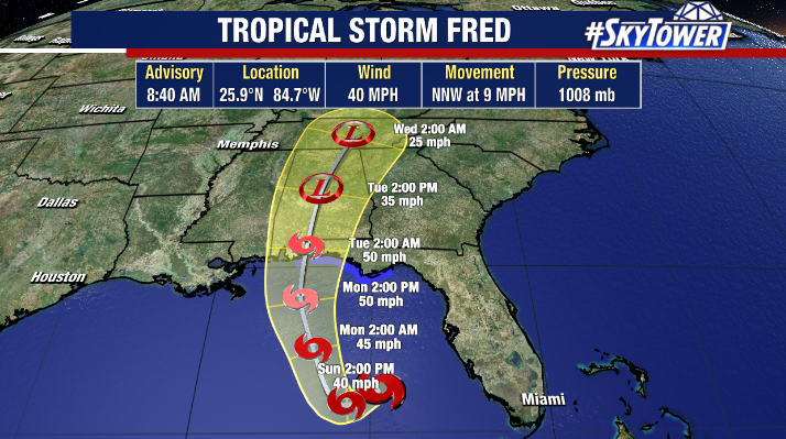
Hurricane Hunters finding a closed low and sufficient winds of 40 mph within the storm.
Regardless of the upgrade, local impacts for the Tampa Bay area remain unchanged and minimal as Fred continues to track in a general northwest direction away from the region with the worst weather staying offshore.
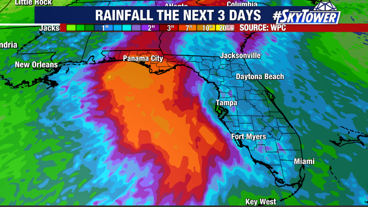
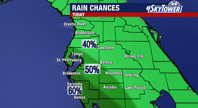
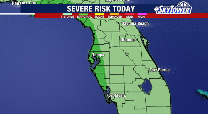
Still, outer bands from Fred could bring occasional waves of rain, especially near the coast during the day on Sunday. A marginal risk for a severe storm exists west of I-75 as well and a quick spin up tornado or waterspout can’t be ruled out. While winds won’t be a significant issue with Fred, there’s an elevated rip current risk along area beaches today and a small craft advisory in effect for boaters.
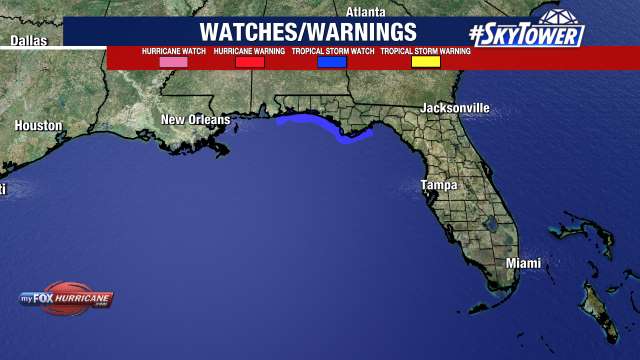
A Tropical Storm Watch has been issued for parts of the Northern Gulf Coast including the Alabama/Florida border to Ochlockonee, Florida. Some additional strengthening is possible over the next day or so and Fred is expected to make landfall near the western Florida Panhandle sometime Monday night/early Tuesday as a moderate tropical storm.