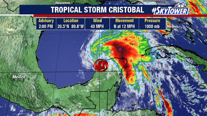
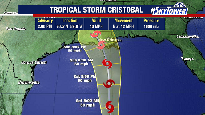
AS of 2pm ET Friday afternoon, Cristobal is once again a tropical storm. It’ll be moving into the Southern Gulf this evening.
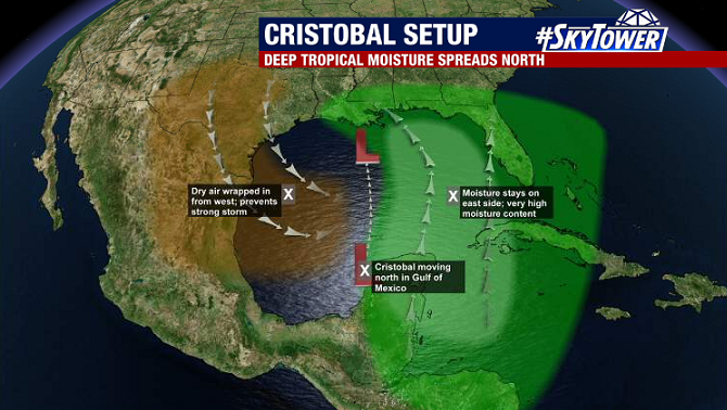
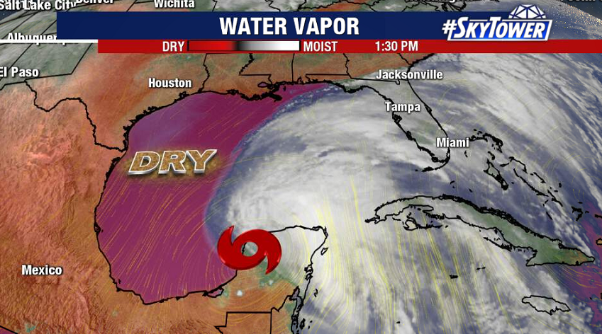
It’s a lopsided system, with an abundance of dry air over the western Gulf, as well as some wind shear, working against it. That being said, we’re still expecting a slow and steady strengthening up until landfall along the central Gulf Coast late in the weekend.
Models continue to be consistent in Cristobal’s track, showing a likely landfall along the Louisiana coast Sunday night. A tropical storm watch is now in effect from Intracoastal City, LA to the AL/FL border.
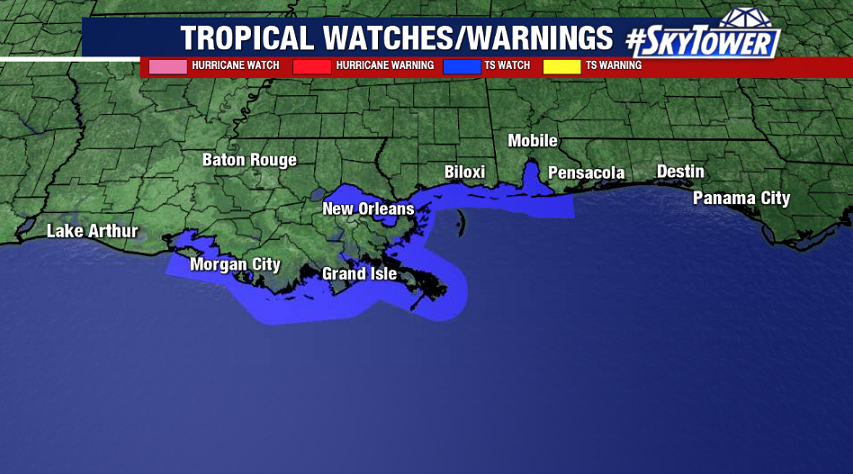
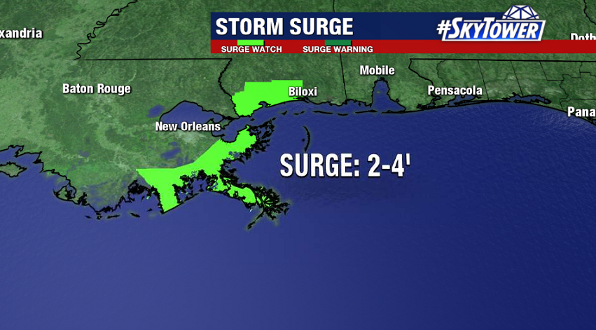
Despite some expected strengthening, Cristobal should remain a lopsided storm – consisting of a broad and asymmetric wind field. Wind and surge issues will be present well east of the center of the storm. Storm surge watches are currently in effect near the mouth of the Mississippi River, and also through the Big Bend region of Florida.
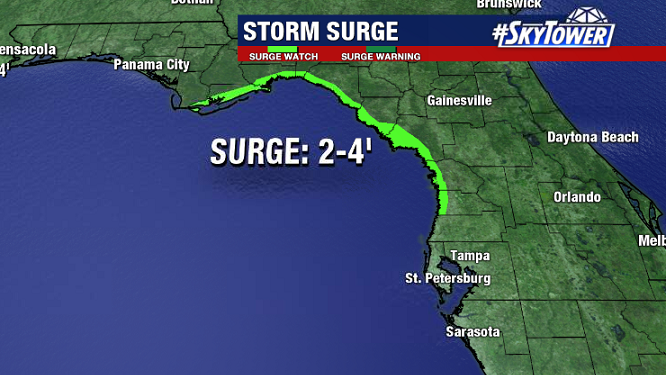
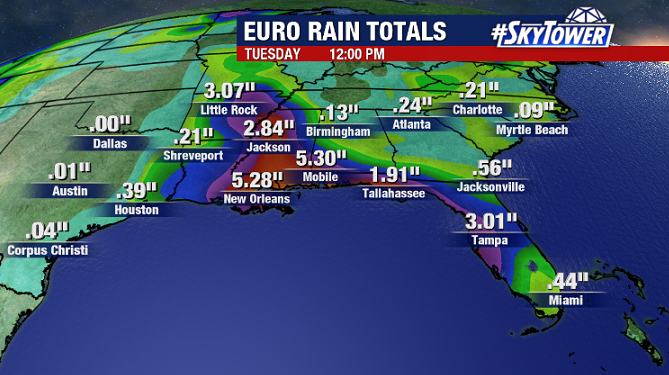
On top of coastal flood issues, an additional 3-5″+ of rain is expected along the central and eastern Gulf Coast through early next week as deep tropical moisture spreads north. This will come on top 2-6″ of rain that has already fallen across the Florida Peninsula over the last 48 hours.