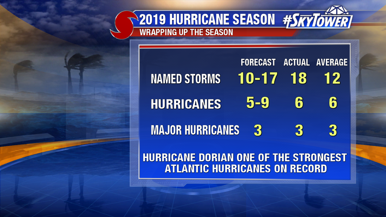
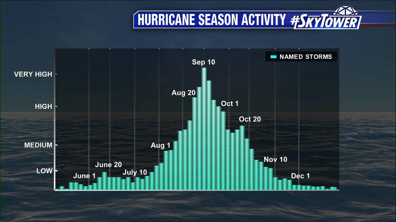
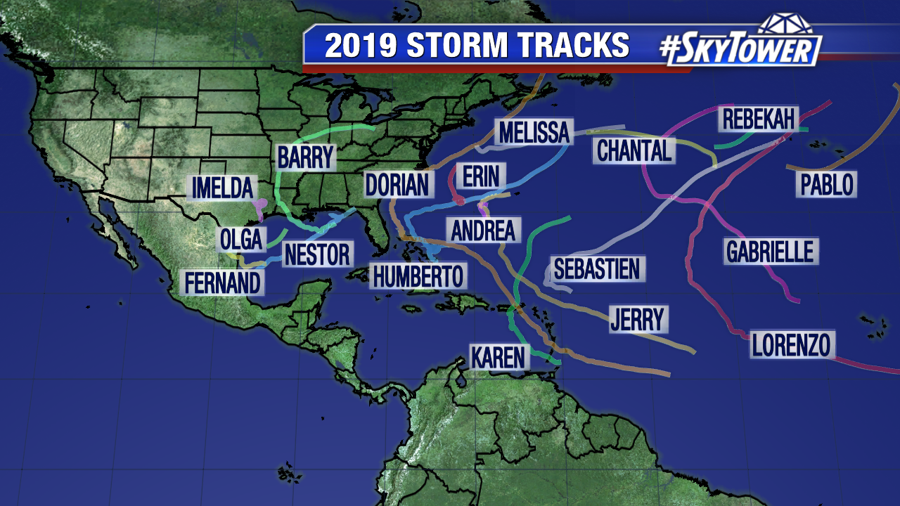
We’ve closed the book on yet another hurricane season. Eighteen named storms formed this year in the Atlantic basin, making it only the ninth season on record with as many or more storms. Many were weak and short-lived, while others will not soon be forgotten for the trail of destruction they left behind.
Andrea
For the fifth consecutive year, the Atlantic hurricane season got off to an early start with preseason Subtropical Storm Andrea forming a few hundred miles southwest of Bermuda on May 20. It would end up dissipating in less than 24 hours.
Aside from Andrea, it was a quiet start to the hurricane season. A weak El Nino was still in place through the month of June. This led to higher amounts of wind shear across the Atlantic basin, helping to further limit tropical activity during what is already a quiet point in the season. In July, the weak El Nino was coming to an end and tropical activity soon began to increase.
Barry
Our second named storm, Barry, formed on July 11 a couple hundred miles off the Louisiana coast. Its formation was rather unique, as an upper-level low had dove south across Tennessee and Alabama and into the northeastern Gulf, where it spawned a surface low. Barry became the season’s first hurricane as it slowly moved toward Louisiana. It made landfall just west of Morgan City, LA on July 13, making it only the fourth July hurricane on record to hit the state.
Prior to landfall, there was fear that heavy rainfall may lead to catastrophic flooding across parts of Louisiana and Mississippi, as rivers were already swollen from recent heavy rains. Thankfully, the threat for up to two feet of rain never really materialized. While flooding issues were still widespread across much of the Lower Mississippi Valley, it wasn’t nearly as bad as it could have been.
Chantal
Following Barry, the hurricane season went through a multi-week lull. Based on climatology, activity was actually running below average for a short time before our third named storm, Chantal, formed over the North Atlantic shipping lanes on August 20. It was also right about this time that NOAA had officially declared the end of El Nino and the National Hurricane Center increased the likelihood of an above-average hurricane season – expecting a very active August, September, and October period. It wasn’t long before that began to come to fruition.
Dorian
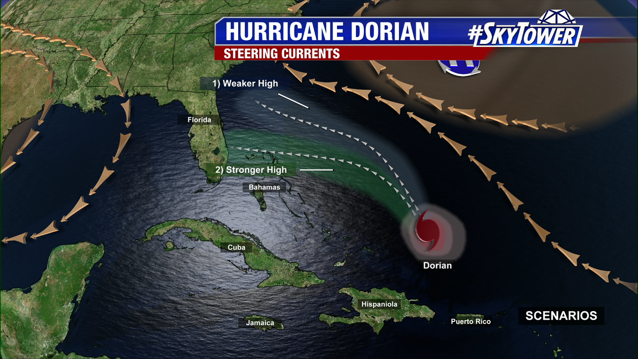
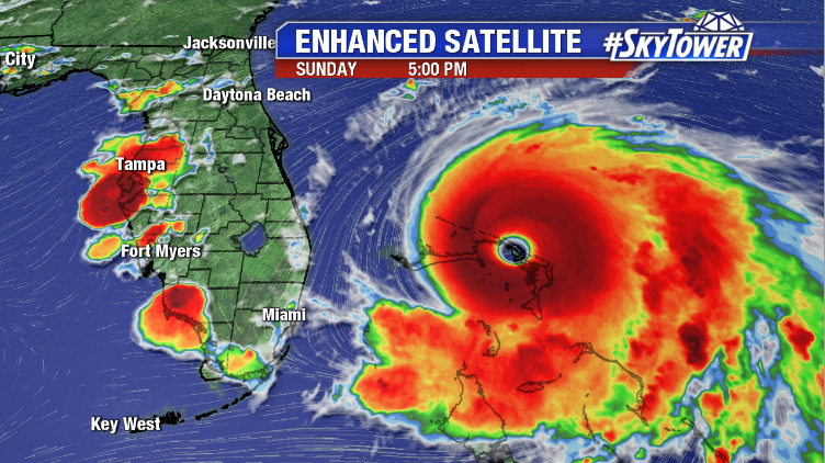
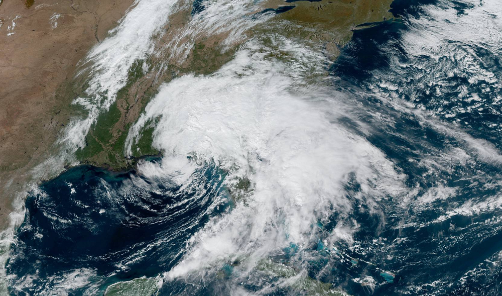
On August 24, we began tracking a new tropical depression in the far eastern Caribbean. Tropical Storm Dorian formed soon after and moved north, bringing rain and wind to the Virgin Islands and Puerto Rico. Dorian became a hurricane as it moved out of the Caribbean Sea and into the western Atlantic. A favorable environment for further intensification and a steering pattern toward the Bahamas and U.S. lay ahead.
As Dorian drew closer, it became very clear it was going to be a big problem for the Bahamas and a very close call for Florida. The intensity forecast was locked in – a potentially catastrophic slow-moving hurricane was headed our way. However, as steering currents weakened, how Dorian would respond was a big question all the way up to its eventual landfall in the Bahamas.
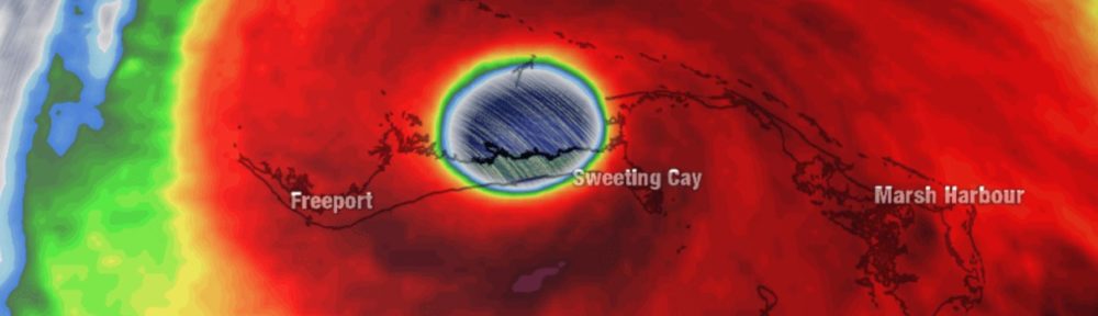
Following a period of unprecedented rapid intensification, the storm eventually made landfall on the morning of September 1 in the northwestern Bahamas with sustained winds of 185 mph and gusts well over 200 mph.
It was the strongest storm on record for the Bahamas and is tied with only the Labor Day Hurricane of 1935 (Florida Keys) for the strongest landfall winds on record anywhere in the Atlantic basin. It also marked the fourth straight year that a Category 5 storm has formed in the Atlantic – the longest such streak on record.
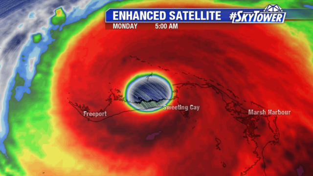
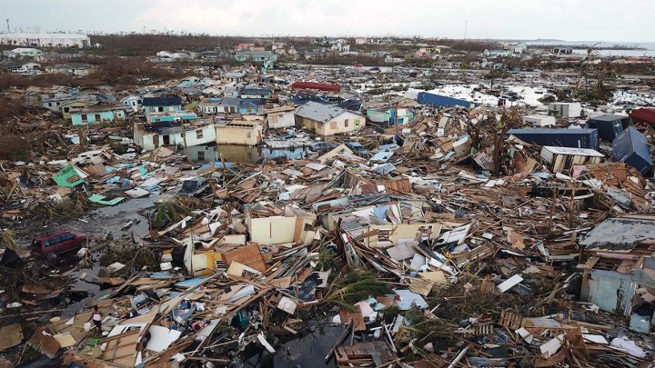
Dorian’s painfully slow forward motion put the islands of Great Abaco and Grand Bahama through more than 48 straight hours of some of the worst weather found anywhere on our planet. Major hurricane-force winds, along with catastrophic storm surge of over 20 feet, caused complete devastation in these islands. Sadly, it will take many years for them to recover.
Following its path through the Bahamas, Dorian found a weakness in the atmosphere between the ridge to its north and an arriving trough from the northwest. This allowed the storm to turn north and eventually northeast, largely sparing the state of Florida. That being said, impacts were certainly still felt along the east coast of Florida, all the way up through the coast of the Carolinas. Dorian eventually did make a U.S. landfall in Cape Hatteras, NC as a category 1 hurricane on September 6 before moving out to sea.
Erin and Fernand
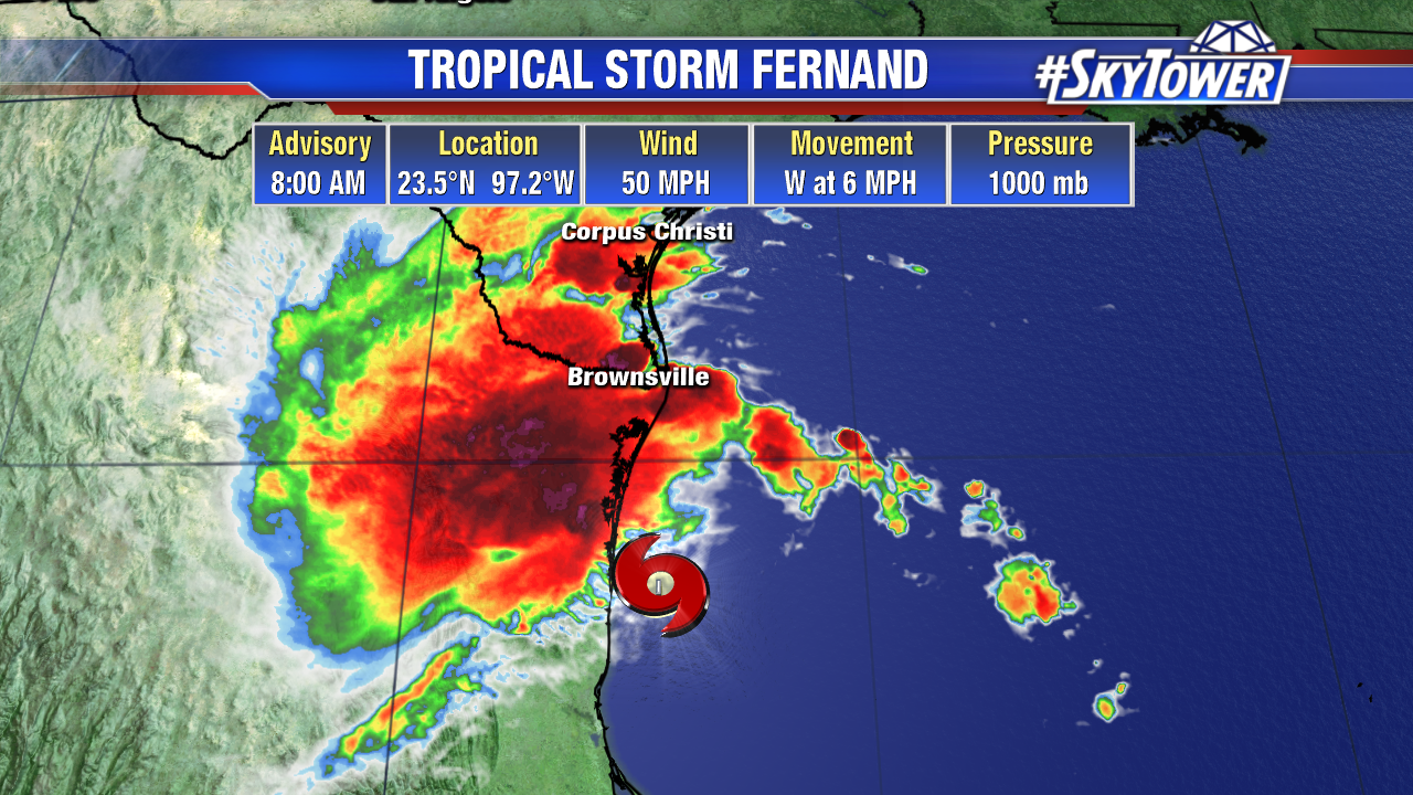
As all eyes were on Dorian over about a two-week span, two more short-lived storms formed. First, Erin developed midway between Bermuda and the United States on August 26. The storm remained over the open Atlantic and did not impact any land areas. Then, in early September, Tropical Storm Fernand quickly formed in the Gulf of Mexico. It brought heavy rain to parts of northeastern Mexico and southern Texas, then quickly dissipated over the rugged mountain terrain.
Gabrielle
On September 3, while Fernand was developing in the Gulf, Gabrielle was forming in the eastern tropical Atlantic. The system strengthened into a tropical storm with 50 mph winds and then weakened into a post-tropical cyclone (no longer possessed sufficient tropical characteristics to be considered a tropical system) a few days later. Gabrielle once again organized and regained tropical storm strength with 65 mph winds, as it remained over the open waters of the Atlantic. Ultimately, Gabrielle didn’t impact any land areas during its entire life cycle.
By this point, we had reached the statistical peak of hurricane season (September 10). So far, seasonal activity was right about average with a total of seven named storms.
Humberto
In the days and weeks that followed, the hurricane season really kicked it into high gear. On September 13, Tropical Storm Humberto formed just southeast of the Northwestern Bahamas. It was a rather weak storm early in its life cycle, but still brought wind and rain to some of the islands that were completely devastated by Hurricane Dorian just a couple of weeks prior.
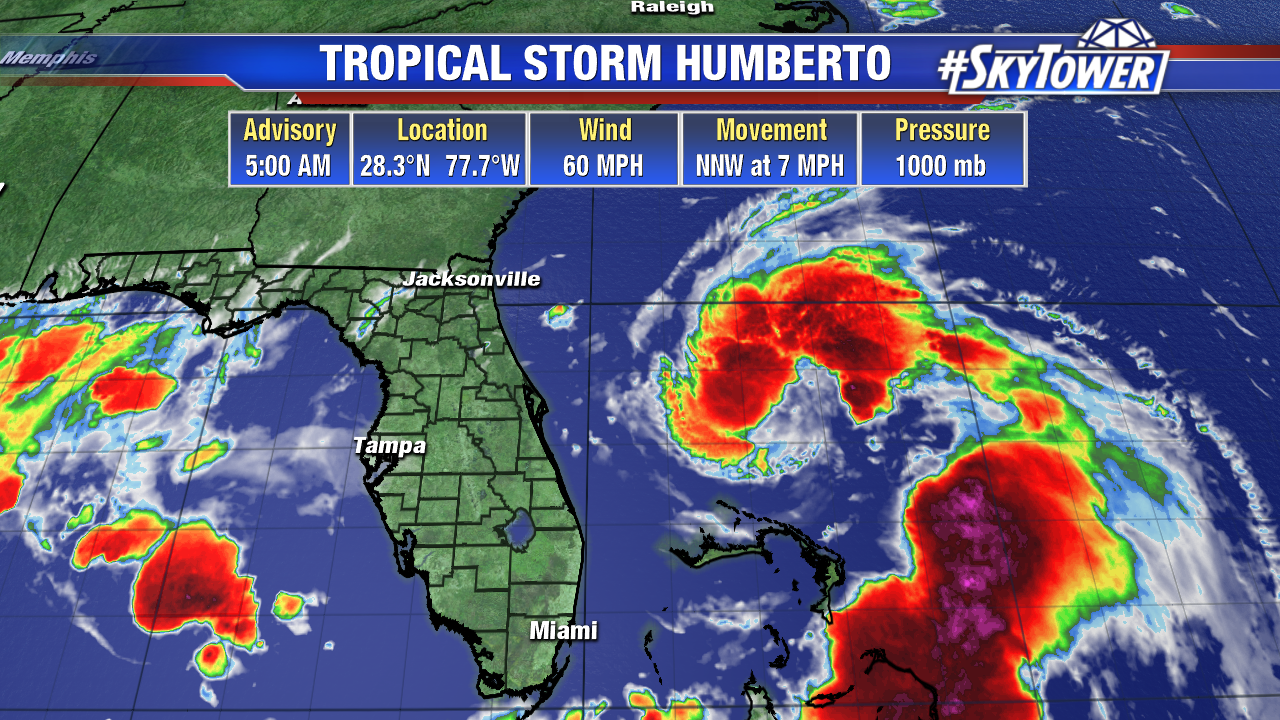
Humberto intensified after passing by the Bahamas. It became a major hurricane as it moved away from the United States, eventually delivering a glancing blow to Bermuda. Wind gusts of over 100 mph were recorded on the island as the storm passed about 75 miles to the north.
Imelda
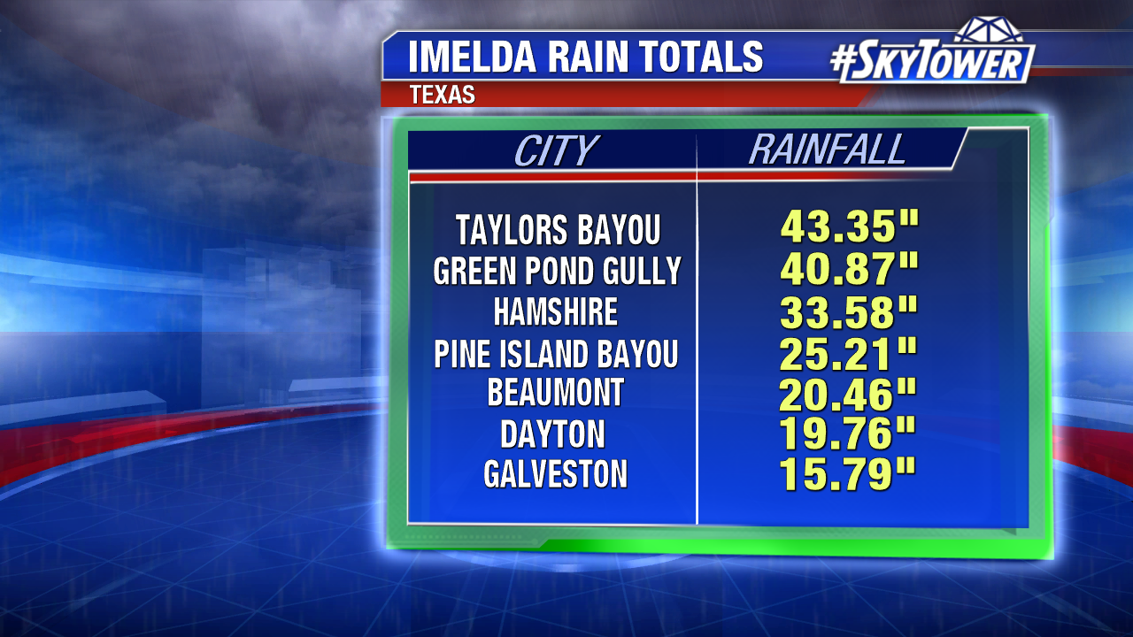
The active month of September continued as Imelda, Jerry, and Karen all formed during the third week of September. Imelda developed very close to the coastline of southeast Texas on September 17 – becoming a named storm only 45 minutes before making landfall in Freeport, TX. It wasn’t a strong storm, but it was very slow moving. The result was persistent heavy rain that caused life threatening flash flooding throughout Southeastern Texas into parts of Louisiana
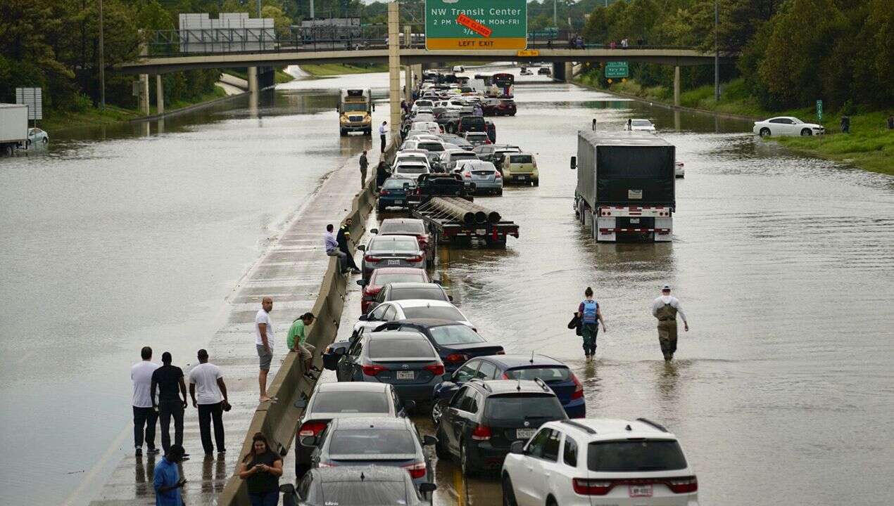
Similar to Harvey just 2 years prior, some areas just east of Houston received more than 3 feet of rain – yet another reminder that every storm is different and can be dangerous in its own way.
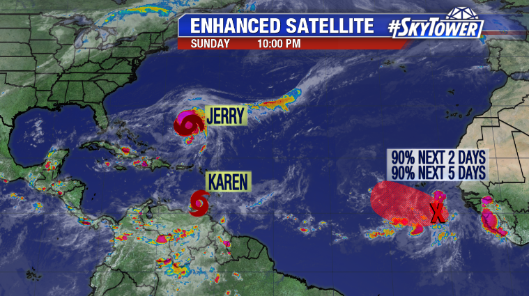
Jerry
Jerry formed in the central Atlantic one day after Imelda made landfall in Texas. It quickly became our fourth hurricane of the season, but other than some wind and rain in the Northeast Caribbean, and in Bermuda a few days later, it was largely uneventful.
Karen
While Jerry was on its last leg near Bermuda, Tropical Storm Karen formed about 100 miles east of Grenada in the Lesser Antilles. It brought tropical storm-force winds and periods of heavy rain across many of the small islands in the southeastern Caribbean before moving north on a similar path to Dorian. It brought more wind and rain to Puerto Rico and the Virgin Islands before moving out to sea.
Lorenzo
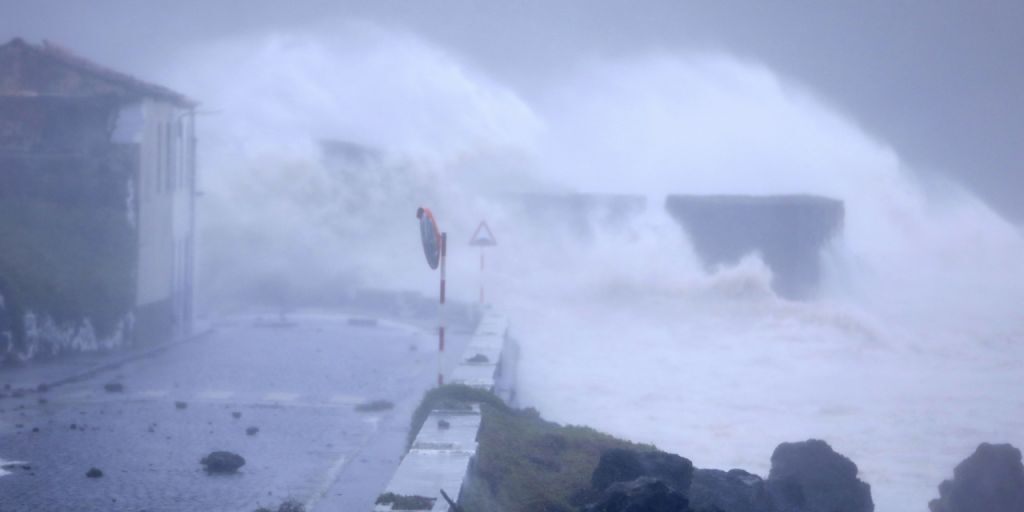
Hurricane Lorenzo was a classic Cabo Verde storm, forming from a tropical wave moving off the coast of Africa on September 23 – just one day after Karen formed. It ended up becoming the third major hurricane of the season – and second category 5 storm – with maximum winds reaching 160 mph as it curved north into the North Atlantic. This put Lorenzo into the record books as the strongest hurricane on record so far north and east in the Atlantic Ocean.
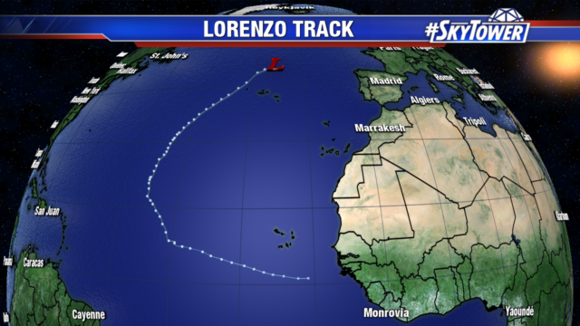
It spent most of its life cycle over the open ocean. But due to its size, it generated large swells across the Atlantic. Luckily, the storm weakened to a category 1 with 90 mph winds as it neared the Azores. Santa Cruz Airport in the western Azores, reported sustained winds of 60 mph and 85 mph gusts. Large waves and heavy rain also pounded the islands.
Melissa
The month of October began quietly, but activity increased mid month as Melissa formed. The system began as a nor’easter off the New England coast. It caused coastal flooding from the Mid-Atlantic states to southeast New England before heading out into the open Atlantic.
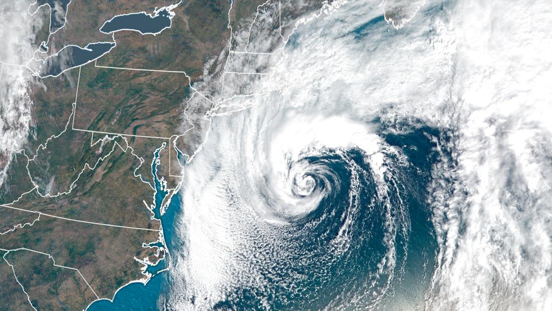
As it moved away from the United States it became a sub-tropical system and then a tropical storm. It generated 65 mph winds at its peak, before steadily weakening as it moved eastward.
Nestor
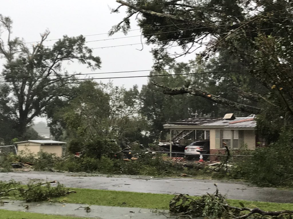
Nestor began as a disturbance in the southwestern Gulf of Mexico on October 17. The next day it strengthened into a Tropical Storm and headed towards the panhandle of Florida. The storm battled strong wind shear as it neared the northern Gulf coast. Nestor became a post-tropical cyclone just prior to making landfall near Cape San Blas in Northwest Florida. It brought tropical storm-force winds, heavy rain, and storm surge all along Florida’s west coast. Tyndall Air Force Base reported 49 mph sustained winds and a gust of 61 mph.
As Nestor passed to the west, much of central Florida dealt with the “messy side” of the storm. In addition to gusty winds and 2-5” of rain, there were 3 confirmed tornadoes around and just south of Tampa Bay. One was a rather uncommon long-track tornado, which left a trail of damage through western Polk County. The town of Kathleen saw the most significant damage. It was rated an EF-2 by the National Weather Service.
Olga and Pablo
In the final six days of October there was a flurry of activity. Olga and Pablo both formed on October 25. Olga formed in the western Gulf, but became post-tropical only 6 hours later. It ended up being the final storm out of seven named storms this season to last 24 hours or less – the most named storms lasting one day or less on record in a single season.
Pablo was one of the tinier systems we have seen. It was embedded within a larger low pressure system in the northeast Atlantic, which brought strong winds to the Azores. Even though it was a compact storm, Pablo briefly became a hurricane at 18.3º W. The farthest east an Atlantic named storm has become a hurricane on record. The previous record was set by Vince in 2005 at 18.9º W.
Rebekah
We ended October with sub-tropical storm Rebekah forming in the north Atlantic on October 30. It developed west of the Azores with max wind speeds of 40 mph. Rebekah only lasted about 36 hours before transitioning to a post-tropical cyclone and dissipating just north of the Azores.
Sebastien
Finally, with just 11 days left in the season, Tropical Storm Sebastian formed several hundred miles northeast of the northern Leeward Islands. It was the latest in the calendar year that we’ve had a named storm form in the Atlantic since Otto in 2016. Despite it being late November, Sebastien surprisingly retained its tropical characteristics for several days, even after moving into the North Atlantic toward the Azores. It did eventually become post-tropical on November 24 while bringing yet another round of strong winds and rain to the Azores.
We hope we were able to be a calming and informative voice for you and your family this hurricane season. Thank you for counting on all of us here at MyFoxHurricane.com all season long.