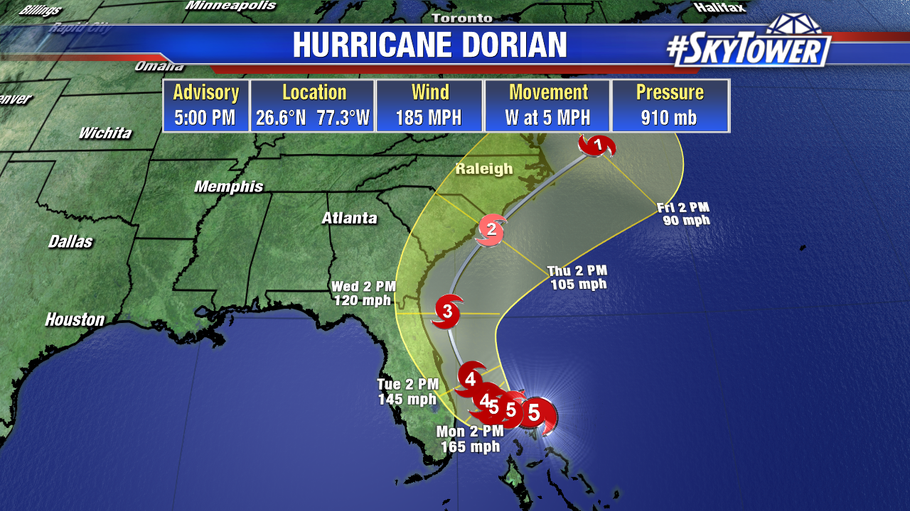
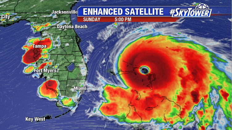
At 5pm Sunday, Hurricane Dorian was located about 95 miles east of Freeport on Grand Bahama Island and moving west at only 5 mph. The storm has already made two landfalls in the Bahamas, both with 185 mph winds. These are tied for the strongest Atlantic hurricane landfall on record with the 1935 Labor Day hurricane.
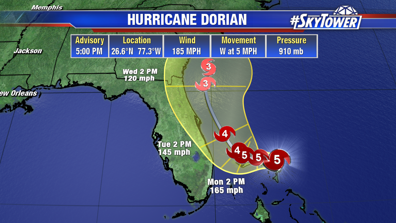
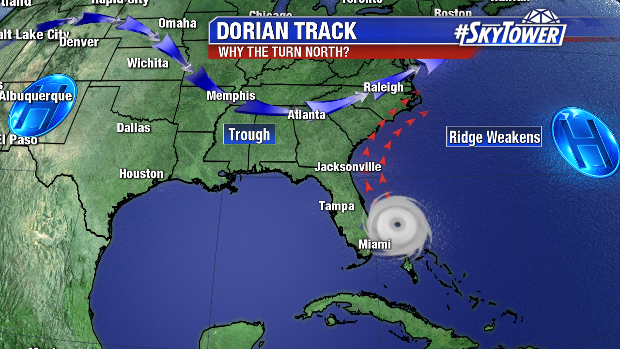
Dorian will continue moving painfully slow through these islands, very near Grand Bahama, over the next 18-24 hours before it begins the turn north and starts to pick up speed again. Majority of reliable models still keep the storm off of Florida’s East Coast, but it will be a very close call. A 25 mile shift here or there will make a make difference when it comes to impacts. A Florida landfall can’t still can’t be completely ruled out. Folks along Florida’s East Coast need to stay prepared for that possibility, especially given Dorian’s intensity.


Hurricane warnings are now in effect along from the Jupiter Inlet to Volusia/Brevard co. line.

Further north, along the coast of Georgia, South Carolina, and North Carolina, there is the possibility of significant impacts from Dorian later in the week. A track offshore is possible here as well, but there is a little less model consensus at this point. Folks in these areas need to be monitoring the progress of Dorian closely in the coming days.