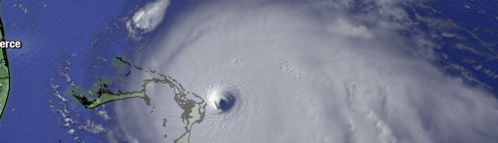
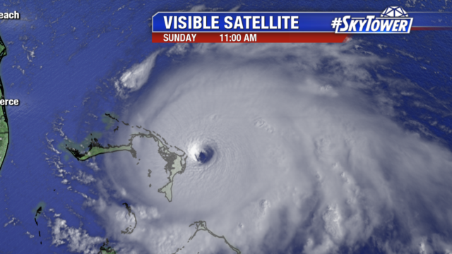
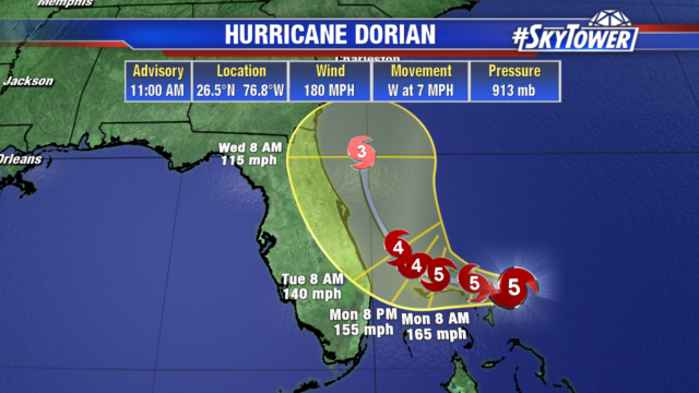
As of 11am, Dorian is the strongest hurricane in modern records for the Northwestern Bahamas with 180 mph winds and greater gusts. It is only 20 miles ENE of Great Abaco Island and has slowed to 7 mph. It will continue to move west today and tonight heading toward Grand Bahama. Ham radio reports indicate a 100 mph wind gust in Hope Town in the Abacos.
Dorian has a well defined eye with a stadium effect and has grown in size. We will likely see fluctuations in Dorian’s strength over the next few days but it will remain a powerful hurricane. Hurricane force winds now extend out 45 miles from the center and tropical storm force winds extend out 140 miles from the center.
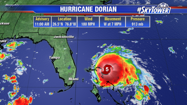
The track hasn’t changed much but Dorian is now expected to maintain category 5 strength as it moves over the northwestern Bahamas today and tomorrow. Florida’s east coast is still in the cone of uncertainty and could still see landfall from Dorian before it turns north. Dorian is expected to slowly weaken as it turns north being steered by a trough in the eastern United States. Georgia and the Carolinas also need to continue to monitor Dorian as impacts along their coasts look more likely.
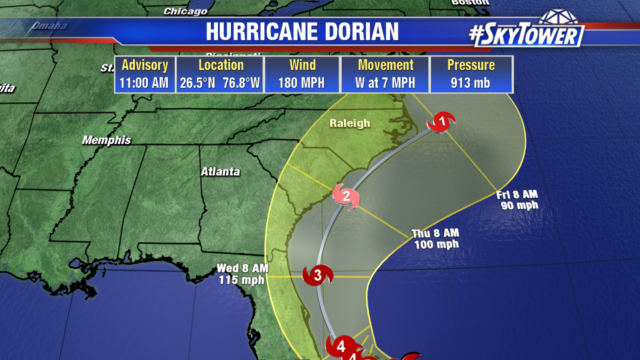
The primary concern for Tampa Bay is tropical storm force winds for Polk and Highlands counties. Tropical Storm Watches have been issued for them. Hurricane Watches have been posted along Florida’s east coast from Deerfield Beach to the Volusia/Brevard county line. Along its current path, 2-4″ with isolated 6″ rainfall totals are possible along the Florida’s east coast. Storm surge and coastal flooding is also a threat. If the peak surge occurs at the time of high tide, Volusia/Brevard County line to Jupiter Inlet could see 4 to 7 ft surge. North of Deefield Beach to Jupiter Inlet could see 2 to 4 ft storm surge.
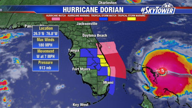
If Dorian stays on its current track the main impacts in Tampa would be gusty winds and a couple inches of rain. But a shift to the west, especially a landfall along Florida’s East Coast would increase Dorian’s impacts. Many models are keeping Dorian’s center offshore as it moves north, but a few bring it onshore making landfall along the East Coast. This is a powerful storm and we will continue to watch it closely.
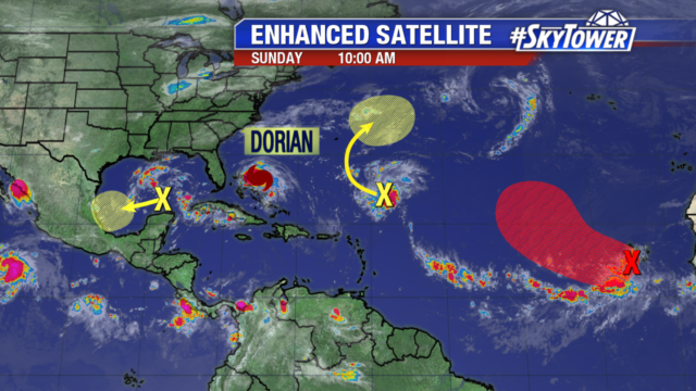
We are also monitoring 3 other disturbances. The wave off the coast of Africa in red, is a broad area of low pressure that has become better organized since yesterday. Conditions look favorable for further development during the next several days and it is likely to become a tropical depression by the middle of next week. The disturbance in the southwestern Gulf of Mexico has minimal chances of development as it heads towards the coast of Mexico. The disturbance well east of Dorian, is several hundred miles SSE of Bermuda and has minimal chances of development as it slowly moves north.