By the numbers, the 2018 hurricane season is running a little above average thus far. We’ve had three named storms, two of which have been hurricanes. Usually we don’t have two hurricanes in the books until near the end of August. NOAA also uses a wind energy index known as Accumulated Cyclone Energy, or ACE, to measure the amount of tropical activity over the course of a season. The current ACE is double what we would typically see at this point in the year.
So, does this mean we’ll continue have above average tropical activity the rest of the season? No, not necessarily. In fact, many signs point toward quite the opposite.
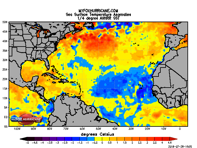
As the season wears on, the main development region for tropical systems is across the Central Atlantic. As of right now, that area continues to have near-record cool sea-surface temperatures (SSTs) thanks to a persistently strong Bermuda High. This feature, when strong, increases the trade winds across the Atlantic causing increased evaporation and upwelling of cooler water from beneath the surface. Tropical development requires warm water and there isn’t a lot of right now. The other main factor is the expected arrival of El Nino conditions over the next few months, which often makes it harder for storms to spin up in the Atlantic due to higher wind shear.
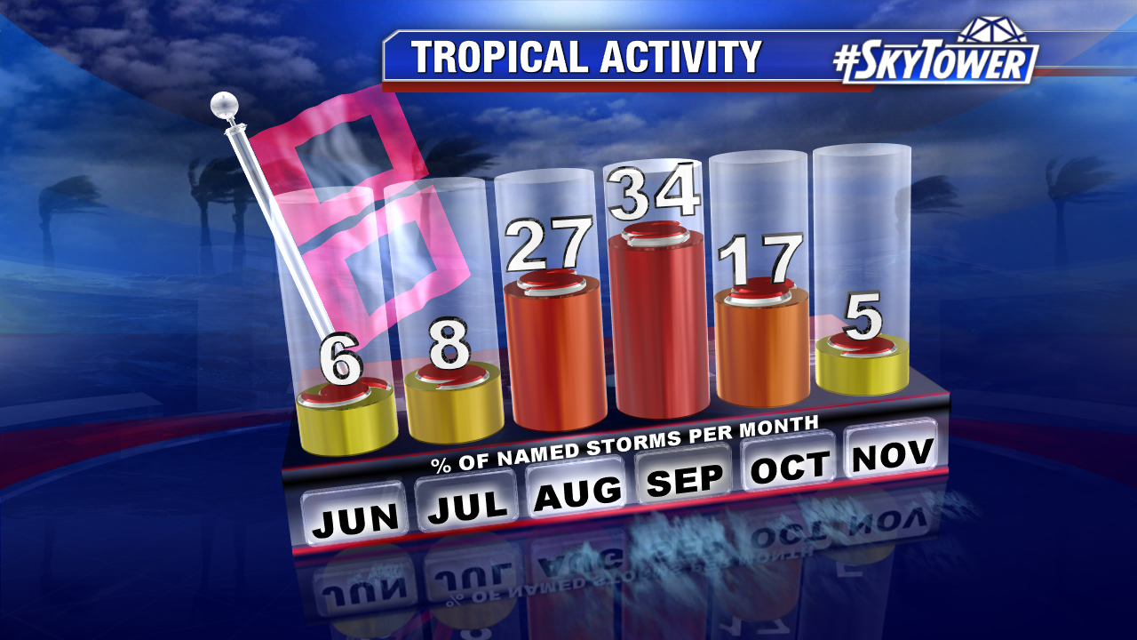
Although signs may point toward a quieter road ahead, we are still heading into the heart of hurricane season. On average, over 60% of all named storms have formed during the months of August and September.