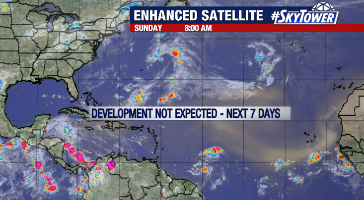
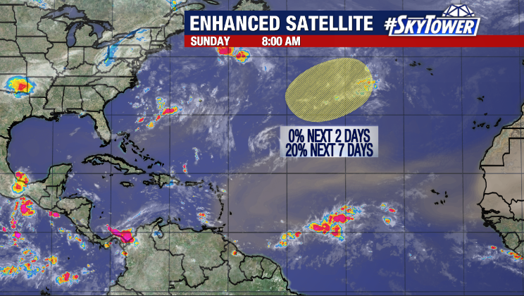
The tropics remains quiet heading into the second week of July with Saharan Dust suppressing activity across the Atlantic basin. The National Hurricane Center calls for no development in the next two days, but is monitoring an area in the central Atlantic where a non-tropical low could develop in the next week and inherit subtropical characteristics as it drifts southeastward. Only a 20% chance has been given for potential formation. Regardless of development, there would be no impacts to the United States.
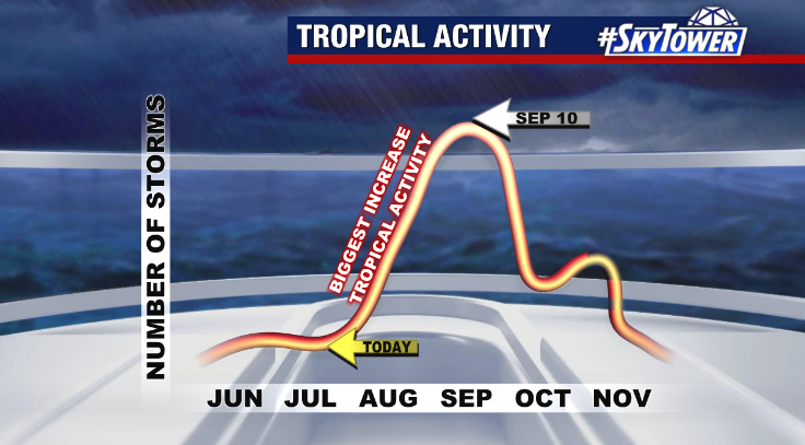
The primary reason for the lull in tropical activity recently is thanks to plumes of Saharan Dust continuing to move across the Atlantic. The dry air 1-3 miles above our heads is a usual occurrence early in the season, stabilizing the atmosphere and working against tropical development. However, it usually goes away after mid-August, allowing activity to ramp up.
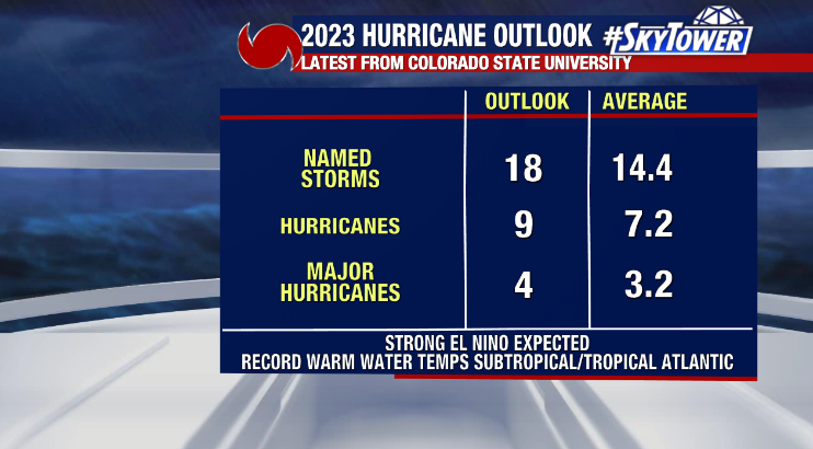
Despite the quiet stretch, the latest hurricane season forecast from Colorado State University now calls for an above average season with 18 named storms, 9 hurricanes, and 4 major hurricanes (cat 3 or stronger). The 18 named storms accounts for the 4 we’ve already seen this year. CSU says the reasoning for the higher storm count in their updated outlook is due to record warm sea surface temperatures in the Atlantic, which is expected to counteract the robust El Niño which typically increases wind shear, decreasing tropical activity.