About two months are left in the 2023 Hurricane Season, and the tropics are still active. We are watching two areas in the Atlantic Basin during the final days of September.
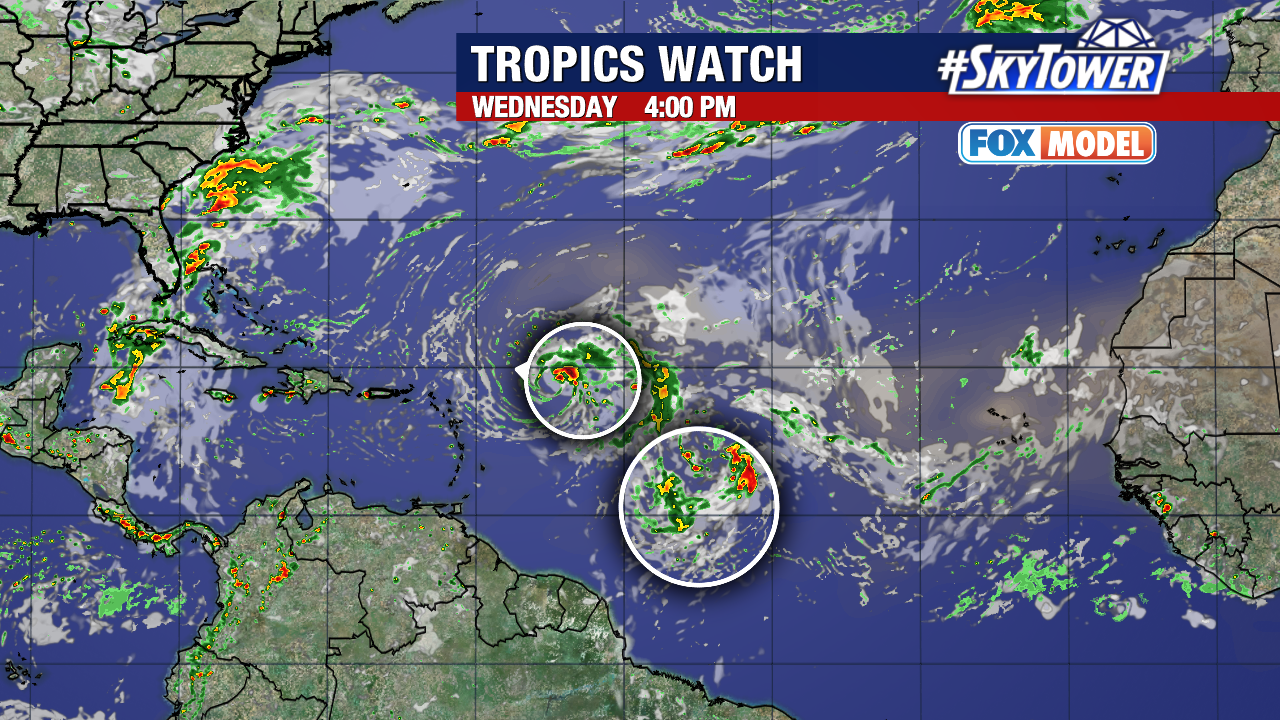
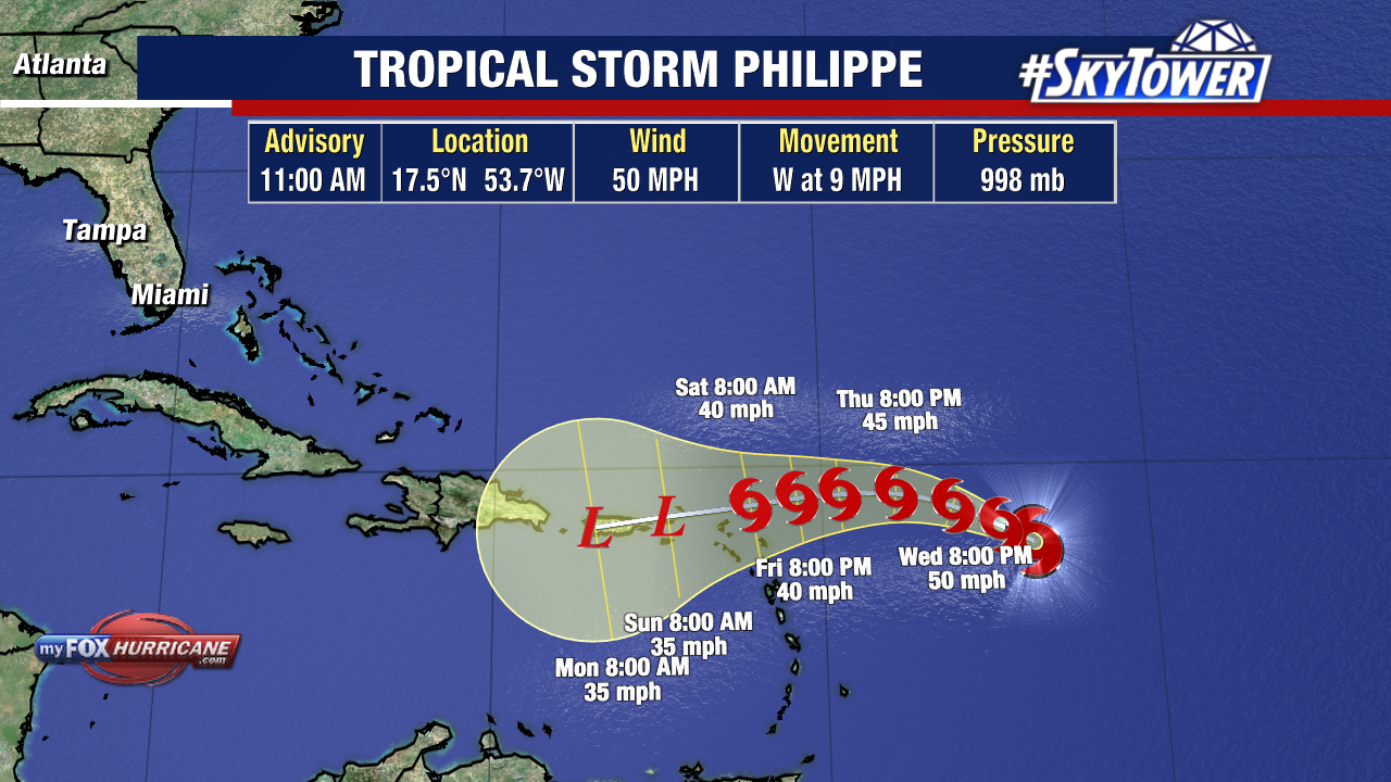
Tropical Storm Philippe is still sitting in the open waters of the Atlantic. The storm is several hundred miles east of the Northern Leeward Islands. As Phillippe continues it’s slow movement west-northwest, wind shear will limit further development.

Over the next few days, Tropical Storm Philippe is expected to weaken as it approaches the Caribbean Islands due to strong shear the storm will encounter. Forecasts call for Philippe to be downgraded to a tropical wave before it reaches land.
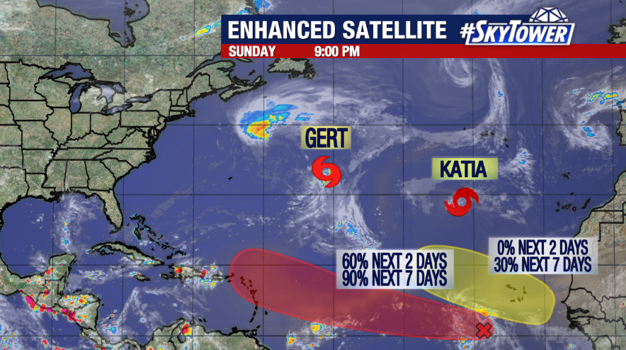
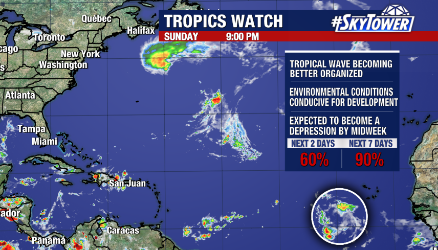
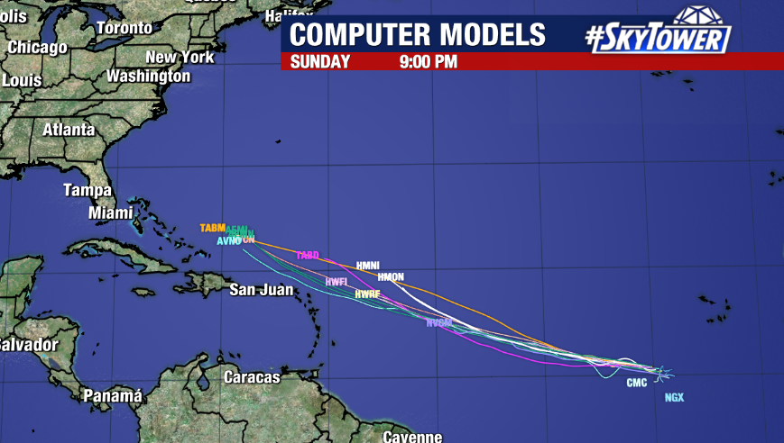
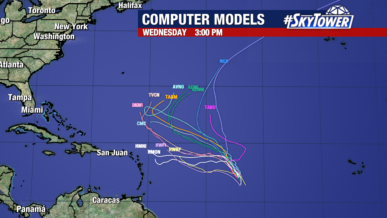
Another disturbance spinning just behind Philippe has a 90% chance of developing over the next week. Invest 91L is about halfway between the Cabo Verde Islands and the Lesser Antilles.

Conditions are more favorable for this storm to take on tropical characteristics as it travels west-northwest through the central Atlantic. It will likely become a tropical depression or storm within the next two days.
If this disorganized area comes together and develops into a tropical storm, it will be named Rina.

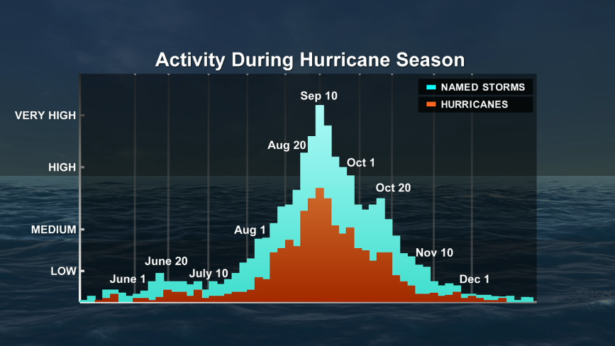
So far this season, there have been 17 named storms and six hurricanes, three of which were major hurricanes. That includes Hurricane Idalia, which made landfall on Florida’s Gulf Coast at the end of August.
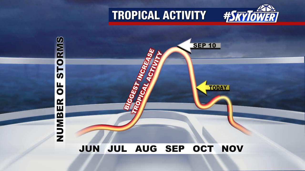
We have already passed the peak of hurricane season, but the tropics aren’t slowing down yet. With two months to go, there are five names left in the 2023 list before forecasters switch to the Greek alphabet if more storms develop.