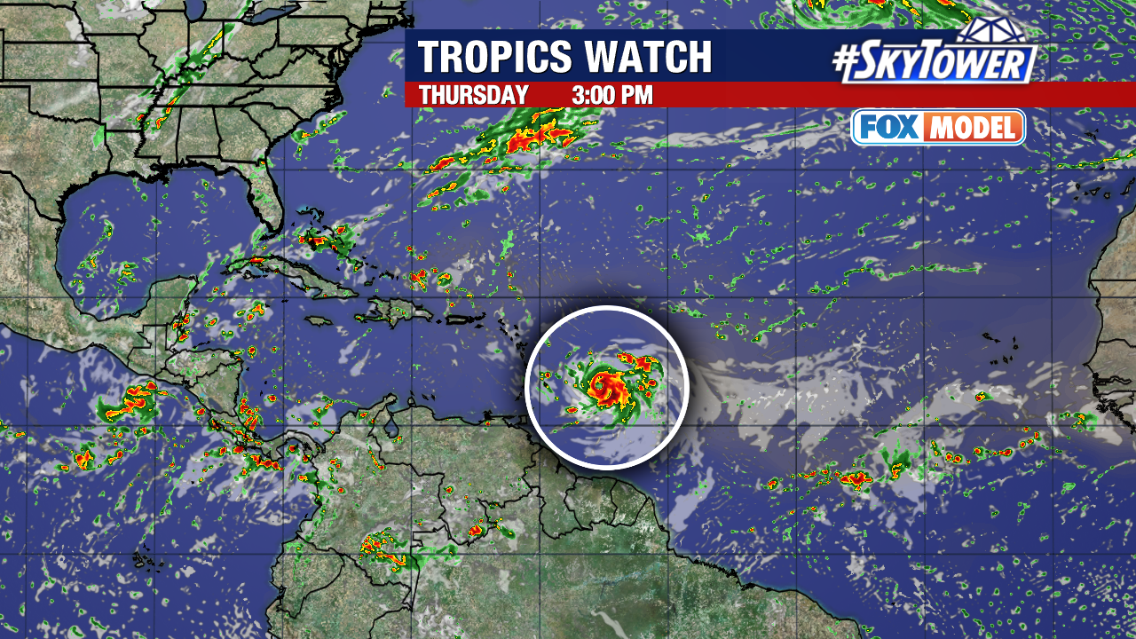
Formerly Tropical Storm Sean has just been downgraded to a Tropical Depression as it spins in the eastern Atlantic Ocean.
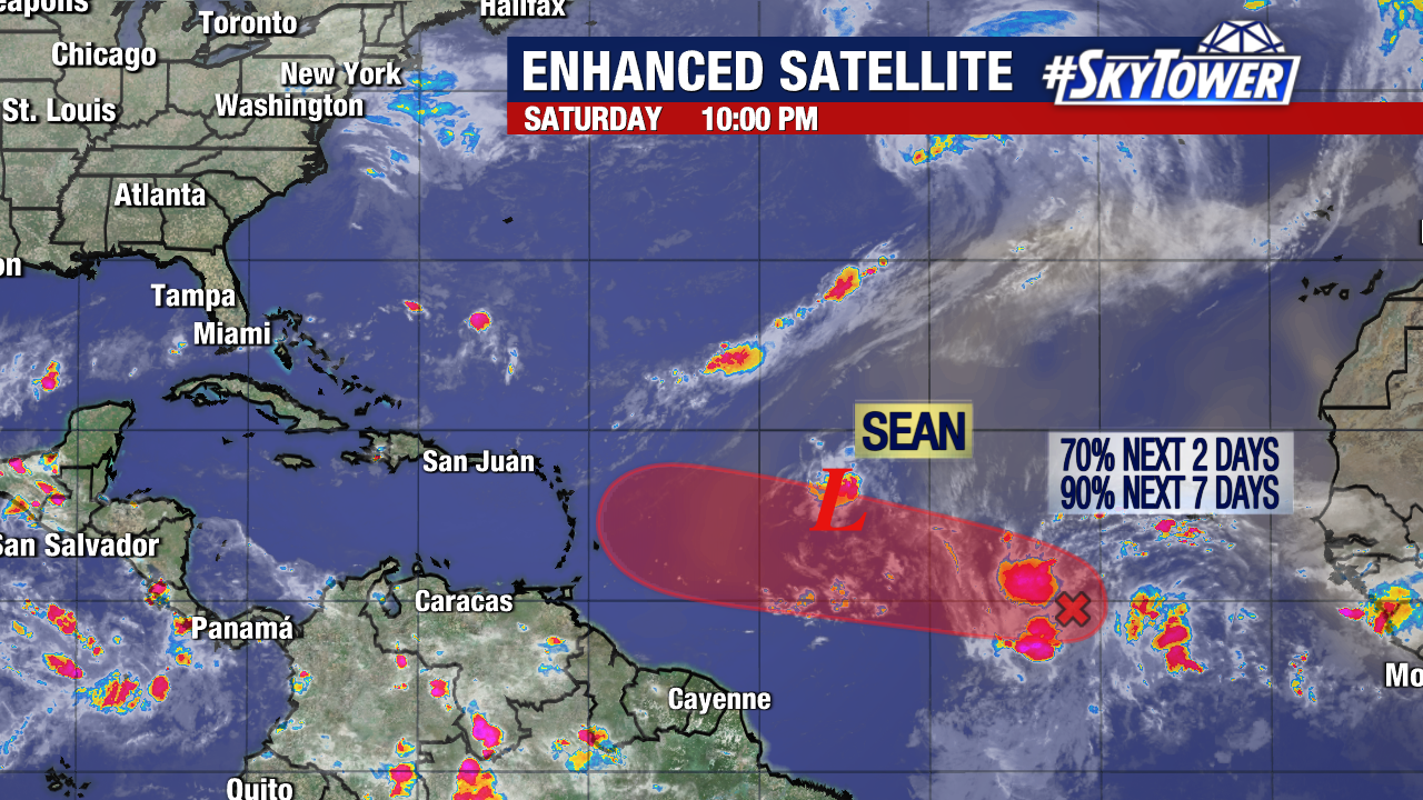
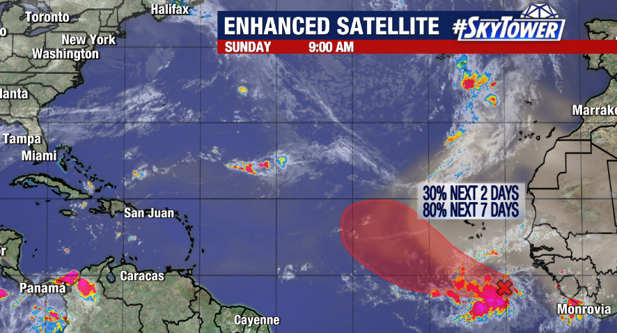
As Sean is weakening, another system is trailing behind it with a better chance of strengthening during the next few days. The tropical disturbance, Invest 94L, has been given a 90% of development by the National Hurricane Center.
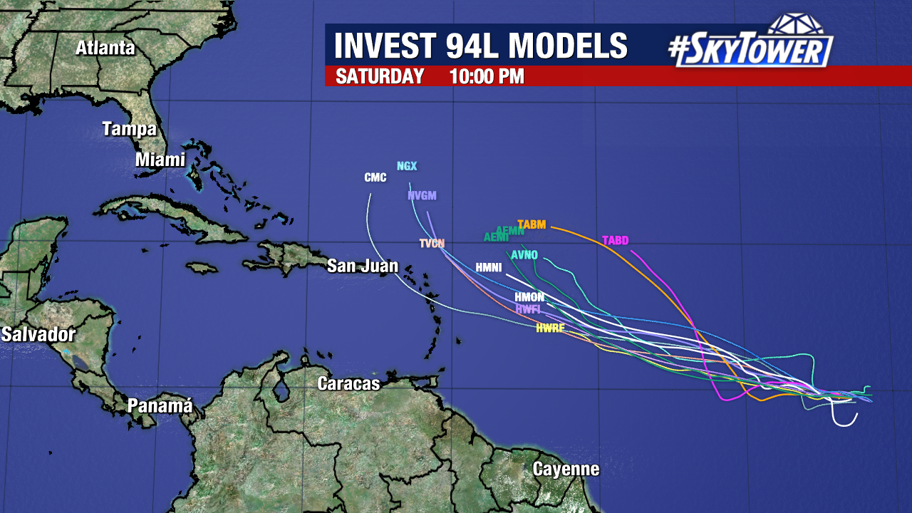
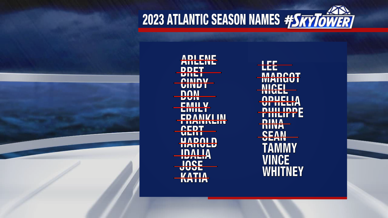
We could soon have our next named storm of the season as the environment ahead of Invest 94L is favorable for a tropical system. If it reaches tropical storm strength, it will be named Tammy.
Waters in the western and central Atlantic are running well into the 80s, which is prime for additional strengthening. Invest 94L will move on a mostly westward track and wind shear will not be much an issue for the storm.
As for Tropical Depression Sean, the storm is forecast to slowly weaken the next few days. It is spinning more than 1,000 miles east of the Lesser Antilles with sustained winds of 35mph.
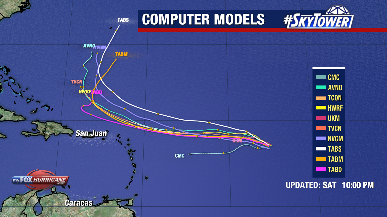
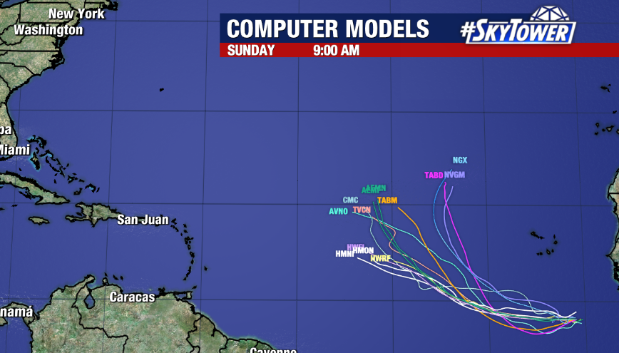
As Invest 94L continues on its path, we will be closely watching as this storm looks to be taking a more southerly route.