It has been the common theme over the past few days, wind shear and dry air will limit Potential Tropical Cyclone One from organizing. Being early on in the hurricane season there is still a lot of strong upper level winds over the Gulf of Mexico and plenty of drier air in the mid levels of the atmosphere. The outcome has not been a surprise, a tropical disturbance that continues to struggle to develop a well defined center of circulation.
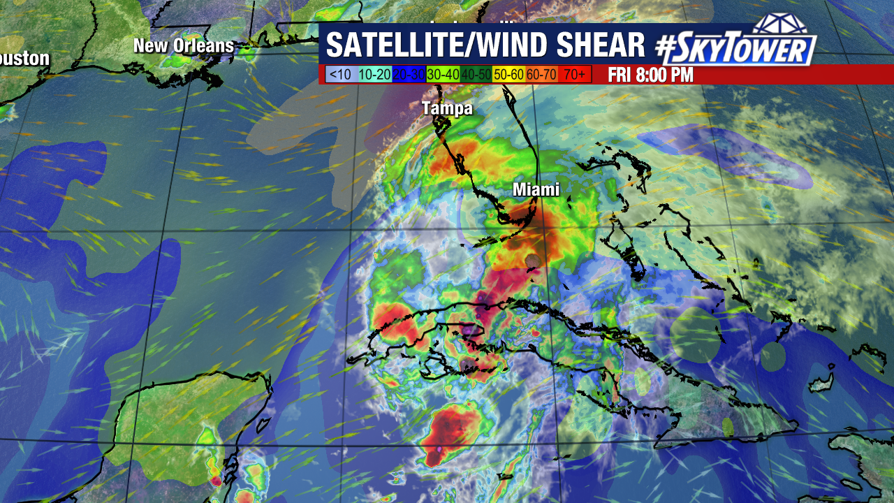
The wind shear will continue to plague this system for its trip over Florida which will continue to limit its ability to organize and strengthen. The second major issue this system is facing is dry air. Tropical systems feed off of warm, moist air. Dry air chokes off the moisture feeding the storm. Dry air is quickly wrapping around the western side of this storm which is not allowing it to develop that ring of storms around the center. This will also lead to a rapid improvement in weather conditions once the limited center it has passes by.
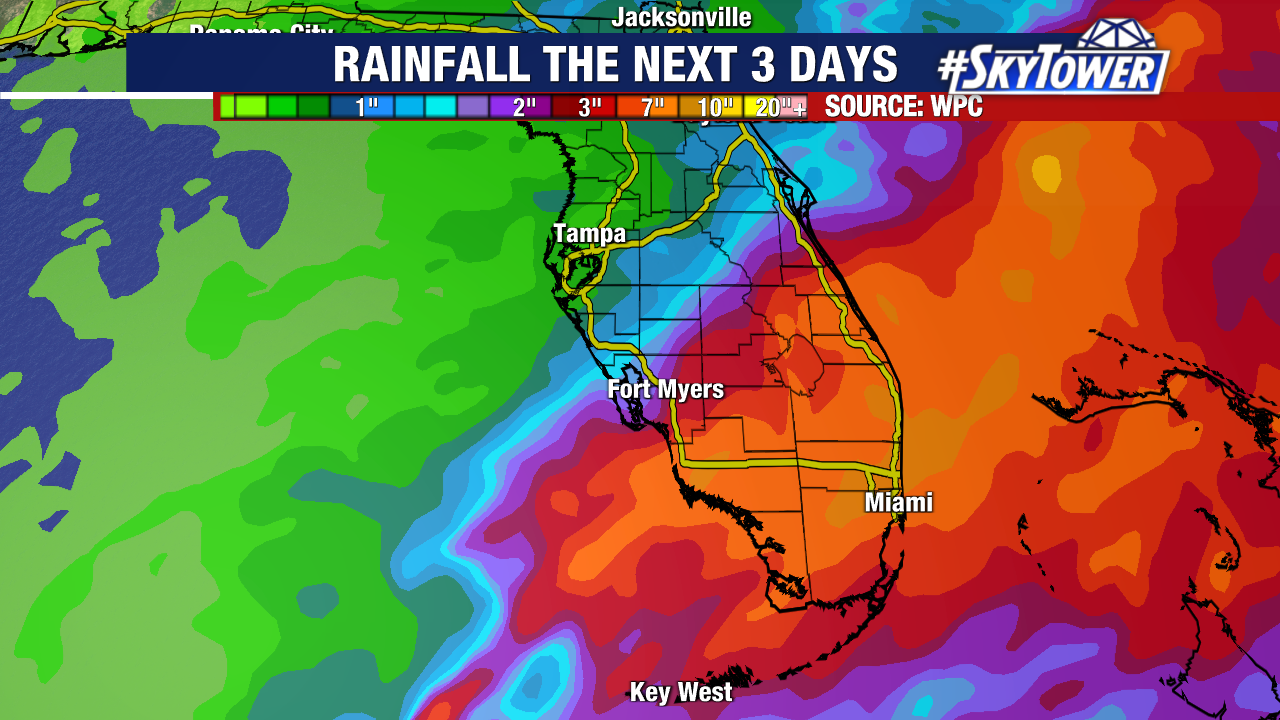
This leaves only one main issue to watch for this storm. Rainfall. The rains will continue over south Florida and at times there will be tropical downpours which will add up over time and lead to the possibility of flooding. Because of the structure of the storm and the dry air which will quickly fill in behind the storm limiting wrap around bands of rain, there will be a sharp dividing line between heavy rain and who gets hardly any rain from this storm.
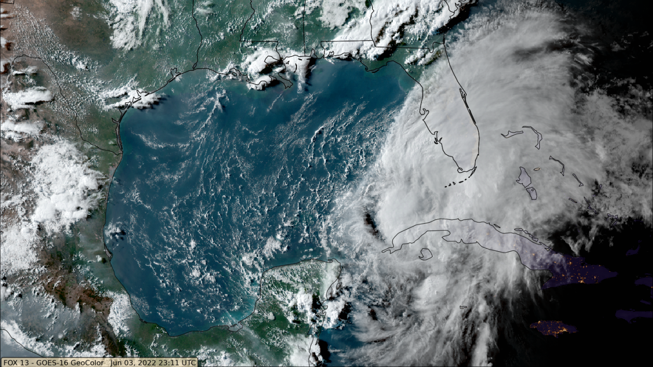
Color satellite imagery at sunset shows the strong convection remains well displaced from the center to the east and the lack of any convection on the entire western side of the storm. It is possible that this system does not become a tropical storm prior to landfall in Florida. We will continue to wait and see if this becomes Tropical Storm Alex.