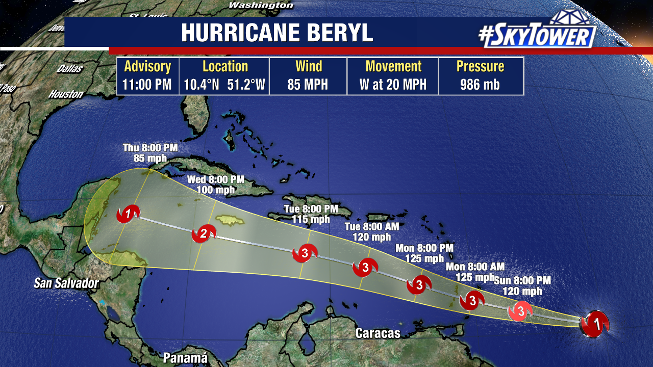
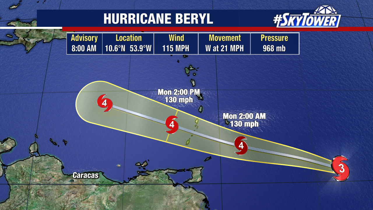
Hurricane Beryl is now at Category 3 strength after the storm quickly intensified over the last 24 hours. Sustained winds are now 115mph as the storm spins about 400 miles east-southeast of Barbados.
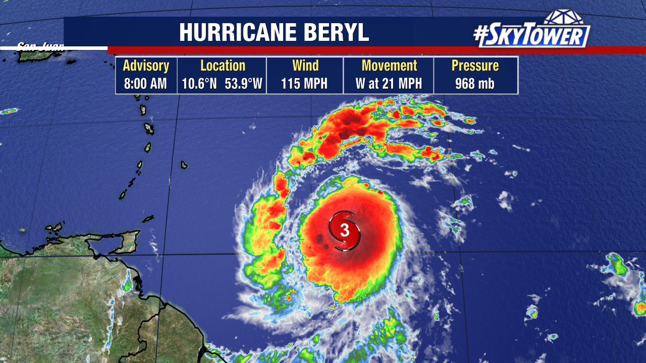
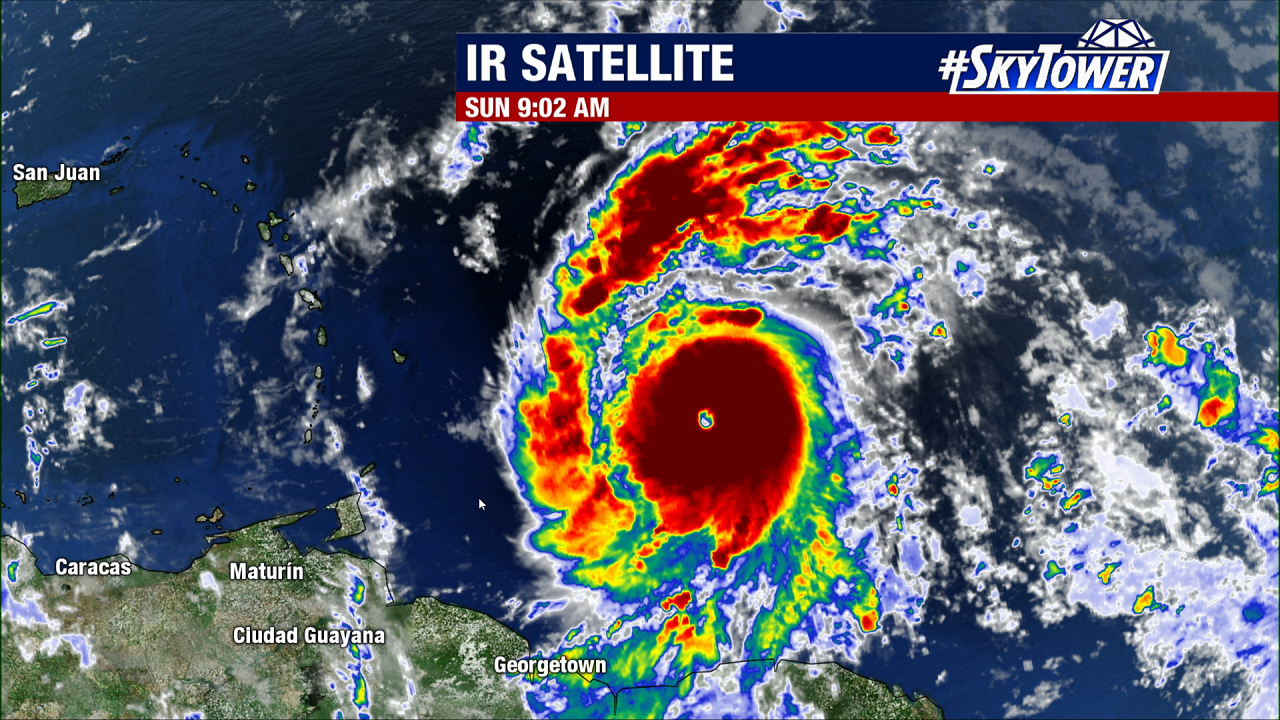
The storm has developed an eye and deep convection is becoming more organized around the storm’s center this morning, a sign of the storm strengthening.
As Beryl spins over very warm Atlantic waters, it is forecast to become a Category 4 hurricane when it reaches the Windward Islands early Monday. All conditions are favorable for additional strengthening before impacting land.
Hurricane-force winds extend outward about 15 miles from the center, while tropical-storm-force winds extend out about 80 miles.
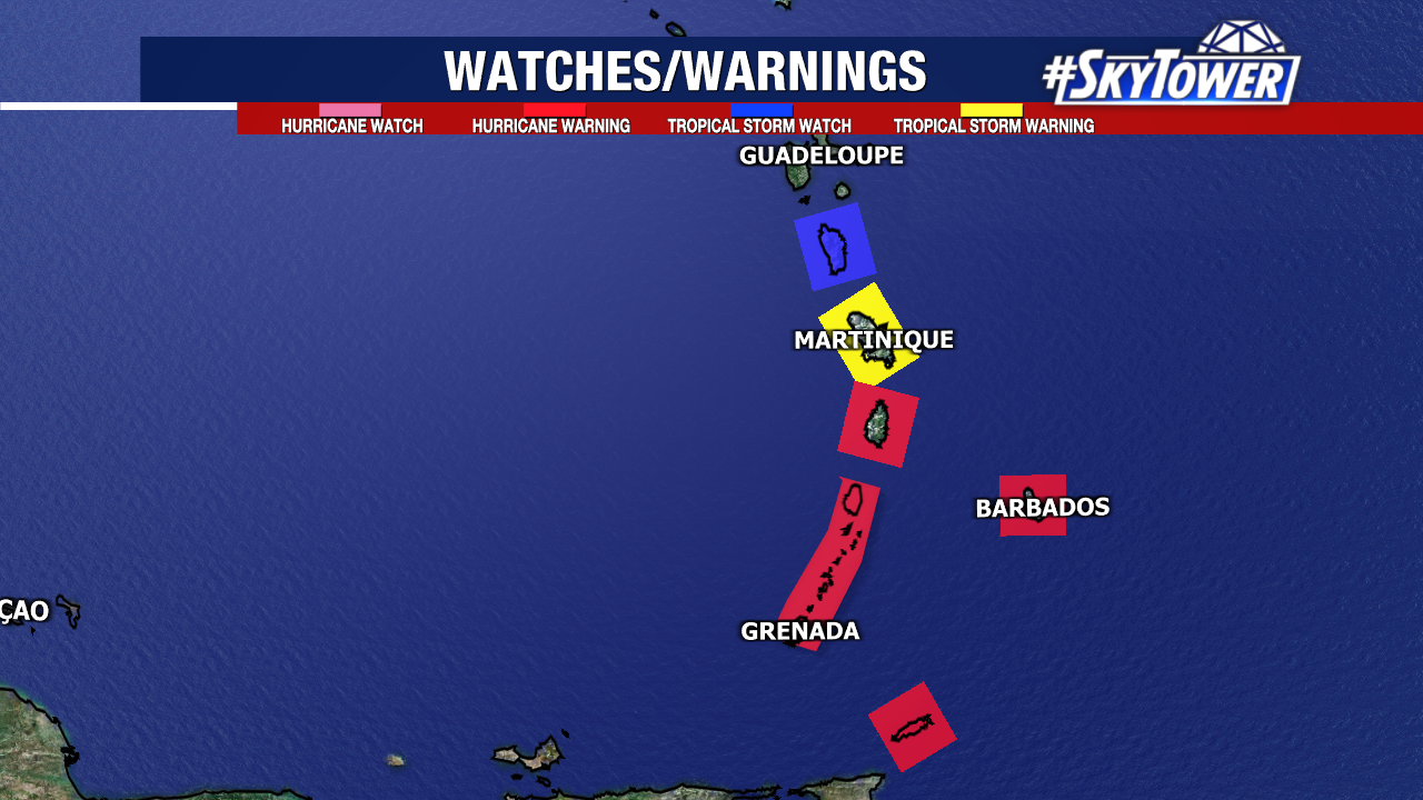
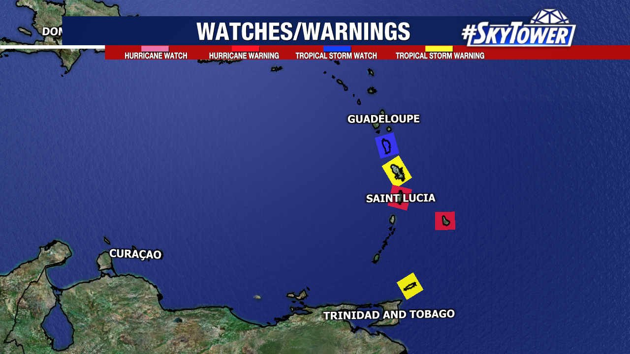
A Hurricane Warning is in effect for:
- Barbados
- St. Lucia
- St. Vincent and the Grenadine Islands
- Grenada
- Tobago
A Tropical Storm Warning is in effect for: Martinique. A Tropical Storm Watch is in effect for: Dominica
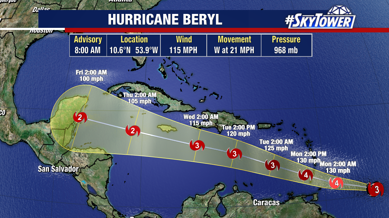
Once Beryl enters the Caribbean, the storm will encounter stronger wind shear which will likely cause the hurricane to weaken through mid-week. But at this point, forecasts still call for it to maintain Category 2 strength.
Hurricane Beryl is moving mostly due west at a quick 21mph. With a strong ridge just north of Beryl, steering flow will keep the storm on a mainly westward path through the Caribbean.
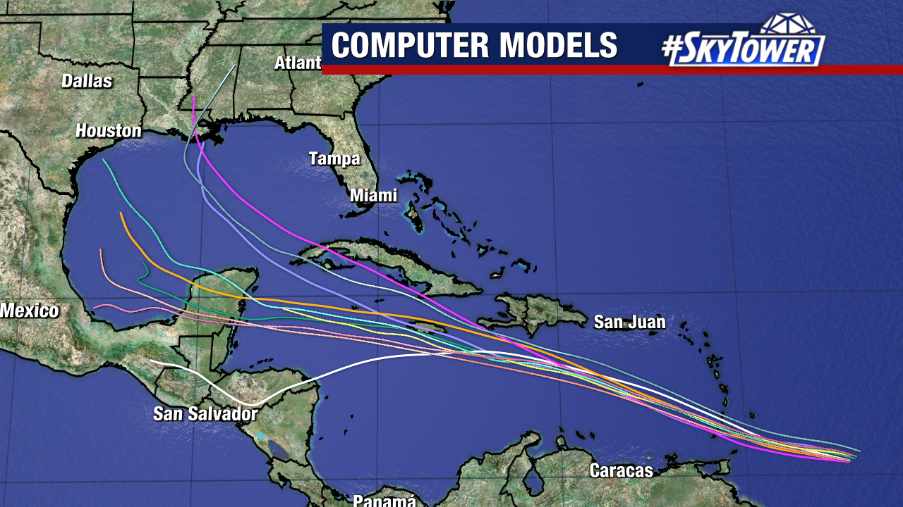
Model guidance is in pretty good agreement over the storm’s track, with a few outliers showing a slightly more NW track.
This is a rare storm for this point in the season and is already breaking records. Beryl is the farthest east a hurricane has formed on record during the month of June.
At this point, this storm is no threat to mainland U.S. but a dangerous situation is unfolding for the Windward Islands.
We’ll be watching this closely. Check back for the latest updates.