As of 4PM Wednesday, Nicole was located about 135 miles east of West Palm Beach. Max sustained winds were at 70 mph.
While some slight strengthening is possible up until the time landfall tonight, whether it’s a category 1 hurricane or tropical storm won’t make any real difference in terms of impacts across the state. Landfall will likely happen somewhere between North Palm Beach and the Sebastian Inlet.

Winds will continue to increase through the evening, with topical storm conditions overspreading Central Florida overnight. Late Wednesday night through Thursday morning will be the window for the worst weather across Central Florida.
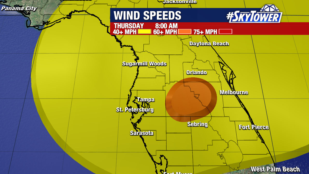
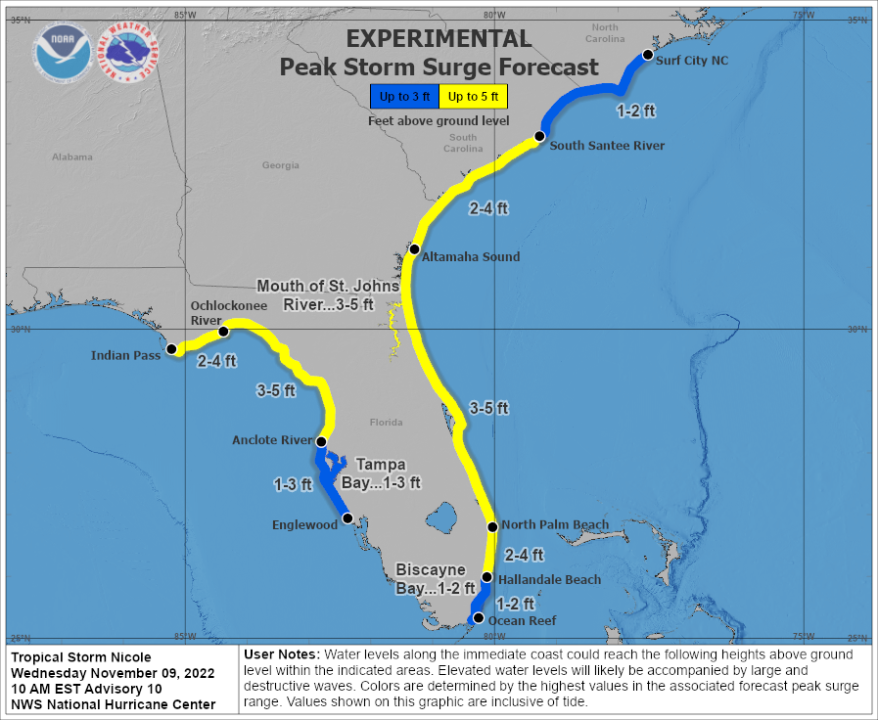
While just about everybody across Central and North Florida will experience a period of tropical storm-force winds and rain squalls tonight through Thursday, by far the biggest impact from Nicole will be coastal flooding near and north of where the center comes ashore. Peak storm surge of 3-5 feet is expected from North Palm Beach up through coastal Georgia.
In the wake of Nicole, cooler/drier air will settle in across the Southeast over the weekend.