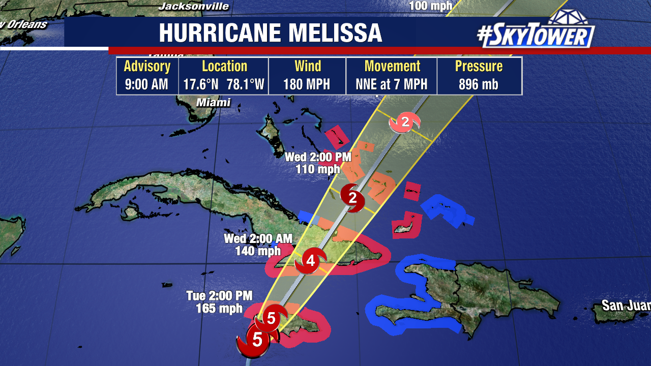
Hurricane Melissa continues to intensify as the eye spins off Jamaica’s southwest coast. The storm’s sustained winds have increased to 185 mph and the pressure has dropped to one of the lowest on record in the Atlantic Basin.
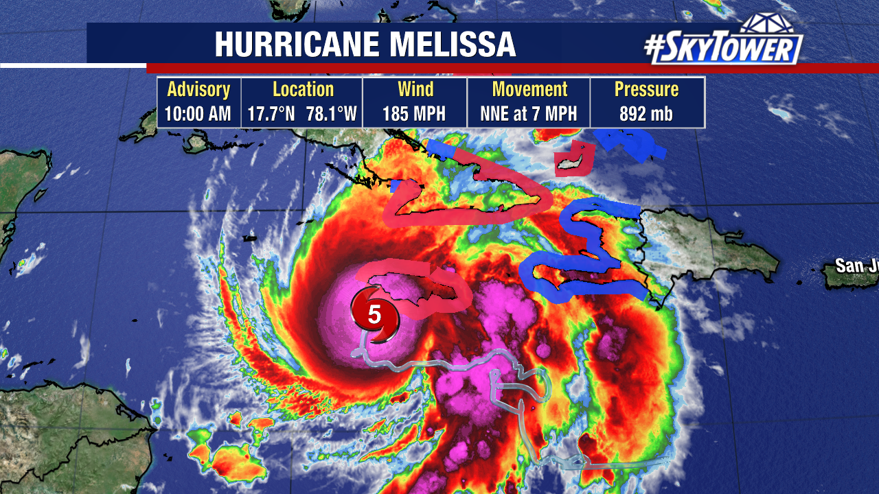
Hurricane Melissa’s 892mb pressure makes it the 3rd strongest on record.
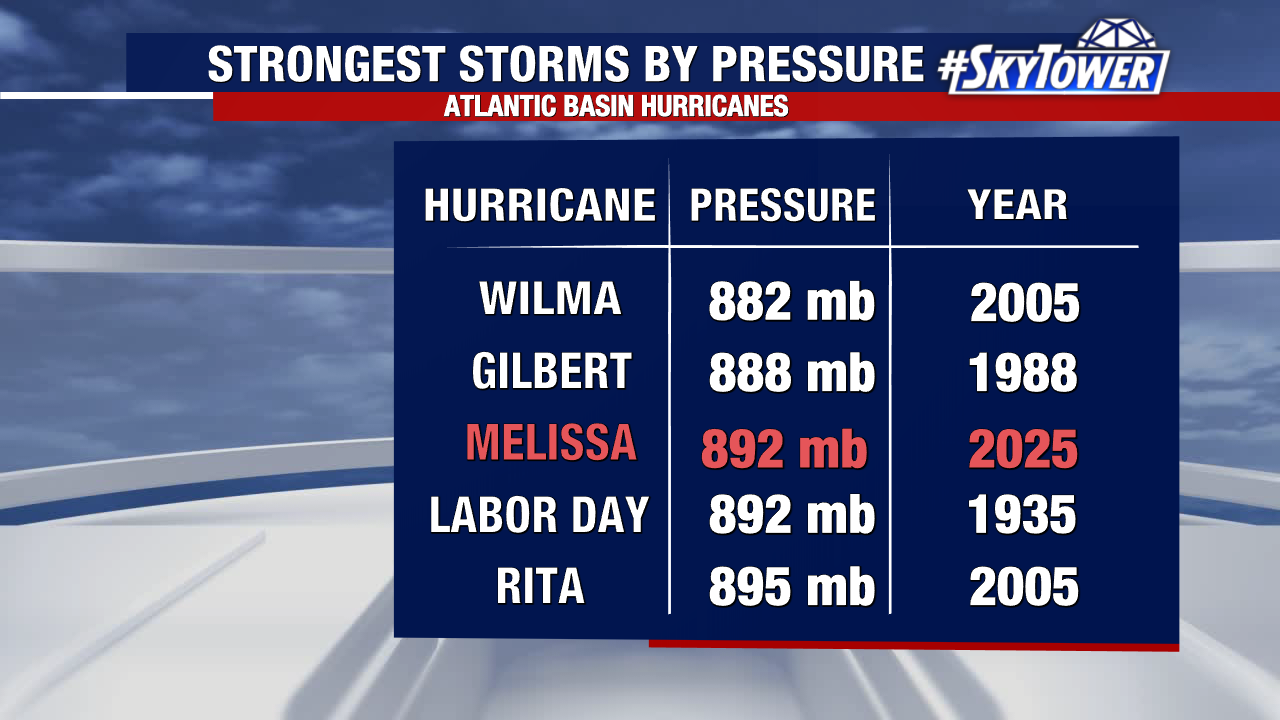
It ties with the Labor Day Hurricane of 1935 that hit the Florida Keys, jogged up the west coast and made a second landfall near Cedar Key, FL. Wilma holds the spot for the lowest pressure on record – 882mb in 2005.
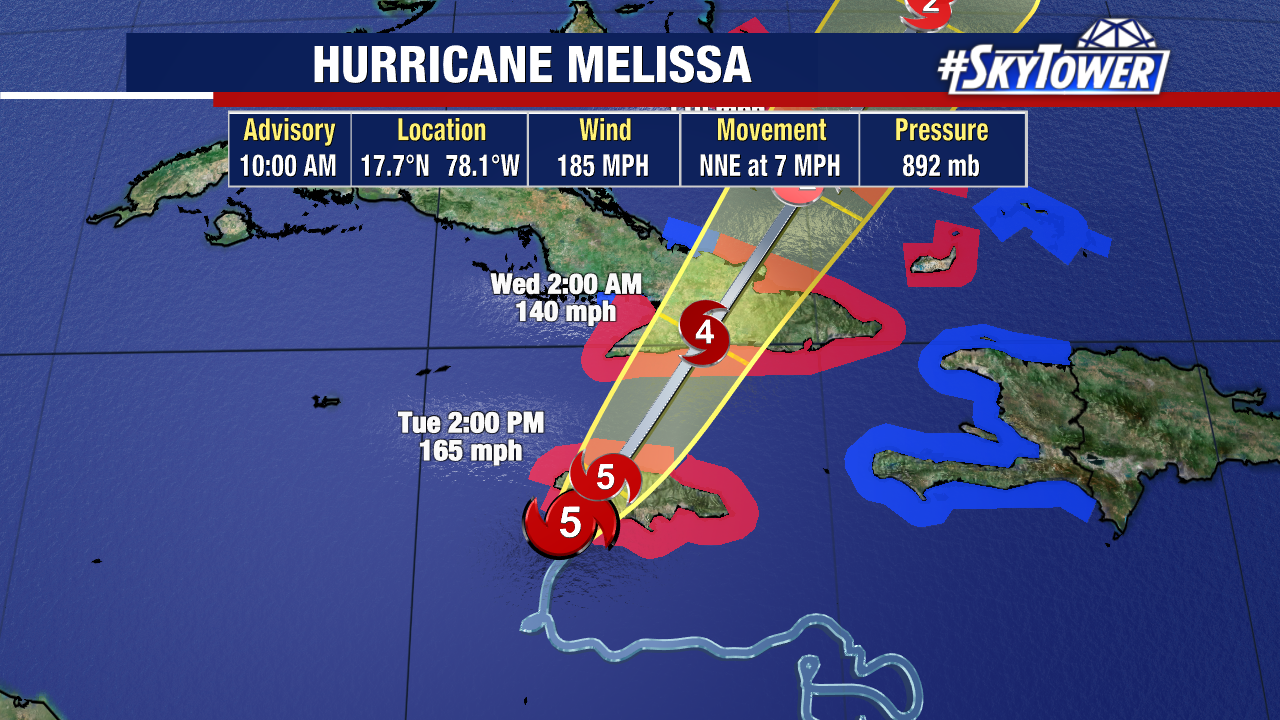
Melissa is approaching landfall within hours along Jamaica’s southwestern coast near Treasure Beach and moving off the north coast near Montego Bay this afternoon.