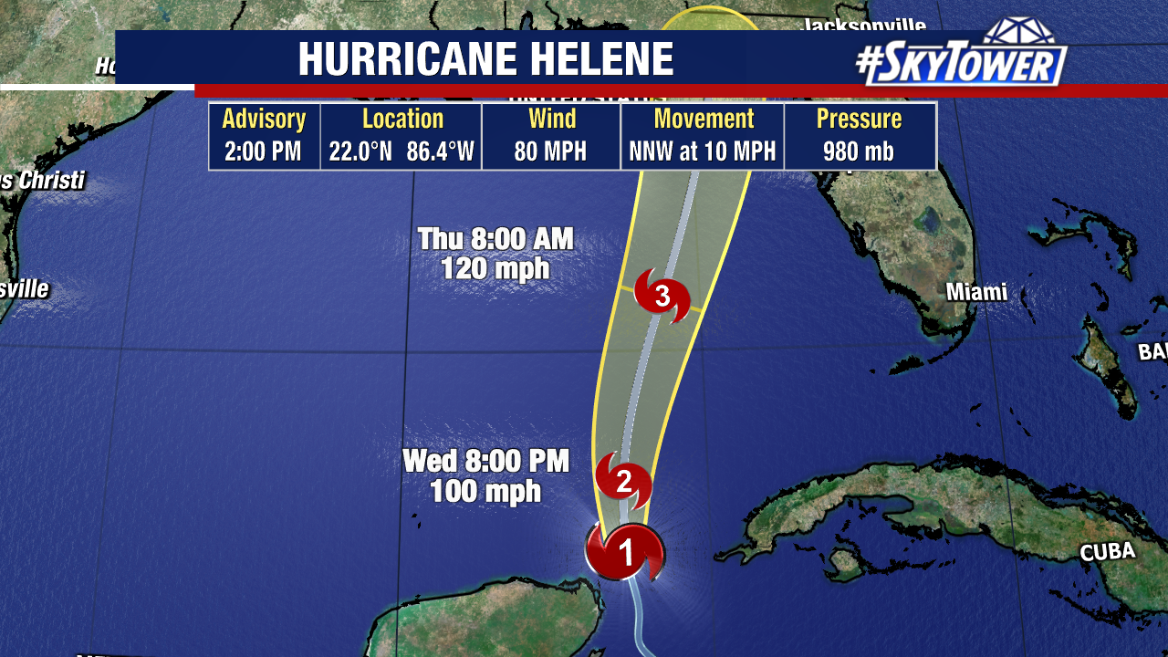
The 2:00 PM advisory is out for Hurricane Helene with no big changes to the forecast and our local impacts.
Helene is currently a Category 1 with sustained winds of 80 mph. The storm is moving NNW at 10mph.
Helene will start to move more northerly before taking a curve slightly NE ahead of landfall Thursday.
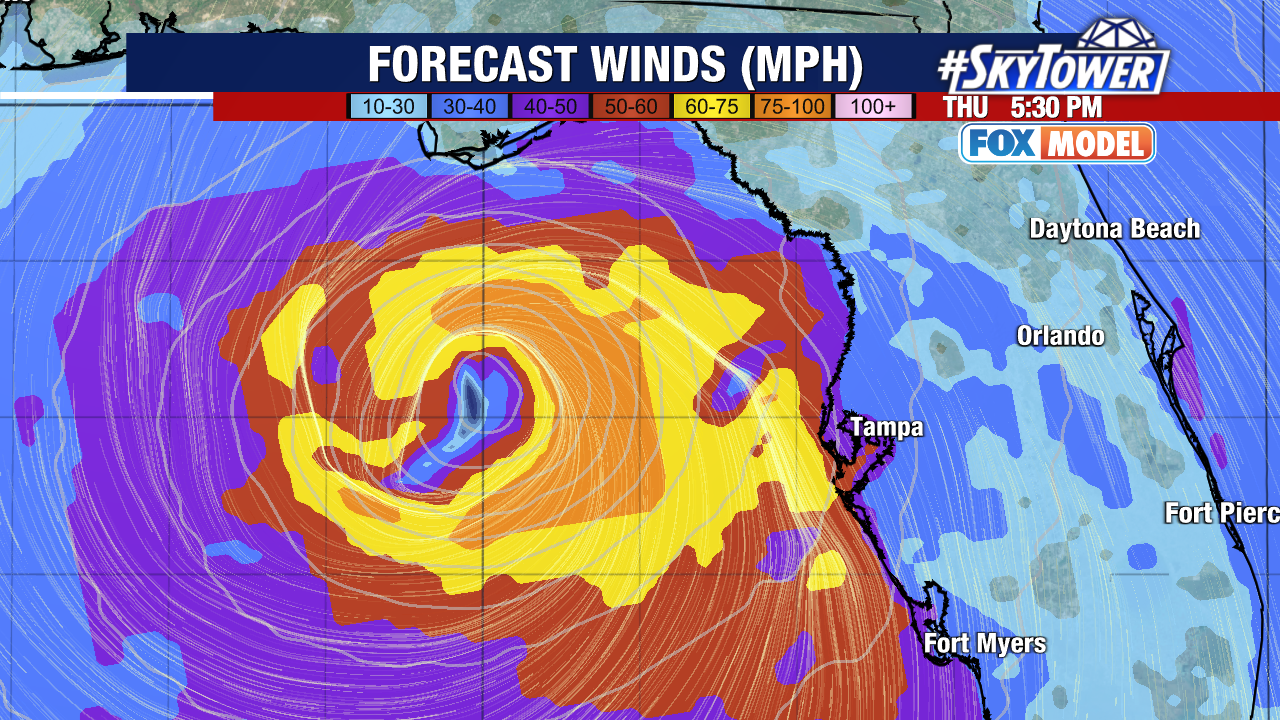
This will become a major hurricane by the time it is off the coast of Tampa Bay with wind speeds even stronger in the latest update.
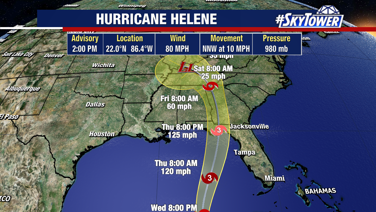
Hurricane Helene is still forecast to make landfall at a Category 3 with winds up to 125 mph. We can’t rule out it being even stronger as there is not much in this storm’s path.
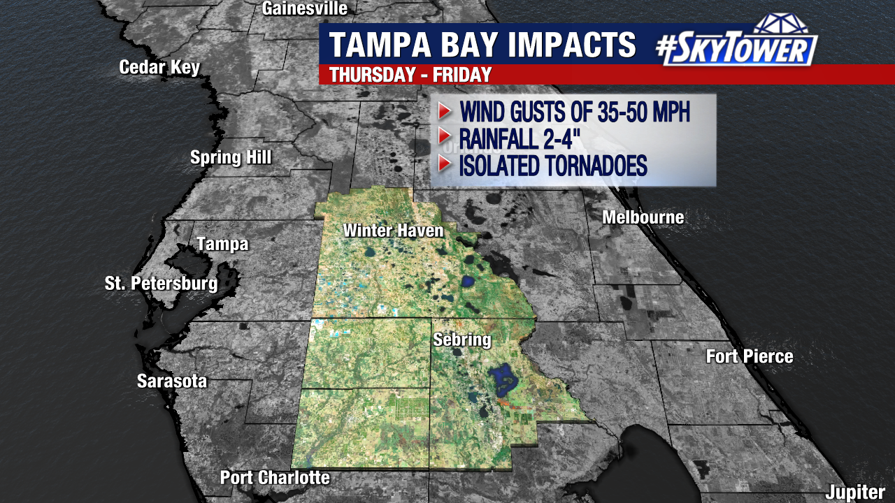
You can read more about local impacts we’re expecting in the previous post.
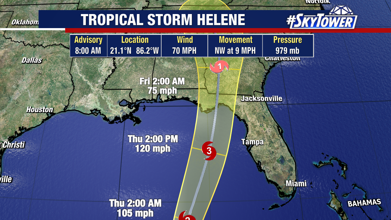
Tropical Storm Helene is still on track to strengthen into a hurricane today as it moves through the warm waters of the eastern Gulf of Mexico.
Helene is expected to intensify quickly on Wednesday, eventually becoming a major hurricane as it jogs next to Florida’s West Coast.
Thursday afternoon is when the storm will be just off the coast of Tampa Bay – around 100 miles offshore. Helene is expected to make landfall Thursday night along the Florida Peninsula.
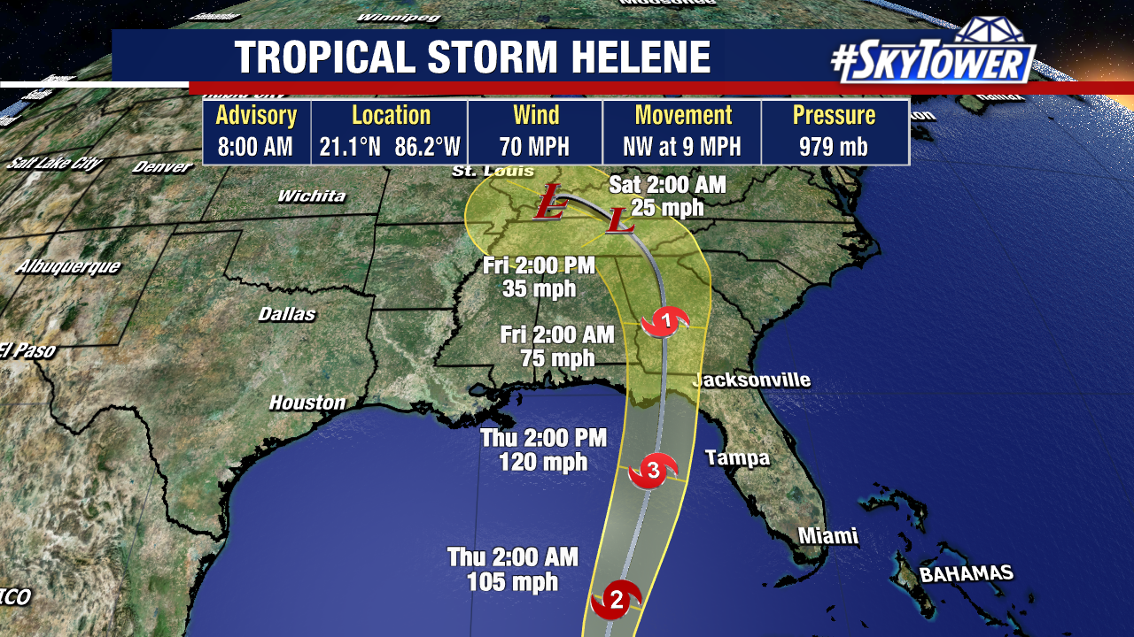
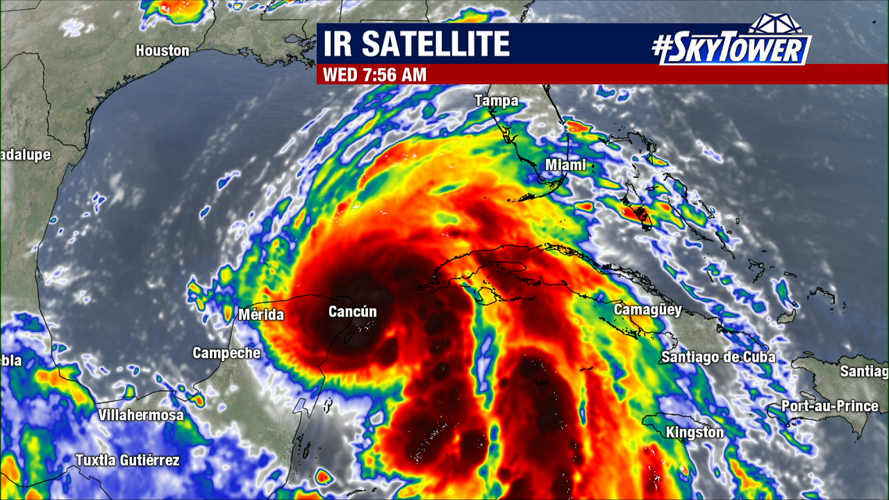
Tropical Storm Helene gathering strength Wednesday morning. Winds have increased, the pressure has dropped and the storm is showing signs of trying to organize.
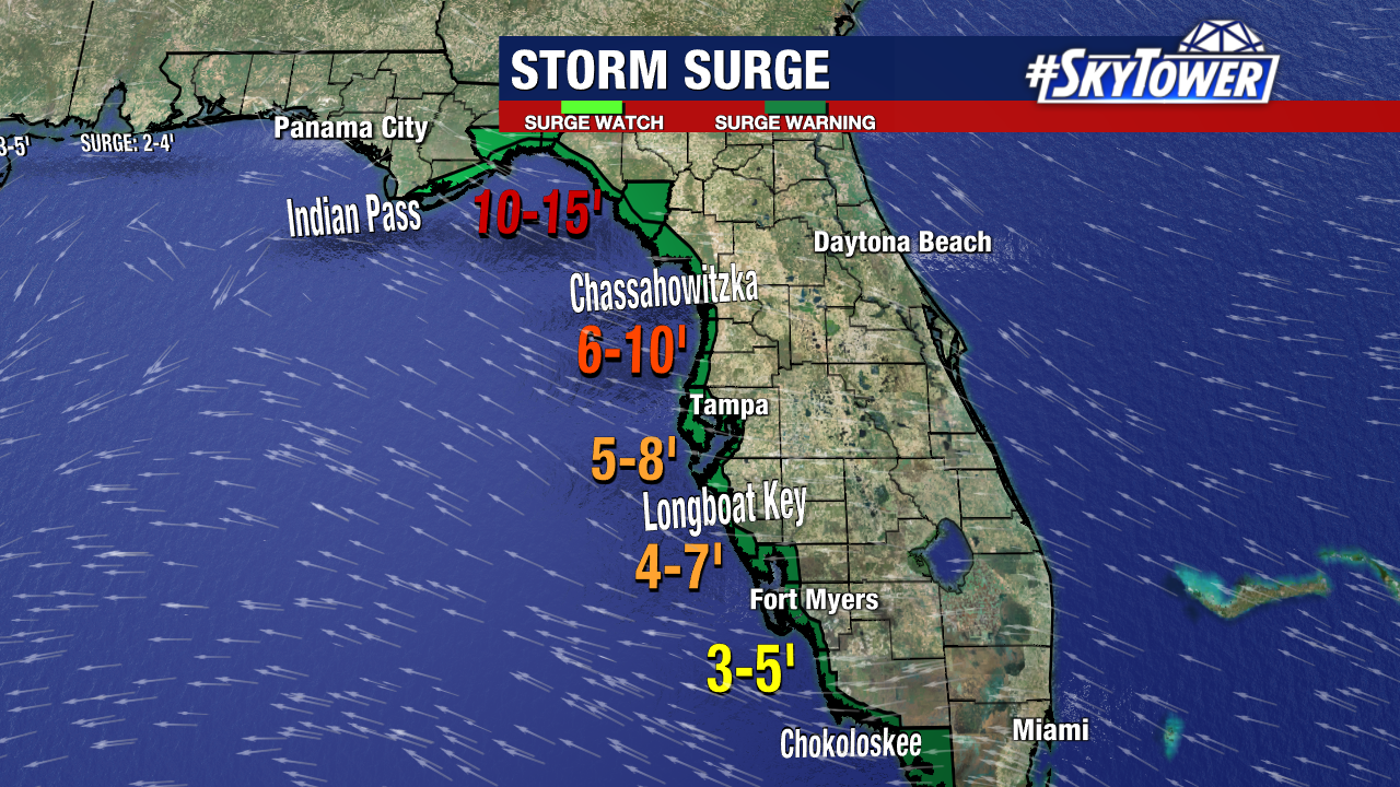
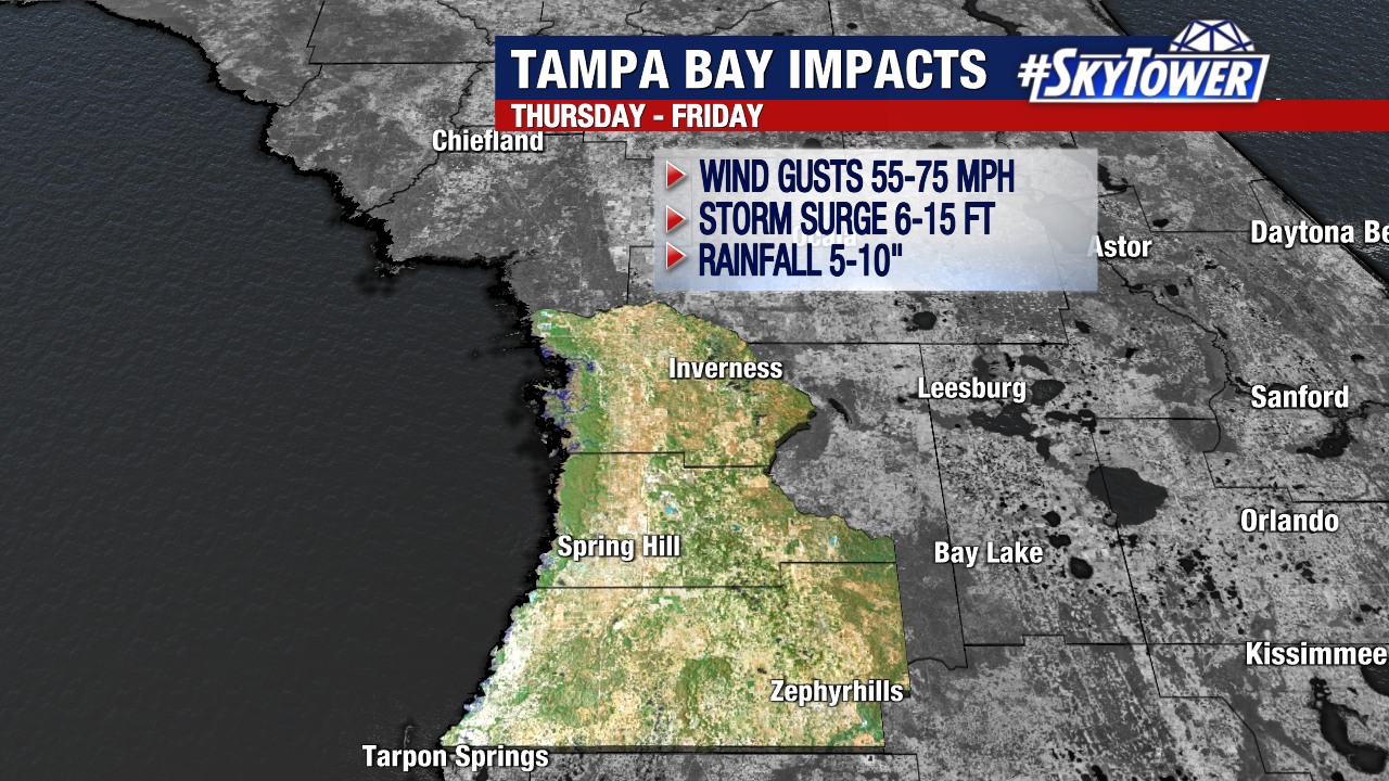
Once it passes the Yucatan Peninsula, there will be nothing in the storm’s path to stall additional strengthening. Storm surge is going to be life-threatening across the Big Bend. Worst case scenario is 15 feet of surge above normal tide.
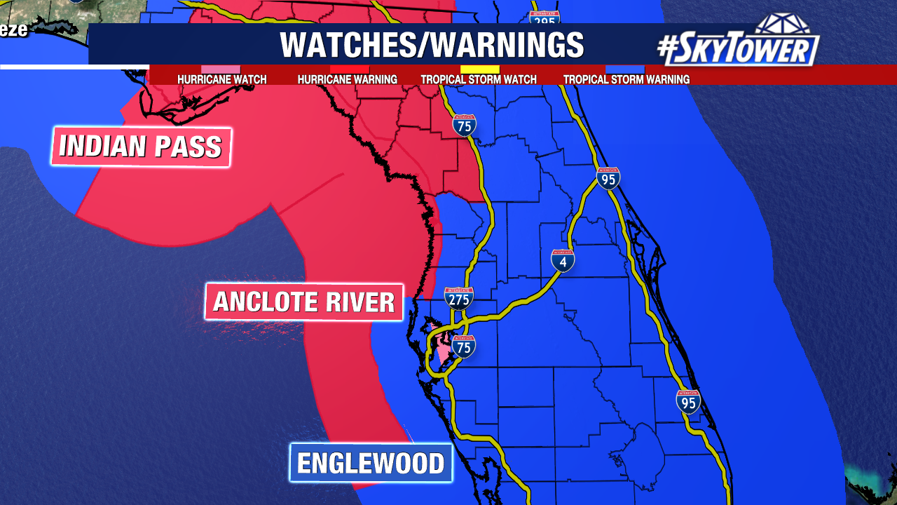
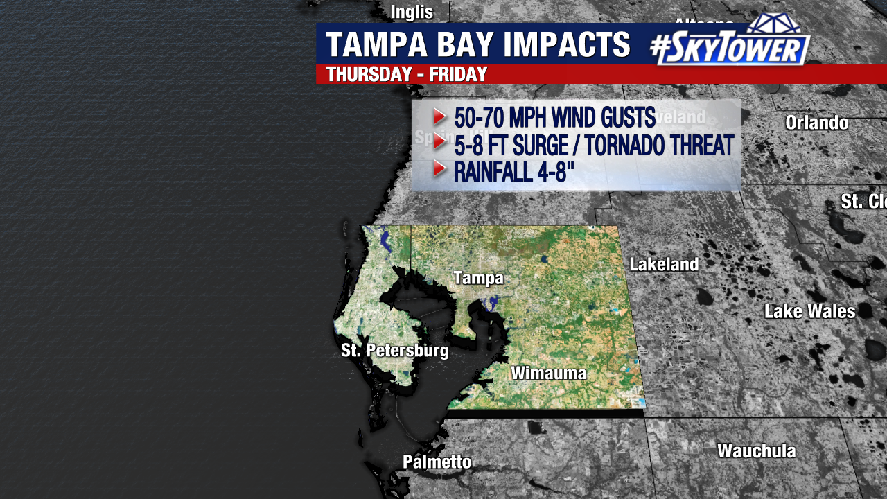
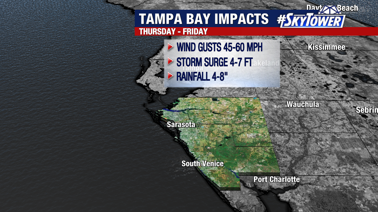
We’re expecting 5-8′ of storm surge in the Tampa Bay Area, 6-10′ from the Anclote River to Chassahowitzka, 4-7′ from Longboat Key to Englewood.
And just the shear size of Helene is incredible. It will probably cover 2/3 of the Gulf and that will come with a massive wind field. Storm surge, damaging winds and rainfall impacts will extend well away from the storm’s center as a result.
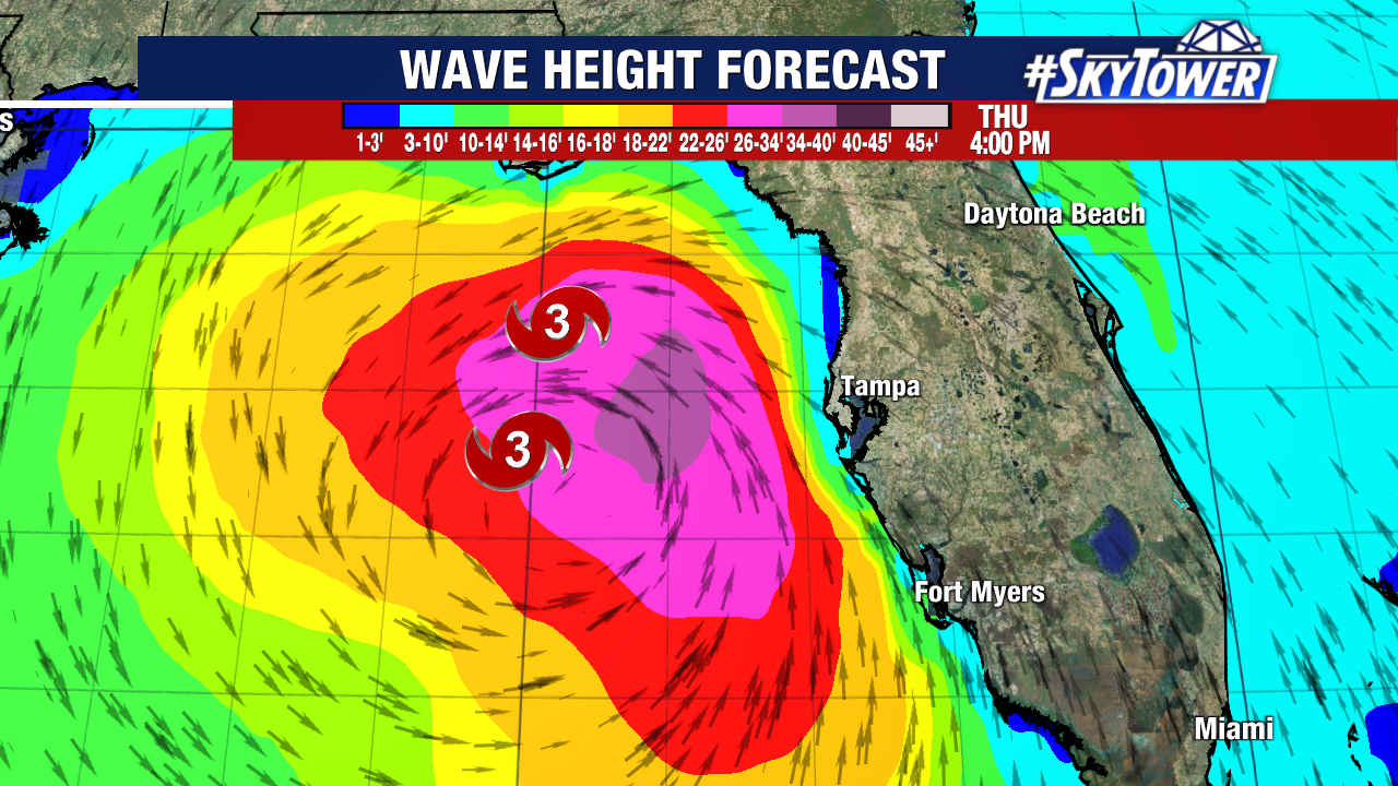
Wave heights will reach up to 40 feet when the storm passes west of Tampa Bay Thursday afternoon. Once it gets just north of us, strong onshore flow will pick up and will cause the worst of the storm surge.
Tropical-storm-force winds extend out nearly 200 miles from the storm’s center, which is why even Florida’s East Coast is under a Tropical Storm Warning.