Tropical Storm Franklin Likely To Form Soon In The Western Caribbean

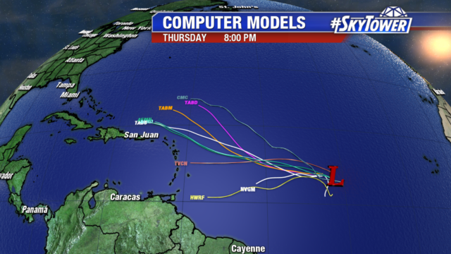
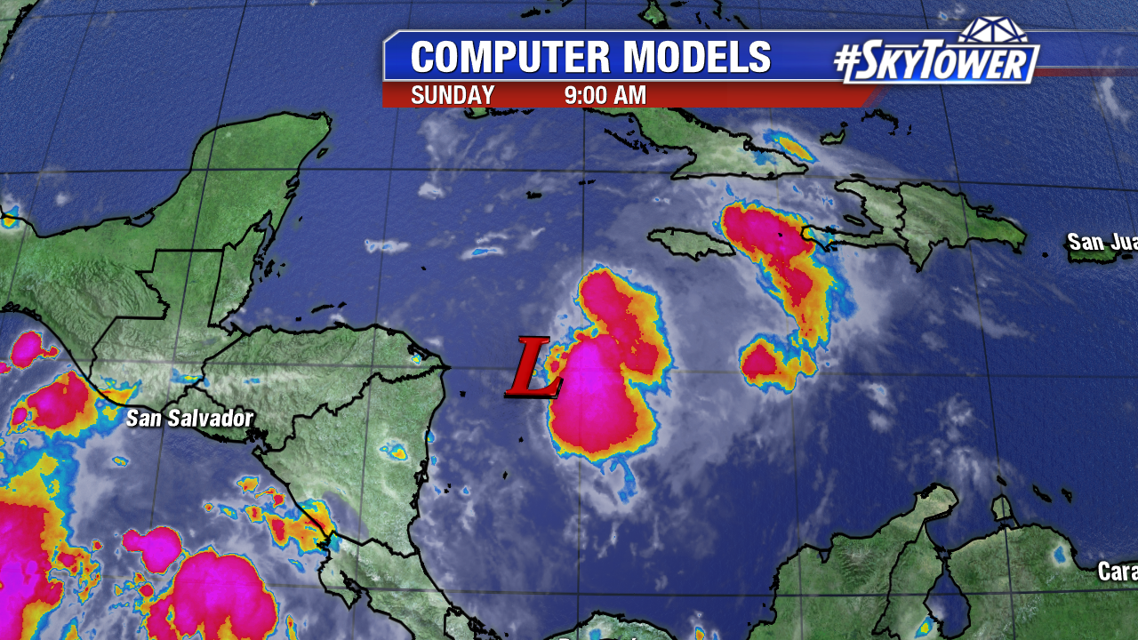
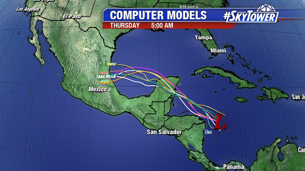
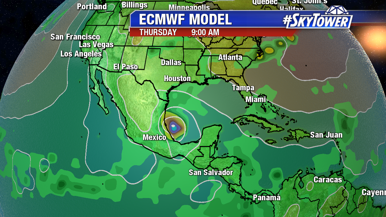
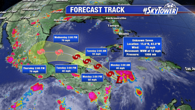
On Sunday evening, the National Hurricane Center began issuing advisories on Potential Tropical Cyclone Seven in the western Caribbean. Moving into an increasingly favorable environment for further development, this is likely to become Tropical Storm Franklin within the next 24 hours. Tropical Storm warnings are now in effect for the Yucatan Peninsula, as impacts in that area may be felt as early as Monday afternoon. From there, this system should move across the Bay of Campeche and into eastern Mexico late Wednesday into early Thursday. Heavy rain and gusty winds are likely in the aforementioned areas, but at this time, no U.S. impacts are expected.

fiona

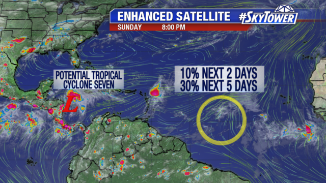
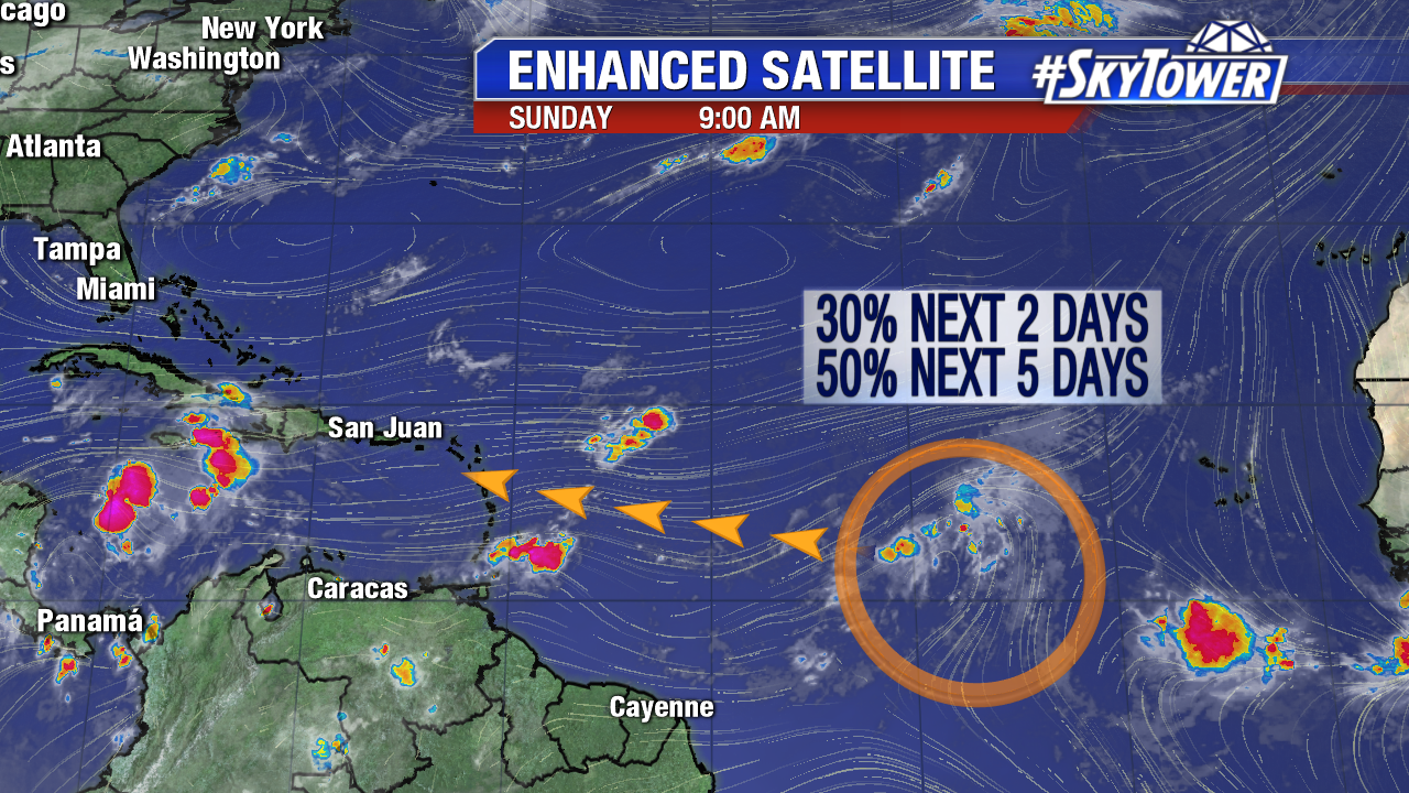
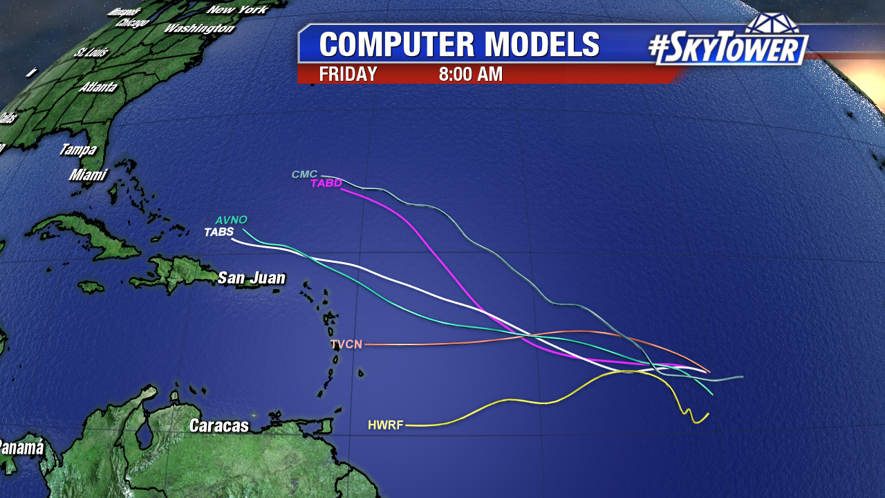
We also continue to monitor the progress of Invest 99L in the central Atlantic. As of Sunday night, convection was almost non-existent around the disturbance, and the National Hurricane Center continues to lower its expectations for development in the short-term. It has a very tough road ahead of it thanks to strong upper level winds, but it still bears watching as it moves WNW over the next week or so.

atlantic-wide-2d-ir-enhanced invest-90l-models


Invest 90L Organizes, Headed for the Yucatan; Invest 99L Disorganized in the Atlantic

There are two areas of interest Sunday in the Atlantic. Invest 90L south of Jamaica has organized some the past 24 hours. While convection blossoms early Sunday, moderate northwesterly shear displaces it on the eastern side of the tropical wave. Sunday’s Hurricane Reconnaissance mission was rescheduled for Monday afternoon. During this time upper levels will favor further organization, and there is a high chance Invest 90L becomes a tropical depression/Tropical Storm Franklin over the next 5 days. It is moving west-northwest towards Belize and the Yucatan Peninsula Monday.

invest-90l-models-png23

Beyond Monday/early Tuesday models are in line with a track into the Bay of Campeche. This area is known for its very warm waters. Tropical cyclones often strengthen rapidly here. Many models are on board with a Hurricane Franklin (GFS/ECMWF/HWRF) by Wednesday or Thursday moving onshore in mountainous East Mexico. Models have trended a bit further north, so interest in extreme southern Texas should keep a watchful eye.

invest-90l-models-png-2

ecmwf-msl-and-precip-rate

Invest 99L has not organized in the Atlantic. Some dry air in the mid levels of the atmosphere keeps convection disorganized early Sunday. The area of low pressure is elongated due to some marginally favorable upper level winds. Wind shear increases as Invest 99L moves west-northwest at 15 mph towards the Lesser Antilles. There is a medium chance it becomes a tropical depression over the next 5 days.

floater-ir-enhanced

12Z computer models have really backed off on the intensity of Invest 99L. A few days ago some were anticipating a hurricane in the long run. More models are trending towards a west-northwest path north of the eastern Caribbean.

invest-93l-models-png23

Even if Invest 99L does not become a tropical depression/named storm over the next 5 days it will still be monitored late in the week. Water temperatures are plenty warm for tropical cyclone intensification in the Eastern Caribbean and near the Bahamas.

western_atl_buoy_watertemp