Hurricane Franklin Forms In The Bay of Campeche; Headed For Mexico

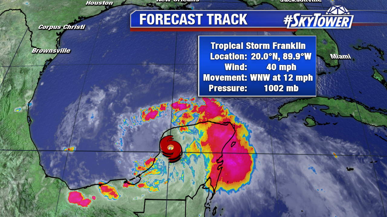
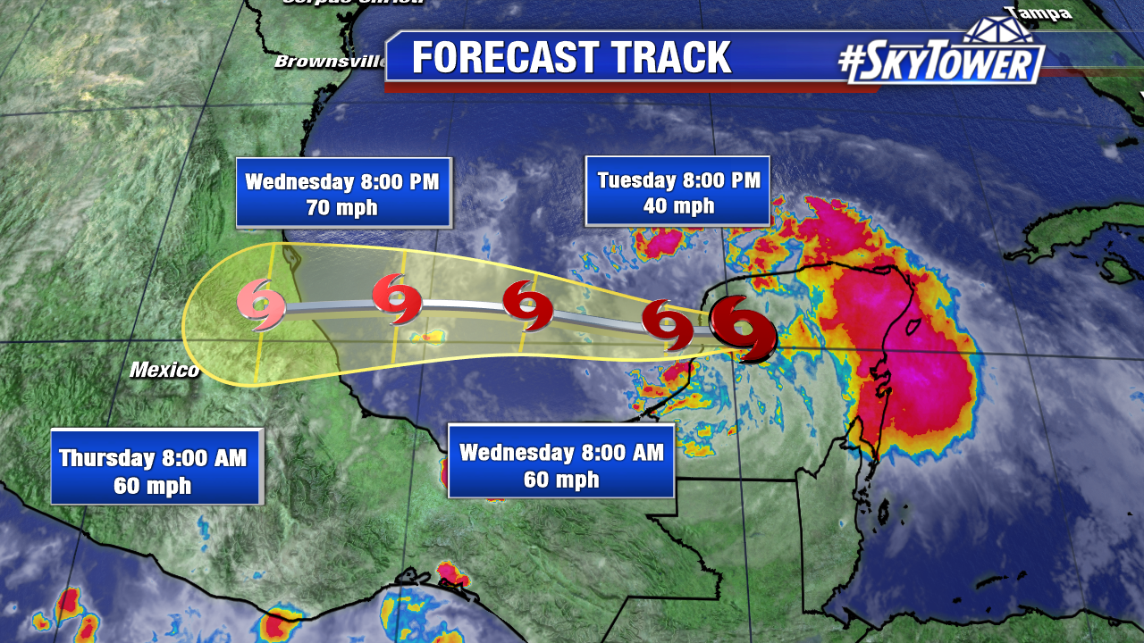
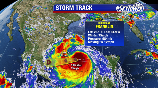
At 5pm Wednesday afternoon, Franklin became the first hurricane of the 2017 Atlantic Hurricane Season. Sustained winds were at 75 mph and it was moving W at 12 mph. The system continues to thrive in a very favorable environment over the Bay of Campeche with very warm sea-surface temperatures, plenty of moisture, and only moderate wind shear. As a result, a little more strengthening is possible before landfall late tonight. This system doesn’t pose any threat to the United States, but it will bring very heavy rainfall, as much as 15″, to the mountainous terrain of eastern Mexico over the next 48 hours.

lynx-3

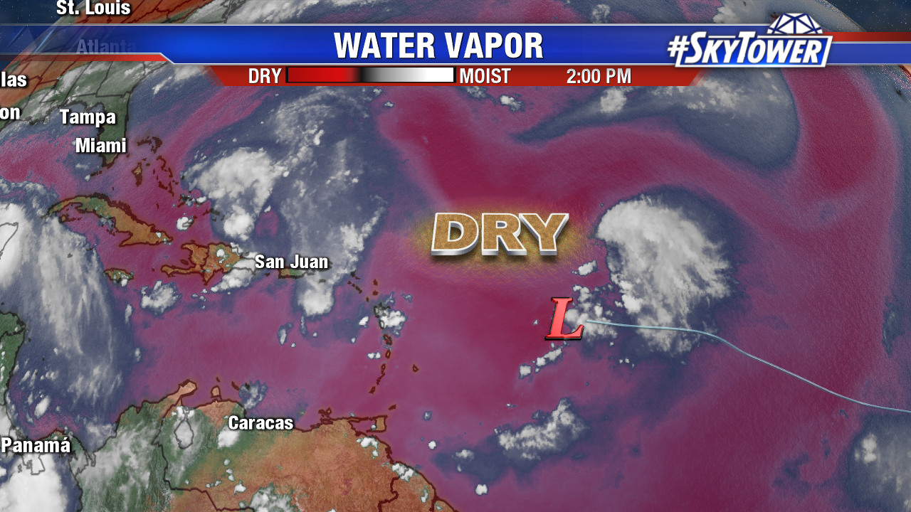
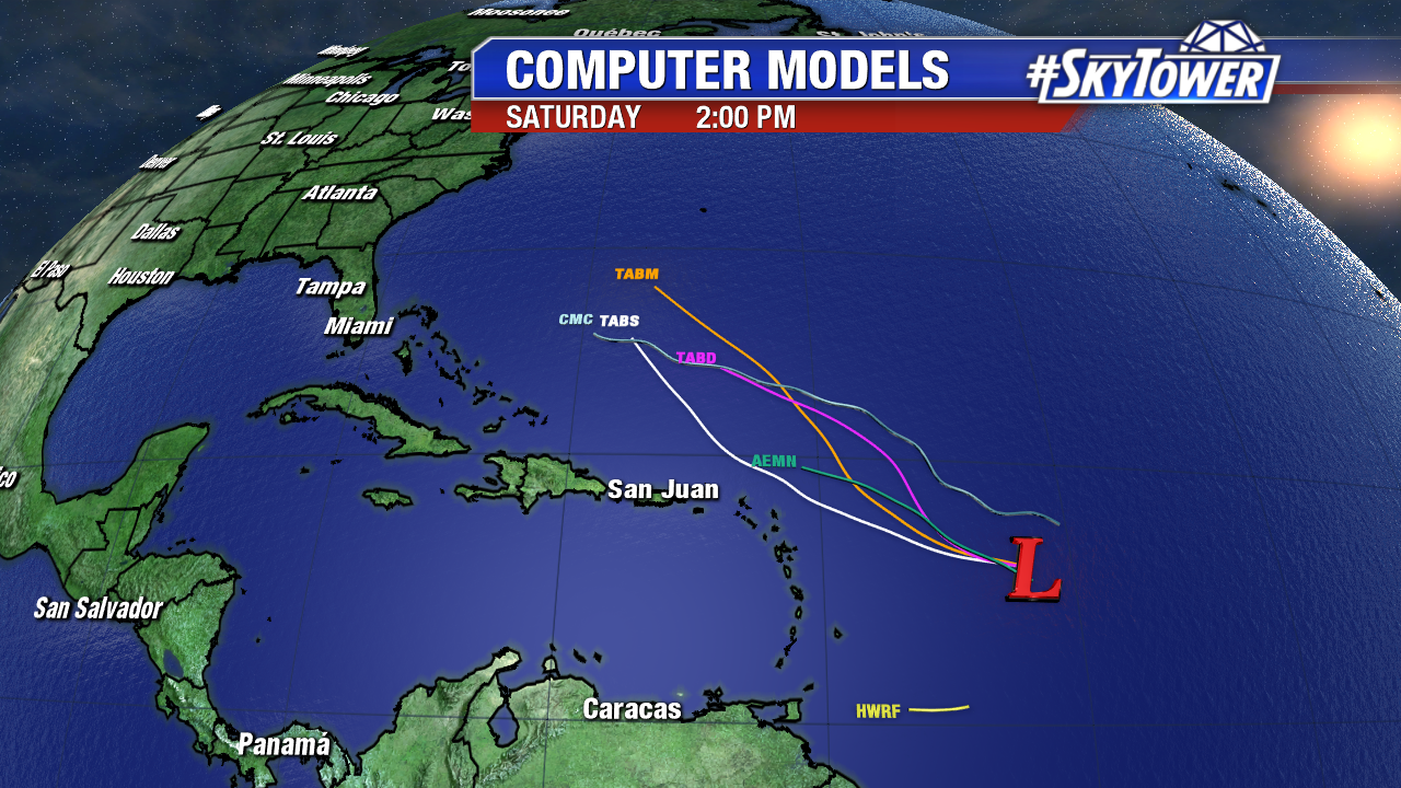
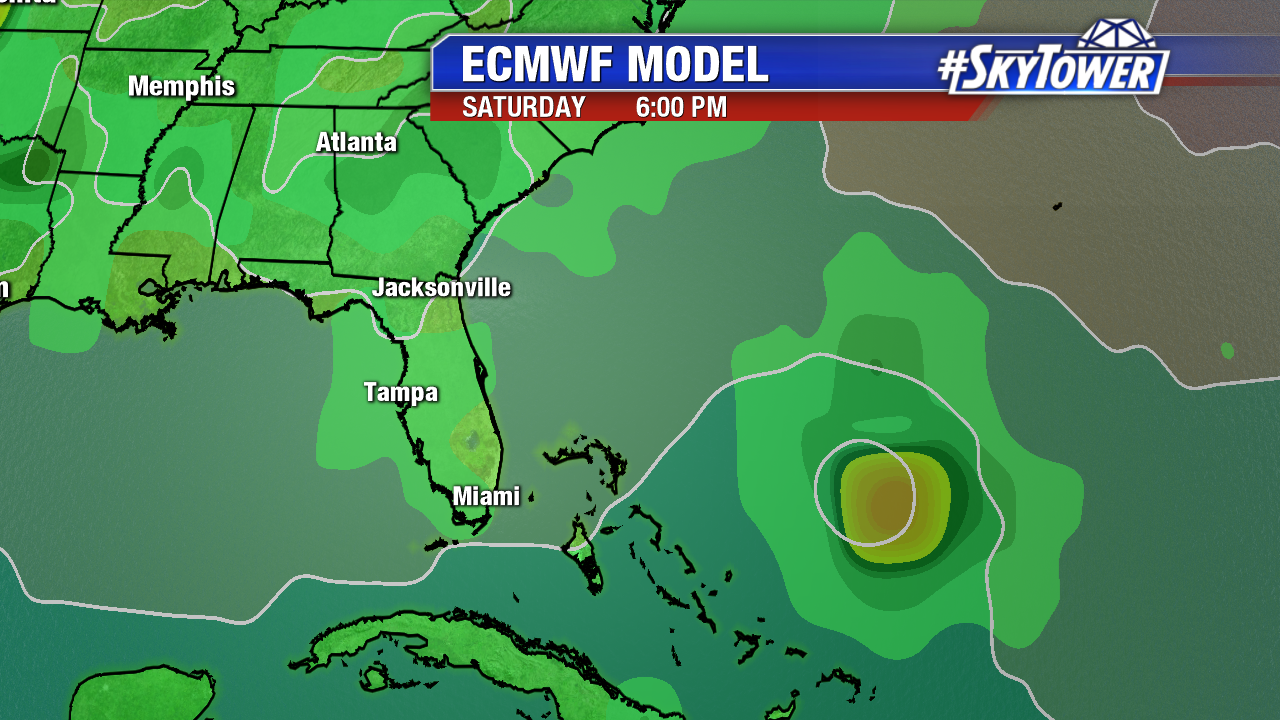
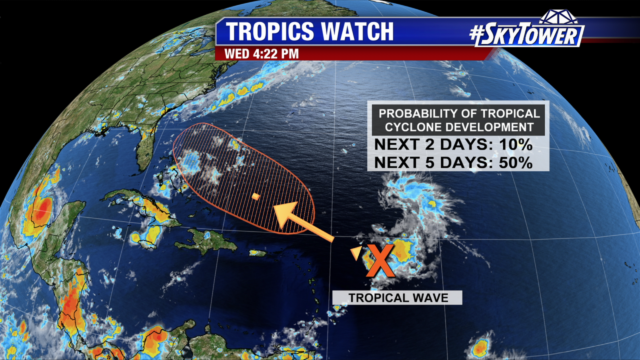
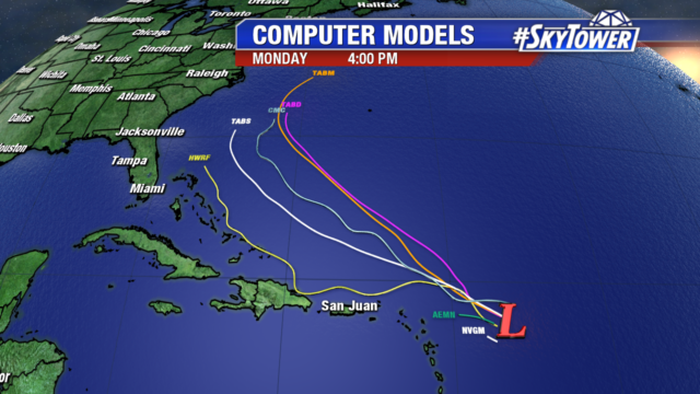
Meanwhile, about 350 miles east of the northern Lesser Antilles, Invest 99L continues to struggle to get organized thanks to strong mid-upper level winds and an abundance of dry air. That being said, conditions should become a little more favorable by this weekend as this system moves WNW.

lynx

Even if 99L develops into Gert, steering flow over the western Atlantic and eastern U.S. should steer it north/northeast and keep it offshore. We’ll continue to watch it closely.

invest-90l-models

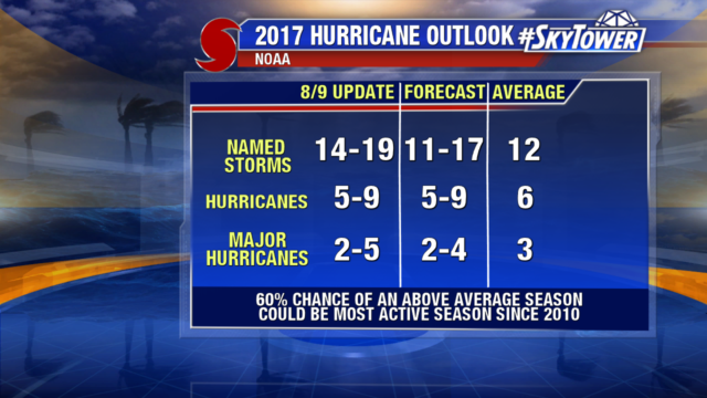
In other news, today NOAA released their final update for the 2017 Atlantic Hurricane Season Outlook – further increasing the amount of activity expected over the next few months. The 2017 season could end up being the most active since 2010, now with a 60% chance of an above-normal season.

noaa-updated-hurricane-forecast-2

Franklin Exits the Yucatan-Headed for East Mexico; Still Watching Invest 99L

Tropical Storm Franklin made landfall late Monday night on the east coast of the Yucatan Peninsula with 60 mph. As of 2 PM Tuesday max sustained winds are down to 40 mph. While it has weakened over land since then, deep moisture still fuels torrential rains. 4-8 inches of rainfall, with isolated amounts near a foot are possible through Wednesday. Franklin will recharge over the southern Gulf of Mexico Tuesday night and early Wednesday. It will get close to hurricane strength before wind shear ramps up. A second landfall is likely by early Thursday in mountainous east Mexico. Mudslides and flash flooding are possible in this region. Up to 15 inches of rain is possible through late work week. Below is the 11 AM official track from the National Hurricane Center.

fiona-png2

fiona

As mentioned the past few days, Invest 99L struggles east of the Lesser Antilles with dry air and increased upper level winds. Tropical cyclone development is highly unlikely over the next few days as the weak area of low pressure moves west-northwest at about 15 mph.

water-vapor-floater-png2

By Friday or the weekend the disturbance moves over the warm waters east of the Bahamas. The past 3 runs of the ECMWF suggest Gert will develop and strengthen during this time, possibly as a hurricane, by late in the weekend east of the Southeast U.S.. A developing trough could keep possible future Gert just off the East coast, but it’s too early to say for sure. The CMC is also on board. Meanwhile the GFS. It’s a wait and see situation late in the week.

invest-90l-models

ecmwf-msl-and-precip-rate

cmc_carib_mslp_41