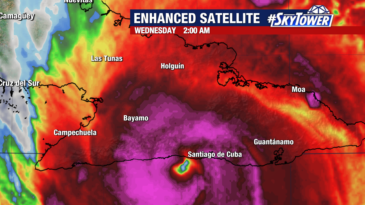
Hurricane Melissa remained a powerful Category 3 storm as it made landfall near Chivirico, Cuba with 120 mph winds early Wednesday morning.
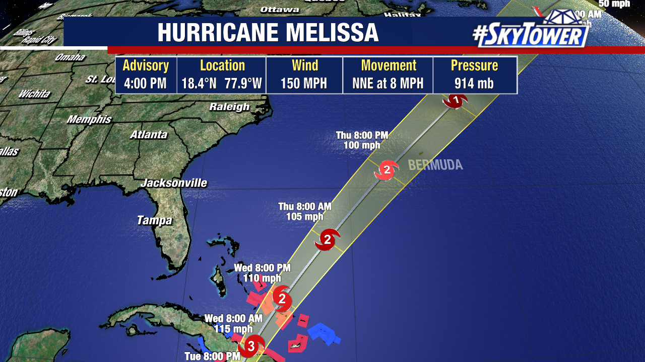
Melissa has been weakening while moving over eastern Cuba but is still at Category 2 strength.
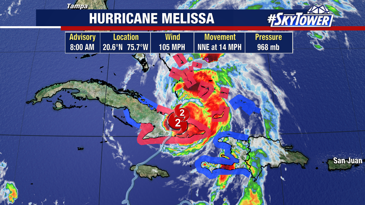
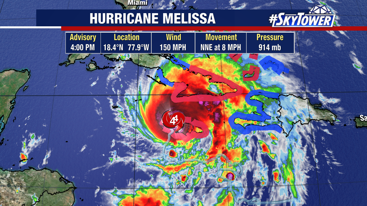
Melissa has 105 mph sustained winds as it spins about 45 miles NW of Guantanamo, Cuba and about 200 miles S of the Central Bahamas.
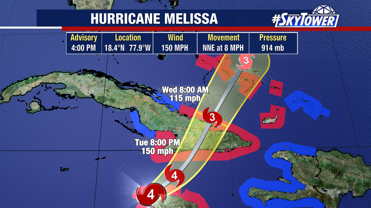
The storm will emerge back over waters in the next few hours as it continues moving northeast, now at a much faster clip of 14 mph.
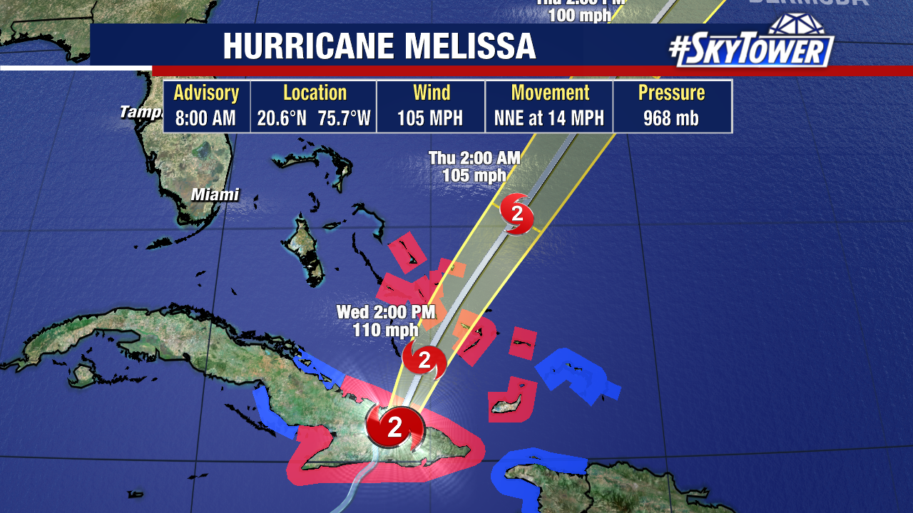
Hurricane Melissa continue to bring impacts to the islands in the coming days. It will emerge back over warm waters and head towards the Bahamian Islands & Turks and Caicos later today.
Hurricane-force winds go out 30 miles from the storm’s center, which will pass near/over the central and SE Bahamas with hurricane conditions starting today, lasting into Thursday.
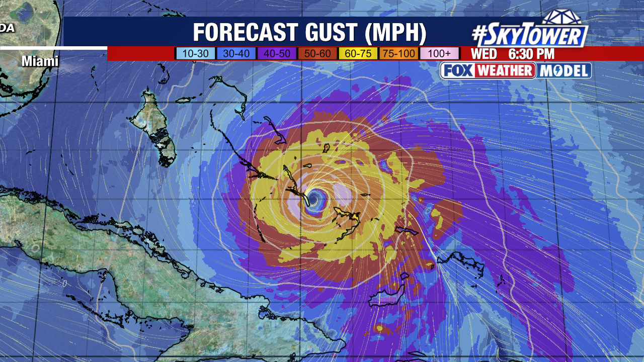
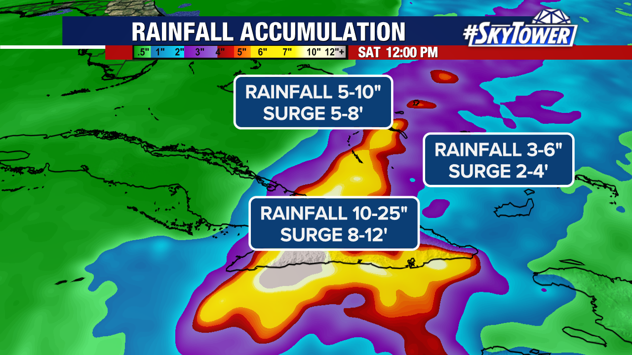
Storm surge is a concern for the low-lying islands with the forecast calling for 5-8′ above normal tide for portions of the Bahamas.
Minor coastal flooding will occur in the Turks and Caicos Islands but surge is more of a concern closer to where Melissa passes. Exuma, Great Inagua, Mayaguana, Ragged Island & Crooked Island are all in the crosshairs.
Over the Southeastern Bahamas, rainfall totals of 5-10″ are expected today. For Turks and Caicos, rainfall totals of 1-3″.
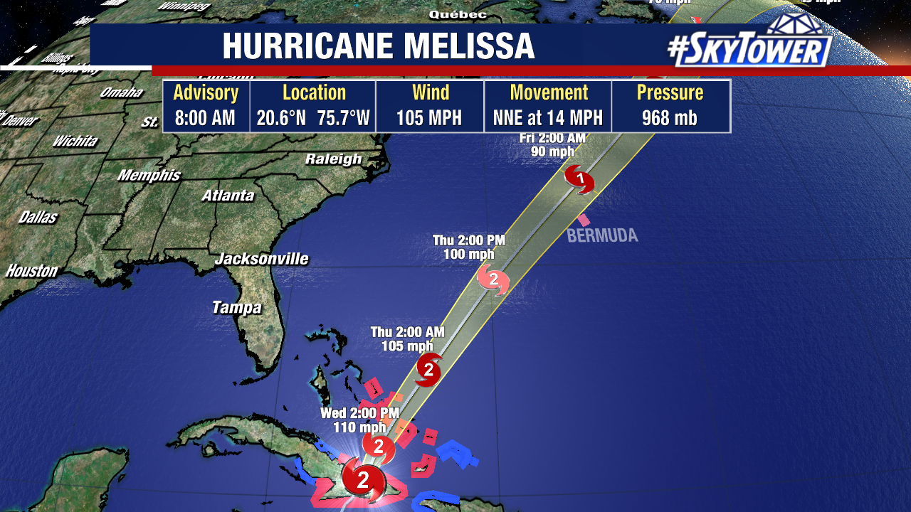
From there, Melissa will pass near Bermuda Thursday into Friday with heavy rain starting to affect Bermuda on Thursday.