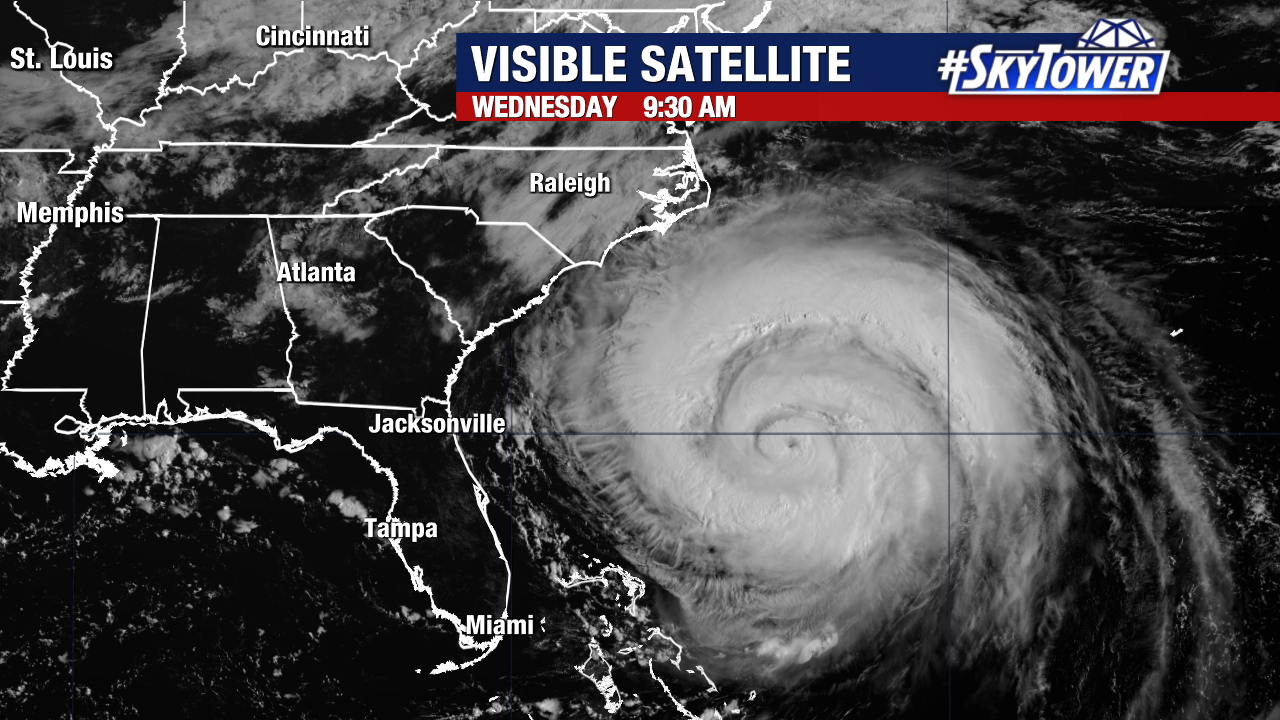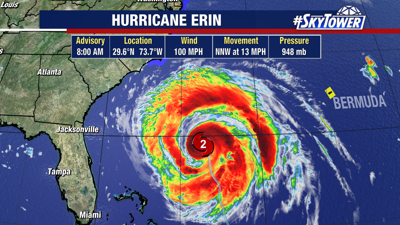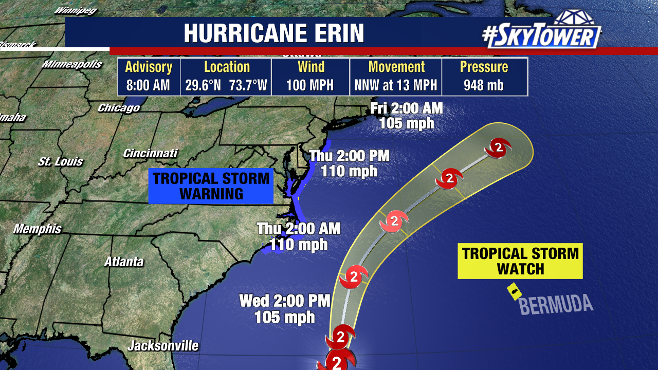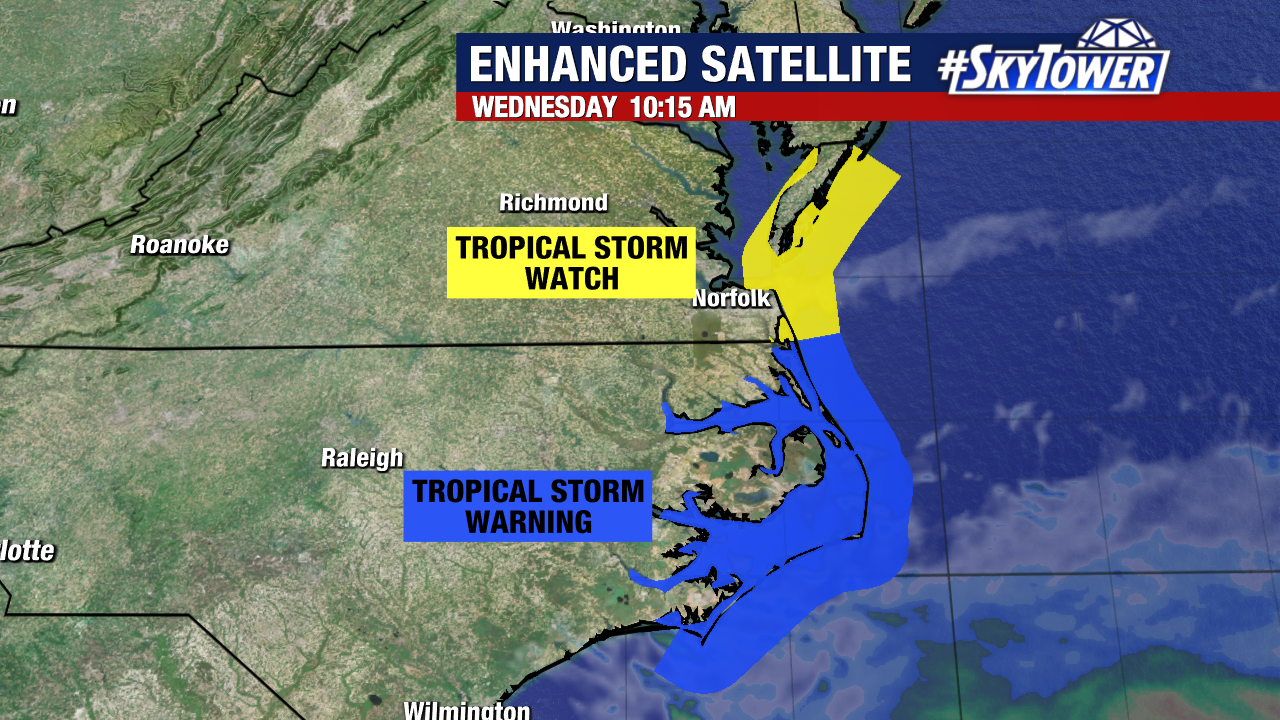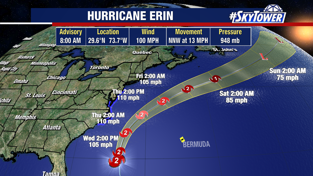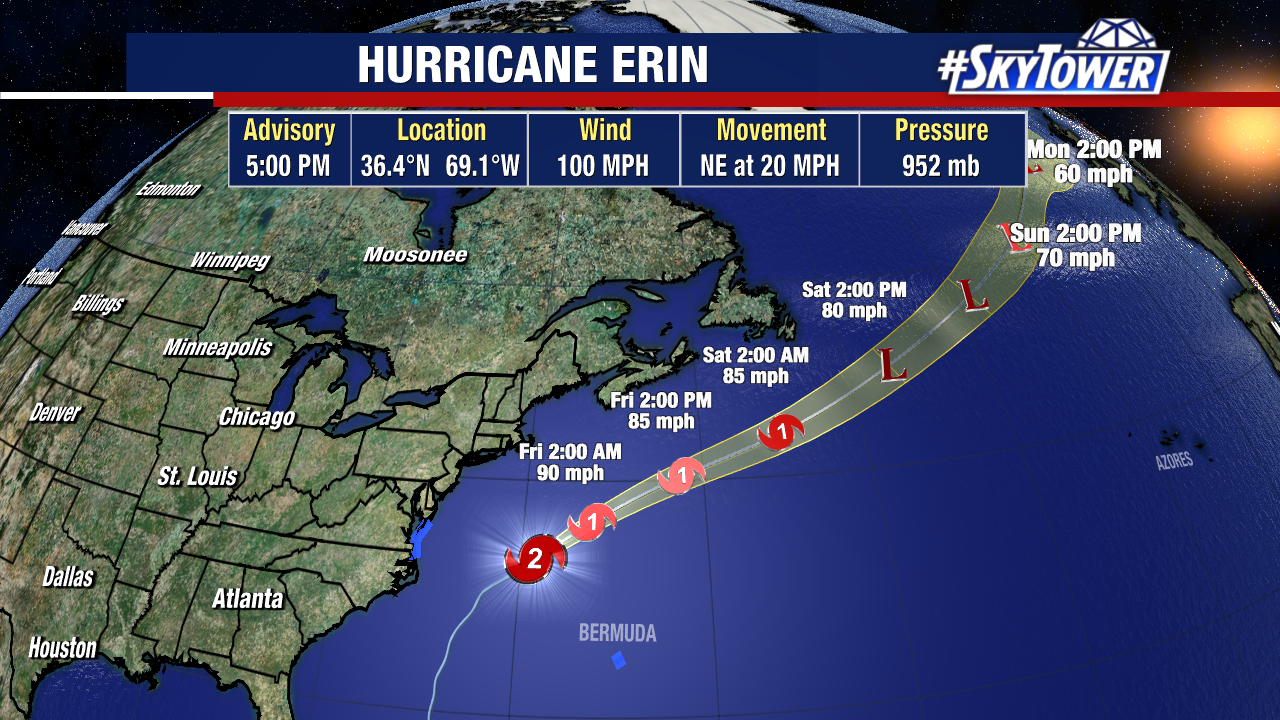
Hurricane Erin is accelerating northeast at 20 mph, moving away from the United States. Tropical Storm Warnings remain in effect for parts of North Carolina, Virginia, and Bermuda, as Erin’s large wind field continues to bring widespread impacts.
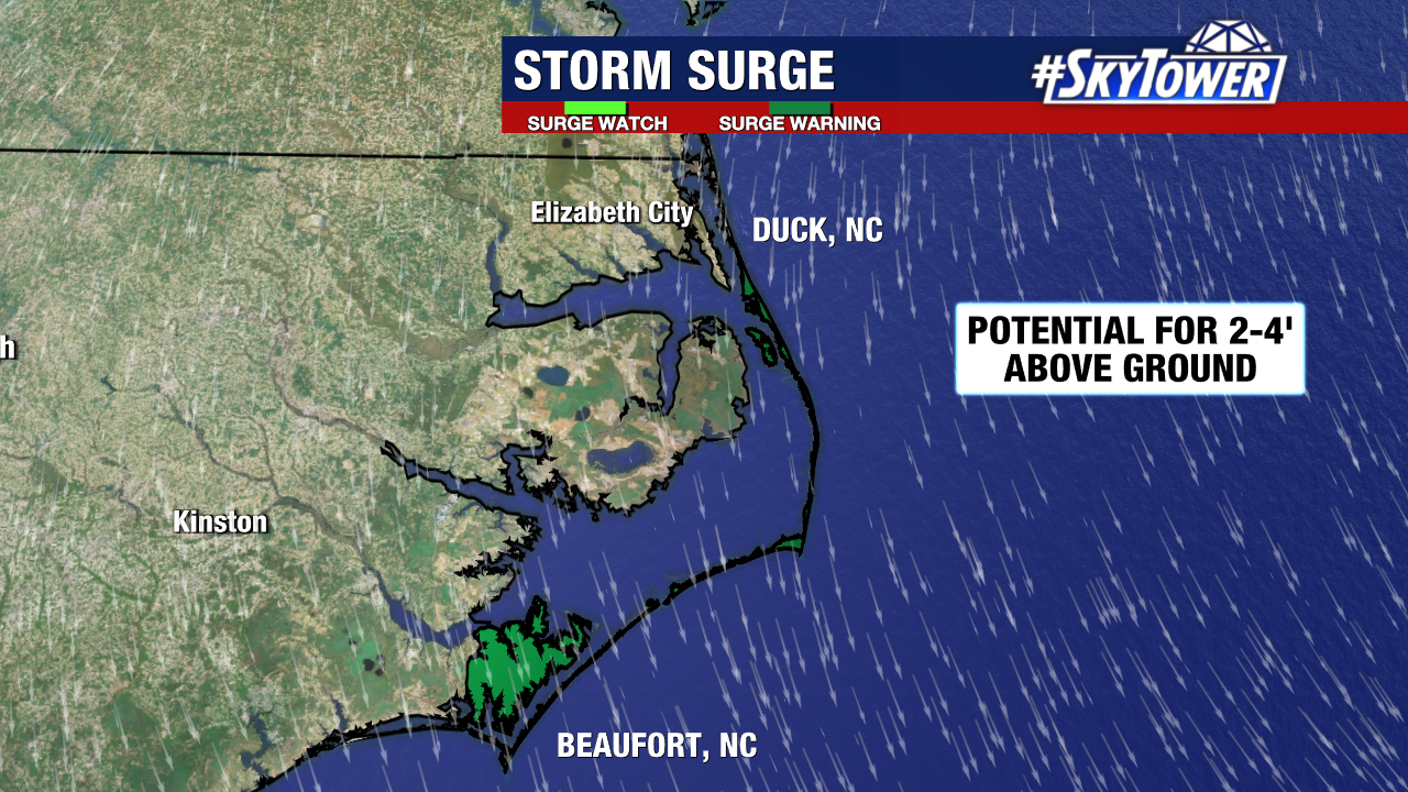
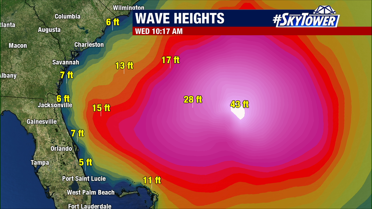
Along the Outer Banks, storm surge warnings are still in place. High tide this evening and tonight could bring a heightened surge threat to vulnerable areas.
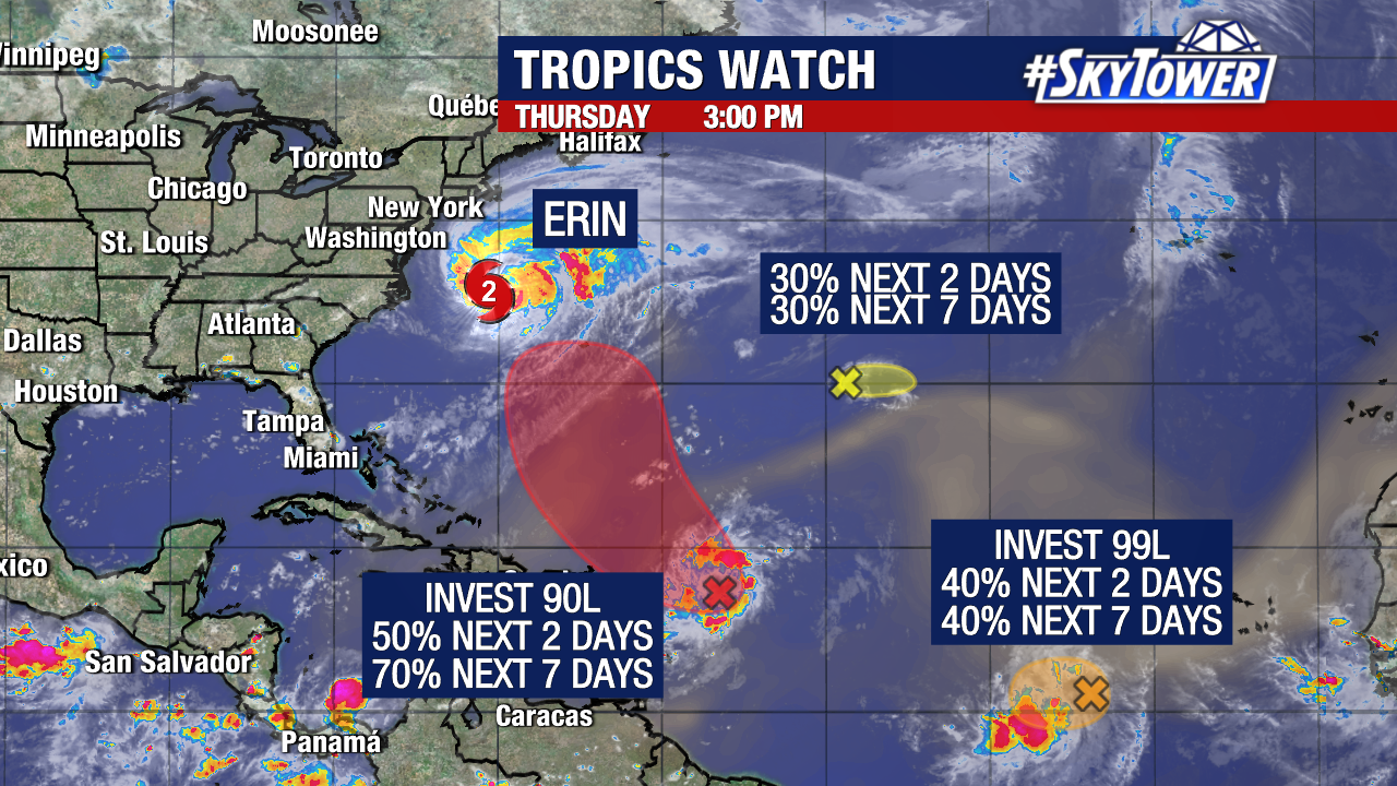
Meanwhile, we’re monitoring three other systems in the Atlantic.
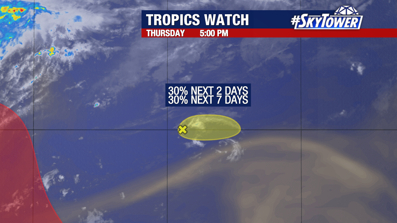
A disturbance in the central Atlantic has a low (30%) chance of development and is moving east, posing no U.S. threat.
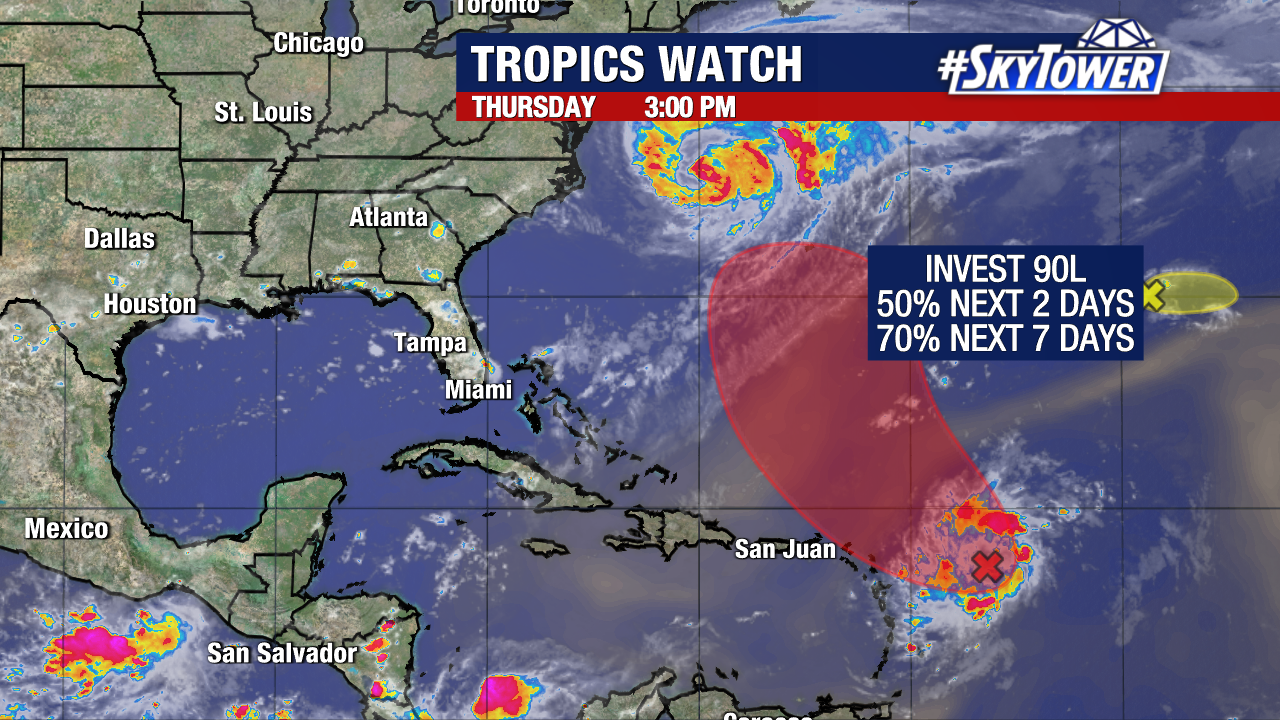
Invest 90L now has a high (70%) chance of development over the next week. Early signs suggest it will likely curve north and northeast, away from the U.S., with potential to strengthen into a tropical storm or hurricane.
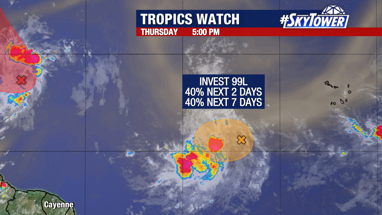
Invest 99L carries a medium (40%) chance of development.
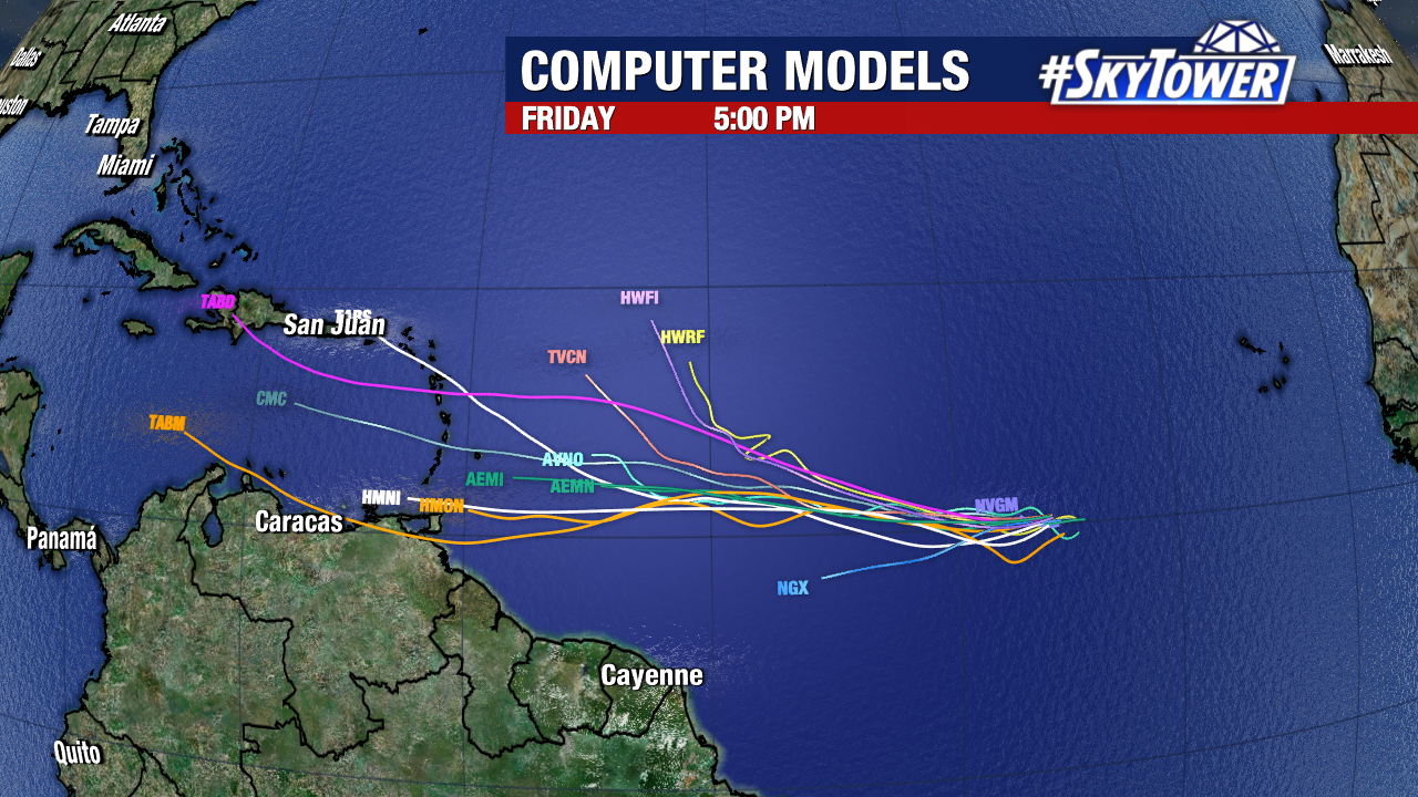
Conditions may briefly favor strengthening in the short term, but could sour by the weekend as it travels farther west. It’s still over 3,500 miles east, giving us plenty of time to watch it.
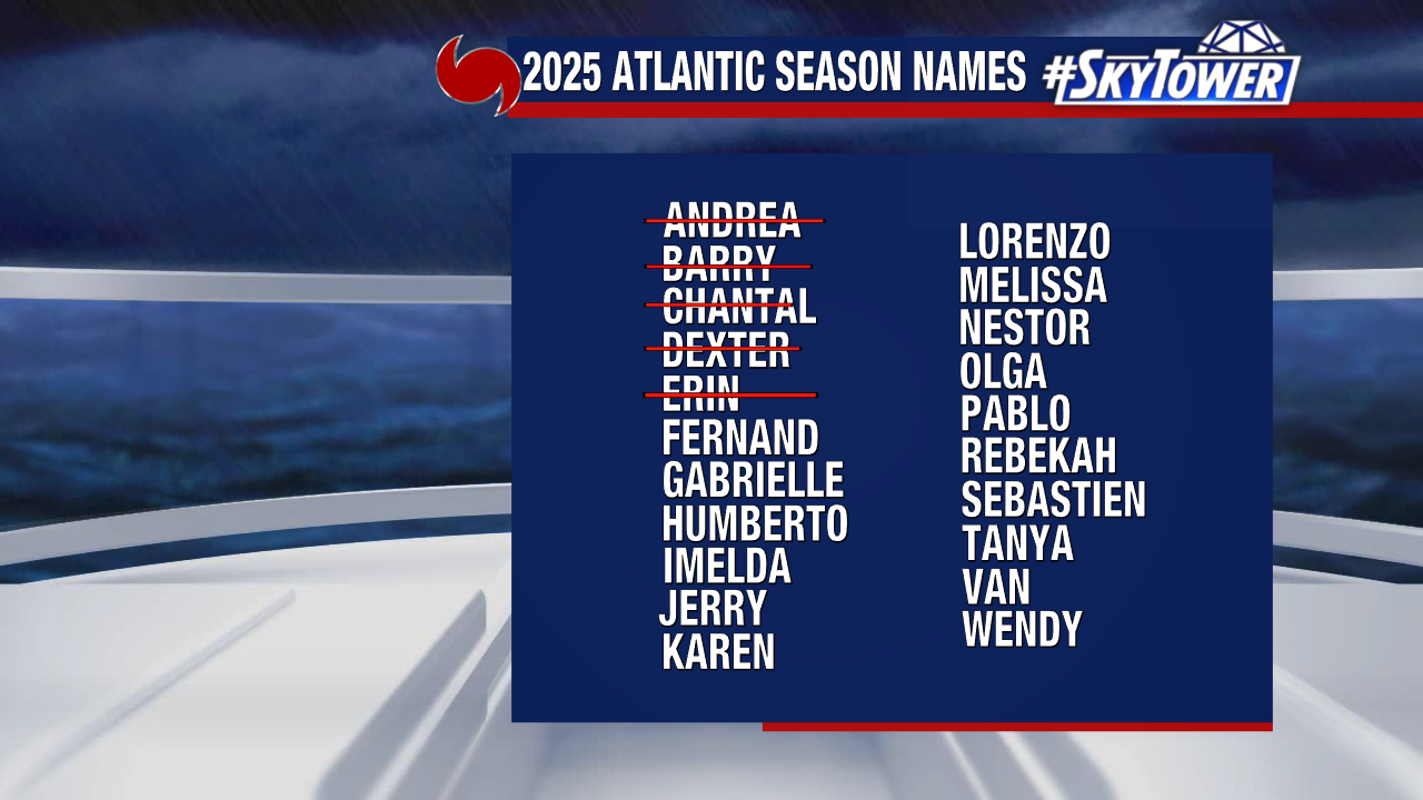
The next name on our 2025 storm list is Fernand.