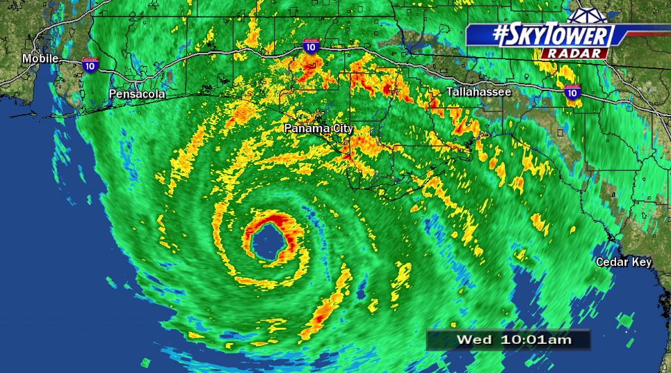
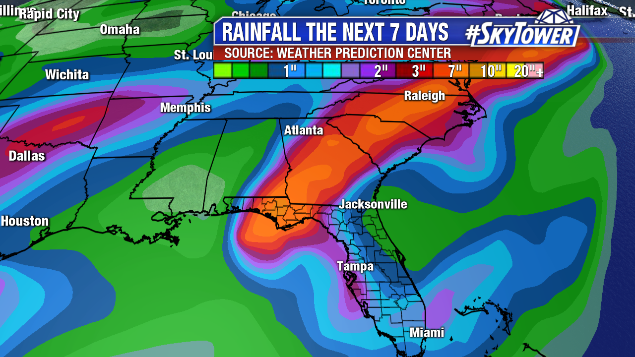
Hurricane Michael continues to move over very warm waters of the Gulf of Mexico. Even with moderate wind shear over Michael, it continues to gain strength and become more organized. There have been some signs of some dry air being pulled into the hurricane. This temporarily slowed the intensifying process overnight, but Michael has been handling much of the environmental challenges it has seen.
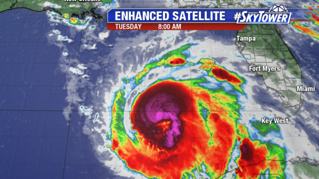
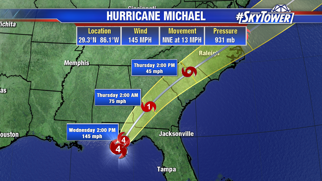
Hurricane Michael will continue to be a very dangerous hurricane with impacts ranging from damaging winds, coastal storm surge, to flooding rainfall. Currently a Hurricane Warning extends from the AL/FL to the Suwannee River. The Tropical Storm Warning has been issued from the Suwannee River to Chassahowitzka and from the AL/FL border to the AL/MS border.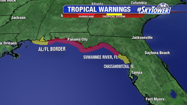
Hurricane Michael will continue to move through the Gulf today in an area of warm waters and moderate wind shear. Hurricane force winds extend out 40 miles from the center of storm. Tropical Storm force winds extend out 195 miles from the center. The forecast track will keep the Tropical Storm force winds offshore of the west coast of Florida. Those winds will begin to reach the panhandle on Tuesday night.
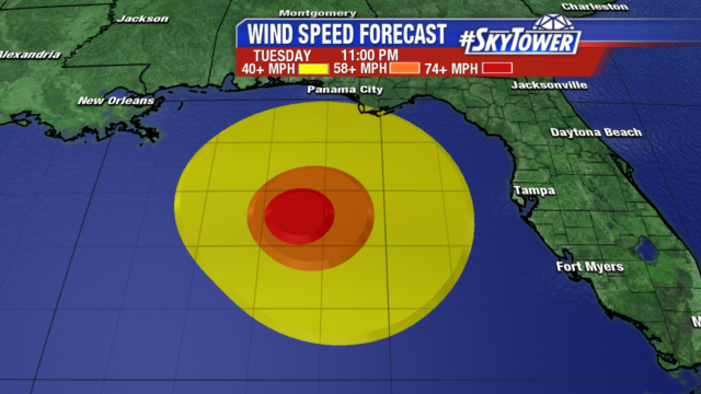
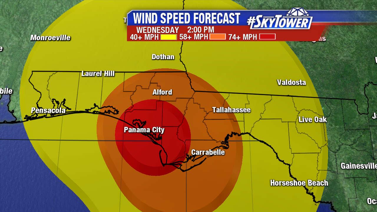
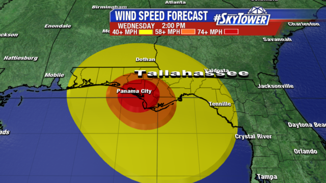
Landfall will occur mid-day on Wednesday with the entire panhandle experiencing at least winds of 40+ mph. At this point Michael is expected to be a major hurricane with winds of 120mph. This will cause devastating damage in the areas along the coast close to the center and reaching well inland. The forward speed and strength will allow very strong winds to reach much further inland before Michael weakens to a Tropical Storm.
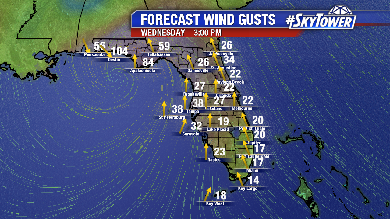
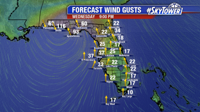
The wind gust graphic below shows forecast wind gust at 9pm on Wednesday. The strongest part of the hurricane will be centered between Destin and Apalachicola.
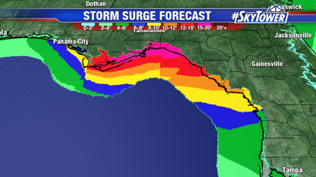
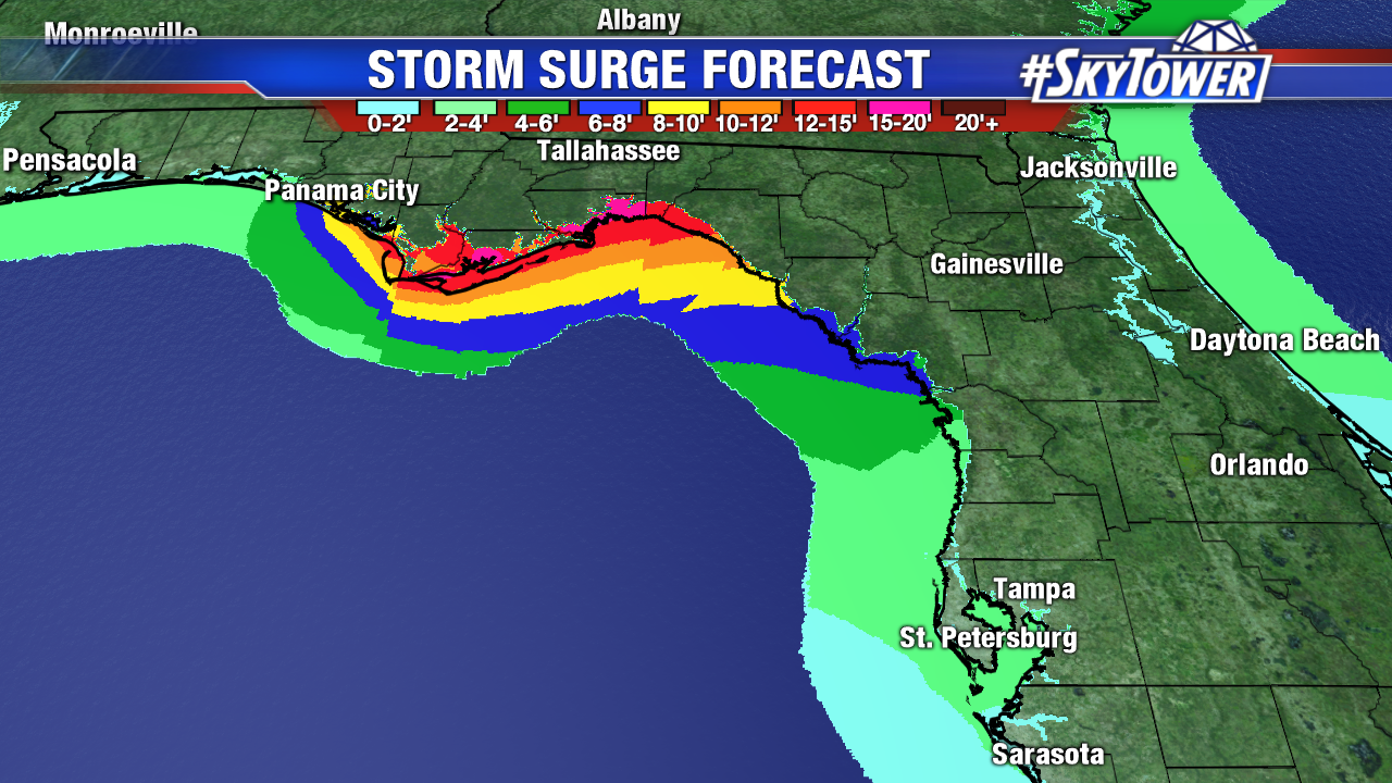
A storm surge warning has been issued for much of the coastline down to the Anclote River. A storm surge watch has been issued from the Anclote River to Anna Maria. The track will keep the strongest winds off the west coast of Florida and much of the surge. Pinellas and Tampa Bay could see some higher than normal tides but effects should be minimal. Surge effects will increase as you move northward with 6-8′ of surge possible into Citrus County. Exact amounts of storm surge can be affected by the exact strength and structure of the hurricane.
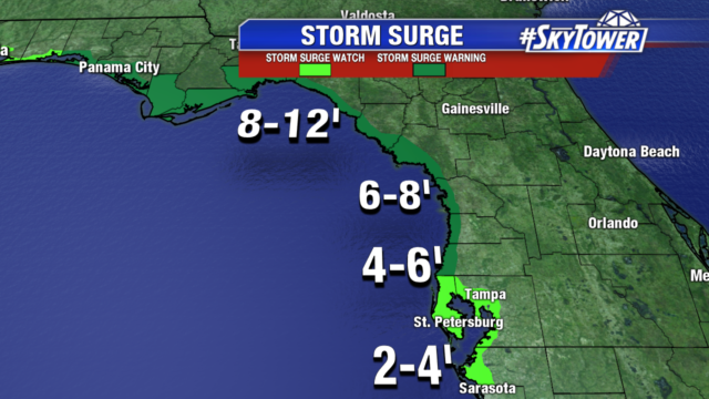
The hardest hit areas as far as storm surge will be along the big bend of Florida. North and west of Cedar Key should expect 8-12′ of storm surge with the landfall of the hurricane.