Florence Weakens, But Widespread Flood Threat Remains

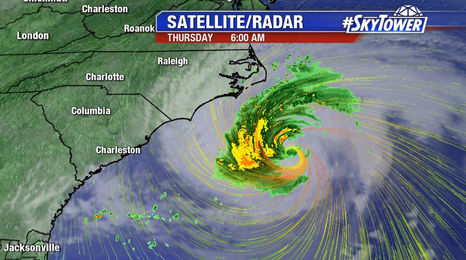
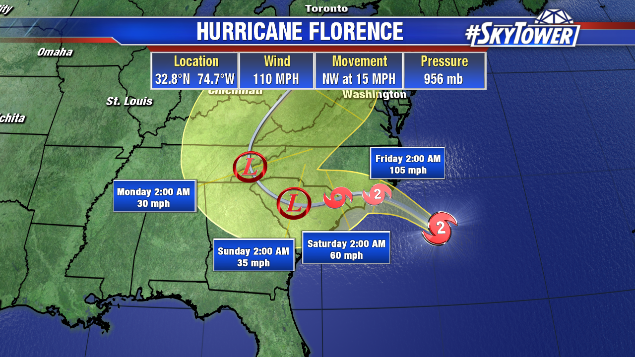
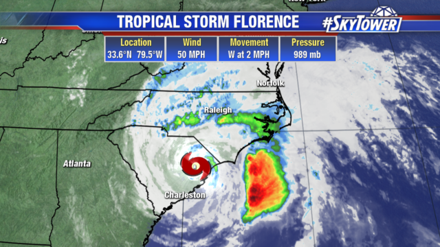
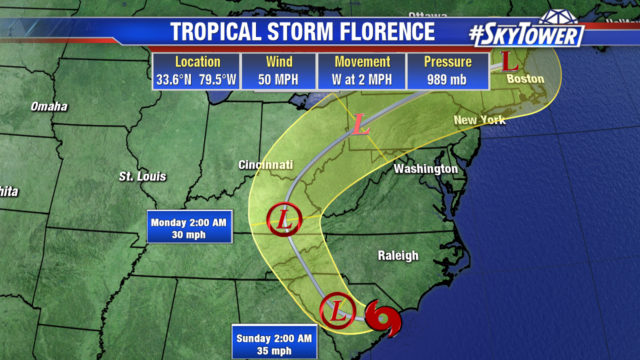
Tropical Storm Florence continues to weaken as it slowly creeps west. It will become a tropical depression by this evening. Florence will still be in South Carolina Sunday morning, adding to the flash flood threat. By early Monday, Florence will have made noticeable movement to the northwest into Eastern Kentucky.

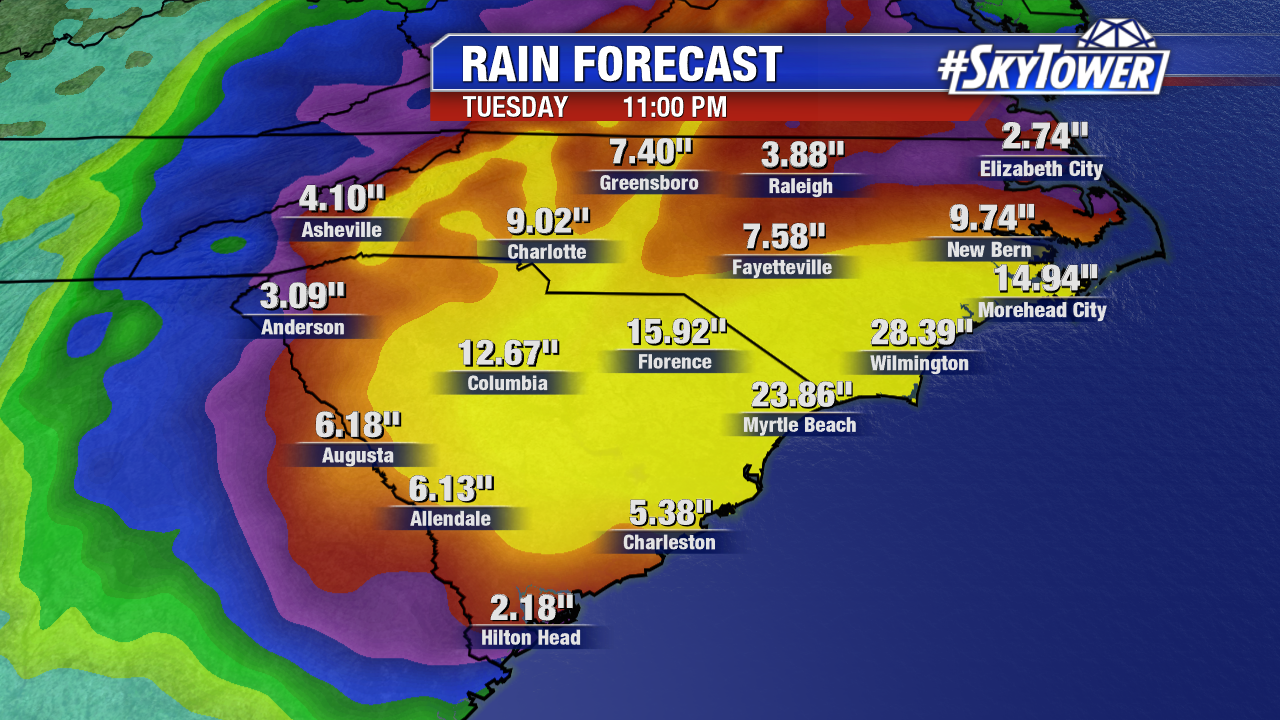
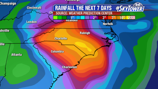
Widespread flooding remains the main concern. Many locations have already seen 1-2 ft of rain and an additional 1-2 ft of rain is possible over the next 2 days. River levels will rise into the middle of next week, even after Florence has moved away. The significant flooding will continue to impact the Carolinas next week. Landslides are also a concern as Florence brings heavy rain to the mountains.

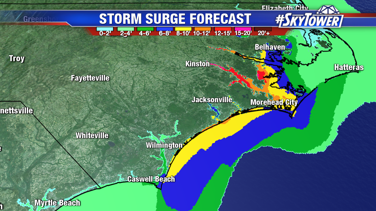
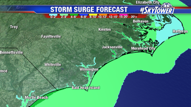
Storm surge of 3-5 ft. remains an issue along the coastline in onshore flow. The surge threat will lessen as Florence moves further inland.

Tropical Storm Joyce will stay over the open Atlantic Tropical Storm Helene will continue heading towards Ireland and the United Kingdom late Monday. Isaac has now weakened into a trough and the remnants will move west in the Caribbean. Right now it doesn’t look like Isaac will impact Tampa, but we will continue to monitor it as it moves into the Gulf.

Florence Weakens A Bit – Still An Incredibly Dangerous Storm

No big changes to Hurricane Florence in the overnight updates Wednesday night. They eye of the storm was not fully intact Thursday morning as some dry air has entrained into the circulation and it was encountering SSW wind shear. That being said, max sustained winds are still at 110 mph. The overall wind field has expanded with hurricane force winds now extending out about 70 miles and tropical storm force winds extending out about 170 miles.

Florence will slow to a crawl as it nears the coast late Thursday night into Friday morning. The current forecast has the storm moving from near Wilmington, NC to near Columbia, SC (~200 miles) in a 48 hr span. That equates to a painfully slow 4-5 mph storm motion. This will present major flooding issues through much of the Carolinas. Widespread 10-20″ totals by can be expected by early next week, with possible isolated amounts of nearly double that. While coastal areas will deal with life-threatening storm surge and damaging winds, the inland freshwater flooding threat will be the most widely-felt impact of Hurricane Florence and should be taken very seriously.