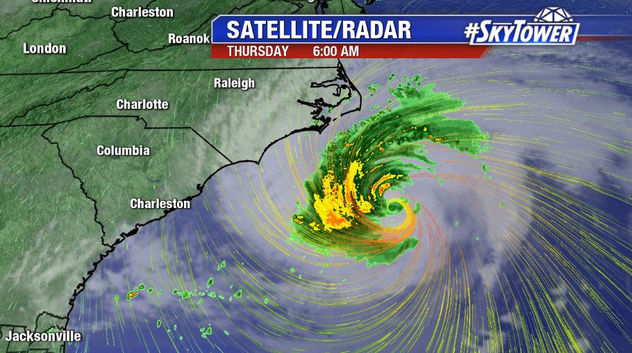
No big changes to Hurricane Florence in the overnight updates Wednesday night. They eye of the storm was not fully intact Thursday morning as some dry air has entrained into the circulation and it was encountering SSW wind shear. That being said, max sustained winds are still at 110 mph. The overall wind field has expanded with hurricane force winds now extending out about 70 miles and tropical storm force winds extending out about 170 miles.
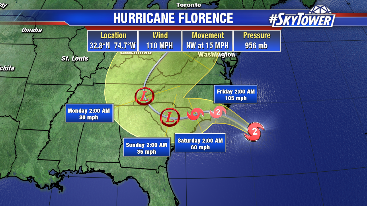
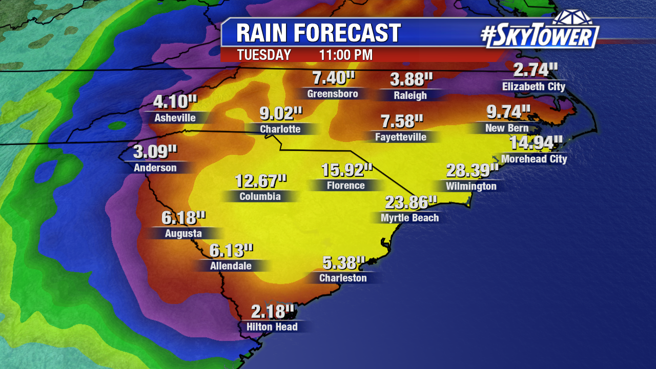
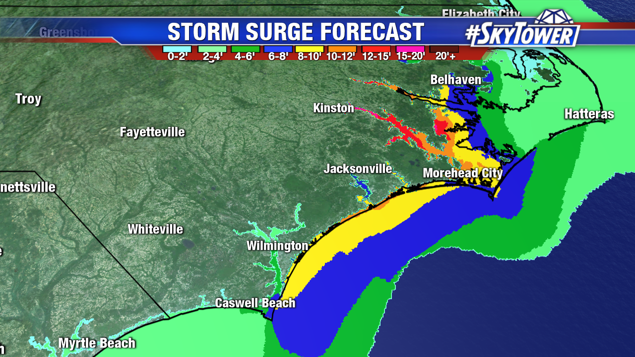
Florence will slow to a crawl as it nears the coast late Thursday night into Friday morning. The current forecast has the storm moving from near Wilmington, NC to near Columbia, SC (~200 miles) in a 48 hr span. That equates to a painfully slow 4-5 mph storm motion. This will present major flooding issues through much of the Carolinas. Widespread 10-20″ totals by can be expected by early next week, with possible isolated amounts of nearly double that. While coastal areas will deal with life-threatening storm surge and damaging winds, the inland freshwater flooding threat will be the most widely-felt impact of Hurricane Florence and should be taken very seriously.