Tropical Wave Now 50% Chance of Development Next Week

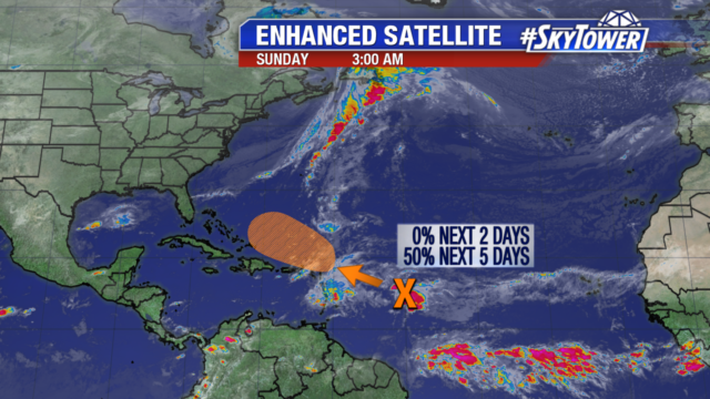
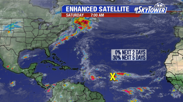
Even though we are nearing the end of Hurricane Season, tropical waves continue to come off the coast of Africa. Dry air and wind shear have been limiting their development. But we are watching a tropical wave become better organized with gusty winds. It is still several hundred miles east of the Lesser Antilles. Significant organization over the next 2 days is unlikely. But next week as it moves north of Puerto Rico it could become better organized. Even if it does organize, models are bringing a trough off the East Coast of the U.S., which would steer it away from the coast.

Slight Chance of Development for Tropical Wave

A tropical wave several hundred miles east of the Lesser Antilles has a slim chance of development. Wind shear and dry air are still prevalent in the tropics. It is in an area unfavorable for organization, so has a 0% chance of development over the next 2 days. But as it nears the Greater Antilles during the middle of next week we may see some organization.

In 2016, Hurricane Otto formed late in the month and was a rare Atlantic to Pacific basin storm. It strengthened to a category 3 storm and crossed over Nicaragua and Costa Rica. Heavy rain and flooding killed 18 people with some areas receiving nearly a foot of rain. The storm set several records. It was the latest hurricane to form in a calendar year in the Caribbean Sea and the strongest hurricane on record so late in a calendar year. Otto is the only hurricane known to cross over Costa Rica and had the southernmost landfall in Central America.