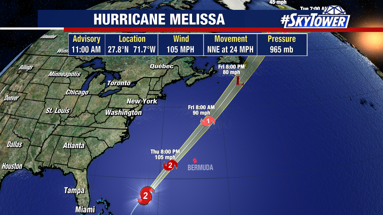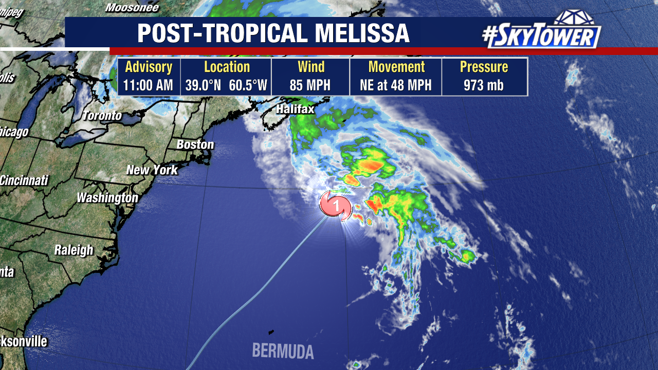
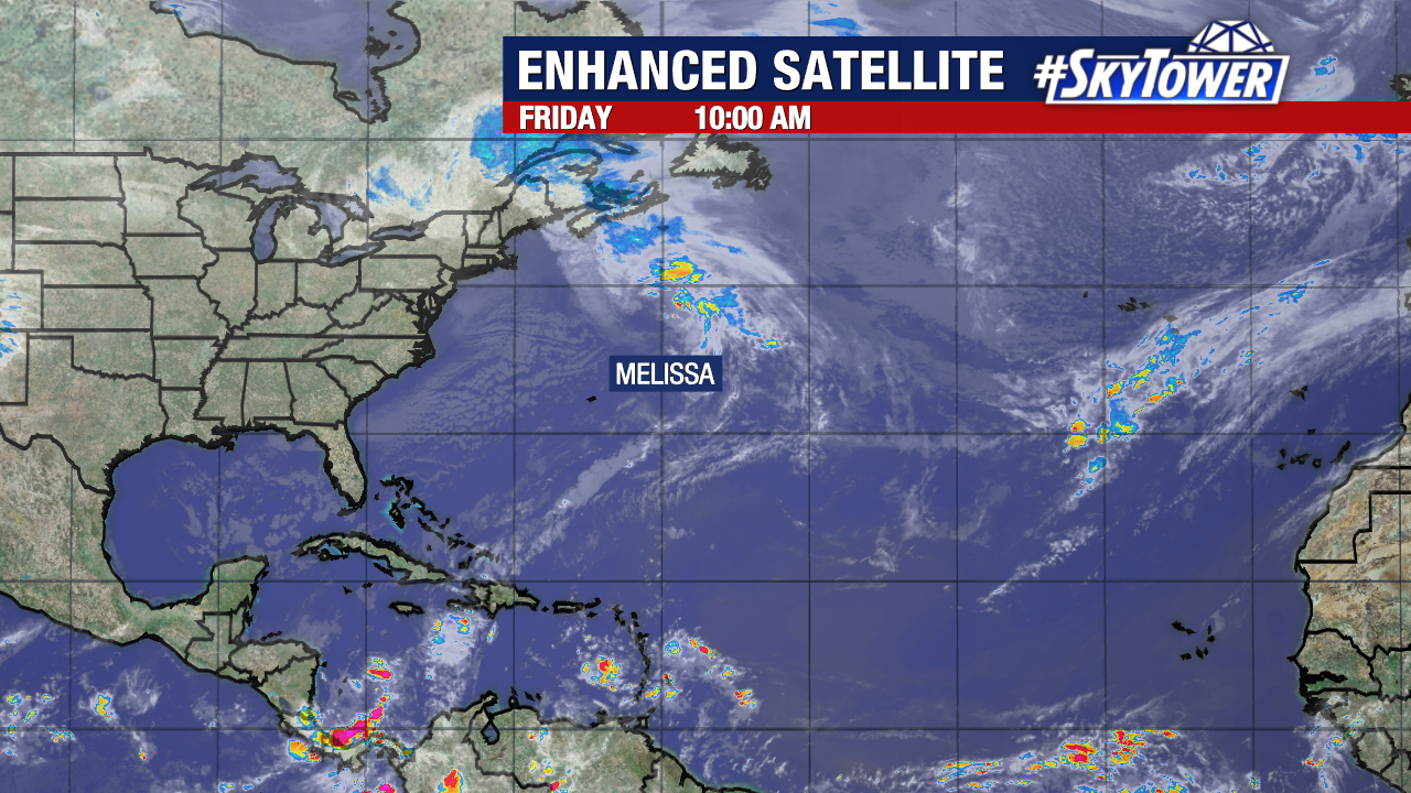
After passing west of Bermuda, Melissa has now become a post-tropical cyclone. Its now moving at a whopping 48 mph to the northeast. Wind gusts as strong as 98 mph were observed on Bermuda as the fast-moving hurricane moved by.
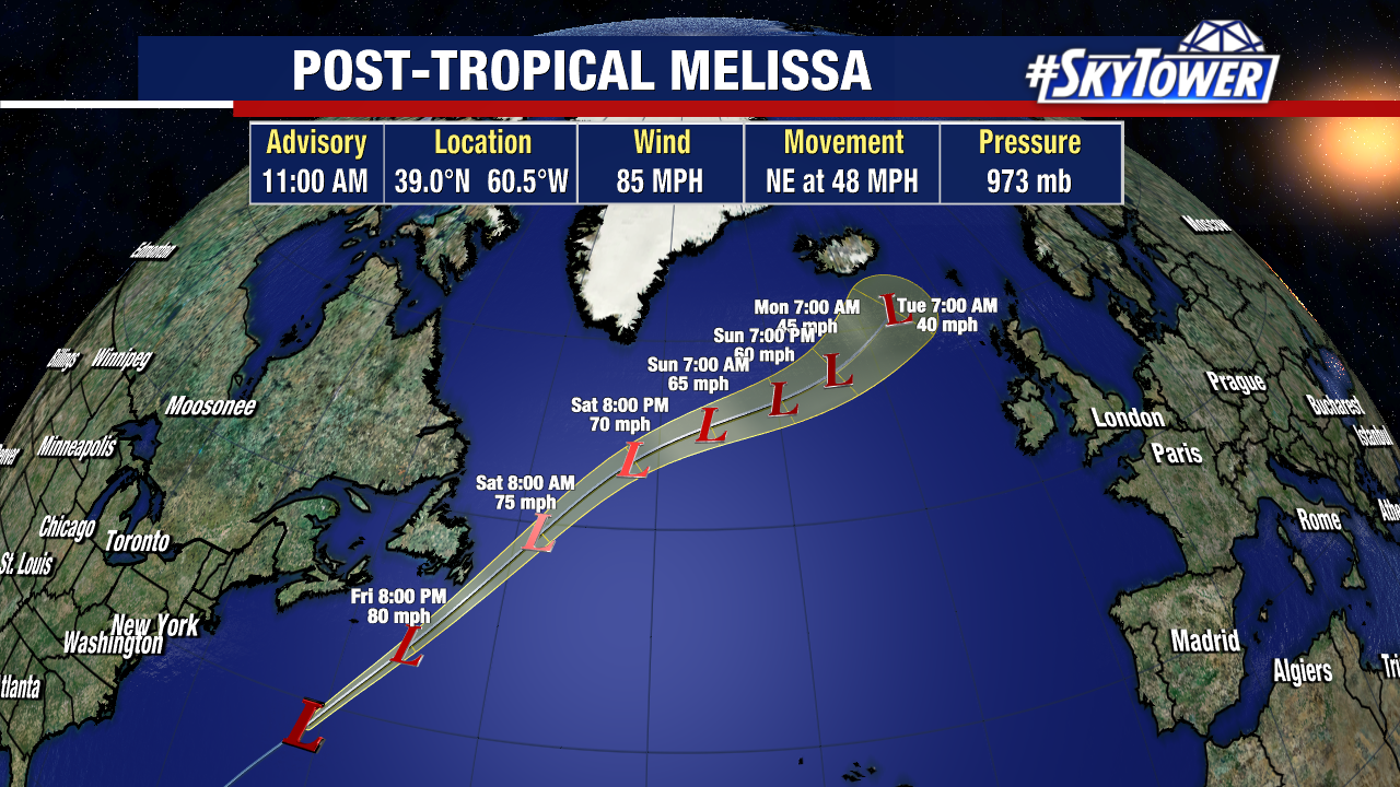
Its remnants are expected to traverse the north Atlantic over the weekend.
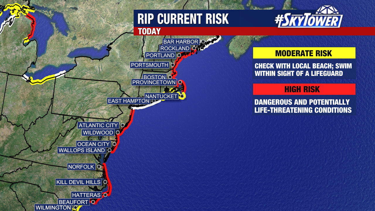
High surf and rip-currents, and generally dangerous ocean conditions have been reported along the northeast U.S. coastline, despite the storm passing hundreds of miles off their shores.
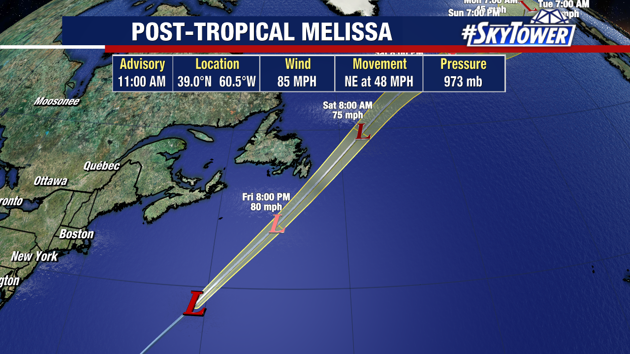
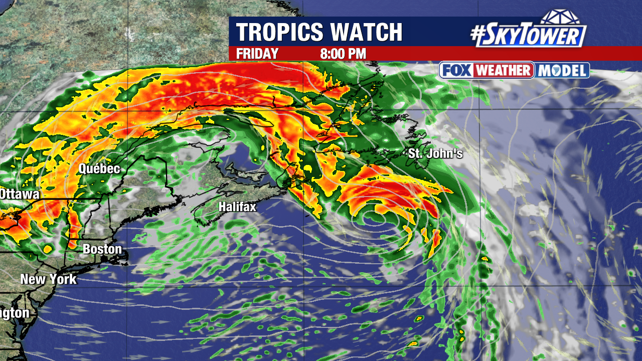
Newfoundland is no longer included within Melissa’s forecast cone. Impacts will still extend well outside this cone.
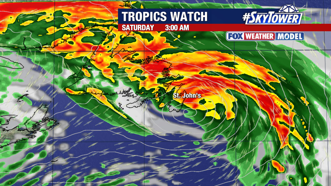
Even with the storm becoming post-tropical, it could still be capable of bringing them winds over 80 mph on Friday night into Saturday morning.
Beyond Melissa, there are no other active Atlantic disturbances or named systems being tracked by the National Hurricane Center.