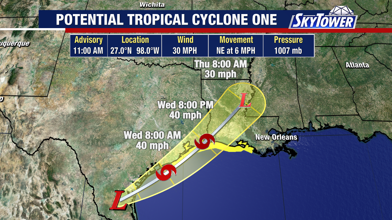
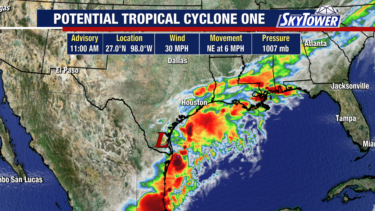
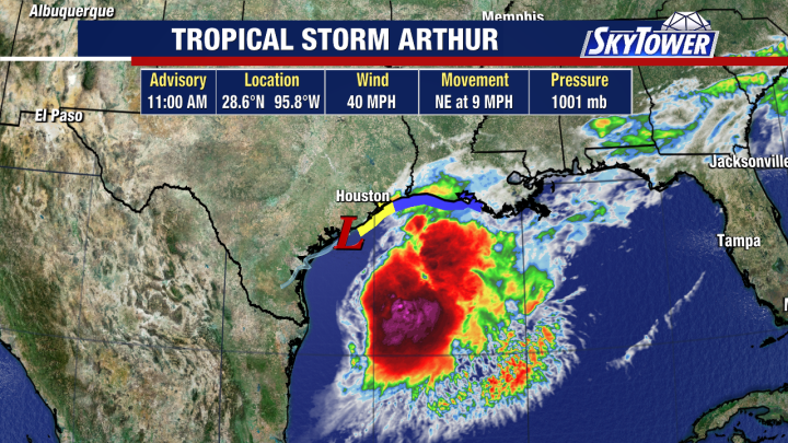
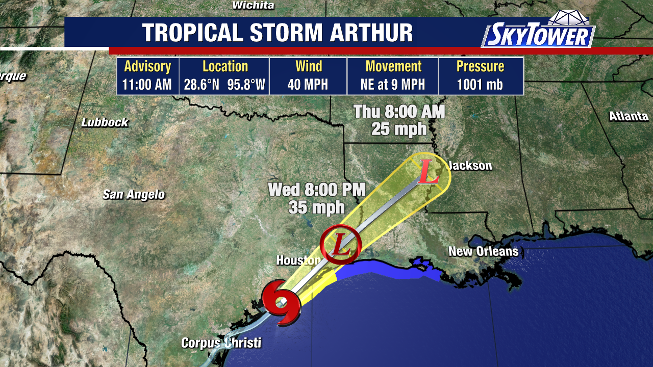
Tropical Storm Arthur, the first storm of the Atlantic season, just formed along the coast of Texas.
Sustained winds jumped from 30 to 40 mph Wednesday morning, officially making this a tropical storm.
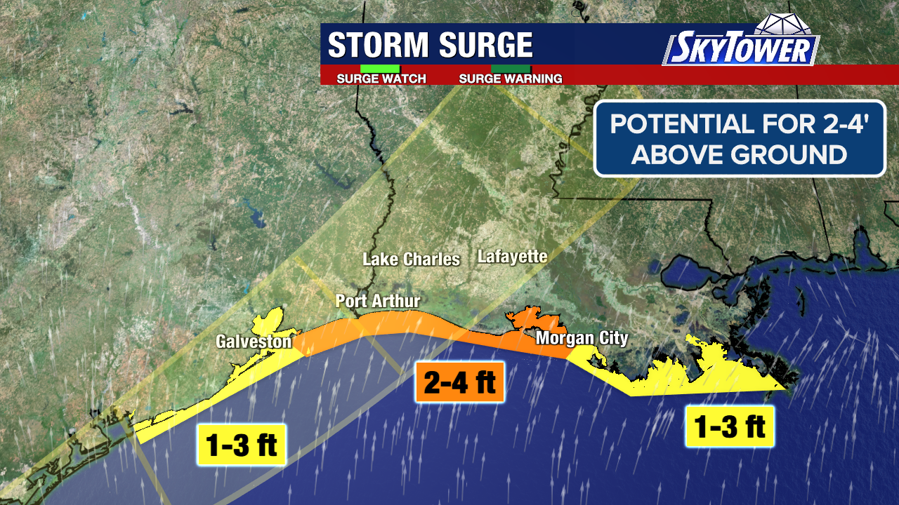
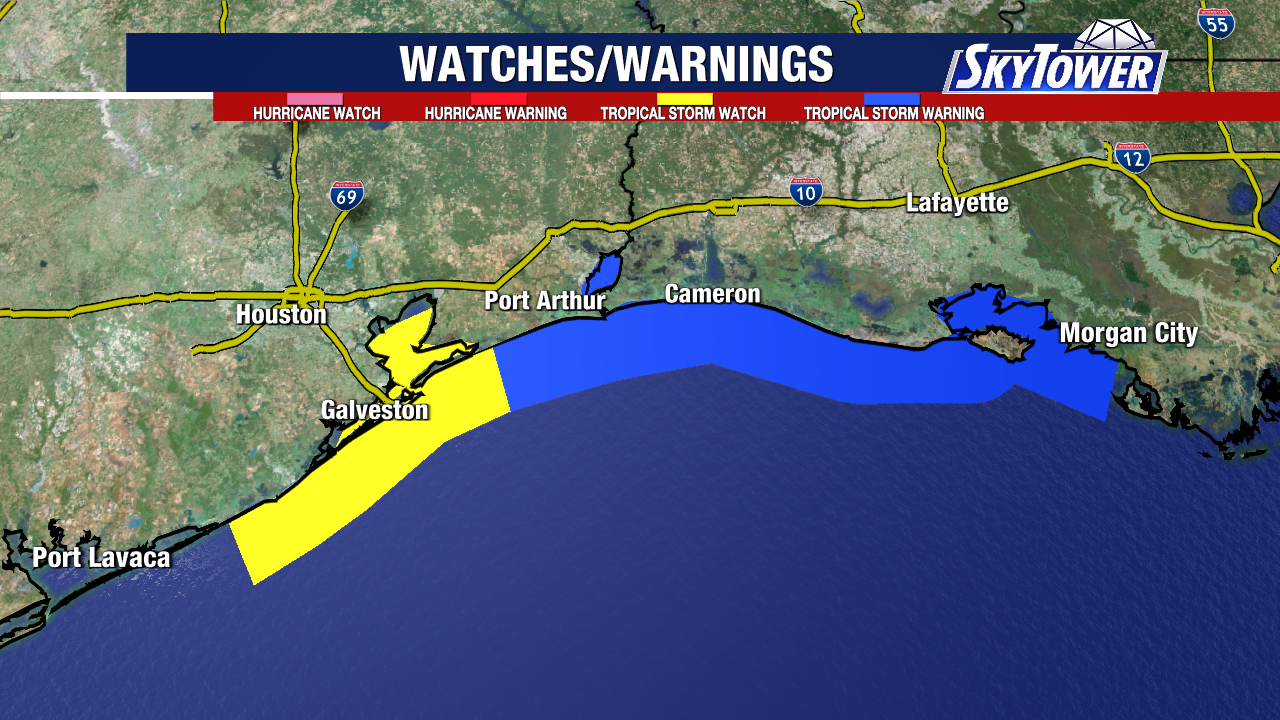
The Tropical Storm Warning has been extended west to High Island, Texas and runs to Morgan City, Louisiana. Tropical Storm Watch is in effect for Sargent, TX to High Island, TX.
Arthur will weaken quickly as it moves through Texas & Louisiana today and Thursday.
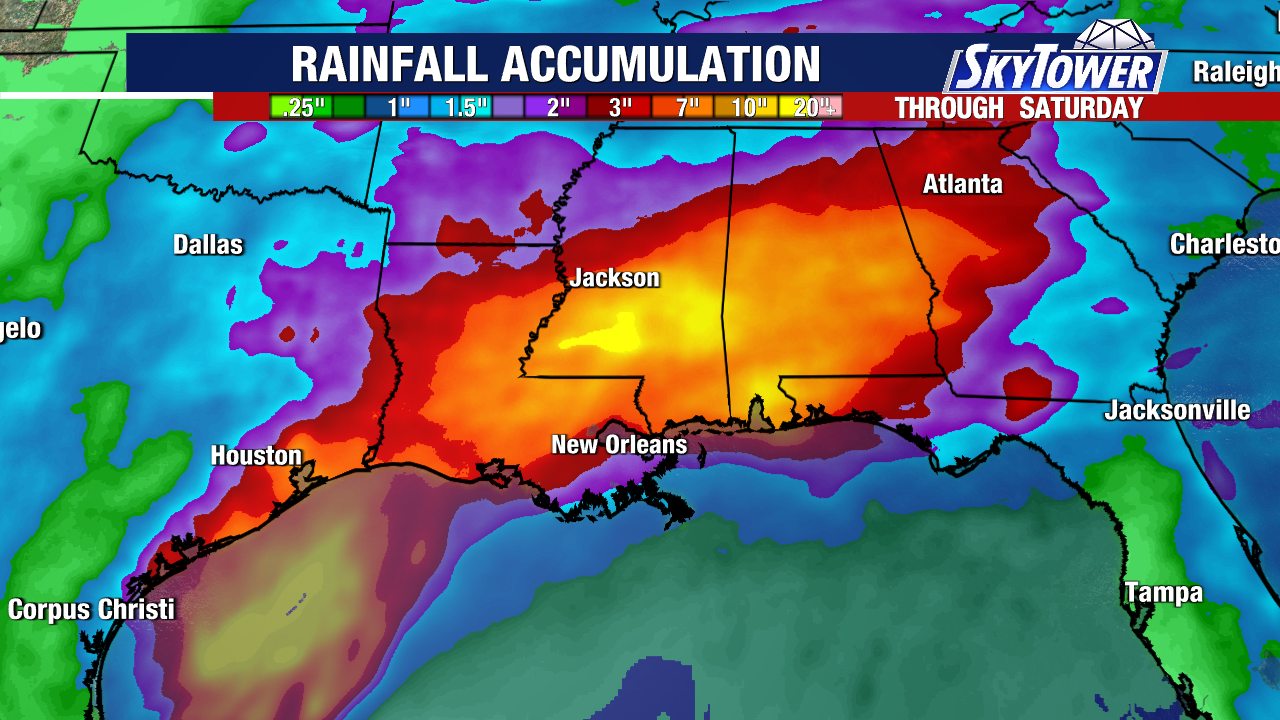
Heavy rain and flash flooding continue to be the main threat from Arthur. Looking at rainfall totals of 5-10″, isolated totals near 20″ through Friday.
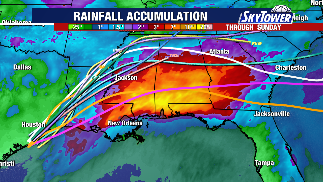
Heaviest rainfall will be from the Mid-Upper Texas coast into Louisiana, Mississippi and Alabama.
Western portions of Georgia and the Florida Panhandle will also see locally high rainfall amounts that could cause dangerous flash flooding.