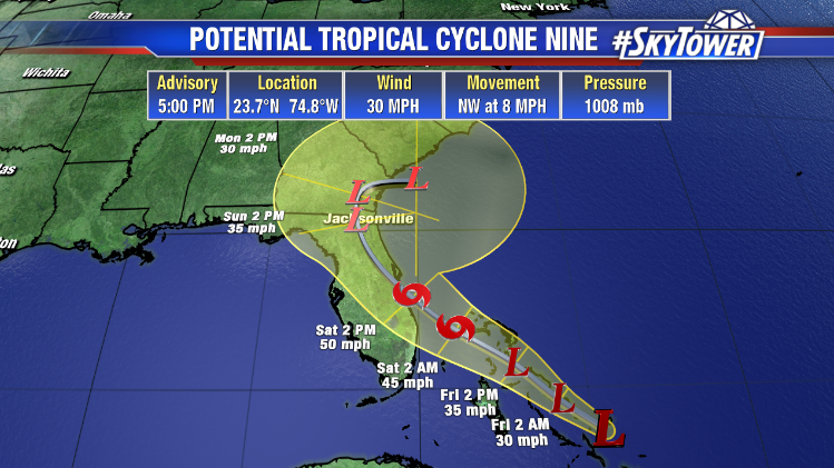
‘Potential Tropical Cyclone Nine’ is what we have moving through the Bahamas today. This designation is used by the National Hurricane Center when a storm has yet to form, but it is expected to form soon close to land. It allows them to issue watches/warnings for areas that may be impacted within 48 hours. Tropical Storm Humberto is likely to form any time within the next 24-36 hours.
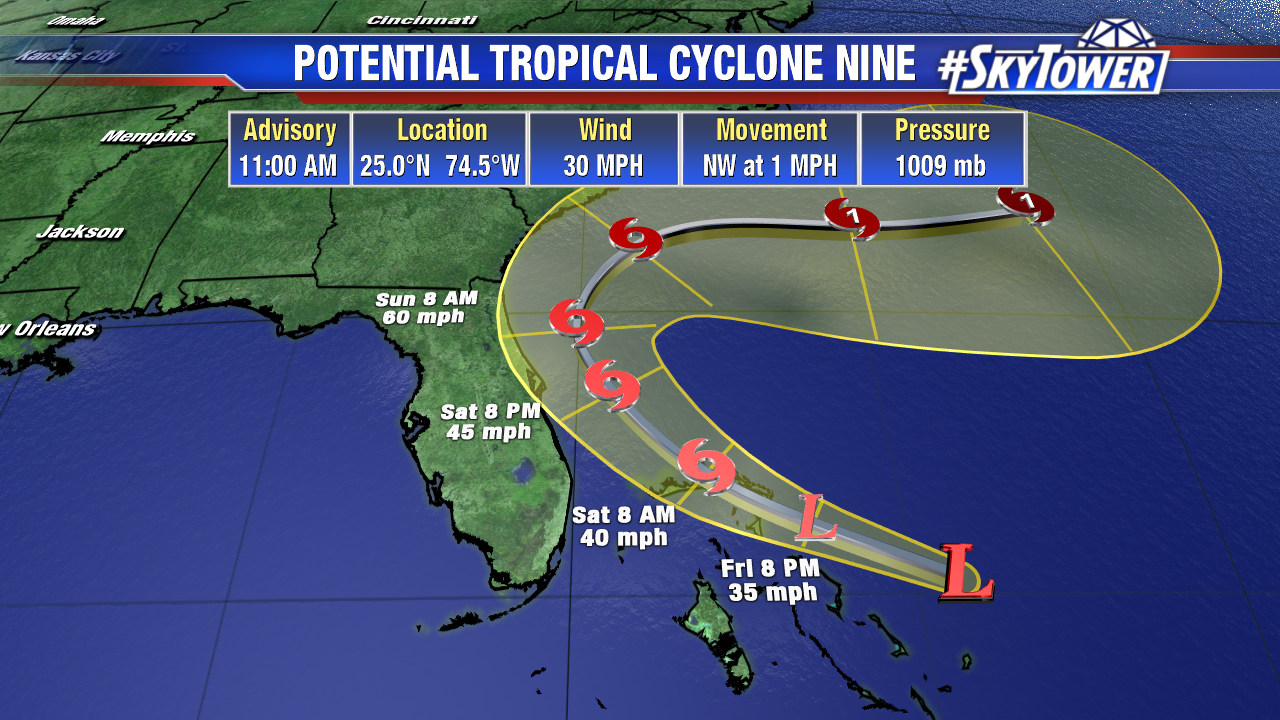
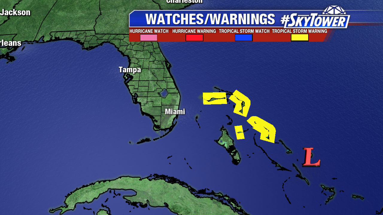
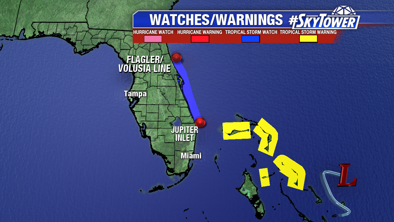
As of 11am Friday, this system was located about 190 miles ESE of Great Abaco Island. Mind you, that area, along with Grand Bahama, was completely devastated by Hurricane Dorian less than 2 weeks ago. Unfortunately, they’ll have to deal with some very gusty winds and heavy rainfall from this disturbance today and Saturday before it moves further north on Sunday. Tropical storm warnings have been issued for all of the Northwestern Bahamas excluding Andros Island.
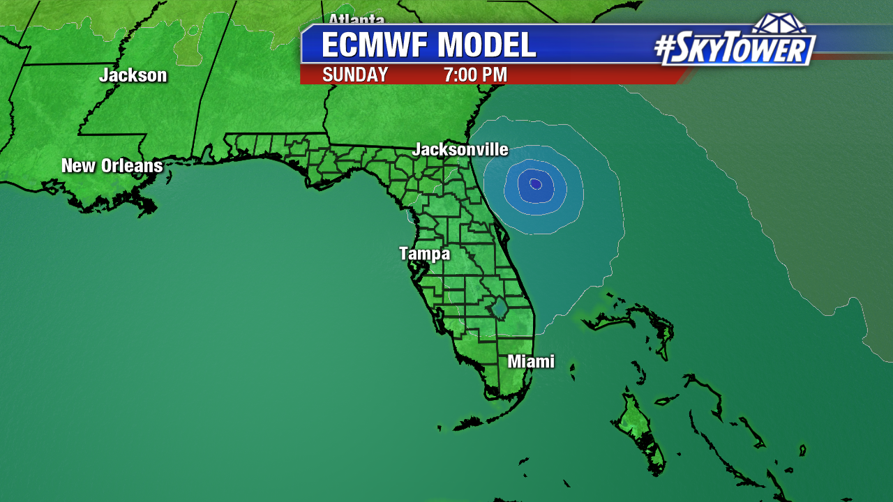
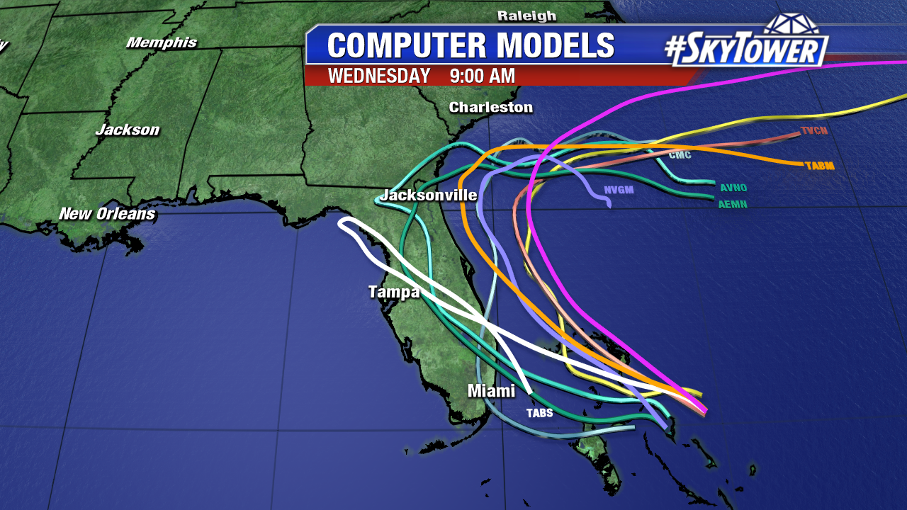
Moderate southwesterly shear has kept this system from getting further organized, but that shear should gradually diminish over the next day or two, allowing Tropical Storm Humberto to form off Florida’s East Coast. Majority of model guidance continues to show a storm moving northwest, then north, then northeast, along with gradual strengthening. In addition, there is increasing confidence that Humberto will stay offshore.
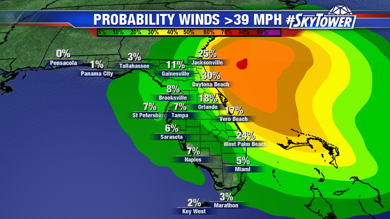
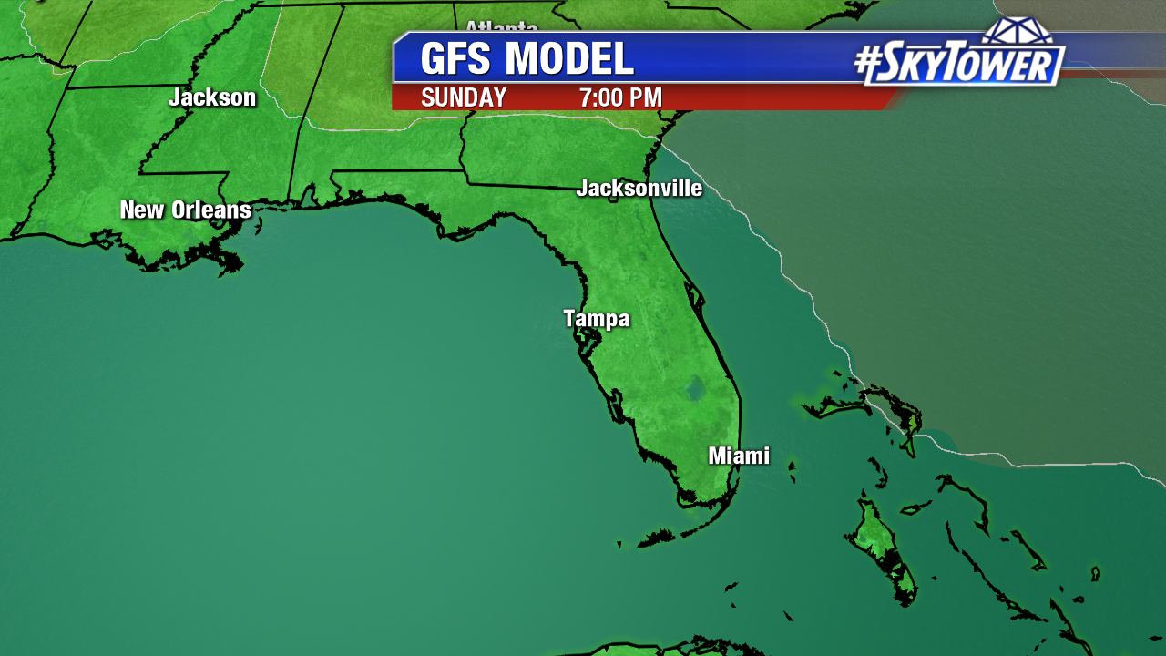
For Florida, a track off the East Coast almost always leads to minimal impacts, especially with a tropical storm. For now, those on the East Coast can expect off and on rain with gusty winds, possibly up to tropical storm-force, from Saturday afternoon through Monday morning, along with high surf. A tropical storm watch is in effect from the Jupiter Inlet to the Flagler/Volusia co. line. On the west coast of the state, impacts will be limited to a couple windy days with a few fast-moving showers.