Imelda Brings Torrential Rain to SE Texas; Tropical Storm Jerry Forms In Central Atlantic

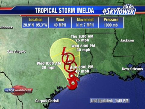
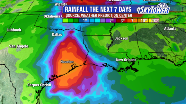
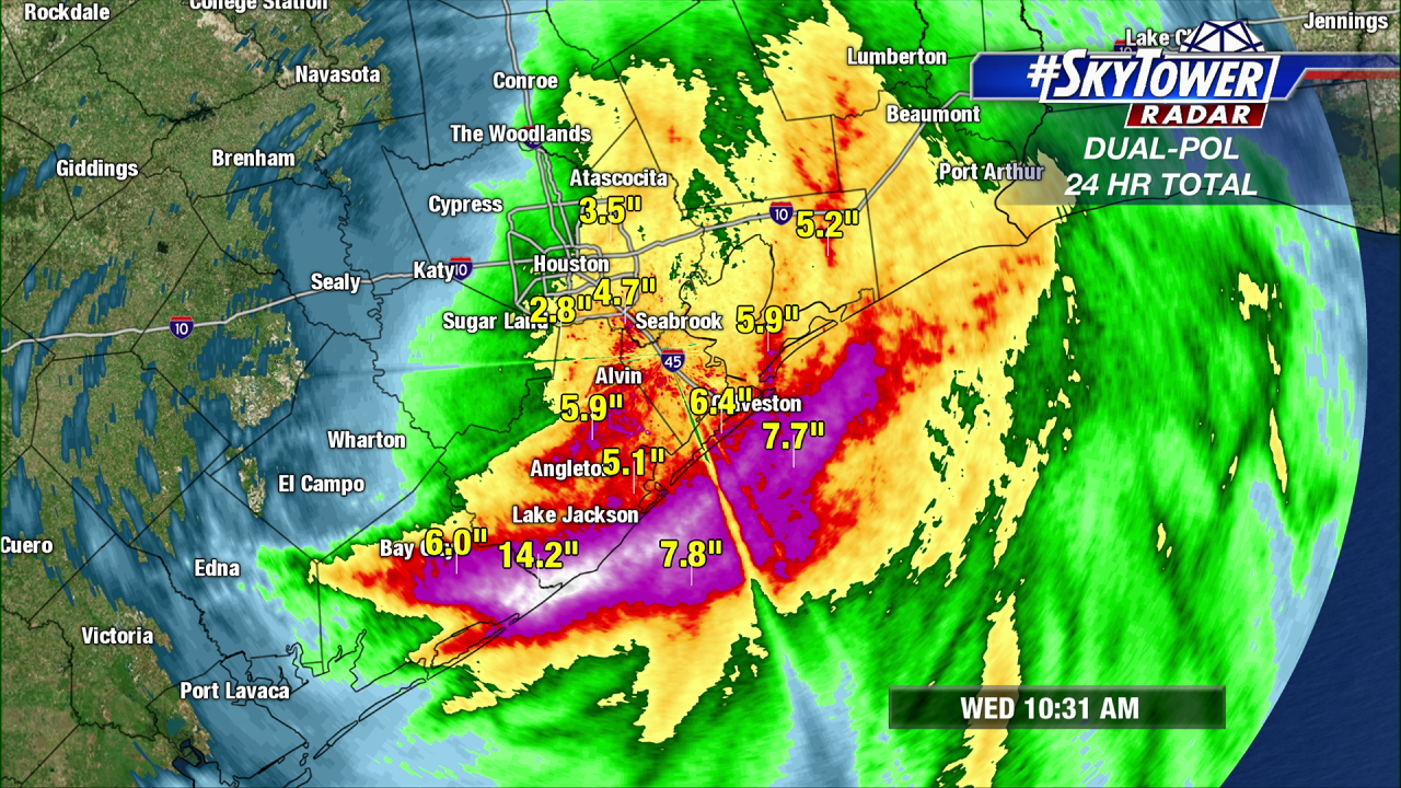
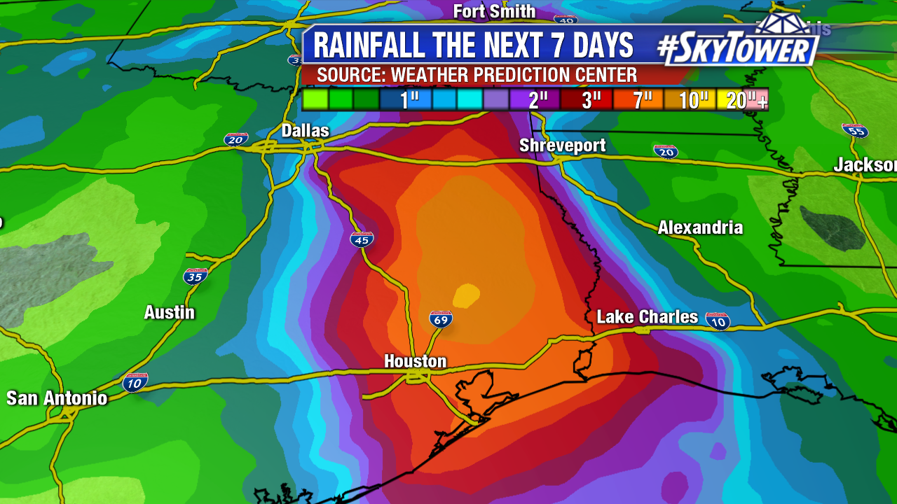
Imelda, now a tropical depression, continues to pound southeastern Texas with heavy rainfall. Several inches of rain has already fallen, with more on the way today and Thursday. When all is said and done, expect widespread 6-12″ totals, with isolated amounts of up to 20″. Heavy rain and a significant threat of flash flooding will spread inland over eastern Texas during the next couple of days.

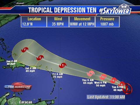
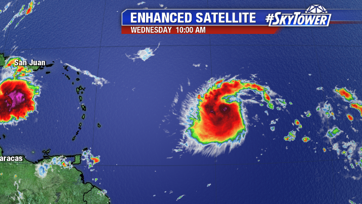
In the central Atlantic, Tropical Storm Jerry formed early this morning, and is currently located about 855 miles east of the Leeward Islands. The environment around Jerry is somewhat dry, but wind shear is low and will remain low for the next day or so. On satellite, it’s a well ventilated storm, and looks primed for at least some strengthening over the next 24 hours or so. Increasing shear should slow development somewhat later in the week.

The current track from the National Hurricane center has Jerry near the northern Leeward Island on Friday as a category 1 hurricane. It’s still too early to determine the severity of any impacts for those islands.

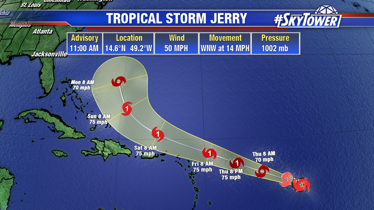
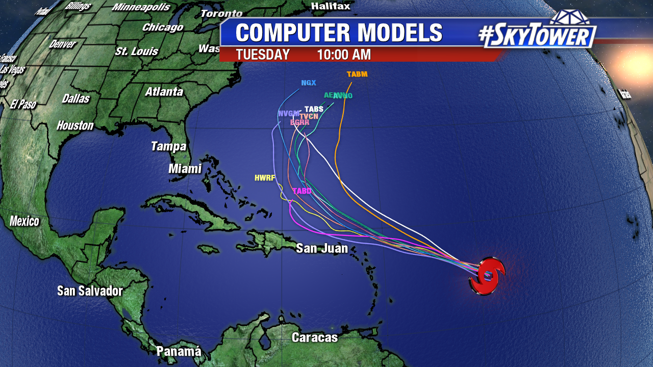
Long term, majority of model guidance indicates that Jerry will ultimately find a weakness in the ridge and follow in the wake of the departing Humberto – curving to the north, and moving safely out to sea. While this is the most likely scenario, this turn to the the north is still 4-5 days away, so we’ll be keeping close tabs on Jerry through the weekend.

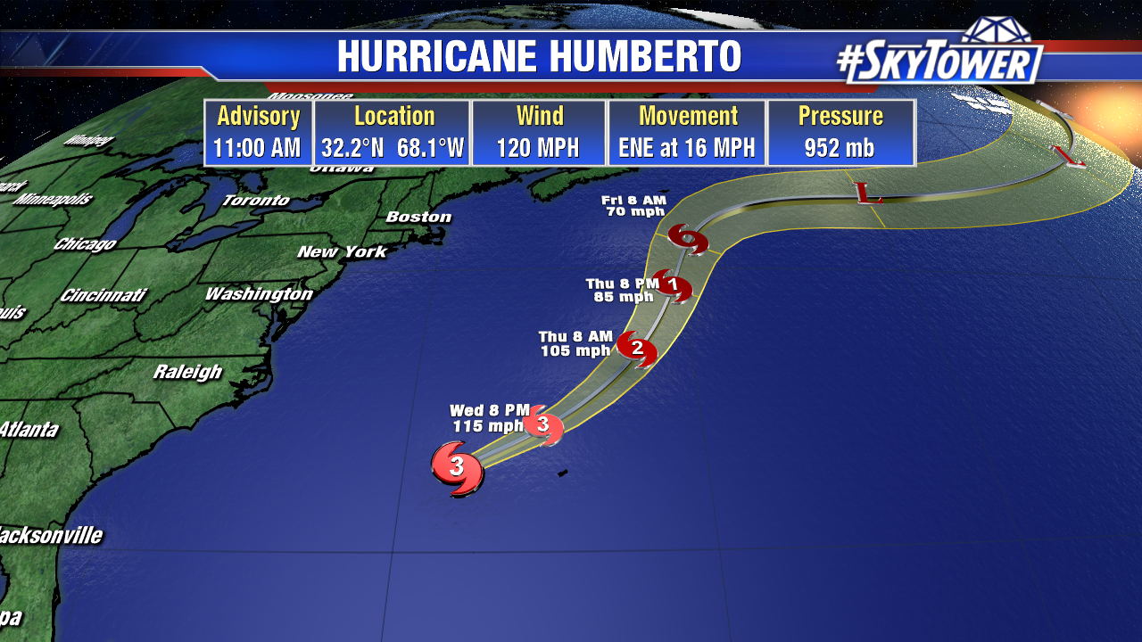
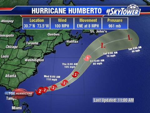
Humberto will bring a period of hurricane-force winds to the island of Bermuda this evening through Thursday morning. A few inches of rain, along with a storm surge of 1-3 feet on the southern shore, can be expected.

Tropical Storm Imelda brings heavy rains to Texas

We have been watching Hurricane Humberto, but now we have an additional tropical depression and newly formed Tropical Storm Imelda. Tropical Storm Imelda has quickly flared up today and is already bringing rain along the SE coast of Texas from Port Lavaca to near Port Arthur, TX. Advisories were initiated at 12PM CDT today with winds speeds of 35mph.


The main threat will be heavy rains as this system slowly drifts northward onshore. Rainfall amounts will be heaviest to the east of the center with widespread areas of 4 to 7 inches of rain but could see pockets over 12+ inches of rain. This will likely cause significant issues for the flood prone areas around Houston.

Humberto continues to grown in size and strength with top winds of 100mph. Hurricane force winds extend out 60 miles and tropical storm force winds extend out 175 miles. Even with the track moving NW of Bermuda, the size of the wind field will bring tropical storm force winds and possibly hurricane force winds to the island.

We also have the newly formed Tropical Depression #10 in the Atlantic. It has shown persistent storms and growing organization overnight and is expected to continue to thrive in a low wind shear environment with warm SST. The only limiting factor for this system is some dry air it will have to contend with over the next couple of days. This system is shown to intensify in vast majority of models as it moves WNW and to the north of the Caribbean. It will continue on this path until it reaches a weakness in the ridge allowing it to turn northward.