We have been watching Hurricane Humberto, but now we have an additional tropical depression and newly formed Tropical Storm Imelda. Tropical Storm Imelda has quickly flared up today and is already bringing rain along the SE coast of Texas from Port Lavaca to near Port Arthur, TX. Advisories were initiated at 12PM CDT today with winds speeds of 35mph.
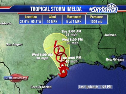
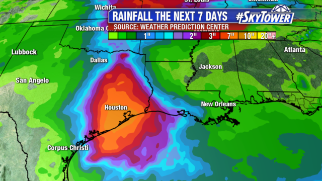
The main threat will be heavy rains as this system slowly drifts northward onshore. Rainfall amounts will be heaviest to the east of the center with widespread areas of 4 to 7 inches of rain but could see pockets over 12+ inches of rain. This will likely cause significant issues for the flood prone areas around Houston.
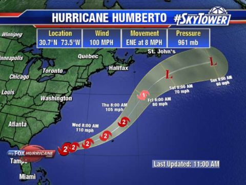
Humberto continues to grown in size and strength with top winds of 100mph. Hurricane force winds extend out 60 miles and tropical storm force winds extend out 175 miles. Even with the track moving NW of Bermuda, the size of the wind field will bring tropical storm force winds and possibly hurricane force winds to the island.
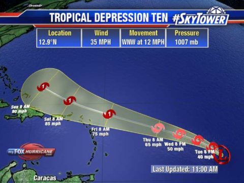
We also have the newly formed Tropical Depression #10 in the Atlantic. It has shown persistent storms and growing organization overnight and is expected to continue to thrive in a low wind shear environment with warm SST. The only limiting factor for this system is some dry air it will have to contend with over the next couple of days. This system is shown to intensify in vast majority of models as it moves WNW and to the north of the Caribbean. It will continue on this path until it reaches a weakness in the ridge allowing it to turn northward.