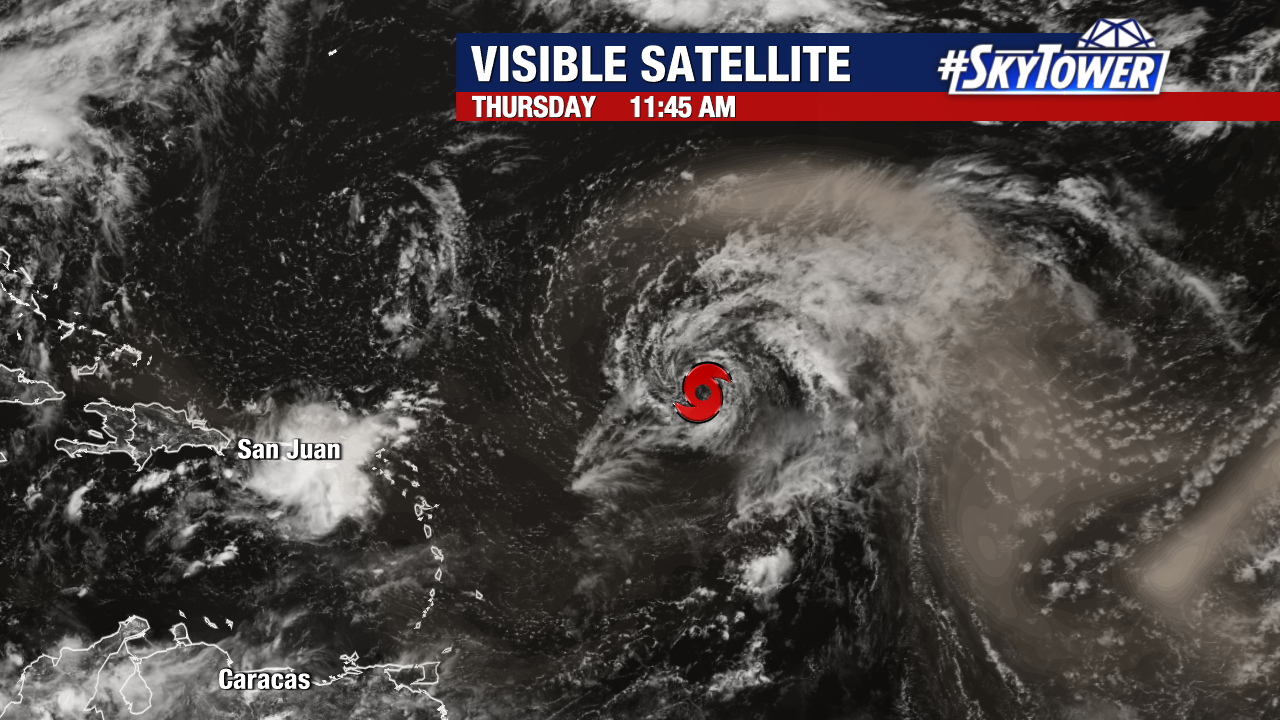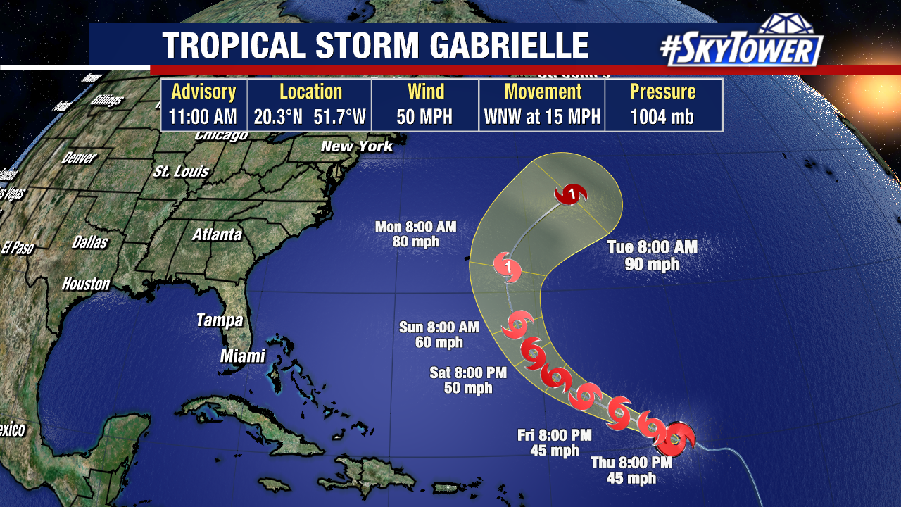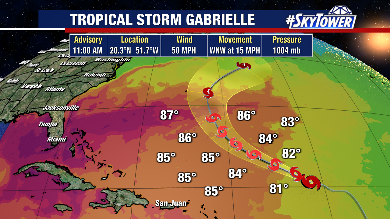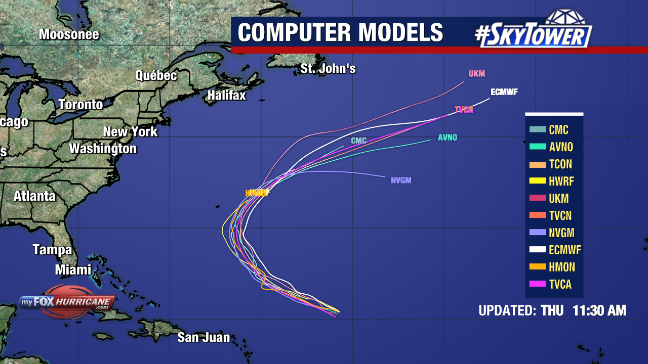
Tropical Storm Gabrielle will likely strengthen into a hurricane by the end of this weekend.
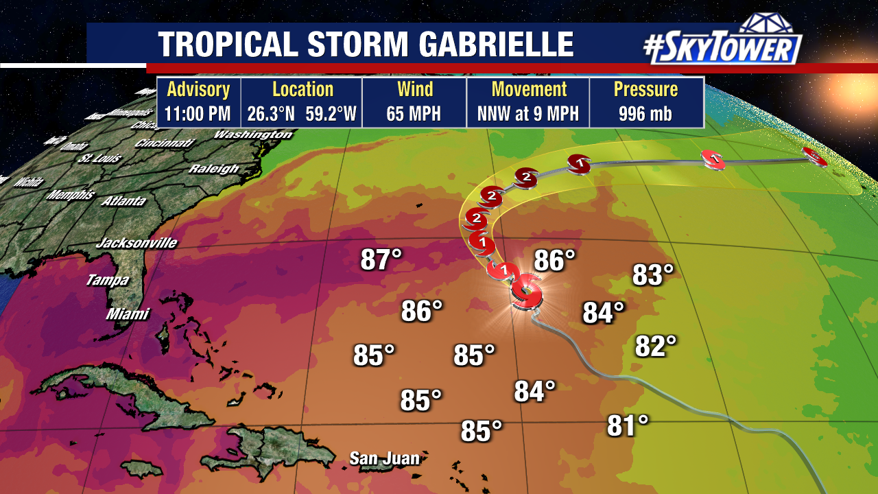
The storm is currently moving northwest into warmer waters and a more favorable environment for intensification.
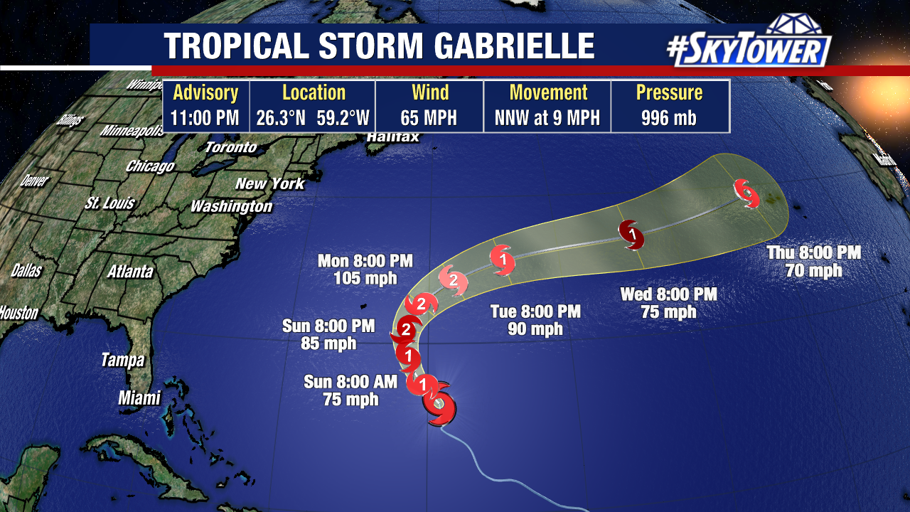
Gabrielle will not bring any direct impacts to the United States and should pass east of Bermuda, though the island should still monitor it for fringe impacts. The National Hurricane Center’s latest forecast still calls for this storm to become a Category 2 hurricane.
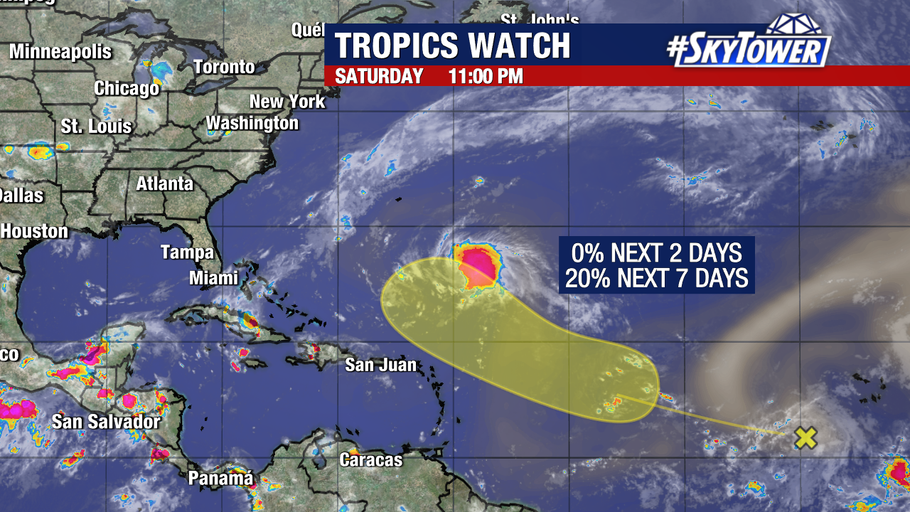
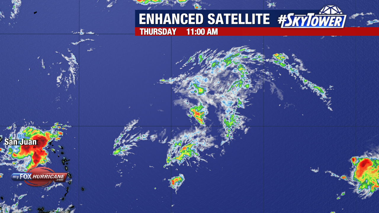
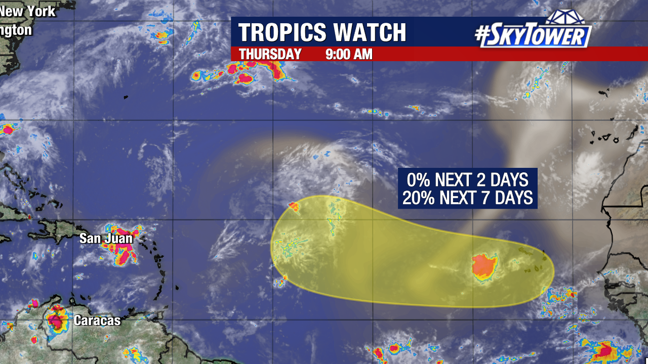
Behind Gabrielle, one separate spot being watched for development. A tropical wave will have a low (20%) chance to form in the yellow shaded region within the next seven days. While most weather models do not have this spot organize into a named storm, those that do steer it away from Florida (similar to Gabrielle).

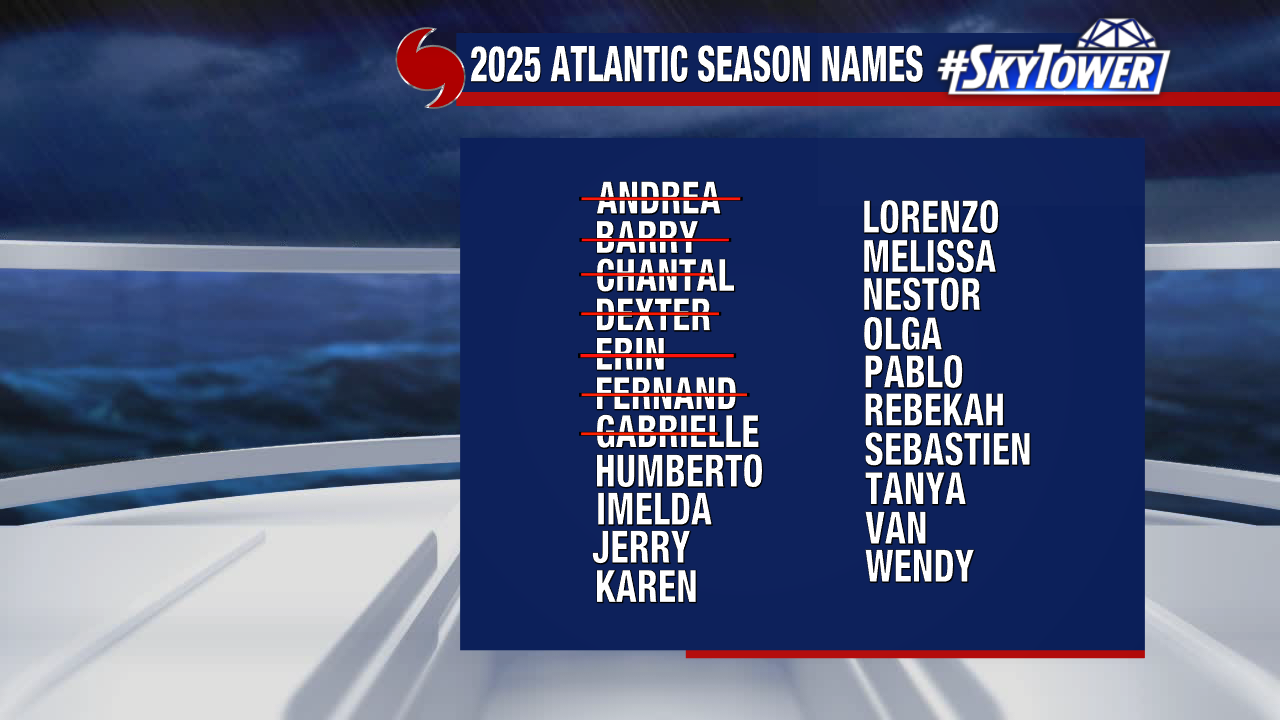
Humberto is the next name to be used from our 2025 storm naming list.