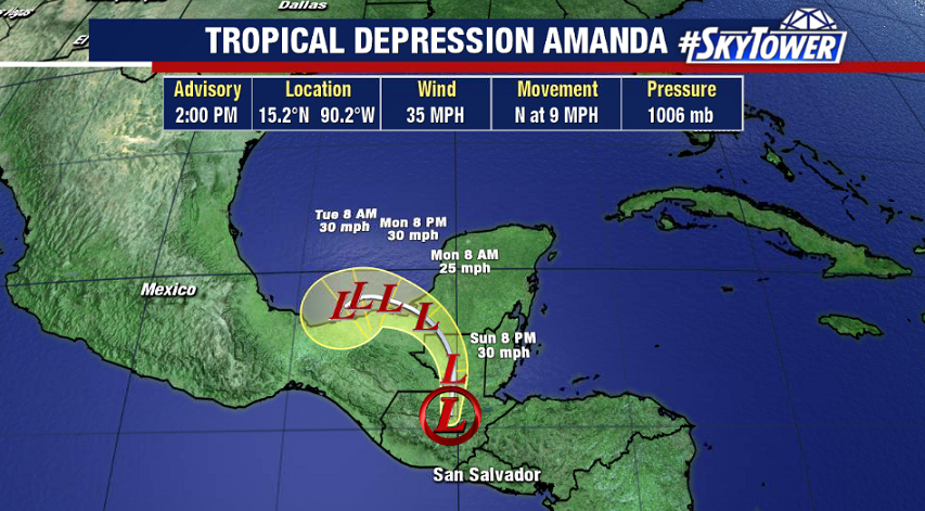
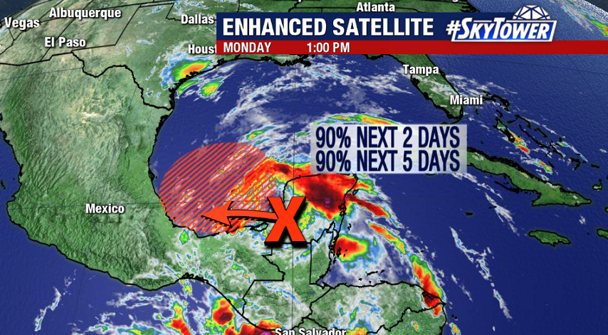
The remnants of what was Tropical Storm Amanda in the Eastern Pacific continue to slowly move across southern Mexico this afternoon producing torrential downpours and localized flooding. This disturbance will move over the Bay of Campeche later today, and a tropical depression or tropical storm could form within the next 24 hours.
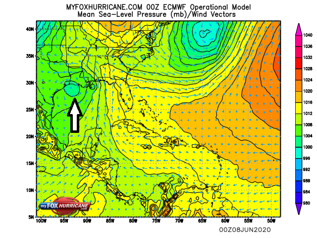
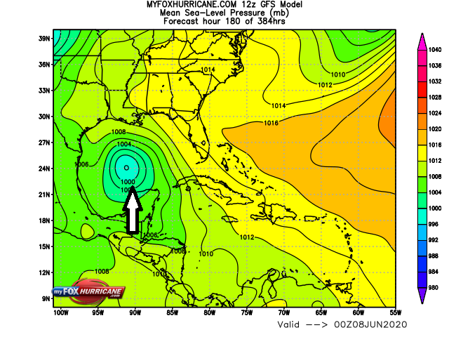
Whatever does form will be drifting around the Bay of Campeche through at least the middle of this week. Beyond that point, models are in fairly good agreement that we’ll have Tropical Storm Cristobal moving north toward Texas/Louisiana this weekend.
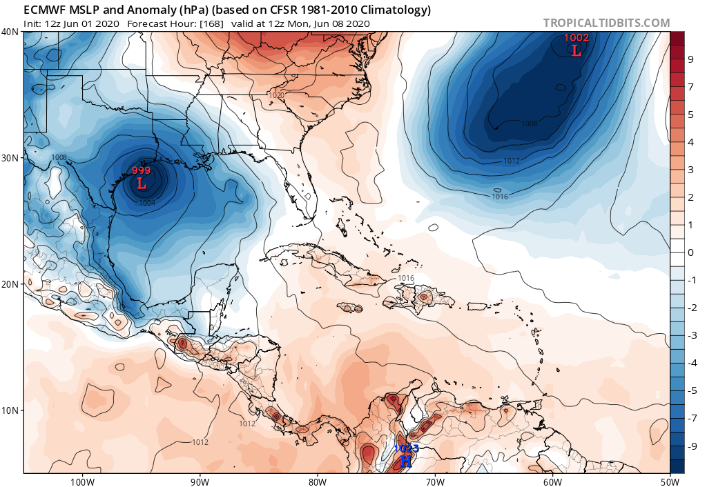
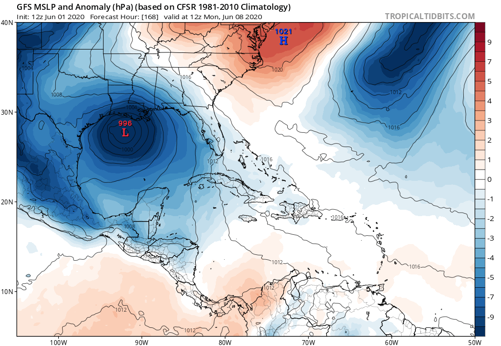
As always, we’ll take it day by day. For now, the threat for heavy rain across southern Mexico, Guatemala, Belize, El Salvador, and Honduras will be continuing through midweek. By Wednesday or Thursday we’ll have a pretty good idea of what U.S. impacts there may be over the weekend.