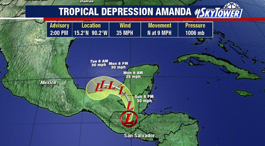
The Eastern Pacific Tropical Storm Amanda has moved inland over Guatemala and weakened to tropical depression as of 2pm Sunday afternoon. Amanda will continue to drift north toward the Bay of Campeche over the next 24 hours.
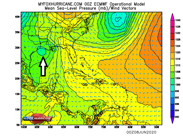
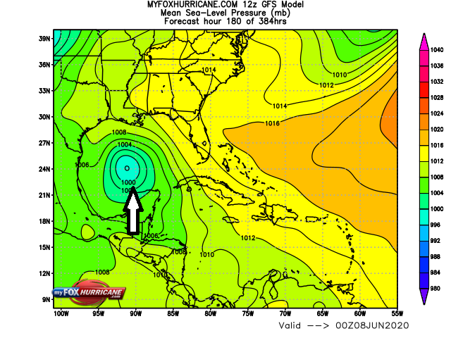
While land interaction will continue to weaken the system, it’s quite possible that its low-level circulation survives and emerges over the southwestern Gulf. It’s actually pretty rare for this to happen. In fact, since 1851 it’s only happened 18 times. If indeed it does maintain its low-level circulation it would keep the name ‘Amanda’ even after moving into the Gulf. If it dissipates, and then reforms in the Gulf, it would get the next name on the Atlantic list – ‘Cristobal’.
All of this aside, the ingredients will be there for whatever moves into the Bay of Campeche to slowly strengthen. The primary threat through middle of this week is going to be very heavy rain for parts of southern Mexico and Central America, as the area of disturbed weather won’t be moving much. However, in the 6-10 day time frame there is support from various models that a weak tropical system will emerge and head north in the general direction of Texas/Louisiana. It’s something that we’ll be watching closely over the next week, so be sure to check back.