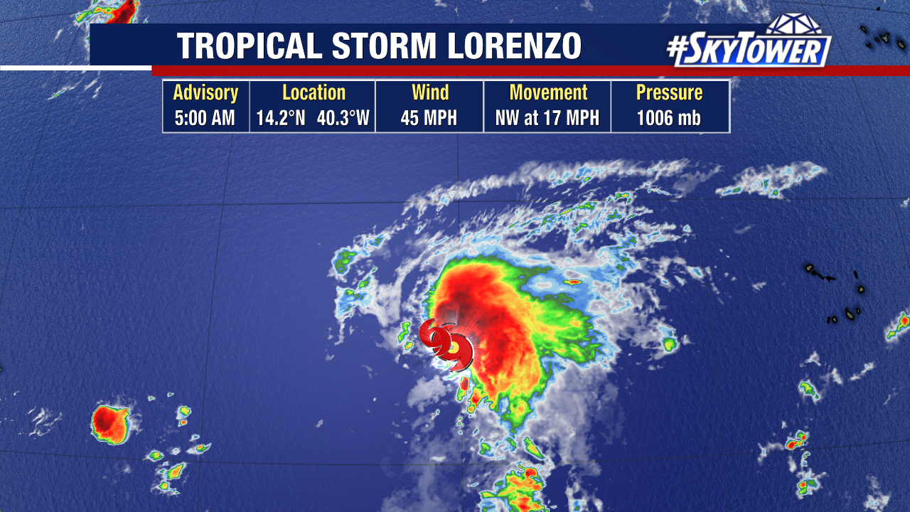
Tropical Storm Lorenzo, the 12th named storm of the season, formed early Monday morning in the central Atlantic.
The good news is Lorenzo will move north, staying out to sea and far away from land thanks to a weakness in the subtropical ridge.
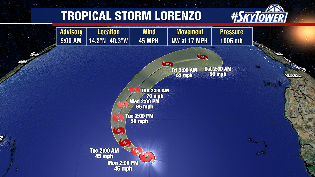
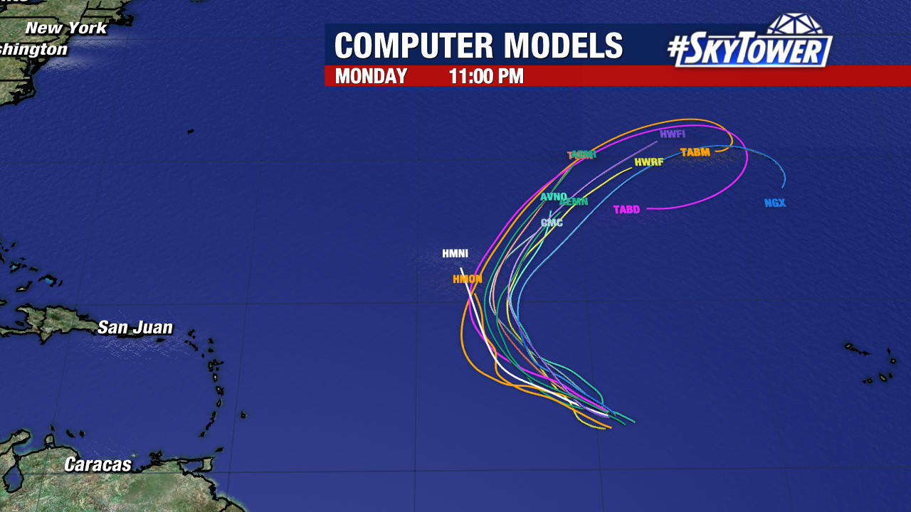
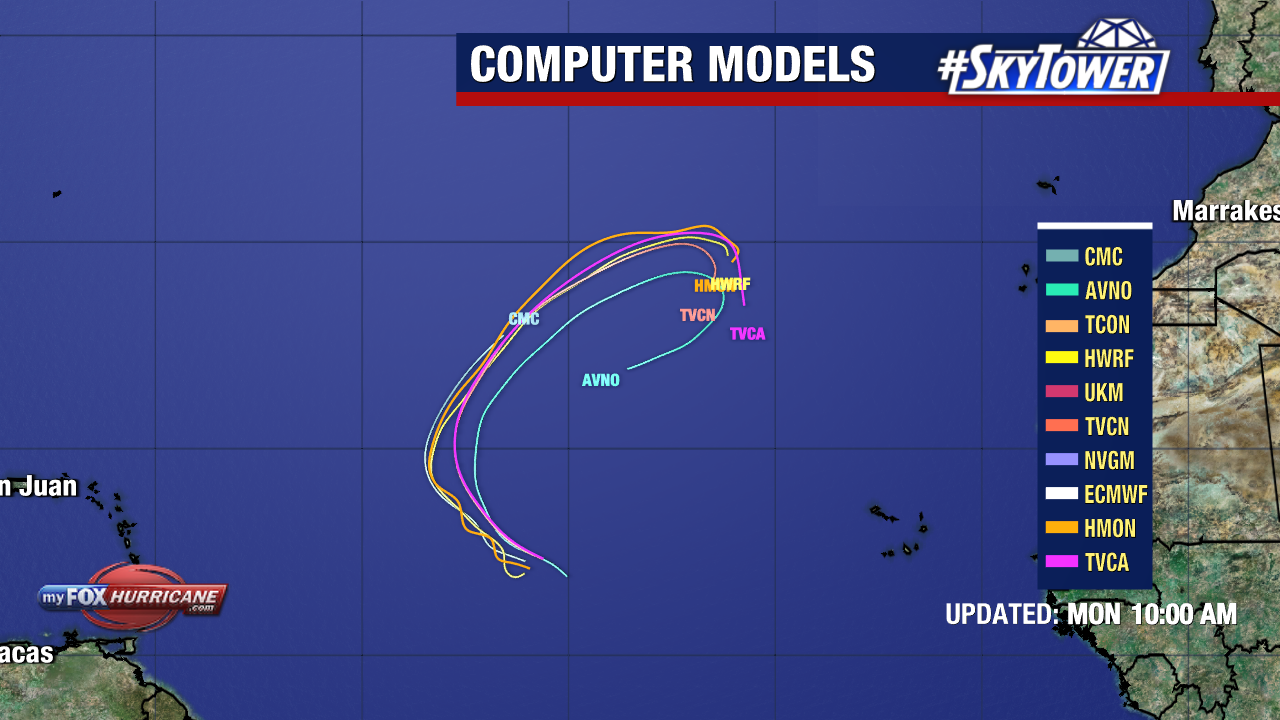
Tropical Storm Lorenzo will strengthen by early Thursday with 70 mph sustained winds forecast. From there, it will gradually weaken into this weekend as it curves NE south of the Azores.
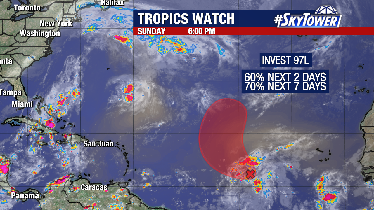
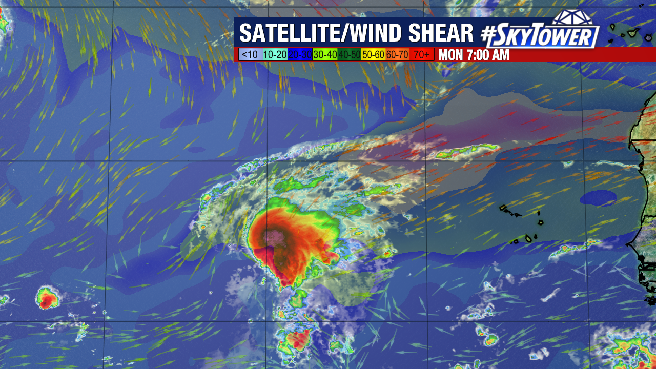
Lorenzo is currently about 1,000 miles west of the Cabo Verde Islands with 45 mph sustained winds.
It is fighting off some wind shear, which is limiting strengthening, but shear will lessen and will open the door for Lorenzo to strengthen more on Wednesday-Thursday.
The storm is moving northwest at about 17 mph but is expected to gradually turn north on Tuesday then NE.
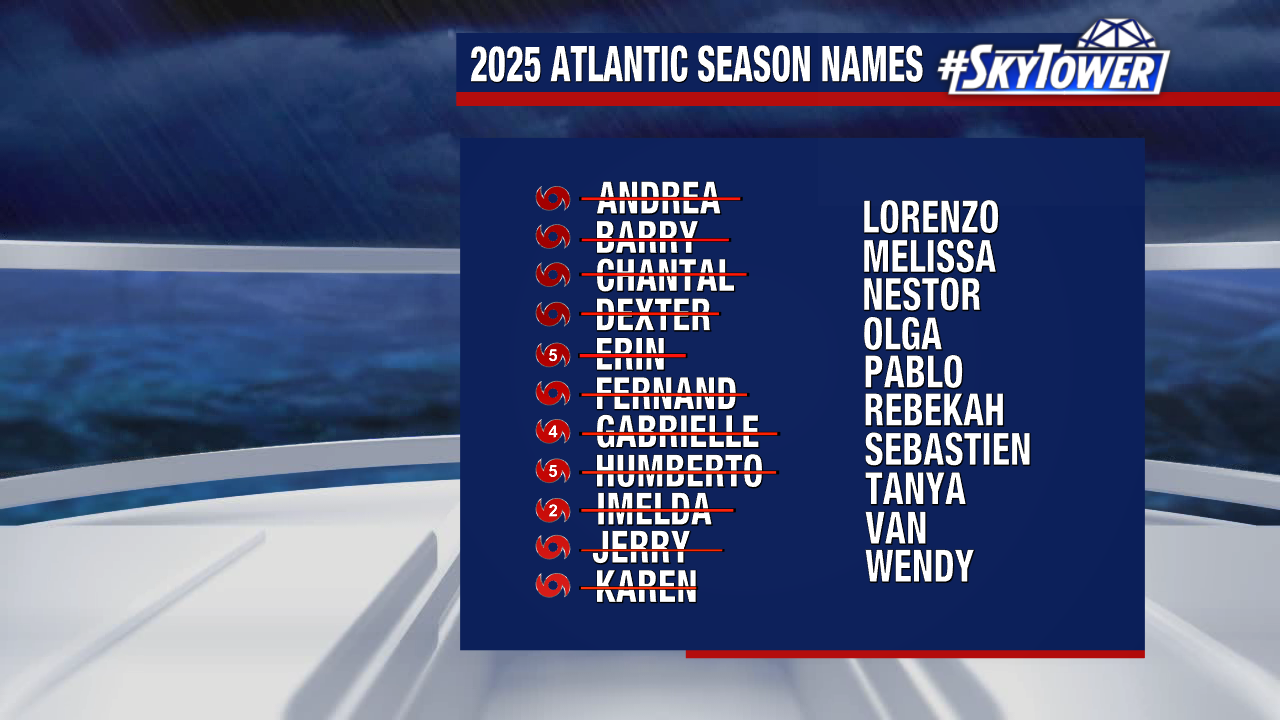
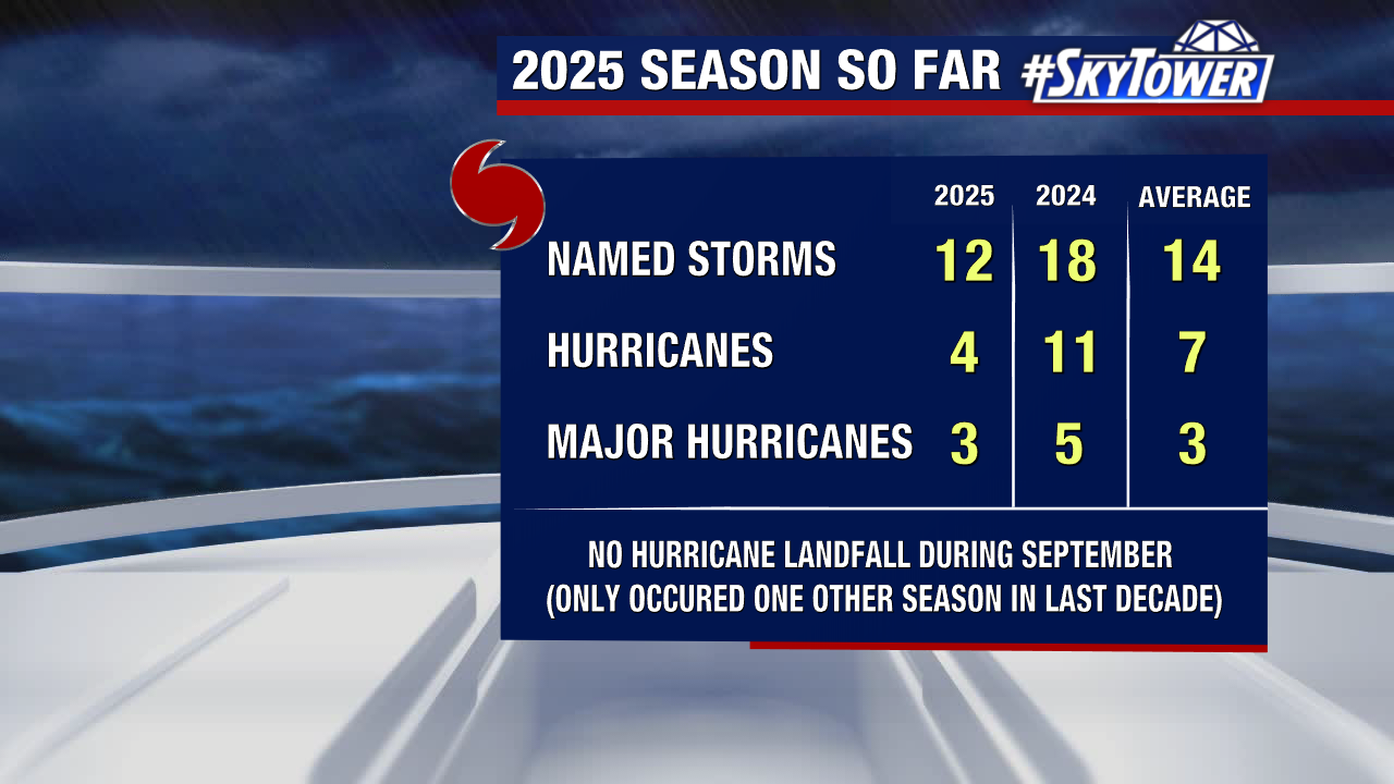
So far this season: 12 named storms, 4 hurricanes and 3 major hurricanes have formed.
The trend of storms taking a hard turn north and curving out to sea or remaining out to sea entirely has been notable.
Melissa is the next name in line on the 2025 season list followed by Nestor.