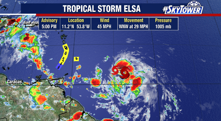
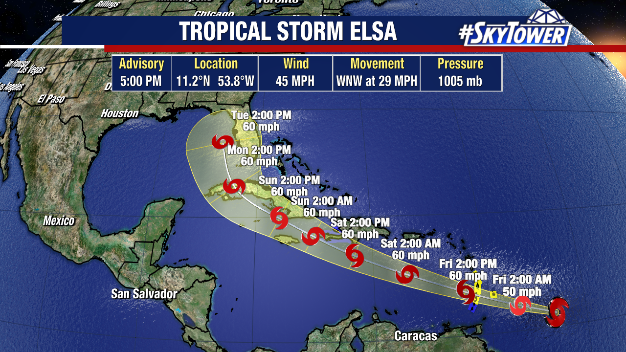
Elsa moved through the southern Lesser Antilles on Friday. Wind gusts topped 90mph in Barbados producing quite a bit of damage on the island. The storm continues to race through the eastern Caribbean Sea at 30mph!
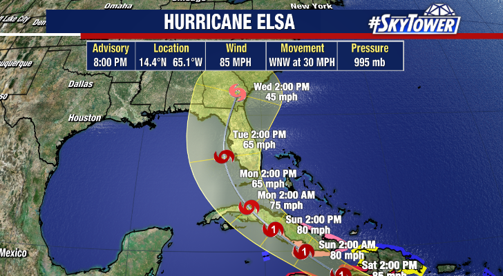
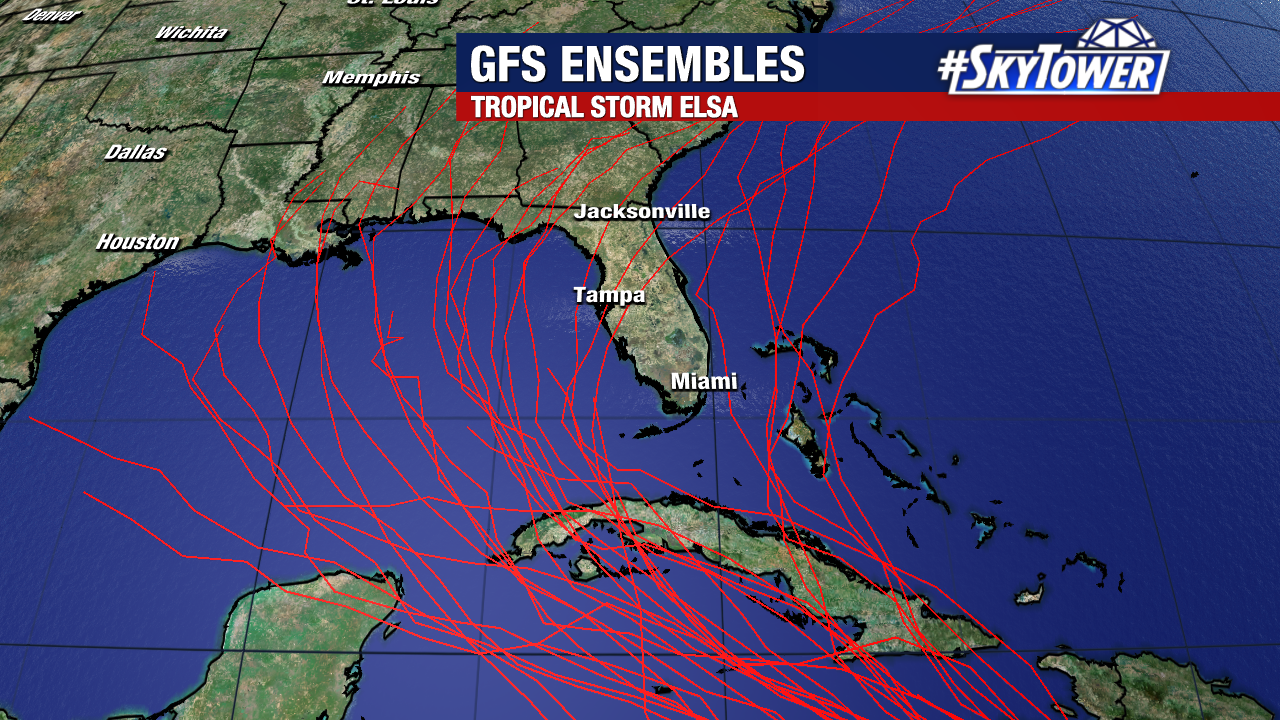
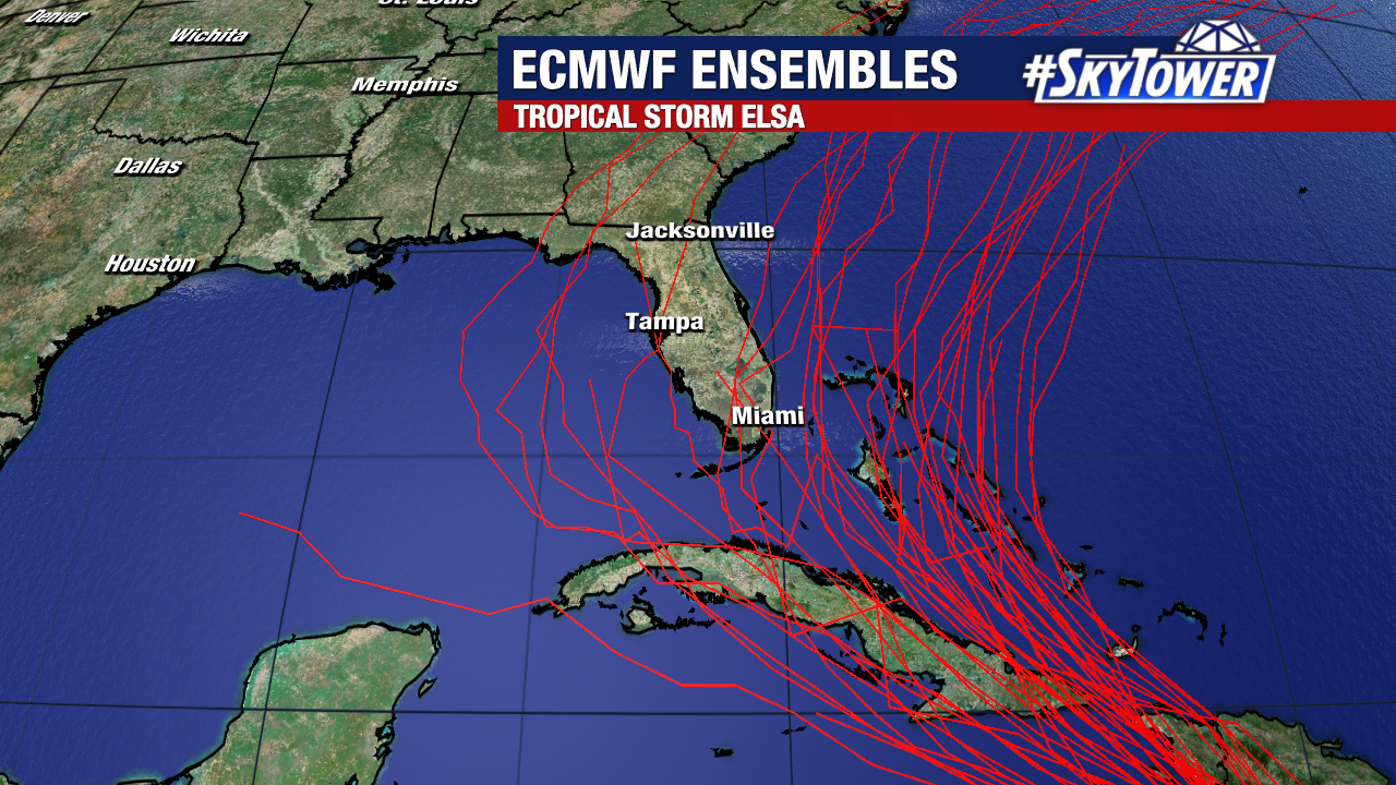
Expect Elsa’s strength to remain fairly steady over the next 24 hours. Beyond that point, how it navigates through and around the island of Hispanola (Haiti/DR) will be crucial. Tall mountain peaks on that island have a long history of shredding storms. Once we see how that plays out (by Sunday morning), we’ll have a much better idea of what, if any, impacts there will be for Florida. Be sure to check back for updates through the weekend.