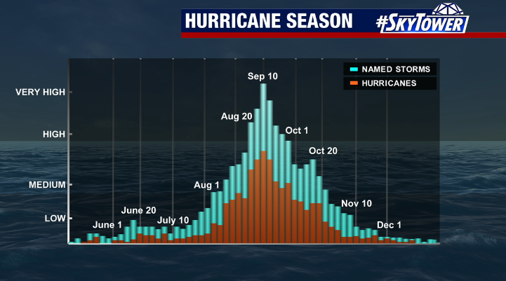
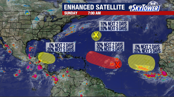
After an August which had no named storms in the Atlantic for just the third time on record, things are heating up as we head into September. There are currently 3 areas we’re watching for potential development, but the good news is that it doesn’t appear any of them will have an impact on the U.S… if any land areas at all.
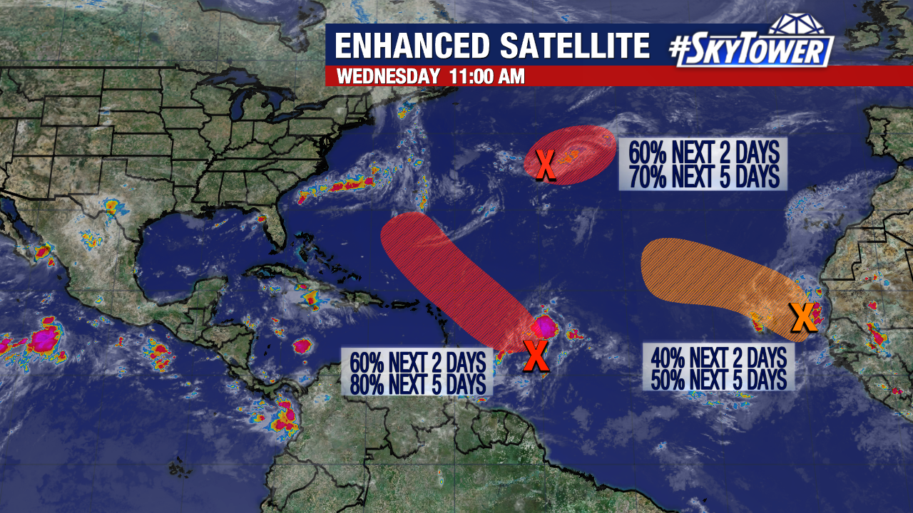
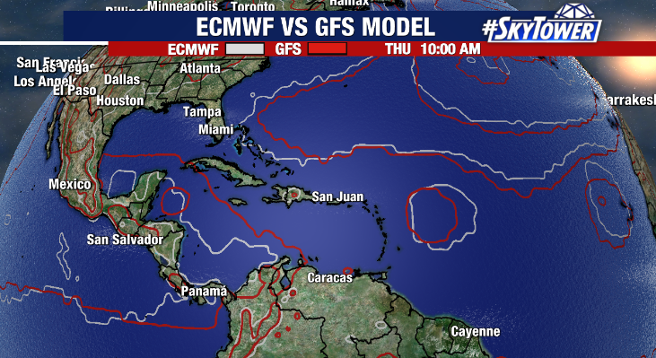
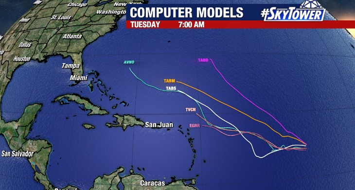
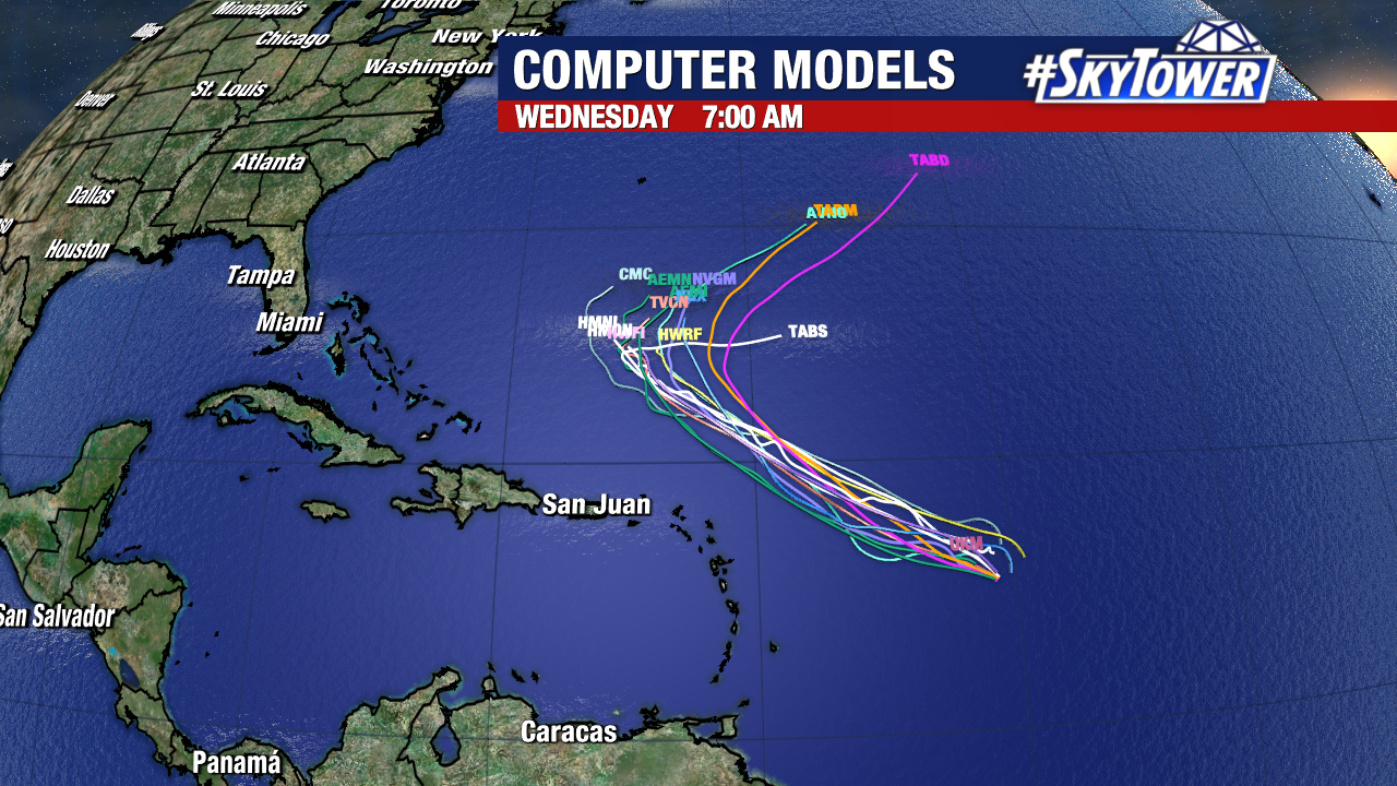
Danielle, Earl, and Fiona are the next names on the list, and we may cross two or three of them off over the next week. We’ll start with the central Atlantic tropical wave that has had a lot of buzz around it in recent days. Environmental conditions aren’t exactly ideal for development right now, but it still has enough going for it that gradual organization should take place.
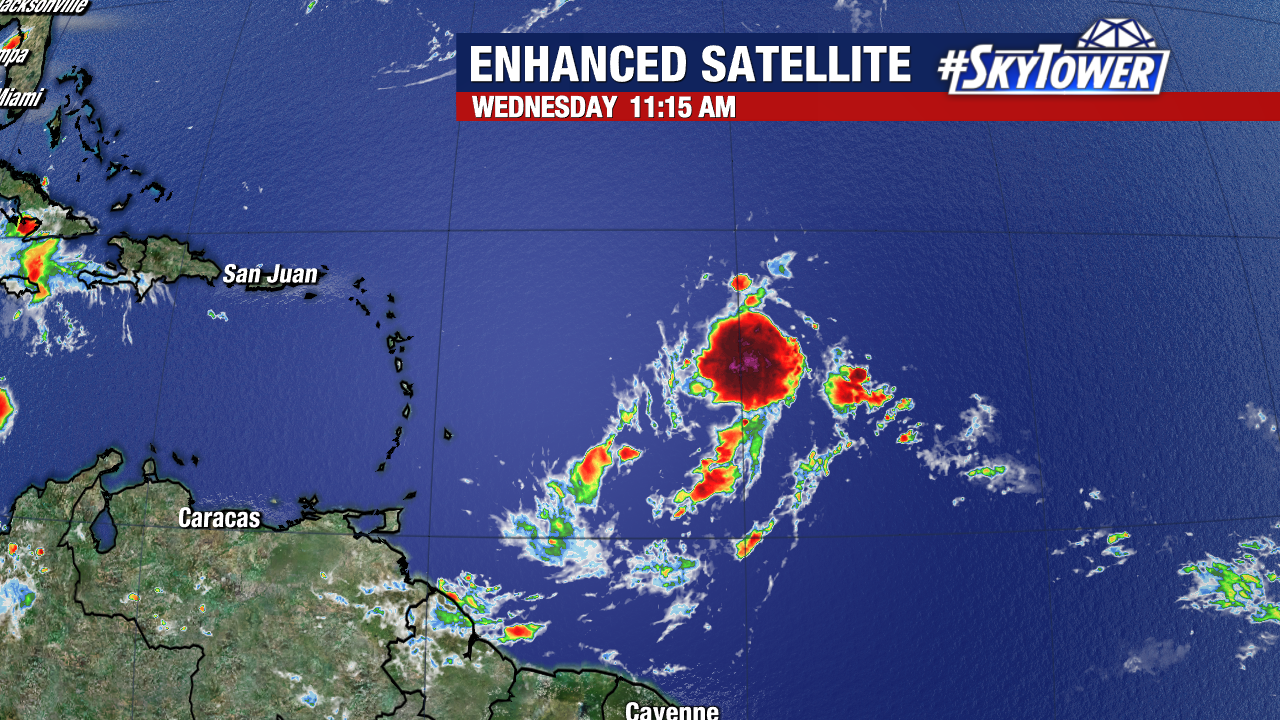
A tropical depression could form within the next couple days as this moves northwest. There is good model consensus this will stay north of the islands and begin its turn back out out to sea early next week.
The two other waves on the map right now have good chances of developing, but all indications right now are that they will simply be fish storms regardless of development.