We’ve been tracking several different areas of investigation over the last few days, as hurricane season begins to ramp up after a quiet stretch.
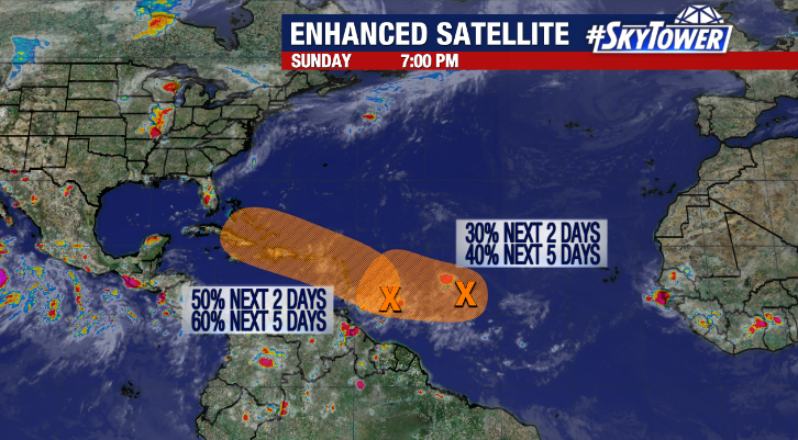
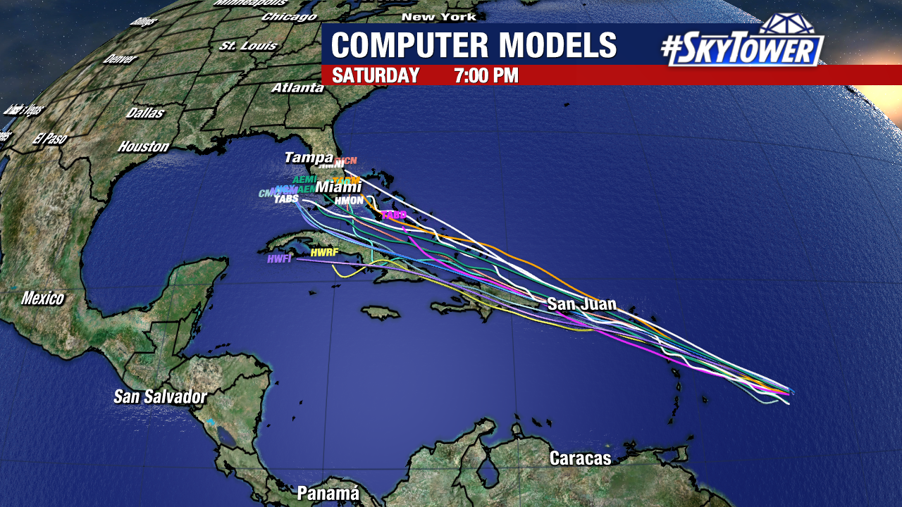
While there are no disturbances we need to be concerned about at the moment, Invest 94L will need to be watched closely through the week as it moves across the northern Caribbean. This will generally be in the vicinity of Florida by next weekend. Beyond increased rain chances for parts of the state it’s simply too early to speculate about any possible impacts. With land interaction, dry air, and some pockets of higher wind shear to contend with at times, this may simply be a slug of moisture when all is said and done. So, for now, we continue to keep a close eye on it and will keep you apprised of any development in the coming days.