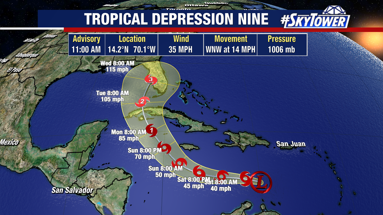
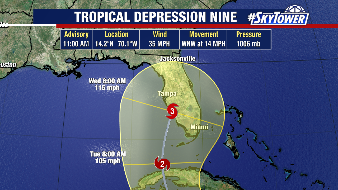
As of 5pm Friday, Tropical Depression Nine was located a little over 400 miles ESE of Jamaica. The system is still battling of bit of northeasterly wind shear, but it’ll be moving into an environment much more conducive for organization this weekend. It could become a named storm at any time.
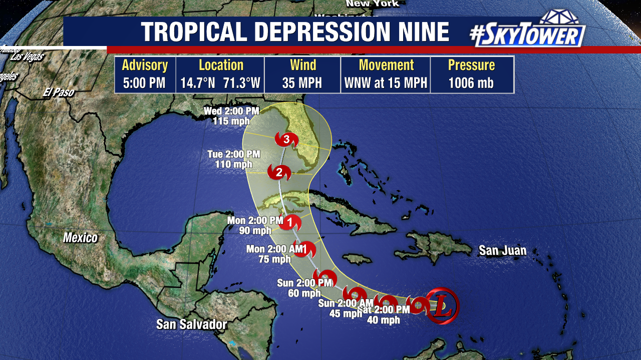
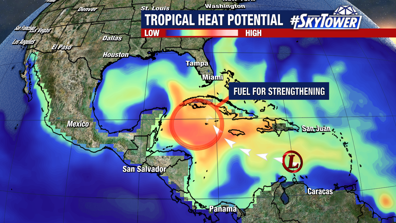
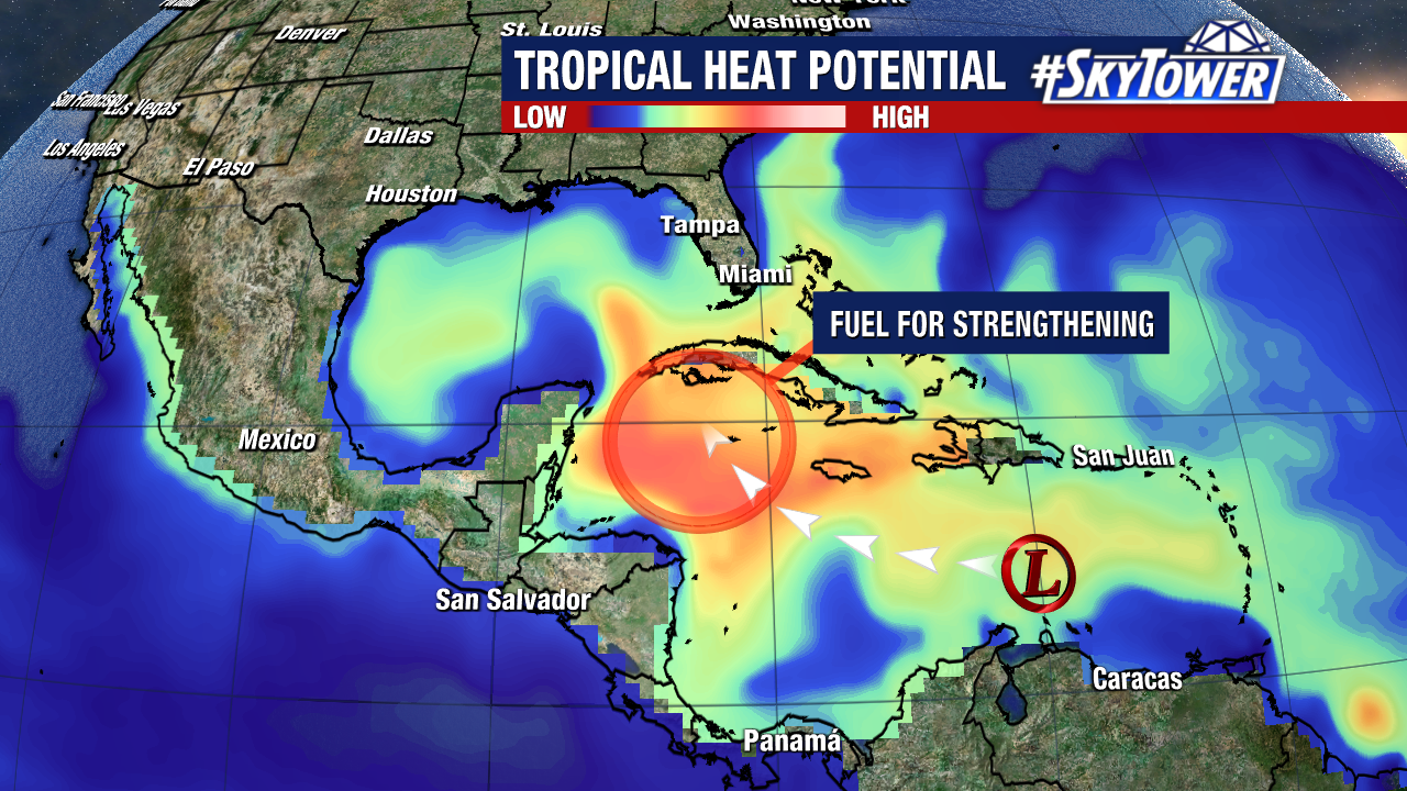
As this moves further to the west, it reaches an area with enormous tropical heat potential. Very deep, warm water will undoubtedly lead to straightening. In all likelihood this becomes a hurricane late Sunday or early Monday south of Cuba, and approaches Florida Tuesday into Wednesday. We must stress, it’s not out of the question that this becomes a major hurricane (category 3+) during that time.
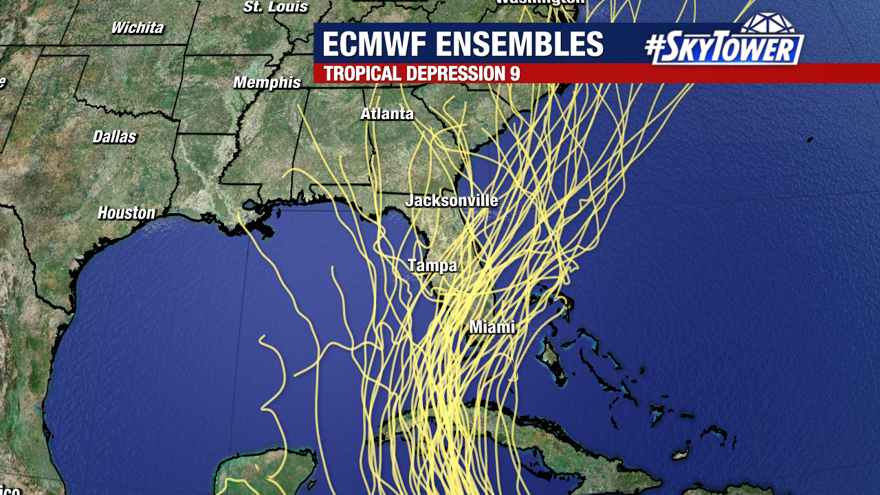
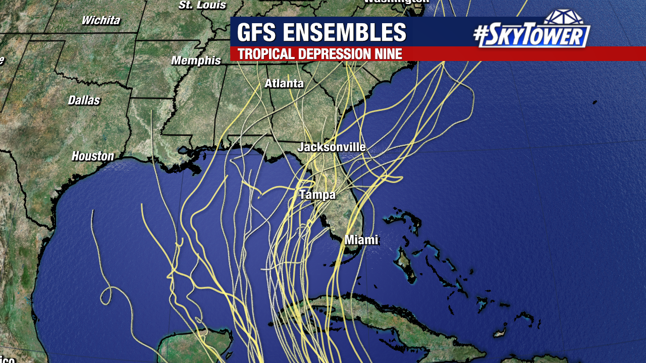
With respect to track, although we’ve been able to narrow it down to a general path toward Florida, it’s important to remember that the cone is still very wide at day 5 (about 400 miles). A track up the left hand side of the cone vs the right hand side means drastically different impacts for any given location. So, while it is still too early to nail down the specific timing/location of impacts, folks anywhere along the Florida peninsula need to be in the early stages of their prep. This means it’s time to review your plan and take an inventory of your supplies should you need to start taking action early next week.
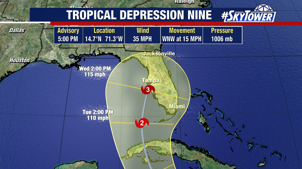
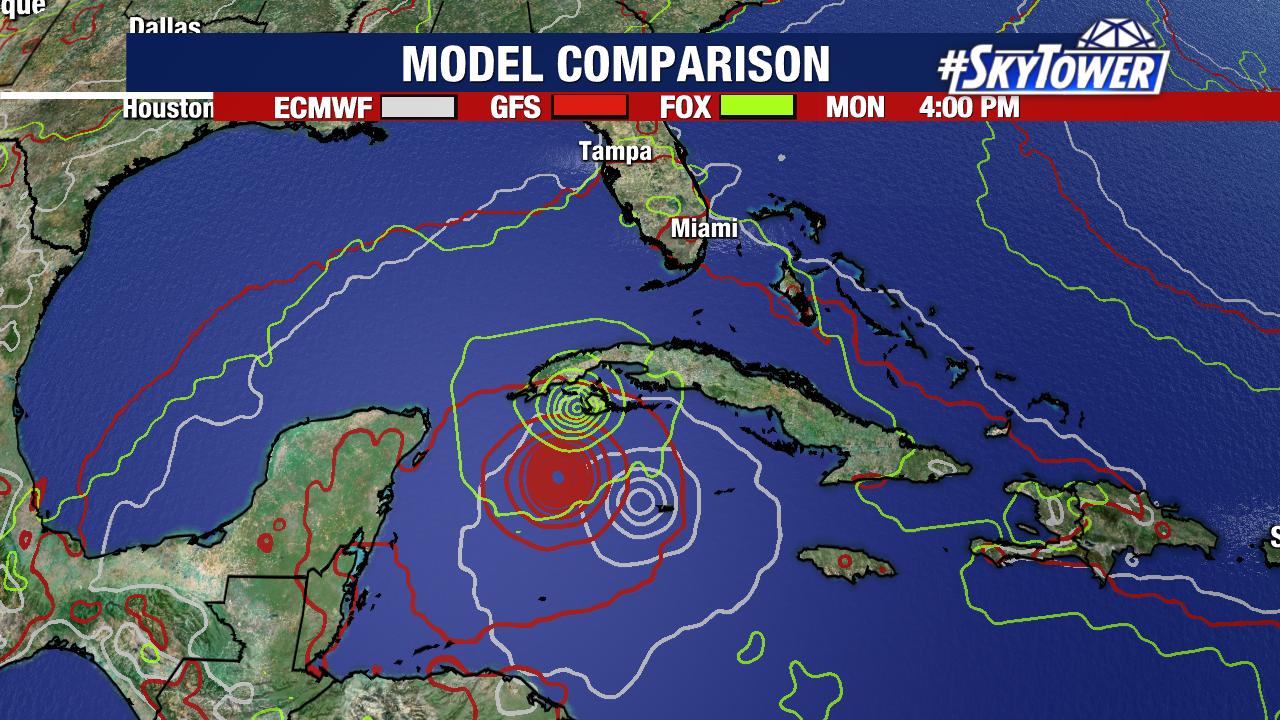
Afternoon model guidance is still a bit split beyond the next 2-3 days. The latest Euro hints at a southwest Florida landfall while the GFS is further north into the Big Bend. Again, these are two drastically different outcomes when it comes to impacts. As data collection continues and the storm develops a bit more, models will come into better agreement. So, just as we know a lot more now than we did yesterday or the day before, we’ll know a lot more over the weekend.