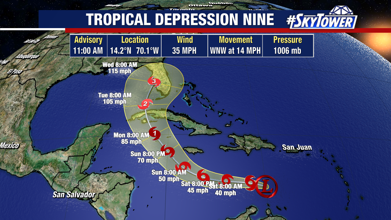
The area of disturbed weather that we’ve been tracking for several days has now become Tropical Depression 9 – so we now have a track from the National Hurricane Center. There are still a lot of details to be ironed out though.
Here’s what we know right now…
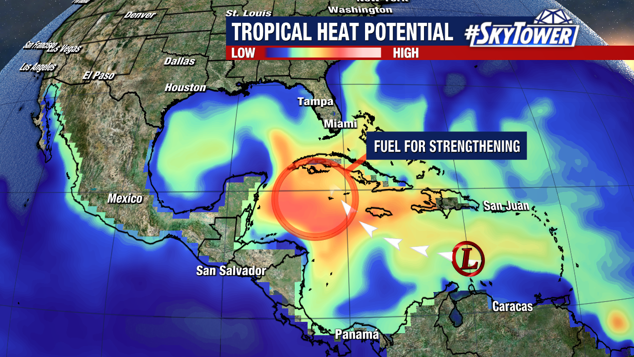
Expect this to become a named storm at any time. Strengthening will take place over the weekend as it moves west-northwest. Odds are it will become a hurricane late Sunday or early Monday, with additional strengthening early next week. There is a lot of tropical heat potential (fuel for storms) in the western Caribbean and southeastern Gulf.
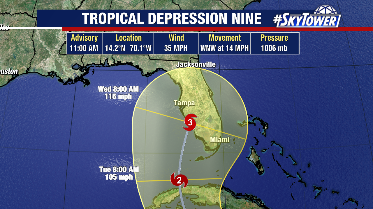
We’ve gotten some better model agreement since Thursday evening that Florida is the likely destination for this storm. It is important to remember though, the cone is about 200 miles wide at day 5. A track up the left hand side of the cone vs the right hand side mean drastically different impacts for any given location. So, while it is still too early to nail that down, folks anywhere along the Florida peninsula need to be in the early stages of their prep. Meaning it’s time to review your plan and take an inventory of your supplies should you need to take action early next week.
We’ll have some fresh model data to go over this afternoon, and I’ll post another blog entry after the 5pm advisory comes in from the National Hurricane Center.