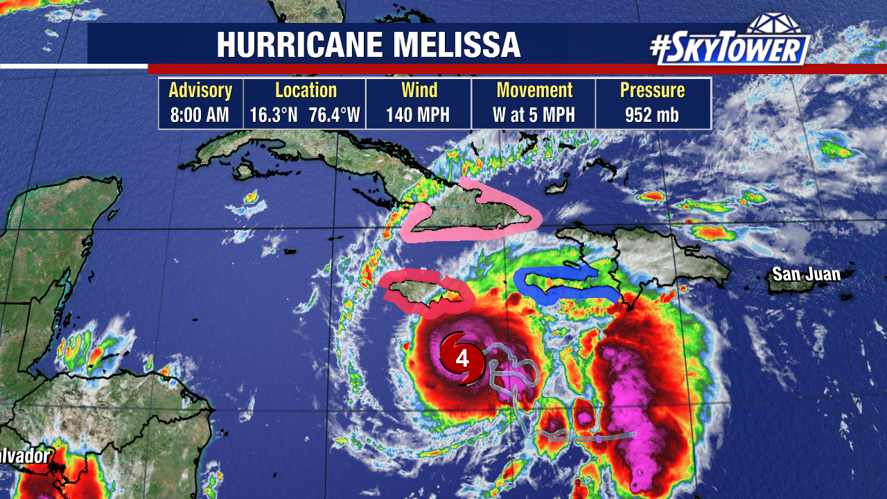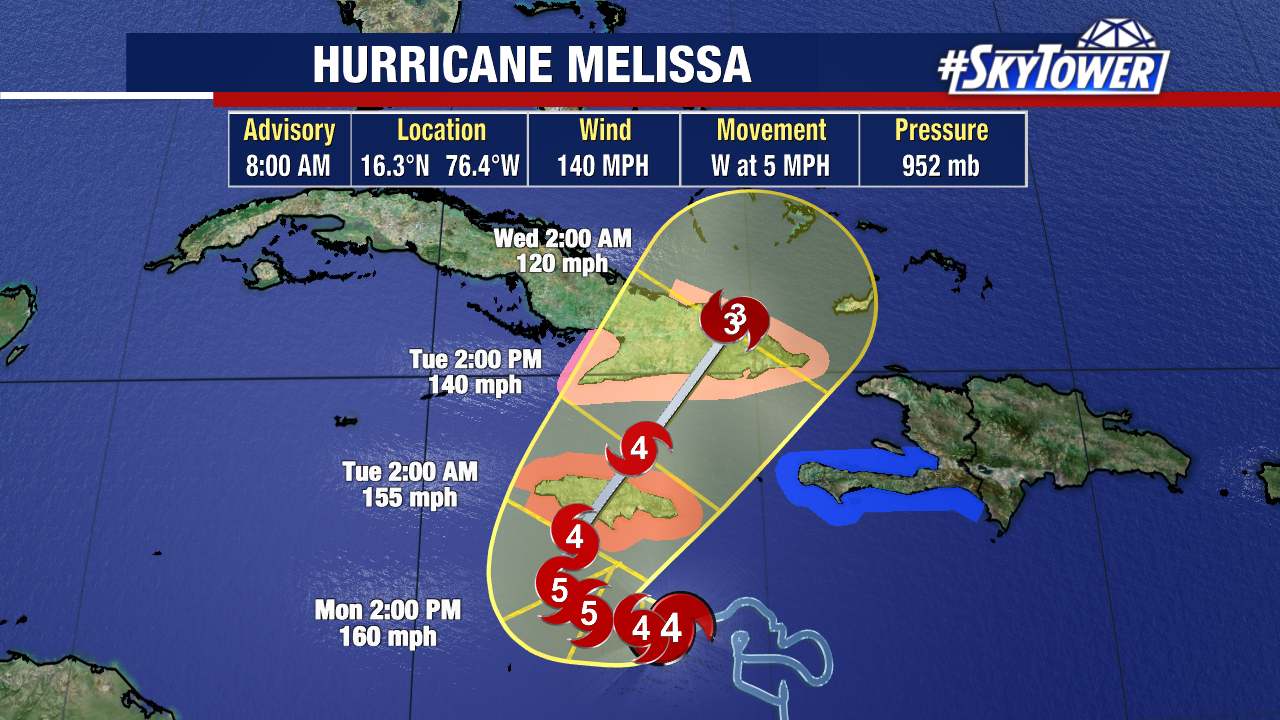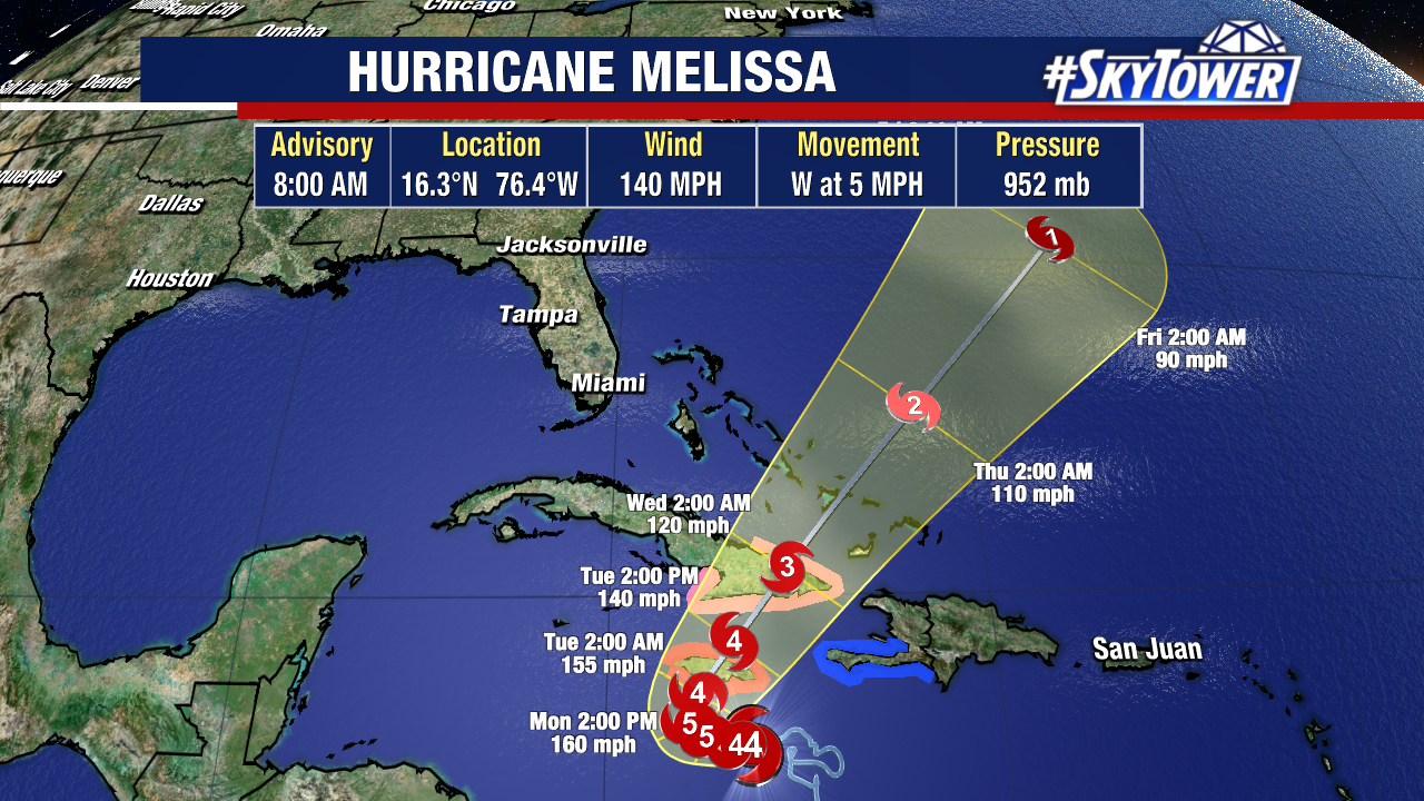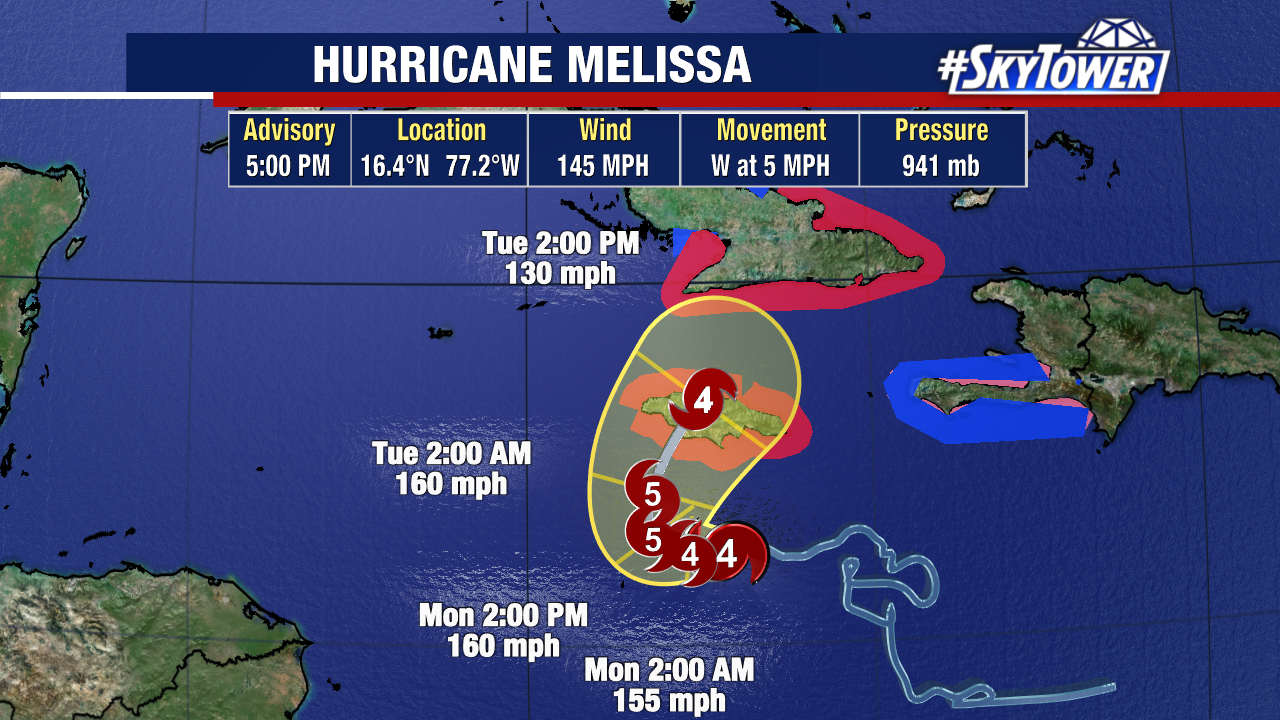
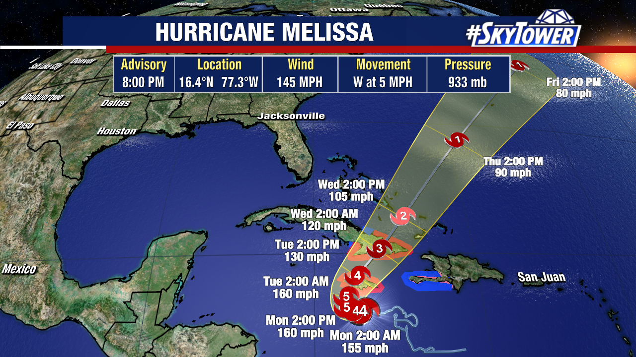
Hurricane Melissa has resumed strengthening this evening and is still forecast to become a Category 5 hurricane within the next day.
At the moment, Melissa has sustained winds of 145 mph and a pressure of 933 mb.
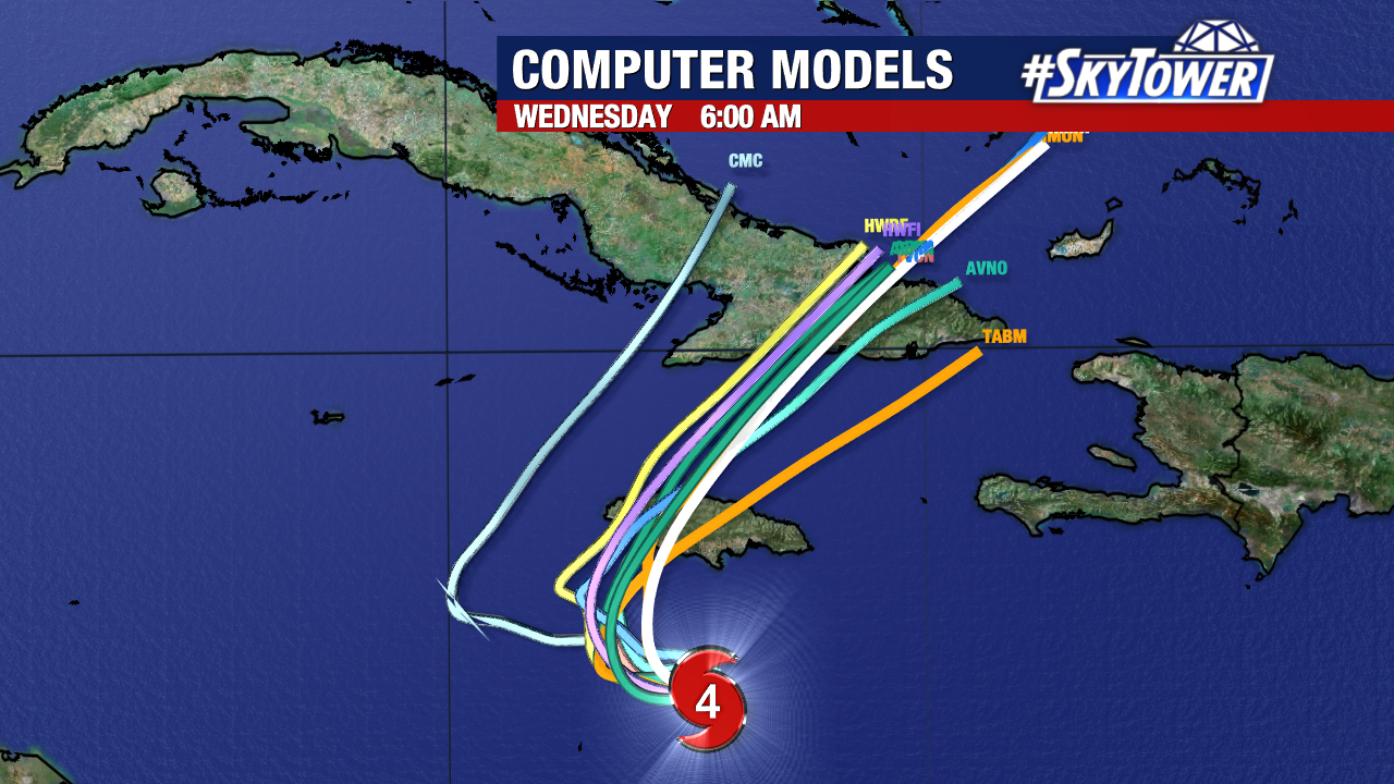
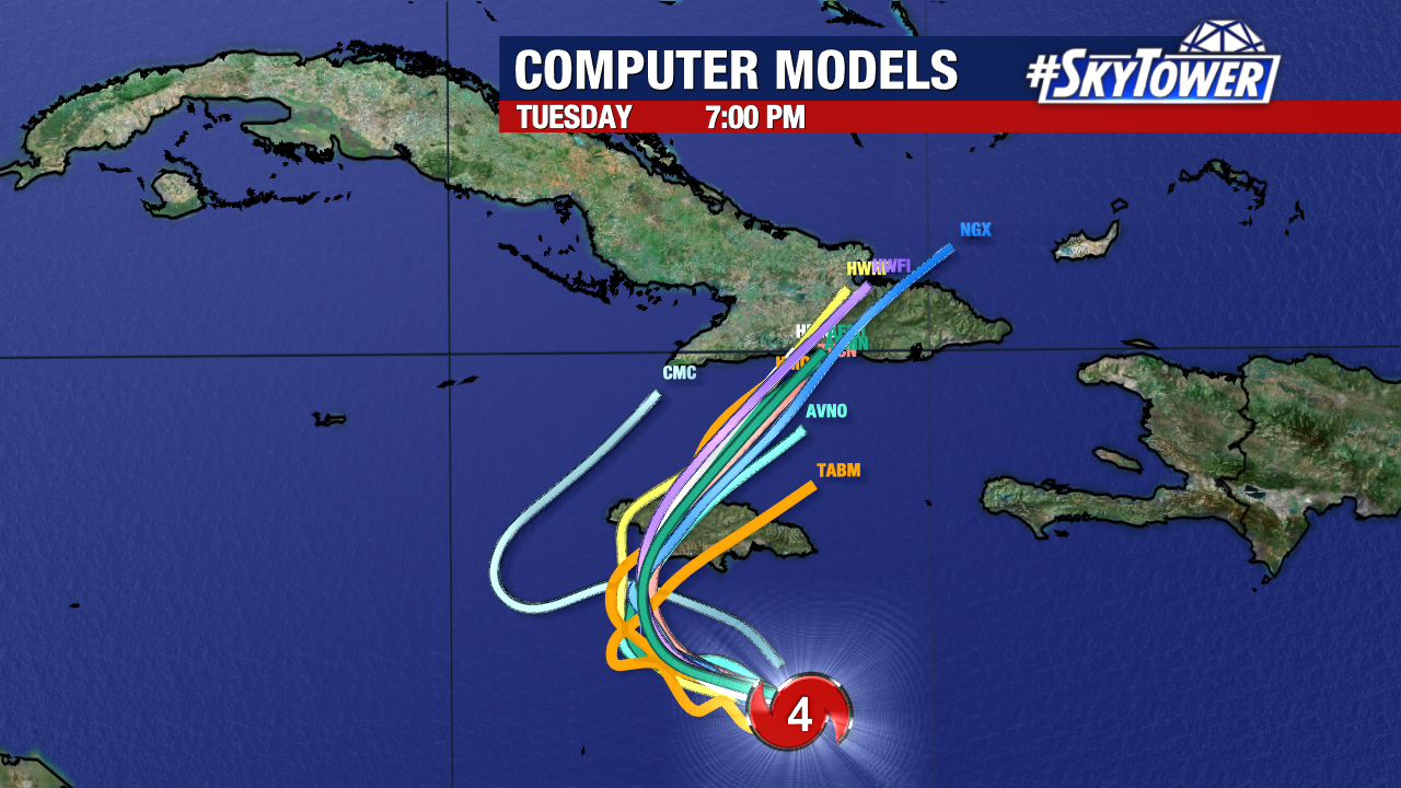
It will likely make landfall in Jamaica on Tuesday, but impacts have already begun on the island.
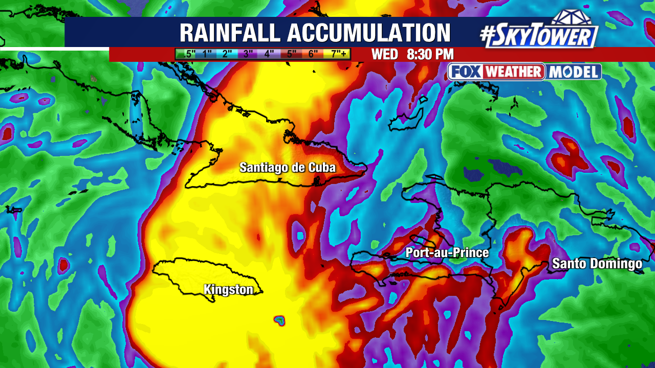
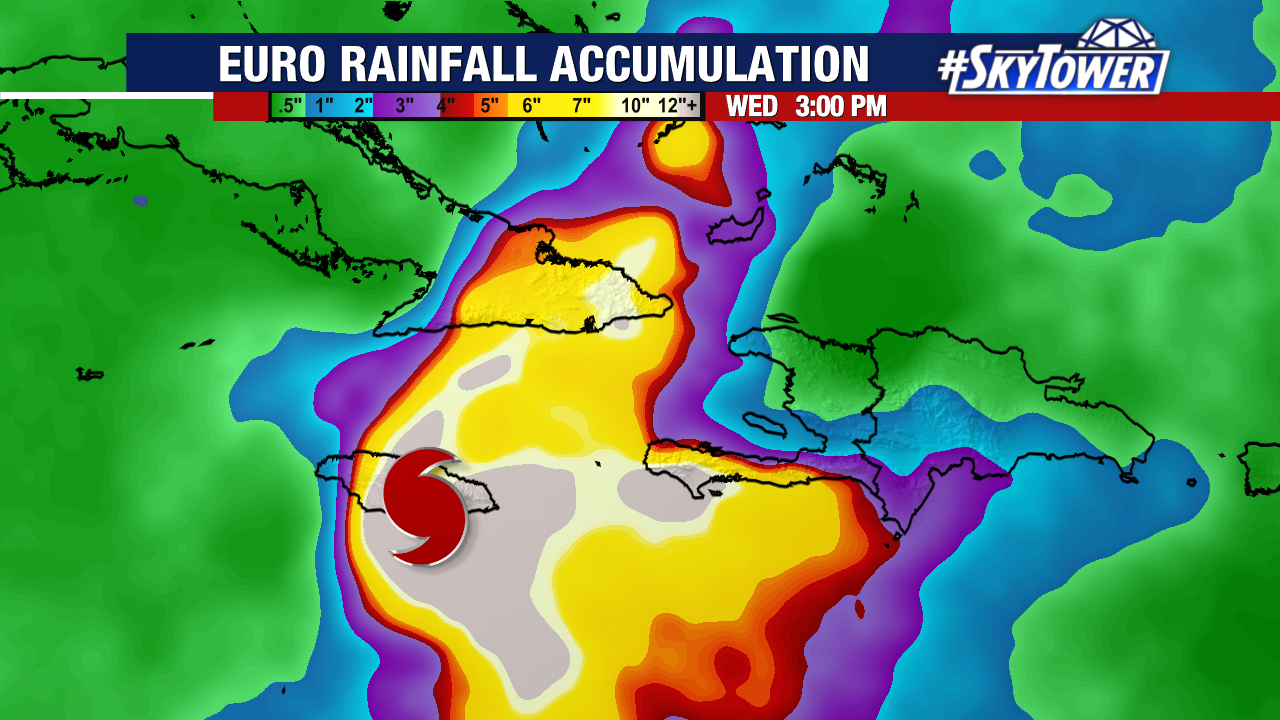
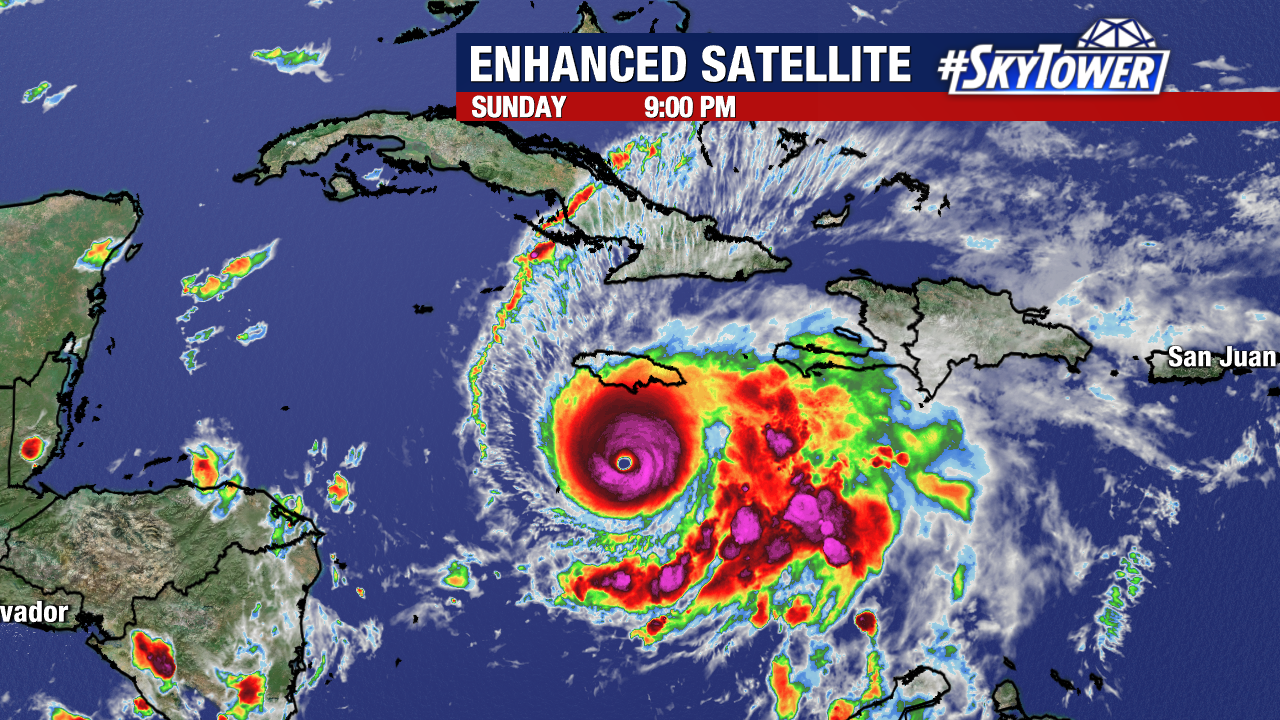
A multi-day catastrophic rainfall event is underway. Up to 40 inches (over 1,000 mm) of rain could occur within the next four days. This will create a widespread flash flooding and landslide potential. Southwest Haiti and eastern Cuba will also be susceptible to multiple feet of rainfall as Melissa passes.
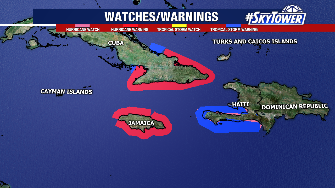
Hurricane warnings are active for Jamaica and eastern Cuba. Tropical Storm Warnings are also in effect for Cuba and southwest Haiti. While not all of Hispaniola is under active tropical storm warnings, flash flooding and landslides will be a concern for the entire island.
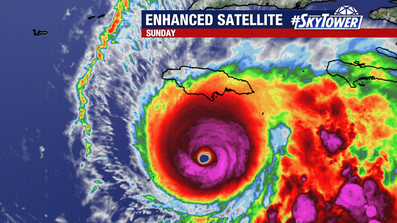
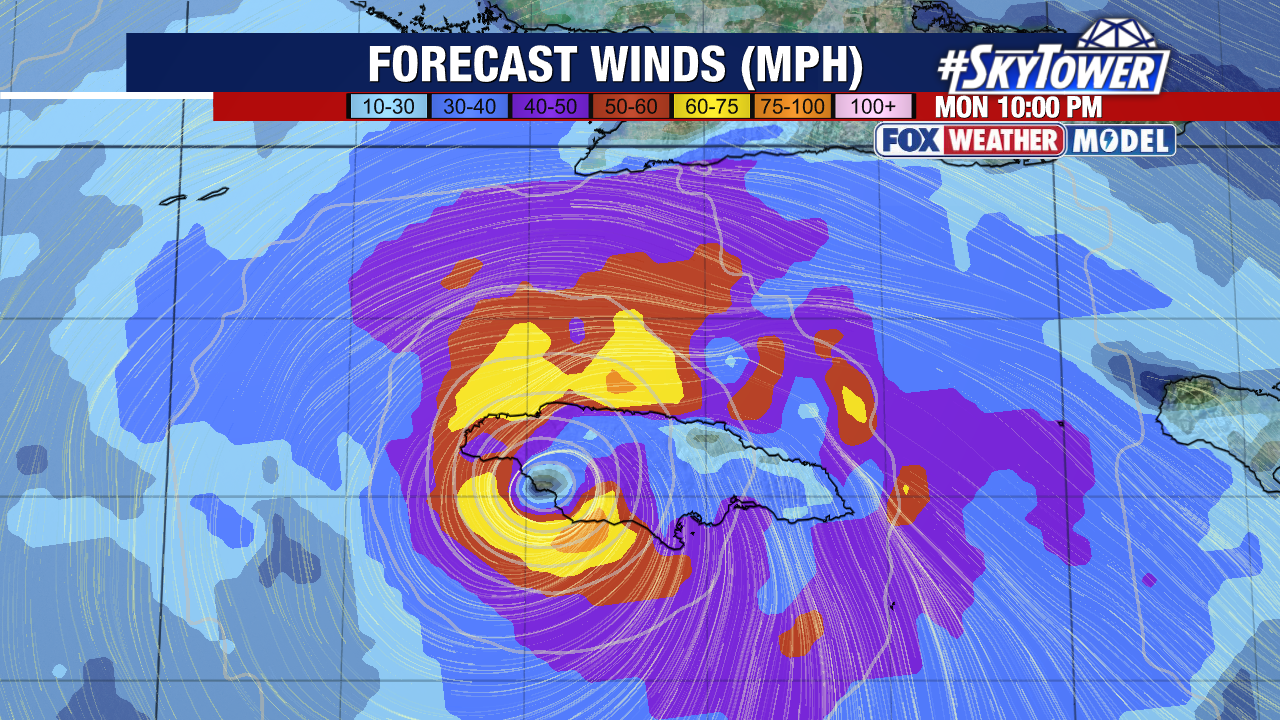
Damaging winds, potentially exceeding 150mph, will be possible near the center of the hurricane as it makes landfall. Additionally, the east side of the eye may create life-threatening storm surge. Early estimates place as much as nine to thirteen feet (2.7 to 4 meters) of surge along parts of Jamaica’s southern coastline as Melissa comes ashore.
Bermuda, the Bahamas, and the Turks and Caicos Islands should continue monitoring this storm for potential impacts. Melissa will stay well away from United States.