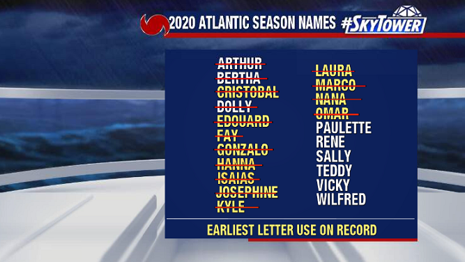
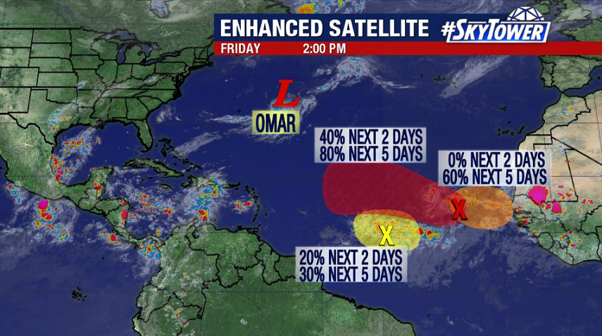
The peak of hurricane season is fast approaching and the tropical Atlantic remains very active. It’s quite possible that Paulette, Rene, and Sally all form over the next week. That being said, it doesn’t appear that any of them would pose a threat to the U.S.
We’re starting to get the first cold fronts of the season through the eastern U.S. and general troughing over this area should persist over the next 7-10 days. This sets up a steering flow that acts to keep any tropical threats out to sea.
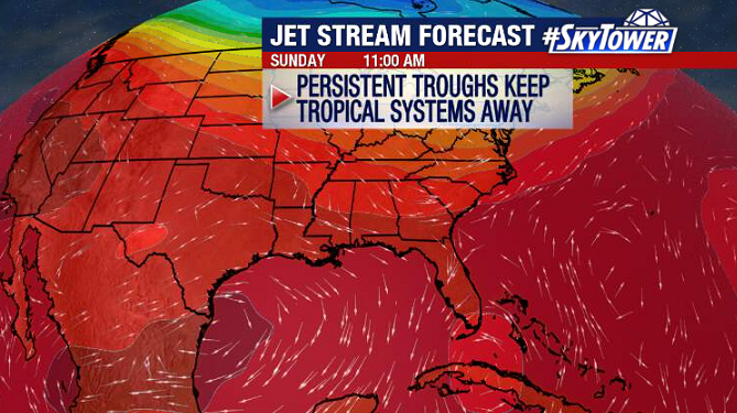
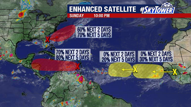
The one exception to this would be a ‘home grown’ system – if one were to form. While this doesn’t appear likely, we’ll be keeping a close eye on the Gulf of Mexico as the next couple of cold fronts stall over the water – which can often be a focal point for an area of low pressure to develop.
For now, no worries, so sit back, relax, and enjoy your Labor Day Weekend!