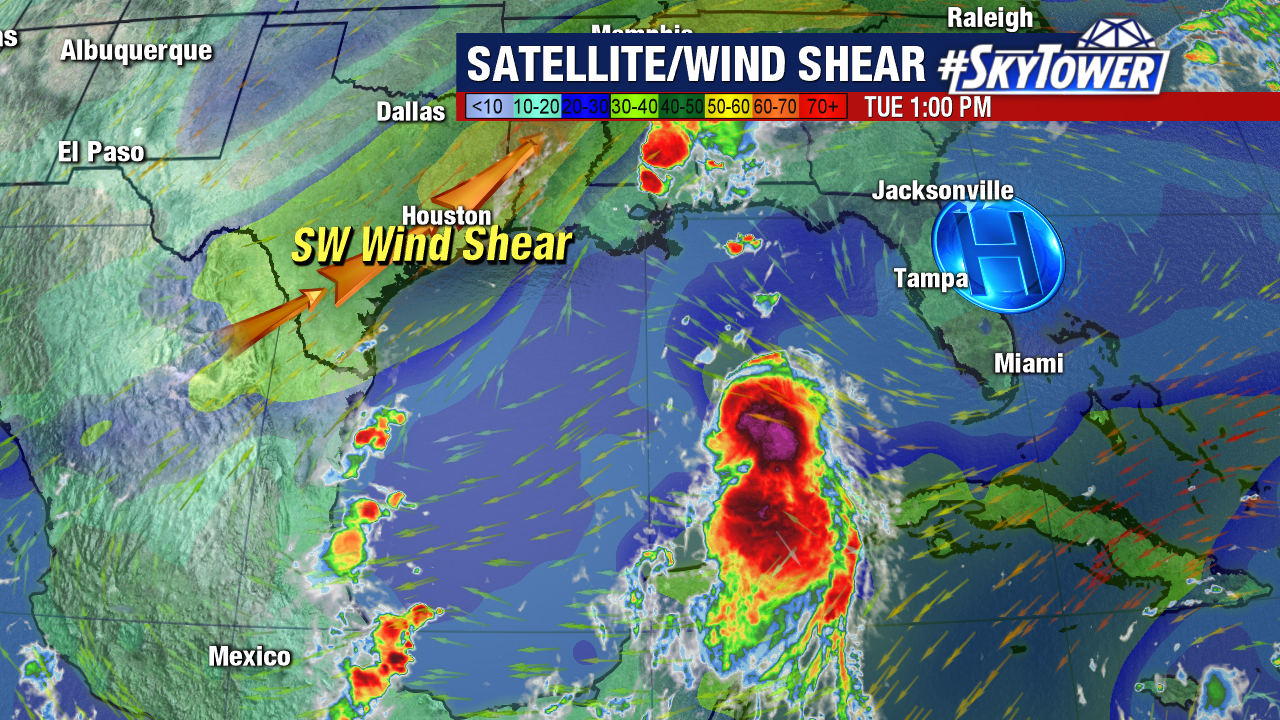
Just as Laura moved away from Cuba it became a hurricane. Now with light wind shear and warm water in its path it is beginning to show signs of convection intensifying.
The current forecast track from NHC now calls for Hurricane Laura to become a major hurricane on Wednesday with winds of 115mph. Conditions will begin to deteriorate along the Louisiana and Texas coast on Wednesday afternoon.
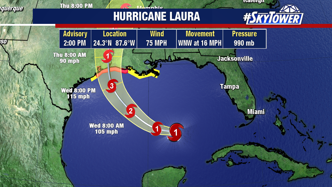
Along with the damaging winds the storm surge is expected to be significant as Laura moves onshore. Current storm surge models are indicating a storm surge of 7 to 11 feet just to the right of where Laura makes landfall.

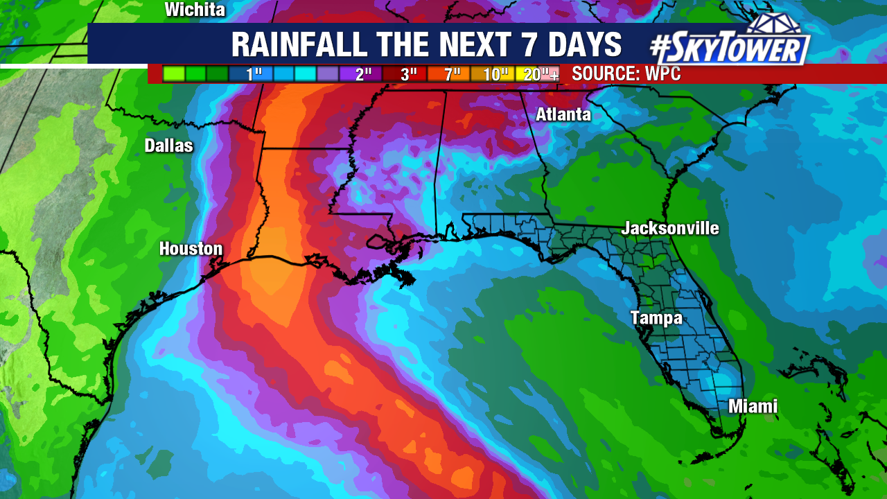
Flooding from torrential rain will also pose a serious threat with wide spread rainfall amounts of 4 to 8 inches with isolated areas of up to 12 inches.