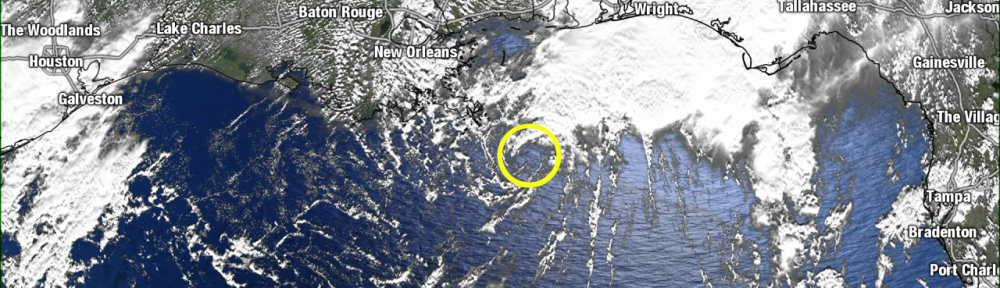
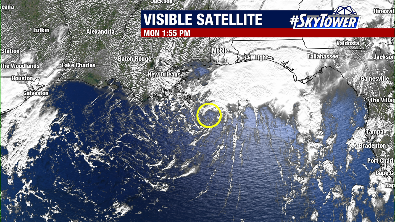
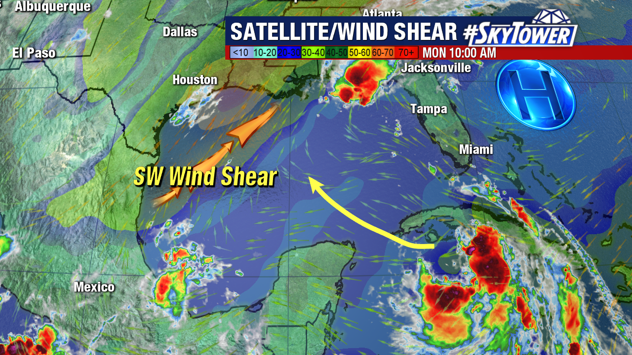
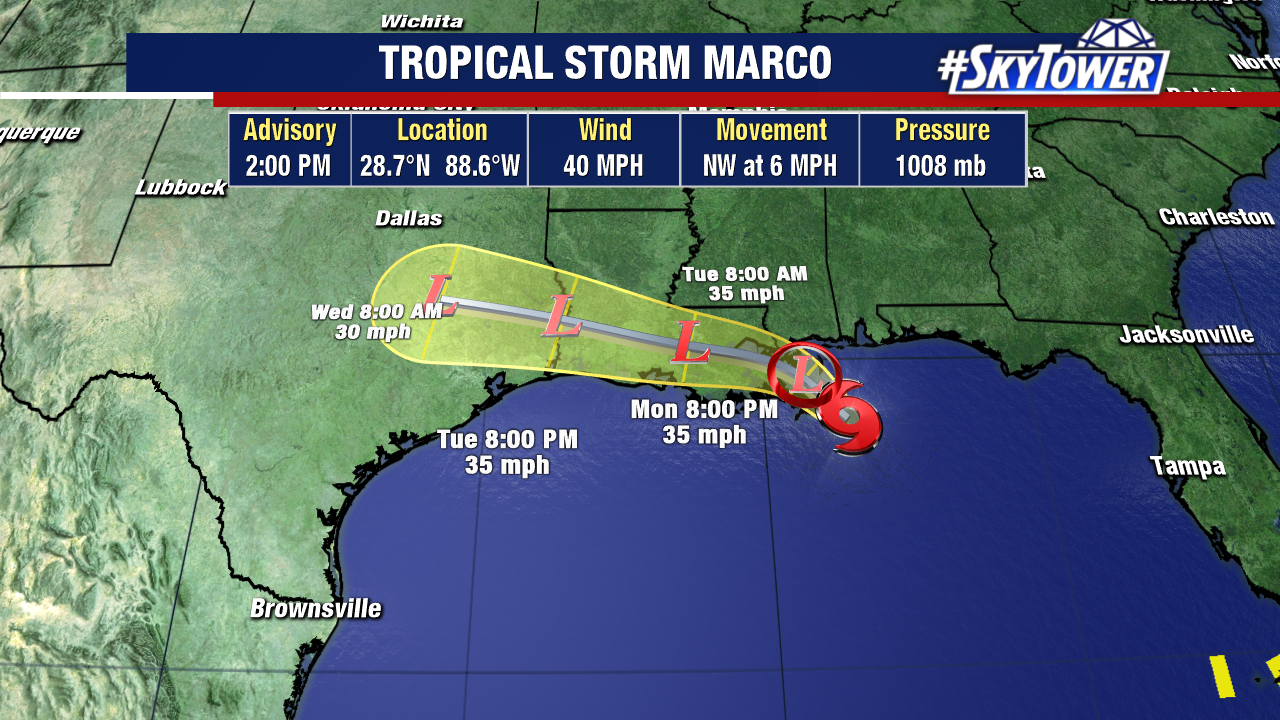
Southwesterly wind shear has had a huge affect on Marco since Sunday. It has blown all the deep convection away from the center and to the NE, exposing the center circulation.
This strong wind shear will continue and as Marco moves onshore it should quickly weaken but still bringing heavy rain across parts of the deep south.
Rainfall totals from Marco will be from 2-4″ with some isolated pockets up to 7″ of rain. If this was the only activity in the tropics this would be a very good scenario with a hurricane being sheared and weakened prior to landfall.
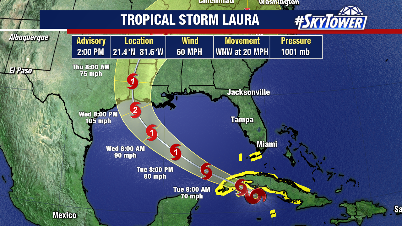
Tropical Storm Laura will move into the Gulf of Mexico on the heels of Marco. Unlike Marco, Laura will move into a nearly ideal environment, with light wind shear and warm water. This increases the probability of rapid intensification over the next couple of days. Current official forecast call for a category 2 hurricane with 105mph winds. There is some reliable guidance to suggest we may see this storm grow even stronger that that. At this point it is a wait and see as intensity forecasting continues to pose real struggles. Areas that are in the foretasted area for landfall should be preparing for the idea that this could be stronger than anticipated.